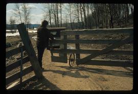
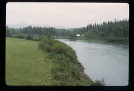
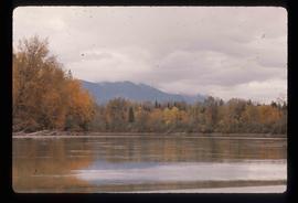
Image depicts the Upper Fraser Canyon from what appears to be the entrance to Gang Ranch.
Image depicts a wooden structure at Gang Ranch. It is possibility an elevated water trough.
Image depicts the Gang Ranch house.
Image depicts the Gang Ranch office.
Image depicts the sign to Gang Ranch, located in the Upper Fraser Canyon, with graffiti on it.
Image depicts an individual opening the gate at Nautley in Fort Fraser, B.C.
Image depicts a gauging station at Shelley, B.C.
Subseries consists of materials collected by Kent Sedgwick for research on the geography and natural resources in Prince George and its region. Includes material on the natural resource industry, including the opening of the McArthur Sawmill, the W. Lamb and Sons Lumber Sawmill, and mining; photocopied aerial photographs of Prince George; the climate, temperatures, and flooding; and the geographical features of Prince George.
File contains slides depicting a hike near the Geraldine Lakes.
Image depicts the Germansen River, with the buildings of Germansen Landing visible on the other side.
Image depicts a child in the foreground, and the Germansen Landing trading post in the background in Germansen Landing, B.C.
Image depicts a helicopter in Germansen Landing, B.C.
Image depicts the Gibraltar mine site north of Williams Lake, B.C.
Image depicts an 80 tonne truck full of rocks at the Gibraltar mine site north of Williams Lake, B.C.
Image depicts a number of workers putting in blasting powder at the Gibraltar mine site north of Williams Lake, B.C.
Image depicts a loading truck at the Gibraltar mine site north of Williams Lake, B.C.
Image depicts an aerial view of the Gibraltar mine site's pits and waste dumps, north of Williams Lake, B.C.
Image depicts the Ginter House and the surrounding woods, in Prince George, B.C.
Image depicts a private driveway, most likely leading to the Ginter Property in Prince George, B.C.
Image depicts a road near the Ginter House in Prince George, B.C.
Image depicts the Giscome, B.C. town site with the Giscome railway station and the Giscome store in the center surrounded by vehicles. Map coordinates 54°04'18.5"N 122°21'57.7"W
Image depicts mill site and dock in Giscome, B.C. with Eaglet Lake in the background covered in ice. There is a large crowd of people gathered near the dock. Map coordinates 54°04'34.9"N 122°21'50.0"W
Image depicts the remains of a street of houses in Giscome, B.C. The quarry is slightly visible in the background. Map coordinates 54°04'20.9"N 122°21'53.1"W
Image depicts the Giscome mill site in Giscome, B.C. The railroad tracks are in the foreground. Map coordinates 54°04'17.6"N 122°22'06.1"W
Image depicts the Giscome bunkhouse in Giscome, B.C. Map coordinates 54°04'17.6"N 122°22'06.1"W
Image depicts the old CN station in Giscome, B.C. Map coordinates 54°04'20.7"N 122°22'01.1"W
Image depicts the Giscome Community Hall in Giscome, B.C. Map coordinates 54°04'18.5"N 122°21'57.7"W
Image depicts a large, old and collapsing barn, as well as a nearby house of the dairy farm in Giscome, B.C. Map coordinates 54°03'53.3"N 122°21'22.6"W
Image depicts the dairy farm in Giscome, B.C. Map coordinates 54°03'53.3"N 122°21'22.6"W
Image depicts a farm in Giscome, B.C.
Image depicts Giscome with the school on the left, the remnants of the town site in the middle and the church on the right. Map coordinates 54°03'58.2"N 122°22'04.8"W
Image depicts several houses and the Giscome saw mill in Giscome, B.C. in the background. Map coordinates 54°04'20.9"N 122°21'53.1"W
Image depicts an open area with Eaglet Lake in the background. It depicts the previous site of the mill at Giscome, B.C. Map coordinates 54°04'19.7"N 122°22'04.7"W
Image depicts the Giscome mill foreman's house on the hill. Map coordinates 54°04'28.0"N 122°22'05.8"W
Image depicts the Giscome mill foreman's house on the hill, with Eaglet Lake in the background and numerous piles of logs in the foreground. Map coordinates 54°04'28.0"N 122°22'05.8"W
Image depicts what is possibly the quarry located at Eaglet Lake in Giscome, B.C.
Image depicts the Giscome, B.C. mill site looking west. Map coordinates 54°04'18.5"N 122°21'57.7"W
Image depicts the Gitwinksihlkw Elementary School in Gitwinksihlkw, B.C.
Image depicts a cabin and several sheds somewhere in Goat River, B.C.
Image depicts the CN Railway and Station at Goat River, B.C.
Image depicts an old, collapsing log building somewhere in Goat River, B.C.
Image depicts a set of rail road tracks and an old, collapsing log building somewhere in Goat River, B.C.
Image depicts the Fraser River in the Grand Canyon, B.C.
Image depicts a clearing through the woods, possibly an abandoned grade for the BCR. It is possibly located on Iron Road South, near Woodpecker B.C.