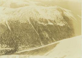
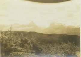
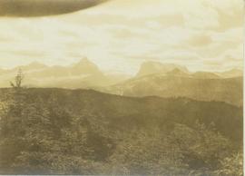
Image depicts a dirt road leading through a forest with what appears to be an area for turning around at the end.
File contains slides depicting areas around the Discovery Passage.
Photograph features Terrace Gardens.
Photograph depicts a distance view of tree covered mountain slopes in winter.
Photograph depicts a distant mountain range visible over a forested slope. The location of photo is between Wapiti Lake and Red Deer Valley.
Photograph depicts a tree-covered valley with a snow-covered mountain range in the background. The location of photo is between Wapiti Lake and Red Deer Valley.
Photograph depicts a distant river running through a forested mountainous landscape.
Photograph depicts a snowy plateau with a distant snow-covered mountain range in the background and coniferous trees in the foreground.
Photograph depicts a distant snow-covered mountain range with evergreen trees in the foreground.
Photograph depicts settlement across frozen lake. Trees cross midground, mountains stand in background. Handwritten annotation on verso of photograph reads: "Distant view of Tete Jaune B.C.", on recto of photograph: "I marked about where you loaded your boat the telephone pole is down the road toward 53. Tete Jaune Mile 52."
Image depicts a section of disturbed ground at an unknown location.
Image depicts an area of disturbed ground, most likely due to a landslide, at an unknown location.
Image depicts a large section of disturbed ground at an unknown location.
Image depicts an area of disturbed ground, most likely due to a landslide, at an unknown location.
Image depicts a ditch of water at an uncertain location.
Image depicts Divide Lake.
File contains slides depicting images of and around Divide Lake.
Image depicts the "Divides Lake Waterfall."
Image depicts the "Divides Lake Waterfall" as well as a man in front of a helicopter in the foreground.
Image depicts an unidentified individual diving into a pool of water at an uncertain location.
Image depicts a dock on a lake in Carp Lake Provincial Park, possibly War Lake.
Image depicts a dock in Prince Rupert, B.C.
Photograph of a large dock littered evidence of lumber transportation. Small buildings and stumps are on the shoreline. Annotation on recto reads: "Prince Rupert BC, '07."
Image depicts an individual sitting on a dock on a lake somewhere on Haida Gwaii.
Image depicts numerous docked boats in Prince Rupert, B.C.
Image depicts numerous docked boats somewhere in Prince Rupert, B.C.
Image depicts a ferry docked at Haida Gwaii, B.C.
Photograph depicts a dog sitting in shoveled walkway in steep snow, snowshoes inserted in the snow banks over dog's head. Unidentified building in background.
Photograph depicts dog seated on grass in foreground. Unidentified individuals visible below with fishing nets in waterfall area at Moricetown Canyon.
Image depicts a dog in a forest, possibly somewhere near Woodpecker, B.C.
Image depicts a dog standing on a path through the woods somewhere in Carp Lake Provincial Park.
Image depicts an unknown individual and a dog on a bridge over what is possibly the Robson River.
A woman stands in distance on a road with high snowbanks and trees on either side. A dog can be seen in foreground, facing woman. A fence and other structures stand in midground. Tree-covered slope in background.
Image depicts two dogs and numerous chickens in a yard at Island Cache.
Image depicts a pair of dogs in a forest, possibly somewhere near Woodpecker, B.C.
Photograph depicts a dogwood tree in front of the garden at 1057 Beach Ave. in Vancouver. The photo is taken looking northeast.
Photograph depicts the dogwood tree in winter at the former site of 1057 Beach Ave. in Vancouver. The view is looking east.
Image depicts what is possibly the CN Station in Dome Creek, B.C.
Image depicts the CN Station in Dome Creek, B.C.
Image depicts a log cabin somewhere in Dome Creek, B.C.
Image depicts an old, unused log cabin somewhere in Dome Creek, B.C.
Image depicts Downton Lake, the Lajoie Dam reservoir.
Photograph of several buildings down the street in Prince Rupert, including the church. Lumber pallets are littered around the buildings. Annotation on recto reads: "Prince Rupert, BC. 20.10.07."
Photograph depicts a lighthouse on a rocky shoreline with a forested area in the background. Annotation on verso of photograph states: "Driad Pt. light near Bella Bella kept by B.B. indian"
Image depicts a number of identical buildings and vehicles at "Driftwood Creek" in the Driftwood Canyon Provincial Park.
Photograph depicts driftwood on a beach at Skidegate, Queen Charlotte Islands.
Image depicts a driveway cordoned off by a red mesh material in Newlands, B.C. The address of the house is labelled 31951, and the name listed is "Fauchers." Map coordinates 54°06'47.8"N 122°08'22.4"W