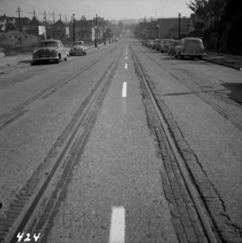
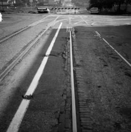
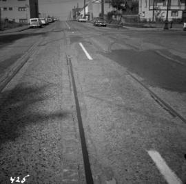
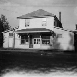
File consists of material regarding freight transport for the fishing industry. Predominantly consists of photocopy reproductions, excerpts from books, and clippings from periodicals. Includes information about fish traffic from CNR in Prince Rupert, canneries and the role of railways in product distribution, fish canneries near Prince Rupert, the Gulf of George Cannery, and canneries in Steveston.
File consists of material regarding container ports, intermodal centres, and other shipping ports. Predominantly consists of photocopy reproductions, excerpts from books, and clippings from periodicals. Includes information about Roberts Bank Port, the Port of Prince Rupert, piggyback service, Vancouver's Deltaport, planning a container port, containerized transport, Ogden Point Docks in Victoria, Prince Rupert's Ridley Island Port, and the Port of Vancouver.
File consists of material regarding freight transport for the coke fuel industry. Predominantly consists of photocopy reproductions, excerpts from books, and clippings from periodicals. Includes information about coke ovens at Union Bay, Fernie, and Michel.
File consists of material regarding freight transport for the coal mining industry. Predominantly consists of photocopy reproductions, excerpts from books, and clippings from periodicals. Includes the following works: "Once Accursed the Crowsnest Blooms" by G. Patrick Green; "Coal Mines of Vancouver Island" compiled by Davies; "How Strong is Coal?" by Andy Cummings; "Coal Mines in the East Kootenays of B.C." compiled by Davies; "Coal From the Crowsnest: How Canadian Pacific moves British Columbia Bituminous" by John Garden; "Cumberland: Coal-dust Memories Stir a Sleepy Village" by McGill and Strong; "Quintette Mine: The Heart of North East Coal"; and "Where's That Coal Train Going?" by Tom Murray.
File consists of material regarding freight transport for the cement, brick, glass, gypsum, and limestone industries. Predominantly consists of photocopy reproductions, excerpts from books, and clippings from periodicals. Includes information about Lafarge Cement, limestone quarrying in British Columbia, the cement industry at Kamloops, Clayburn Brickworks near Abbotsford, the limestone quarry and kiln at Pavilion, gravel processing, the Tilbury Cement Company, the gypsum mine in Falkland, and railway ballast quarries.
File consists of material regarding freight transport for the automobile industry. Predominantly consists of photocopy reproductions, excerpts from books, and clippings from periodicals. Includes the following works: "Outgoing Automobile Rail Traffic in BC" by Davies and "Railroads and the Automobile Age" by Jim Hediger.
Series consists of research material regarding rail freight in British Columbia and in general. Includes information about freight statistics, freight customers in BC, freight revenue, less-than-carload service, types of freight loads, freight loading and discharging devices, and intermodal freight. Also includes information on the rail transport of coal, coke fuel, ore, lumber, pulp and paper, potash, sulfur, cement, gypsum, grain, fish, chemicals, petroleum, automobiles, and livestock.
Photograph depicts the Fraser St. road bridge over the north section of the north arm of the Fraser River (ie. between Vancouver and Mitchell Island). Shot is looking northeast.
Photograph depicts the Fraser St. road bridge over the north section of the north arm of the Fraser River, looking north from Mitchell Island to Vancouver, BC
Postcard depicts Fraser River in the Canadian Rockies.
Postcard depicts Fraser Canyon near North Bend, BC
Postcard depicts Fraser River Canyon, showing Cariboo Highway, CPR and CNR Railways, British Columbia, Canada.
Postcard depicts Fraser River Canyon, near North Bend, BC
Postcard depicts Fraser River Canyon, BC
Postcard depicts Fraser Canyon in the Rocky Mountains of western Canada.
Postcard depicts Fraser Canyon in the Canadian Rockies.
Postcard depicts Fraser Canyon, BC"The Saddle Rock view shows some of the rugged grandeur on the Canyon route between Hope and Lytton. It's muddy waters, at this time, gathered fourteen large and many small tributaries as it flows to the great Pacific."
Postcard depicts Fraser Canyon. "One can catch thrilling sights through the Canyon such as this. Just a few miles south of Lyton, this view offers one some of the Fraser's best scenery."
Photograph depicts the rear view of Ridgewood Studio, Ltd., furnishers and furniture renovators. The wood shed was used for repair and repolishing of furniture.
Photograph depicts a frame house in Vancouver. A high rise apartment on Barclay Street was being built and was just appearing in the background.
Postcard depicts the Four Tunnels over Fraser River, BC
Postcard depicts the Four Tunnels in Fraser River Canyon, BC
Photograph depicts Fort Steele in the Kootenays region of British Columbia.
Photograph depicts shay locomotive #115. It was running order, but not in steam on the day the photograph was taken. A rod locomotive was found in a shed towards the left. Rails of the spur found in the foreground that led to the shed.
Photograph depicts shay locomotive #115 in steam and with a working engine for the day. It was about to take on water.
Photograph depicts shay locomotive #115. It was running order, but not in steam on the day the photograph was taken. A rod locomotive was found in a shed towards the left, while the "Dunrobin" lay in disuse (but was still workable) in a shed on the rear right.
Photograph depicts a coal tub car that was on display in Fort Steele.
Photograph depicts locomotive #115, the "Robert E. Swanson," that was built by Lime Locomotive Works in 1934. It was brought to Forst Steele in 1972.
Photograph depicts former tram tracks in Vancouver, BCPhotograph taken from the intersection of Fir St. and a piece (in the left hand of photo) leading to First Ave., with the B.C. Electric Railway behind.
Photograph depicts former tram tracks at the north end of Fu St. on the south side of False Creek in Vancouver, BC
Photograph depicts former tram tracks down east Georgia St. in east Vancouver, BC
Photograph depicts former tram tracks still intact at east Georgia St. and Campbell Ave. in the east end of Vancouver, BCThe tracks continued forward and crossed the low ground on a trestle.
Photograph depicts former tram tracks, looking north from the intersection at Campbell Ave and east Georgia St. in Vancouver, BC
Photograph depicts the former "Terminus Hotel" on 32 Water St., 50 yards from the center of old Vancouver.
Photograph depicts a former store on main street in Pitt Meadows in the Fraser Valley.
Photograph depicts a former service station on the main street of Pitt Meadows in the Fraser Valley.
Photograph depicts a former Sailor's Home at the southeast corner of the intersection at Alexander St. and Jackson St. in Vancouver, B.C.
Photograph depicts a turntable where behind it a former roundhouse stood.
Photograph depicts a CN roundhouse that was built in 1929 at the Kamloops Junction. It was demolished in November, 1993.
Photograph depicts a CN roundhouse that was built in 1929 at the Kamloops Junction. It was demolished in November, 1993. The prime reason for its demolition was not wanting to pay local taxes on a building rarely used for anything except for motor vehicles, general temporary storage, etc.
Photograph depictsa former RCAF hanger. Plane was airworthy, only required engine repairs.
Photograph depicts a former RCAF that is not airworthy. It had lost its tail unit.
Photograph depicts a former RCAF that is not airworthy. Its interior was in shambles.
Photograph depicts a view 1 mile west of Youbou, Cowichan Lake on Vancouver Island, on a former logging railway (or possible C.N. extension). The "yard limit" sign is still standing.
Photograph depicts a former logging railroad trestle west of Port Alberni, BC
Photograph depicts a former light ship called "Thomas E. Bayard." Image captured the view of the foredeck and base of the mast holding a light.
Photograph depicts a former light ship called "Thomas E. Bayard." Visible is a schooner before the ship.
Photograph depicts Lardeau's former depot - Gerrard Railway (CPR) and agents office at the CPR ferry ship in Lardeau. It was last used as such around 1966/67. In the weeds of the foreground, is a disused grain spur which connects to the trackage of the wharf. Rails on this spur are dated 1905.
File consists of documentary photographs taken by David Davies of former KVR trackage in the Christina Lake area of British Columbia.