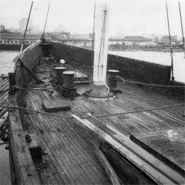
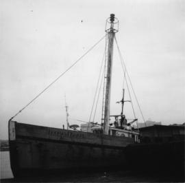
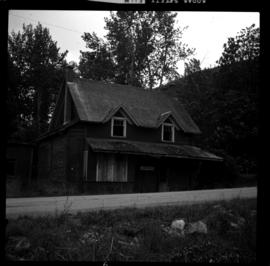
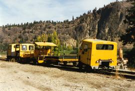
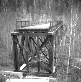
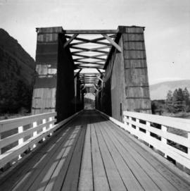
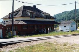
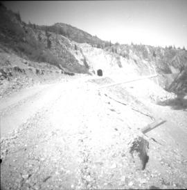
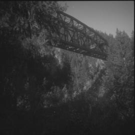
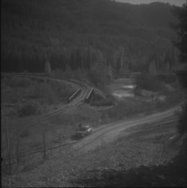
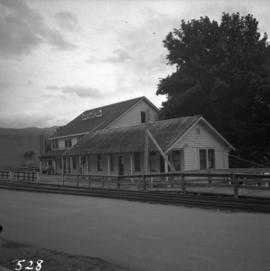
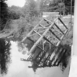
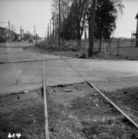
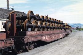
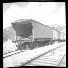
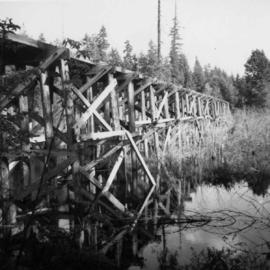
Photograph depicts a former logging railroad trestle west of Port Alberni, BC
Photograph depicts a former light ship called "Thomas E. Bayard." Image captured the view of the foredeck and base of the mast holding a light.
Photograph depicts a former light ship called "Thomas E. Bayard." Visible is a schooner before the ship.
Photograph depicts Lardeau's former depot - Gerrard Railway (CPR) and agents office at the CPR ferry ship in Lardeau. It was last used as such around 1966/67. In the weeds of the foreground, is a disused grain spur which connects to the trackage of the wharf. Rails on this spur are dated 1905.
File consists of documentary photographs taken by David Davies of former KVR trackage in the Christina Lake area of British Columbia.
Photograph depicts former KVR track in Summerland. CPR speeders were parked on the main line.
Photograph depicts a road widening that exposed a concrete rail over/road under a bridge that was originally part of an embankment. Portals were dated 1912 (this side) and 1913 (other side). It was believed that the gap was originally spanned by a wood trestle and then upgraded for an opening of the KVR to the west.
Photograph depicts a former icehouse at the Nelson CPR depot. It is located about 150 yards west of the main depot building. It also shows service boxcar CPR #412120, on the right track. The view is looking east.
Photograph depicts a former highway bridge that was probably made obsolete when the new road to Edmonton was built in 1970.
Photograph depicts a former Great Northern Railway bridge, which carried the line over the Similkameen River between Keremeos and Hedley. The bridge is about 2-3 miles west of Keremeos.
Photograph depicts a former Great Northern Railway bridge carrying a single track over the Similkameen River, between Keremeos and Hedley. The bridge is about 2-3 miles west of Keremeos.
Photograph depicts a former electric service car of the B.C. Electric Railway located in Chilliwack. It is in remarkably good shape.
Photograph depicts the former C.P.R. passenger vessel "Lady Alexandra", now a floating restaurant in Coal Harbour. The Bayshore Hotel is at the right. The picture was taken after a snowfall and shows a view looking east.
Photograph depicts a view of former C.P.R. steam locomotive sheds at North Bend, B.C. in the Fraser Canyon.
Photograph depicts the former CPR depot in Castlegar that was now a museum. Depot rebuilt in 1907.
Photograph depicts the former CPR Coquihalla to Brookmere rail line. It shows a former rail tunnel at about 15 miles northeast of Hope. The view is looking northeast.
Photograph depicts the former CPR Coquihalla to Brookmere rail line. This view is about 10 miles northeast of Hope. The abandoned bridge has been left to stand in isolation.
Photograph depicts the former CPR Brodie Junction at mile 65.2 from Spences Bridge on the former Merritt Subdivision, connecting with Princeton, 42.5 miles to the south. The view is looking southeast with the existing line on a sharp curve, and two former connector of the Coquihalla line converging onto it. The northbound connector, with rails from 1913, 1914, and 1919, is still in position but the southbound connector has been lifted, though the bridge is still retained. The elevation is 3025 ft.
Photograph depicts a former C.N.R. station at Youbou on Lake Cowichan on Vancouver Island. The track is still used to serve the plywood lumber mill at Youbou.
Photograph depicts a turntable that had been lifted out of a pit and set on the ground at the Kamloops Junction. Lifting had been done by two powerful sterling cranes.
Photograph depicts a former turntable pit that was pictured immediately after the table was removed. The pit was later filled in with dirt/gravel. R.H. track wioth 2 locomotives was made into a running line. L.H. track that had a switcher was made into a dead-end spur.
Photograph depicts a former turntable pit iat the CN Kamloops Junction that was pictured immediately after the table was removed. CN lost no time in filling the pit. A running rail was salvaged by the 2141 Society.
Photograph depicts a car standing on what was once the Carson spur of the CPR (pre-1919 it was GNR). Car was switched by G.F. Railroad Co. locomotive #6703.
Photograph depicts the former bridge that crossed the Nanaimo River. Davies had taken a photograph of the bridge in June 1965, when it was in use. The bridge was superceded by a newer one a year prior the photograph was taken. On June 13, 1972, it was standing, but on this day the Highways Department took it down.
Photograph depicts a former boiler house and machine shop built in 1929. Located at the CNR Kamloops Junction.
Photograph depicts the former B.C. Electric Railway track crossing Sea Island Way near Bridgeport, Lulu Island, and looking north to the Oak St. road bridge. The track was lifted in 1965 when the new Steveston route went into service.
Photograph depicts the former B.C. Electric Railway spur running westwards along Bridgeport Rd., leading from the former main trackage. It was not in use for many years and was lifted in 1965, except for road crossings. The photo is taken from the intersection with Sexsmith Rd., looking east. The former main trackage is sited about 300 yards in the background and at right angles to the track in the foreground.
Photograph depicts the former automobile, passenger ferry, "San Diego," that had been acquired for conventions and sightseeing purpsoses. It was believed to have been a San Francisco ferry before being purchased by its present owner in 1973.
Photograph depicts the folding steel stern door of the S.S. Canora C.N.R. ferry to Vancouver Island. The door is raised and lowered by a 2 cylinder steam winch.
Photograph taken at the main main fire station on the site of the former RCAF station near the Vancouver Airport. Visible is foam pumper #2, operated by the Federal Department of Tranpsort, as well as a Sicard truck.
Photograph depicts a Gruman Goose float-amphibian plane on a ramp of the lake. Side base was owned by Forest Industries Flying Tankers Ltd.
Photograph depicts a float plane landing at Gold River on west Vancouver Island.
Photograph depicts the repairing of a float plane. The tug was used as a ladder.
Photograph depicts a flat car wheel set carrier not related to Kamloops Auxiliary Trains.
Photograph depicts a flat car on the CPR line at Rock Creek, located about mile 11.7 from Midway, which is east of Osoyoos. The flat car had a temporary roof to carry work train supplies. The sidings capacity is 70 cars.
Photograph depicts fisheries protection and examination vessels.
Photograph depicts a road crossing (to Jura and Osprey Lake), northeast of Princeton.
Photograph depicts a road crossing (to Jura and Osprey Lake), northeast of Princeton. Looking downgrade into Princeton Valley.
Photograph depicts a First Nations dugout canoe at Lillooet, BCIt is about 10 ft. long.
Postcard depicts the first crossing of the Kicking Horse.
Postcard depicts the first crossing from Golden B.C., over the Kicking Horse River.
Photograph depicts a CPR firefighting water tank placed on a flatcar, which was the ex tender of a steam locomotive. The service car is #415391 and the pump is at the left, beyond the photo.
Photograph depicts "Fireboat" that was built for the Nanaimo-Vancouver Bath-Tub Race. The race had terminated at Fisherman's cove on the same day.
Photograph depicts a fire float at False Creek. It is one of the two operated by the Vancouver Fire Department in Vancouver.
Postcard depicts Field, BCand Mt. Stephen in the Canadian Rockies. "The gateway to the wonderfuk Yoho Valley. Here is situated the spacious and comfortable Mount Stephen House of the CPR."
Postcard depicts Mt. Stephen and Field, BC
Photograph depicts a field roller made out of logs.
Postcard depicts Field Hill at Yoho National Park.
Photograph depicts ferry equipment.
Photograph depicts a ferry barge and tug operated by the Department of Highways.