Showing 2347 results

Archival description
1046 results with digital objects Show results with digital objects
2003.4.3.012 · File · 1980
Part of Kemano Completion Project Dispute Collection

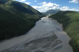
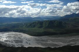
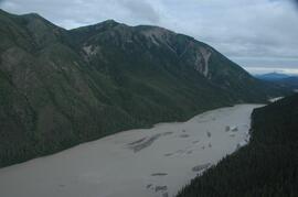
File consists of a draft paper from B.D. Tutty entitled "Utilization of Chinook Salmon Rearing in the Upper Nechako River", a paper by S.A. Macfarlane entitled "Utilization of the Nechako River by Chinook Salmon", and a summary of observation made and data recorded on rearing chinook salmon fry in the Nechako River by Department of Fisheries and Oceans' staff during field trips conducted from April 29 to May 2, 1980 and from June 23-29, 1980.

Various conference materials
2002.14.5.02 · File · 2002-2004
Part of Marianne (Marika) Ainley fonds

File consists of speaking notes, programs, pamphlets, and notes from various conferences Ainley attended. File also contains receipts and reimbursements for travel costs.

2002.14.4.28 · File · 1994-2003
Part of Marianne (Marika) Ainley fonds

File consists of conference proceedings from Ainley's presentations, "'Gynopia' at Work: Gendered Careers in Canadian Science," "Gendered Careers: Canadian women in science, 1890-1970," "Re-explorations: science and environment in 19th and 20th century Canada and Australia" and "Women and the Popularization of Science: 19th-century Women Science Writers in Canada"; an annual report for the University of Northern British Columbia; notes; and other material.

Various speaking notes
2002.14.4.02 · File · 1994-2002
Part of Marianne (Marika) Ainley fonds

File consists of speaking notes for a speech made by Ainley on December 6, 2000 at a memorial for the Ecole Polytechnique Massacre in Montreal, Quebec; Ainley's retirement speech speaking notes; and speaking notes for a presentation of Ainley's research for her Social Science and Humanities Research Council (SSHRC) funded project, "Engendering Canadian Science: Biographies of Women Scientists."

2000.1.1.3.18.005 · Item · [ca. 1960?]
Part of Cassiar Asbestos Corporation Ltd. fonds

Photograph depicts an unidentified individual wearing a welding helmet, and kneeling behind large bearing cups of one of the Ruston Hornsby diesel engines that turned the generators in the power house on the Cassiar plant. Door, bulletin board, and miscellaneous supplies in background.

West side of Generc River
2023.2.2.13.2.10 · Item · 8 Jul. 2007
Part of Dr. Paul Sanborn fonds

This image is part of the outbound sequence of aerial images obtained on the helicopter flight to the Klutlan Glacier study site. The sequence starts from the base camp at the White River crossing on the Alaska Highway and heads south, to a point just upvalley of the debris-covered terminus (approx. 10-15 km from Alaska border), and turning back north to the landing spot on the Generc River floodplain close to the study site (see Fig. 1 in paper).

2023.2.2.13.2.26 · Item · 8 Jul. 2007
Part of Dr. Paul Sanborn fonds

This image is part of the outbound sequence of aerial images obtained on the helicopter flight to the Klutlan Glacier study site. The sequence starts from the base camp at the White River crossing on the Alaska Highway and heads south, to a point just upvalley of the debris-covered terminus (approx. 10-15 km from Alaska border), and turning back north to the landing spot on the Generc River floodplain close to the study site (see Fig. 1 in paper).

2023.2.2.13.2.27 · Item · 8 Jul. 2007
Part of Dr. Paul Sanborn fonds

This image is part of the outbound sequence of aerial images obtained on the helicopter flight to the Klutlan Glacier study site. The sequence starts from the base camp at the White River crossing on the Alaska Highway and heads south, to a point just upvalley of the debris-covered terminus (approx. 10-15 km from Alaska border), and turning back north to the landing spot on the Generc River floodplain close to the study site (see Fig. 1 in paper).

2023.2.2.13.2.28 · Item · 8 Jul. 2007
Part of Dr. Paul Sanborn fonds

This image is part of the outbound sequence of aerial images obtained on the helicopter flight to the Klutlan Glacier study site. The sequence starts from the base camp at the White River crossing on the Alaska Highway and heads south, to a point just upvalley of the debris-covered terminus (approx. 10-15 km from Alaska border), and turning back north to the landing spot on the Generc River floodplain close to the study site (see Fig. 1 in paper).

2023.2.2.13.2.50 · Item · 9 Jul. 2007
Part of Dr. Paul Sanborn fonds

This image is part of the return trip sequence of aerial images obtained on the helicopter flight leaving the Klutlan Glacier study site. On the return leg at the end of the day, the flight initially went upvalley to pick up another party.

2023.2.2.13.2.25 · Item · 8 Jul. 2007
Part of Dr. Paul Sanborn fonds

This image is part of the outbound sequence of aerial images obtained on the helicopter flight to the Klutlan Glacier study site. The sequence starts from the base camp at the White River crossing on the Alaska Highway and heads south, to a point just upvalley of the debris-covered terminus (approx. 10-15 km from Alaska border), and turning back north to the landing spot on the Generc River floodplain close to the study site (see Fig. 1 in paper).

2023.2.2.13.2.51 · Item · 9 Jul. 2007
Part of Dr. Paul Sanborn fonds

This image is part of the return trip sequence of aerial images obtained on the helicopter flight leaving the Klutlan Glacier study site. On the return leg at the end of the day, the flight initially went upvalley to pick up another party.

2023.2.2.13.2.52 · Item · 9 Jul. 2007
Part of Dr. Paul Sanborn fonds

This image is part of the return trip sequence of aerial images obtained on the helicopter flight leaving the Klutlan Glacier study site. On the return leg at the end of the day, the flight initially went upvalley to pick up another party.

2023.2.2.13.2.09 · Item · 8 Jul. 2007
Part of Dr. Paul Sanborn fonds

This image is part of the outbound sequence of aerial images obtained on the helicopter flight to the Klutlan Glacier study site. The sequence starts from the base camp at the White River crossing on the Alaska Highway and heads south, to a point just upvalley of the debris-covered terminus (approx. 10-15 km from Alaska border), and turning back north to the landing spot on the Generc River floodplain close to the study site (see Fig. 1 in paper).

2023.2.2.13.2.08 · Item · 8 Jul. 2007
Part of Dr. Paul Sanborn fonds

This image is part of the outbound sequence of aerial images obtained on the helicopter flight to the Klutlan Glacier study site. The sequence starts from the base camp at the White River crossing on the Alaska Highway and heads south, to a point just upvalley of the debris-covered terminus (approx. 10-15 km from Alaska border), and turning back north to the landing spot on the Generc River floodplain close to the study site (see Fig. 1 in paper).

White River west bank
2023.2.2.13.2.04 · Item · 8 Jul. 2007
Part of Dr. Paul Sanborn fonds

This image is part of the outbound sequence of aerial images obtained on the helicopter flight to the Klutlan Glacier study site. The sequence starts from the base camp at the White River crossing on the Alaska Highway and heads south, to a point just upvalley of the debris-covered terminus (approx. 10-15 km from Alaska border), and turning back north to the landing spot on the Generc River floodplain close to the study site (see Fig. 1 in paper).

2023.2.2.13.2.71 · Item · 9 Jul. 2007
Part of Dr. Paul Sanborn fonds

This image is part of the return trip sequence of aerial images obtained on the helicopter flight leaving the Klutlan Glacier study site. On the return leg at the end of the day, the flight initially went upvalley to pick up another party. This image was taken after the helicopter turned north to return to base camp.

2023.2.2.13.2.74 · Item · 9 Jul. 2007
Part of Dr. Paul Sanborn fonds

This image is part of the return trip sequence of aerial images obtained on the helicopter flight leaving the Klutlan Glacier study site. On the return leg at the end of the day, the flight initially went upvalley to pick up another party. This image was taken after the helicopter turned north to return to base camp.

2023.2.2.13.2.75 · Item · 9 Jul. 2007
Part of Dr. Paul Sanborn fonds

This image is part of the return trip sequence of aerial images obtained on the helicopter flight leaving the Klutlan Glacier study site. On the return leg at the end of the day, the flight initially went upvalley to pick up another party. This image was taken after the helicopter turned north to return to base camp.

2023.2.2.13.2.72 · Item · 9 Jul. 2007
Part of Dr. Paul Sanborn fonds

This image is part of the return trip sequence of aerial images obtained on the helicopter flight leaving the Klutlan Glacier study site. On the return leg at the end of the day, the flight initially went upvalley to pick up another party. This image was taken after the helicopter turned north to return to base camp.

2023.2.2.13.2.76 · Item · 9 Jul. 2007
Part of Dr. Paul Sanborn fonds

This image is part of the return trip sequence of aerial images obtained on the helicopter flight leaving the Klutlan Glacier study site. On the return leg at the end of the day, the flight initially went upvalley to pick up another party. This image was taken after the helicopter turned north to return to base camp.

2023.2.2.13.2.73 · Item · 9 Jul. 2007
Part of Dr. Paul Sanborn fonds

This image is part of the return trip sequence of aerial images obtained on the helicopter flight leaving the Klutlan Glacier study site. On the return leg at the end of the day, the flight initially went upvalley to pick up another party. This image was taken after the helicopter turned north to return to base camp.

2023.2.2.13.2.01 · Item · 8 Jul. 2007
Part of Dr. Paul Sanborn fonds

This image is part of the outbound sequence of aerial images obtained on the helicopter flight to the Klutlan Glacier study site. The sequence starts from the base camp at the White River crossing on the Alaska Highway and heads south, to a point just upvalley of the debris-covered terminus (approx. 10-15 km from Alaska border), and turning back north to the landing spot on the Generc River floodplain close to the study site (see Fig. 1 in paper).