File consists of copies of exhibits 500-531 (incomplete) provided for the British Columbia Utilities Commission Public Review of the Kemano Completion Project. Includes: a document by T.G. Brown et. al. entitled "Availability of Juvenile Chinook Salmon to Predators Along the Margins of the Nechako and Stuart Rivers, B.C.", dated January 1994 (ex. #500); maps from the Nechako Fisheries Conservation Program entitled "Airphoto Mosaics: Nechako River from Kenney Dam to Vanderhoof" (ex. #520); document by P.A. Slaney entitled "In-Stream Engineering of Fish Habitat Structures in a Large Regulated Central B.C. River" (ex. #521); document by P .A. Slaney et. al. entitled "Debris Structure Placements and Whole-River Fertilization For Salmon ids in a Large Regulated Stream in B.C.", dated 1991 (ex. #522); and a "Submission by H. Brooks" (ex. #531).
File consists of copies of exhibits 537-719 (incomplete) provided for the British Columbia Utilities Commission Public Review of the Kemano Completion Project. Includes: a document by L.R. Russell et. al. entitled "Chinook Salmon Studies in the Nechako River: 1980, 1981, and 1982", dated November, 1983 (ex. #537); "Memorandum from C.S. Shirvell to G. Ennis, regarding Corrections to Notes from Nechako Workshop, November 14, 15", dated November 28, 1985 (ex. #538); "Memorandum from M. Fretwell to D.L. Deans, regarding Nechako River Programs: Stream Fertilization Fish Assessment Proposal", dated May 10, 1988 (ex. #540); "Summary of Evidence from the Nechako Fisheries Conservation Program for Technical Hearing Phase Ill: Fisheries", dated March, 1994 (ex. #572); and a "Memorandum from the Director General Pacific Region to Mr. Lefebvre, regarding Alcan Trial Proposed Out of Court Settlement", dated March 12, 1987 (ex. #719).
File consists of incoming correspondence to BCUC from registered participants and interested parties regarding the Kemano Completion Project review hearings.
File consists of correspondence and memoranda between members of the British Columbia Utilities Commission involved in the Kemano Completion Project hearings.
File consists of BCUC Kemano Completion Project Public Review hearings transcripts, pages 5191-5266 and 5450-5470. Includes transcription of discussion with Clark, Jenkins, Chapman, Mitchell, and Rublee.
Collection consists of material created or received by the British Columbia Utilities Commission for the Kemano Completion Project Review. This material was copied for reference for the Commissioner of the Kemano Completion Project Review, Dr. Peter Larkin. Includes incoming and outgoing correspondence, BCUC documents, information requests from the registered participants in the review, submissions to the public review and community hearings from participants, and exhibits submitted for inclusion in the review.
File consists of a draft copy of the list of exhibits (last revised August 12, 1994) for the British Columbia Utilities Commission Kemano Public Review hearings.
File consists of a report entitled "British Columbia Utilities Commission Kemano Deepwater Release Facility Recommendations: Implications for Sockeye Salmon". Authorship unknown. Annotated.
File consists of outgoing correspondence from BCUC to registered participants and others regarding the Kemano Completion Project review hearings.
File consists of records and textual material related to bear (predominantly in British Columbia) collected by Grant Hazelwood. Highlights include:
- A.N. Hamilton, "Kermode Bears in British Columbia" draft document, 1995 (reproduction)
- A. D. de Leeuw, "Conflicts and Interests in British Columbia Bear Management", Mar. 1997
- MacHutchon and Himmer, "Khutzeymateen Valley Grizzly Bear Study - Annual Progress Report - Year 2 (1990/91)", Mar. 1992
- Wayne McCrory and Stephen Herrero, "Preservation and Management of the Grizzly Bear in B.C. Provincial Parks: The Urgent Challenge", Mar. 1987 (reproduction)
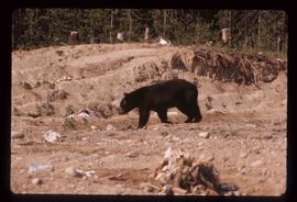
Image depicts a bear located at the Bear Lake Dump.

Image depicts a small section of the Bear Glacier.

Image depicts a close-up of a cave-like opening in the Bear Glacier.
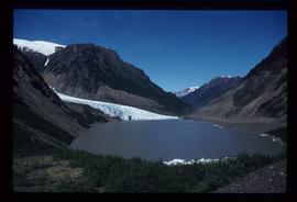
Image depicts the Bear Glacier in Bear Glacier Provincial Park, as well as what is possibly Strohn Lake.
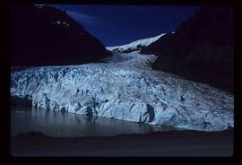
Image depicts the Bear Glacier in Bear Glacier Provincial Park.
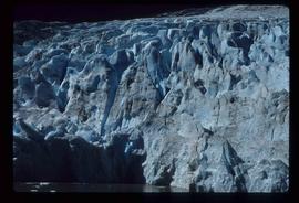
Image depicts a close-up of the Bear Glacier in Bear Glacier Provincial Park.

Image depicts Bear Glacier in the foreground and a mountain in the background, somewhere in Bear Glacier Provincial Park.

Image depicts the Bear Glacier with a cave-like opening.

Image depicts Bear Glacier in the foreground and numerous mountain peaks in the background in Bear Glacier Provincial Park.

Image depicts Sue and Kent Sedgwick with two dogs, standing with the Bear Glacier in the background.

Image depicts Sue and Kent Sedgwick with two dogs, standing with the Bear Glacier in the background.

Image depicts Sue Sedgwick with a dog, standing with the Bear Glacier in the background.

Image depicts the Bear Glacier stretching through a mountain range.

Image depicts the Bear Glacier stretching through a mountain range.

Image depicts the Bear Glacier stretching through a mountain range.

Image depicts a dog on a road, and a view of the mountains in Bear Glacier Provincial Park.
Photograph depicts blurry image of a bear among what is believed to be slash piles in the forest. Handwritten caption beside this photo reads: "Supposed to be a bear".
Photograph depicts a bear at the garbage dump of the Gold River logging camp. Five other bears have retreated to the fire weed and blackened tree stumps.
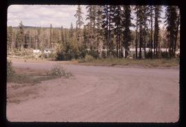
Image depicts a stand of trees in Bear Lake, B.C.
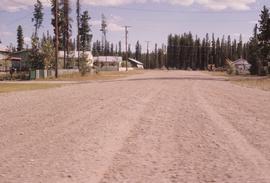
Image depicts some houses in Bear Lake, B.C.
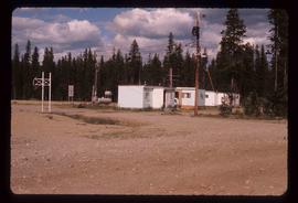
Image depicts some trailers in Bear Lake, B.C.

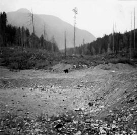
Image depicts a river, possibly near Bear Lake, B.C.

Image depicts a river, possibly near Bear Lake, B.C.
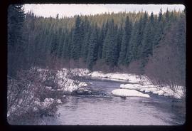
Image depicts the Crooked River in the Crooked River Pronvicial Park near Bear Lake, B.C.
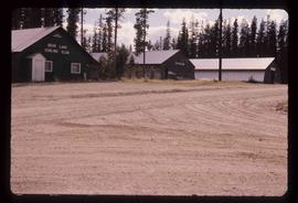
Image depicts the curling club and skating rink buildings in Bear Lake, B.C.

Image depicts some houses in Bear Lake, B.C.

Image depicts a view of Bear Pass, likely from Glacier Highway and somewhere in or near Bear Glacier Provincial Park, located north-east of Stewart, B.C.

Image depicts what is possibly Bear River in the Bear Glacier Provincial Park.

Image depicts the Bear River.

Image depicts what is possibly Bear River in the Bear Glacier Provincial Park.

Image depicts what is possibly Bear River in the Bear Glacier Provincial Park.

Image depicts what is possibly Bear River, flowing out from an opening in the Bear Glacier.

Image depicts what is possibly Bear River flowing past what is likely a section of the Bear Glacier.

Image depicts what is possibly Bear River flowing past what is likely a section of the Bear Glacier.

Image depicts a section of road running through the Bear River Gorge.
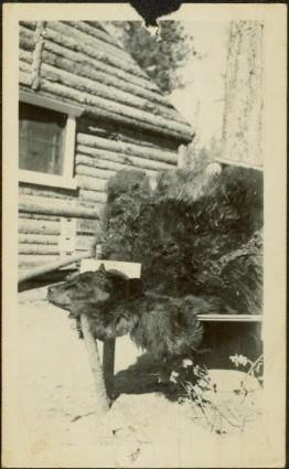
Photograph depicts the head and skin of a bear on display in front of log building. Trees in background.

Image depicts a snow sculpture of a bear, possibly during the Winter City Conference, in Prince George, B.C. Taken at the Prince George Civic Center. Map coordinates 53°54'45.6"N 122°44'59.6"W

Image depicts the canoe group preparing to canoe on Beaver Pond, which is the start of Kibbee Lake.

Image depicts a field of hay somewhere in Beaver Valley.

Image depicts what appears to be a small ranch. The slide is labelled "Becher's Prairie," possibly meaning Becher's Prairie Provincial Park in B.C.