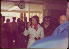
2010.13.01
·
Item
·
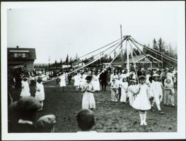
1927
Part of Prince George Historical Photograph Collection
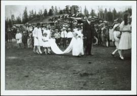
Crowd gathered around young girls holding ribbons anchored to top of pole in centre of image. Buildings stand in background.
Annotation on verso: “Maypole Dance 1927, Prince George."


![Vancouver Carney Study [Existing Land Use]](/uploads/r/northern-bc-archives-special-collections-1/d/8/4/d841cd29016ddb96663d51e137bd7a3b7c4dfe3ec645baca199615e3e4464da3/2023.5.1.21a_-_Vancouver_and_Carney_Study_Area_Existing_Land_Use_JPG85_tb_142.jpg)


![Proposed Land Use 1978-2012, Official Community Plan, City of Prince George [1982 Amendment]](/uploads/r/northern-bc-archives-special-collections-1/6/6/9/669fc9dc3b840a6896f6a2a968a948283a3c5d972b6b48d718b427a57ebbe67f/2023.5.1.22_-_1982_-_Proposed_Land_Use_1982-2012_JPG85_tb_142.jpg)
![Proposed Land Use 1978-2012, Official Community Plan, City of Prince George [1979 Amendment]](/uploads/r/northern-bc-archives-special-collections-1/c/e/d/ced2c18ae074ee79ace57d0454f038b5e09774ff682567e053093476af37c166/2023.5.1.14_-_1979_-_1978-2012_Official_Community_Plan_City_of_Prince_George_JPG85_tb_142.jpg)