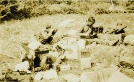
Sheep in a rocky pasture
Rock pile, unknown building, and hills can be seen in background.
Photograph is one of 11 images taken during a World Health Organization (WHO) trip, Human Rights of Women and Children, Peru, 1990. Possibly affiliated with World Council of Churches, International Ecumenical Delegation to Lima, Peru, 14-25 October 1990. See also items 2009.6.1.505 - 2009.6.1.515.
Vehicles and large cement building in background.
Photograph is one of 11 images taken during a World Health Organization (WHO) trip, Human Rights of Women and Children, Peru, 1990. Possibly affiliated with World Council of Churches, International Ecumenical Delegation to Lima, Peru, 14-25 October 1990. See also items 2009.6.1.505 - 2009.6.1.515.
Young girl stands among unidentified women and men seated around her. Man on far left holds tape recorder towards her.
Photograph is one of 11 images taken during a World Health Organization (WHO) trip, Human Rights of Women and Children, Peru, 1990. Possibly affiliated with World Council of Churches, International Ecumenical Delegation to Lima, Peru, 14-25 October 1990. See also items 2009.6.1.505 - 2009.6.1.515.
Unidentified man and woman sit in background.
Photograph is one of 11 images taken during a World Health Organization (WHO) trip, Human Rights of Women and Children, Peru, 1990. Possibly affiliated with World Council of Churches, International Ecumenical Delegation to Lima, Peru, 14-25 October 1990. See also items 2009.6.1.505 - 2009.6.1.515.
Young boy stands among unidentified women and men seated around him. Tape recorder is held towards him on far left.
Photograph is one of 11 images taken during a World Health Organization (WHO) trip, Human Rights of Women and Children, Peru, 1990. Possibly affiliated with World Council of Churches, International Ecumenical Delegation to Lima, Peru, 14-25 October 1990. See also items 2009.6.1.505 - 2009.6.1.514.
Photograph is one of 11 images taken during a World Health Organization (WHO) trip, Human Rights of Women and Children, Peru, 1990. Possibly affiliated with World Council of Churches, International Ecumenical Delegation to Lima, Peru, 14-25 October 1990. See also items 2009.6.1.506 - 2009.6.1.515.
The group stands in front of a cement building.
Photograph is one of 11 images taken during a World Health Organization (WHO) trip, Human Rights of Women and Children, Peru, 1990. Possibly affiliated with World Council of Churches, International Ecumenical Delegation to Lima, Peru, 14-25 October 1990. See also items 2009.6.1.505 - 2009.6.1.515.
Man wearing suit and tie is partially visible in background.
Photograph is one of 11 images taken during a World Health Organization (WHO) trip, Human Rights of Women and Children, Peru, 1990. Possibly affiliated with World Council of Churches, International Ecumenical Delegation to Lima, Peru, 14-25 October 1990. See also items 2009.6.1.505 - 2009.6.1.515.
The group stands in front of a brick wall.
Photograph is one of 11 images taken during a World Health Organization (WHO) trip, Human Rights of Women and Children, Peru, 1990. Possibly affiliated with World Council of Churches, International Ecumenical Delegation to Lima, Peru, 14-25 October 1990. See also items 2009.6.1.505 - 2009.6.1.515.
Trees in foreground, hills in background. Unidentified man stands on far left.
Photograph is one of 11 images taken during a World Health Organization (WHO) trip, Human Rights of Women and Children, Peru, 1990. Possibly affiliated with World Council of Churches, International Ecumenical Delegation to Lima, Peru, 14-25 October 1990. See also items 2009.6.1.505 - 2009.6.1.515.
Unidentified individuals can be seen walking and sitting behind arches. One man lies on street in foreground.
Photograph is one of 11 images taken during a World Health Organization (WHO) trip, Human Rights of Women and Children, Peru, 1990. Possibly affiliated with World Council of Churches, International Ecumenical Delegation to Lima, Peru, 14-25 October 1990. See also items 2009.6.1.505 - 2009.6.1.515.
Item is a photograph of two survey crewmen seated on the ground surrounded by camp rations and eating.
Aerial view, Alpine Club of Canada's 1967 Yukon Alpine Centennial Expedition, Kluane National Park, Yukon
Handwritten photo album caption below this photo reads: "Whitehorse 'Runway'". Photograph depicts three planes in distance on runway, one of them is parked in front of large building on left (hangar?). Two long unidentified buildings in background on left, trees and range of hills in background on right. See also items 2006.20.12.1 & 2006.20.12.43.
Royal Canadian Air ForcePhotograph depicts a group of Whitehorse citizens watching a military parade in front of a Canadian Bank of Commerce.
Aerial view, Alpine Club of Canada's 1967 Yukon Alpine Centennial Expedition, Kluane National Park, Yukon
Frontal detail of <i>Pedicularis</i> in flower, Nunavut
Caption describing photograph: "White Spruce within 20' of pine (see GBW Film 3 Frame 1 - 2007.1.30.2.026). Same age, same site. Height 5' 1966 leader 6". Adelges." Harry Coates stands in the photograph for scale.
Footage of white robin.
Location of filming is unknown.
This image is part of the outbound sequence of aerial images obtained on the helicopter flight to the Klutlan Glacier study site. The sequence starts from the base camp at the White River crossing on the Alaska Highway and heads south, to a point just upvalley of the debris-covered terminus (approx. 10-15 km from Alaska border), and turning back north to the landing spot on the Generc River floodplain close to the study site (see Fig. 1 in paper).
This image is part of the return trip sequence of aerial images obtained on the helicopter flight leaving the Klutlan Glacier study site. On the return leg at the end of the day, the flight initially went upvalley to pick up another party. This image was taken after the helicopter turned north to return to base camp.
This image is part of the outbound sequence of aerial images obtained on the helicopter flight to the Klutlan Glacier study site. The sequence starts from the base camp at the White River crossing on the Alaska Highway and heads south, to a point just upvalley of the debris-covered terminus (approx. 10-15 km from Alaska border), and turning back north to the landing spot on the Generc River floodplain close to the study site (see Fig. 1 in paper).
Alpine Club of Canada's 1967 Yukon Alpine Centennial Expedition, Kluane National Park, Yukon
Image depicts the White Pass Train crossing over a railway bridge at an uncertain location.
Image depicts the White Pass Train crossing over a railway bridge at an uncertain location in the mountains.
Image depicts the White Pass Train crossing over a railway bridge at an uncertain location.
Image depicts a sign, labelled "The White Pass Snow Fleet," which details the history of the fleet; it is located in Skagway, Alaska.
Item is a White Pass & Yukon Route pamphlet from 1971. Shows illustrated route map and fares.
Image depicts a mountain side somewhere along the White Pass railway. The thin ridge along the mountain side is possibly either a highway or part of the railway.
Image depicts a grave somewhere along the White Pass railway.
A blueprint produced by Strong Lamb and Nelson (Kamloops) LTD. It shows the plan the roof framing and sections.
A blueprint produced by Strong Lamb and Nelson (Kamloops) LTD. It shows the site plan of a building.
A blueprint produced by Strong Lamb and Nelson (Kamloops) LTD. It shows the plan the foundation plan and sections.
A blueprint produced by Strong Lamb and Nelson (Kamloops) LTD. It shows the general notes and typical details of a building.
A blueprint produced by Strong Lamb and Nelson (Kamloops) LTD. It shows the plan for first floor and front elevation of a building.
The item is a black and white photograph depicting the front of a white house on a farm.
The item is a black and white photograph depicting the front of a white house in a rural location.
The item is a black and white photograph depicting the front and side of a white house on a farm.
The photograph depicts a white house in the Old Cariboo Highway area outside of Prince George, BC. An RV is parked next to the house and a horse can be seen in a fenced off area behind the house.