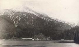
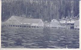
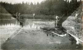
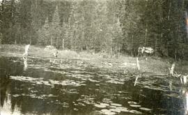
File consists of the first final draft of the "A Report of the Kemano Task Force: Review of the Environmental Studies Report Submitted by Alcan in Support of the Kemano Completion Proposal in Relation to Continued Fish Production from the Rivers Involved". A second final draft of this report was released in 1990, and a third final draft in 1994. The Report of the Kemano Task Force was never officially published, although it was made available upon request to the public after 1994.
File consists of an original copy of the August 1987 final draft of the "Report of the Kemano Task Force", edited by Schouwenburg. Includes accompanying memoranda regarding the report.
File consists of an original copy of the April 1990 final version of the "Report of the Kemano Task Force", edited by Schouwenburg. Includes accompanying memoranda regarding the report.
File consists of an annotated photocopy the December 1985 draft of the "Report of the Kemano Task Force", edited by Schouwenburg.
File consists of a published copy of a Canadian Manuscript Report of Fisheries and Aquatic Sciences report by Emmett et al. entitled "A Prototype Submersible Electrofisher: Design and User Manual".
File contains an original EP 433 report entitled "A Preliminary Working Plan for the Aleza Lake Experimental Forest" by L. DeGrace of the BC Forest Service.
File consists of a review paper by Hartman entitled "A Preliminary Review of and Comments on the Aluminum Company of Canada Ltd. Proposal for Kemano Completion", which was a response to a request to look at rearing biology of salmonids in relation to flow regimes proposed by Envirocon Ltd. and their clients, the Aluminum Company of
Item is an original report by The Sierra Club of Western Canada entitled "A Plan for the Future of Strathcona Park".
Photograph depicts a pile of hunting trophies in Lillooet, B.C. Visible are what appear to be mule deer antlers, big horn sheep horns, and mountain goat pelts and horns.
Photograph depicts A. H. Holland standing under a tarp with a border collie dog. A pile of firewood is also under the tarp.
Item is the BC Forest Service's "A Guide to Stand Treatment".
Item is an original copy of "A Forest Practice Code for the Spruce-Balsam Type" prepared by the Cariboo Section of the Canadian Institute of Forestry.
Item is an original report entitled "A Fisheries and Wildlife Survey of the Burnie Lakes Park Proposal" by E. Osmond-Jones et al. for BC Parks branch biologist W.G. Hazelwood. Includes original photographic prints pasted into the report.
Item is a photocopied version of Alexander's "A Fifteen Year History of the Virgin Spruce-Balsam Type at Aleza Lake Experiment Station and Suggestions for Management". Location of original unknown.
File contains a possible photocopied excerpt (pages 14-47) from "A Field Guide for the Identification and Interpretation of Ecosystems of the SBSj1 in the Prince George Forest Region", which was a 1987 unpublished BC Ministry of Forests report by C. DeLong, S. Jenvey and A. McLeod.
File consists of an article reprint from the Regulated Streams journal by Scott and Shirvell entitled "A Critique of the Instream Flow Methodology and Observations on Flow Determination in New Zealand".
File consists of a photocopy of an article from the Canadian Journal of Fisheries and Aquatic Sciences (Vol. 42) by Mathur et al. entitled "A Critique of the Instream Flow Incremental Methodology".
File consists of a copy of an article by Mathur et al. entitled "A Critique of the Insteam Flow Incremental Methodology" from the Canadian Journal of Fisheries and Aquatic Sciences, Vol. 42.
File consists of a photocopy of an Envirocon graphs and tables, possibly copies of overheads used in a presentation entitled "A Comparison of the Results from Habitat-ENV with Results from Habitat (IFG)".
Photograph depicts open fields, cleared land, rolling hills and a river. There is a fence across the middle of the field and a building near the riverbank.
Photograph depicts a man standing on the deck of a sailboat with a view of a cannery along the shoreline of Ocean Falls with mountains in the background.
Photograph depicts a cannery in front of a forested mountains with water in the foreground.
Photograph depicts a cannery on pilings with a body of water in the foreground and houses and trees in the background.
Item is an original copy of an unpublished brief by M. Keith Moore sent to the BC Parks Branch entitled "A Brief Requesting a Complete Ban on all Hunting in Mount Edziza Provincial Park". Also includes a summary follow-up one-pager by W.G. Hazelwood, Parks Biologist, entitled "Report on Mt. Edziza Wildlife" and accompanying correspondence.
File consists of "A Brief on the Kemano Completion Project's Hydrothermal and Internal Wave Modelling" by G.A. Lawrence.
File consists of "A Brief of the Nechako Valley Regional Cattlemen's Association to the British Columbia Utilities Commission Concerning the Kemano Completion Project".
File consists of "A Brief for Presentation to the B.C. Utilities Commission Review Panel on the Kemano Completion Project by G.F. Hartman". Annotated by Hartman.
Photograph depicts four men bathing in a backwater or lake. One clothed man stands on the shore.
Photograph depicts two men wading and bathing in shallow water with lily pads.
Photograph depicts three men standing on the banks of a backwater or lake, with clothing piled on the ground.
Photograph depicts a stage coach harnessed with six horses, a fence and a log building in the background.
File consists of documentation on E.P. 819.08.03.01 Black Birch Creek Half-Sib Progeny Trial.
File consists of documentation on E.P. 819.06.03.01 Holmes River Half-Sib Progeny Trial.
File contains correspondence regarding lack of funding for research projects between the Science Council of British Columbia and Mike Jull, Prince George Forest Region.
File consists of photographs of trees and forests, some photographs include Harry Coates.
File consists of notes and documentation for experiment 657.06.
File consists of E.P. 657.06 Test Site Report, region 10 Mackenzie site 5 Salmon Lake, Block 99 & 100.
File consists of E.P. 657.06 Test Site Report, region 10 Mackenzie site 3 Dog Creek Block 95 & 96.
File consists of E.P. 657.06 Test Site Report, region 10 Mackenzie site 1 Blackwater, block 91 & 92.
File consists of E.P. 657.06 Test Site Report, region 8 Willow site 3 Camp 4 Block 75 & 76.
File consists of E.P. 657.06 Test Site Report, region 9 Nechako site 2 Fraser Lake, Block 83 & 84.
This map depicts a drawn bench plan for the estimated excavated waste for bench 6440 during the first quarter of 1972. Annotated details include the approximate excavated ore tonnages, broken and planned values for the first quarter and revised calculations from previous years values. Planned excavated areas are drawn with different colors.
This map depicts the pit layout and estimated waste extraction areas for 6410 bench. Extraction dates accompanied by its total tonnages are located within each planned area. Certain extraction dates are labeled with bench numbers. Annotated details include extraction dates, approximate total tonnages per area as well as extraction dates, total planned and broken tonnages, total tonnages from December 31, 1970 and numerical bench markers. The hand drawn plan consists of solid lines drawn with green, yellow, orange and lead pencils.
This map depicts the pit layout and estimated waste extraction areas for 6380 bench. Extraction dates accompanied by its total tonnages are located within each planned area. Certain extraction dates are labeled with bench numbers. Annotated details include extraction dates, approximate total tonnages per area as well as extraction dates, total planned and broken tonnages, total tonnages from December 31, 1970 from a survey done in September 1, numerical bench markers as well as a rough colored legend depicting extraction month by color. The hand drawn plan consists of solid lines drawn with green, yellow, red and lead pencils.
This map depicts the pit layout and estimated waste extraction areas for 6350 bench. Extraction dates accompanied by its total tonnages are located within each planned area. Annotated details include extraction dates, approximate total tonnages per area as well as extraction dates, total planned and broken tonnages and total tonnages from December 31, 1970 from a survey done in September 30. The hand drawn plan consists of solid lines drawn with red, green and orange colored pencils.
This map depicts the pit layout and estimated waste extraction areas for 6320 bench for the end of September to October. Extraction dates are included within certain portions of the plan. Annotated details include numerical bench markers, extraction dates, and approximate waste tonnage calculation for October. The hand drawn plan consists of solid and broken lines drawn with red, orange and lead pencils as well as black ink.
This map depicts the pit layout and estimated waste extraction areas for 6320 bench. Extraction dates accompanied by its total tonnages are located within each planned area. Certain extraction dates are labeled with bench numbers. Annotated details include extraction dates, approximate total tonnages per area accompanied by extraction dates, total planned tonnages, total tonnages from December 31, 1971 as well as a rough colored legend depicting extraction month by color. The hand drawn plan consists of solid lines drawn with green, red, orange and lead pencils.
This map depicts the generalized pit layout and estimated waste extraction areas for 6290 bench for the month of October and November. Extraction dates as well as total unbroken tonnages are included within certain portions of the plan. Annotated details include numerical bench markers, extraction dates, total tonnages to be extracted and approximate waste tonnage calculations for October. The hand drawn plan consists of solid and broken lines drawn with red, green, orange and lead pencils as well as black ink.
This map depicts the generalized pit layout and estimated waste extraction areas for 6290 bench for the month of November. Annotated details include numerical bench markers and waste extraction dates. The hand drawn plan consists of solid and dotted lines drawn with green, orange, red, blue and lead pencil.
This map depicts the pit layout and estimated waste extraction areas for 5870 bench for the end of August to November. Extraction dates, approximate extraction tonnages and ore, waste and talus locations are included throughout the plan. Annotated details include numerical bench markers, extraction dates, approximate extraction tonnages, ore, waste and talus locations as well as waste, ore, talus and total tonnage calculations for October. The hand drawn plan consists of solid and broken lines drawn with red, blue, orange and lead pencils as well as black ink.