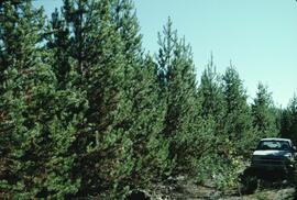
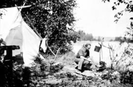
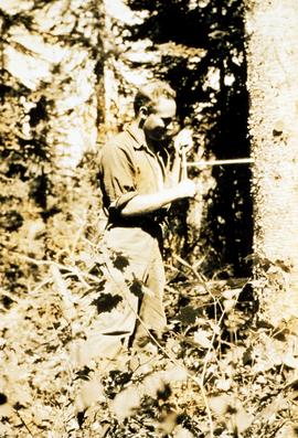
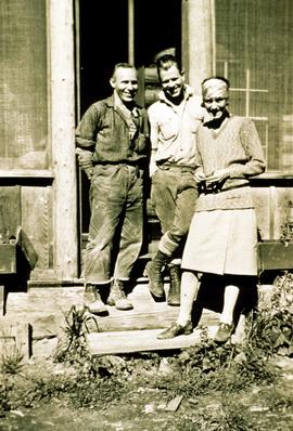
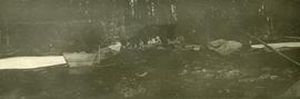
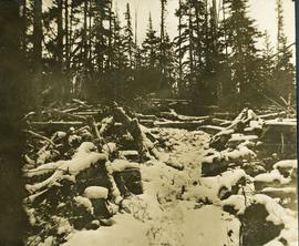
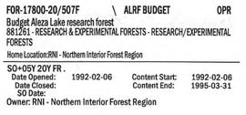
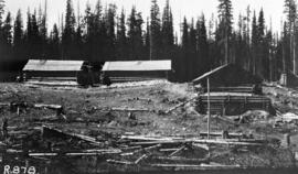
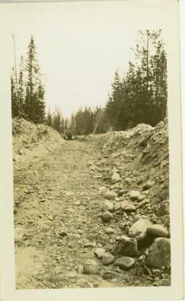
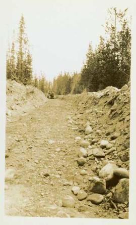
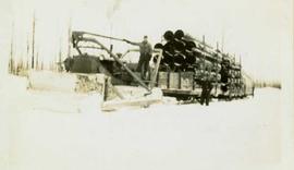
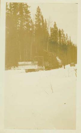
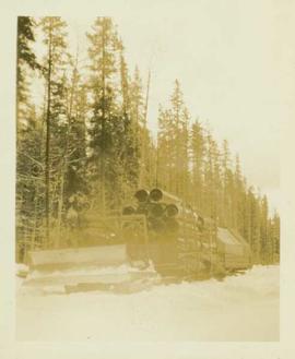
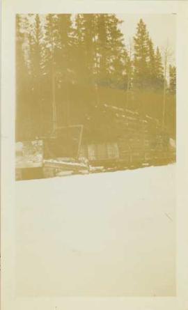
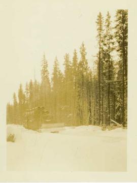
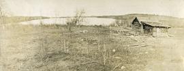
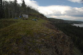
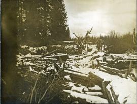
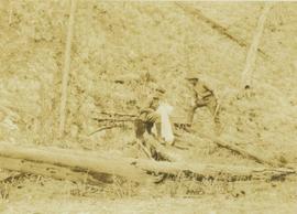
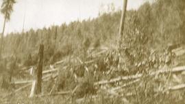
Photograph depicts forest growth with fallen trees and remnants of a forest fire.
Item is a photograph of a copy print that has been reproduced as a slide, resulting in low photographic quality. Location of original photograph unknown.
Alec Gordon was a soil specialist who conducted land use surveys separating forest land from potential agricultural land.
Item is a photograph of a copy print that has been reproduced as a slide, resulting in low photographic quality. Location of original photograph unknown.
"After we made the acquaintance of several girls living in Aleza Lake village, they would be invited to come to the camp on a Sunday to enjoy the music. Social events were infrequent, so they did not complain about having to travel three miles by rail and then walking another three-quarters of a mile on a foot trail that was sometimes quite muddy." -- from An Early History of the Research Branch, British Columbia Ministry of Forests and Range (p. 48)
Item is a photograph of a copy print that has been reproduced as a slide, resulting in low photographic quality. Location of original photograph unknown.
Photograph depicts A cluster of boats anchored on the edge of a stream, some men standing on shore. Photograph is dark and blurry.
Photograph depicts a bow of a boat in the foreground. Thick ice on the edges of the river, water with floating ice beyond the boat. Trees lines the shoreline.
Photograph depicts five men carrying shovels, walking through the snow in single file.
Photograph depicts a view of a small bridge and dirt road joining buildings on two sides of a river. Loaded packhorses are traveling down the road. There are mountains in the distance. Survey of 55th parallel.
Photograph depicts a rustic bridge covered in snow leading across a log jam. A horse is walking on the bridge toward the photographer. [55th parallel]
Photograph depicts a trail through log jam built by survey party. [55th parallel]
Photograph depicts the bridge at Goodacre Pond in Beacon Hill in Victoria, BC. Duck in foreground.
Photograph depicts the bridge at Goodacre Pond in Beacon Hill in Victoria, BC. Swans are swimming in the pond and there is a path and footbridge behind the pond.
Photograph depicts eight men building a wooden bridge over a section of lake. A mining (?) work camp is visible in a foreseted background.
Item is a map of British Columbia and is a key map showing: maps published on scale 1 inch to 2 miles and summary zones of the provincial forest inventory. Map includes index of post offices correct to October 22, 1956.
Photograph depicts the British Columbia Parliament Buildings in Victoria, BC.
Item is a map compiled and produced by Geographic Division, Surveys and Mapping Branch, Department of Lands, Forests, and Water Resources ; geological and physiographical data supplied by Dept. of Mines and Petroleum Resources, Victoria, B.C. (1964).
Photograph depicts Bruce Otto, a hunting guide, standing next to Prentiss Gray, who is seated on a stump skinning his prized mountain goat.
File consists of budget proposals and forecasts for 1993/94 and 1994/95 with recommendations of road maintenance as the central expenditure.
Photograph of Prince Rupert businesses amidst clear cut stumps. Businesses include "Stewart and Mobley Groceries, Fruits and Produce." Printed annotation on recto reads: "Prince Rupert, B.C., Oct. 09."
Photograph copy print contains the following writing on verso:
British Columbia Archives and Records Service Visual Records Unit
Negative No. H-5387
GR 1348
B.C. Forest Service : The Young Men's Forestry Training Plan
September 1, 1935
Photographer's photo number R878. No caption on back of photograph to glean further information. Title provided based on contextual information from related photographs and documents.
Photograph depicts buildings looking north of the Empress Hotel on Douglas Street in Victoria, BC. The Belmont is on the right and the Customs Building on the left.
Photograph depicts a view looking down on the Bulkley River, forested banks on both sides of the river, high mountains in the distance.
Photograph depicts a person operating a bulldozer to clear a path through the snow in a forested landscape.
Photograph depicts a bulldozer convoy freighting supplies into camp in winter.
Photograph depicts a bulldozer driving down a shallow ditchline with a forested area in the background.
Photograph depicts a bull dozer driving down a gravel road through a forested landscape.
Photograph depicts a bulldozer in a winter landscape pulling sleds loaded with large pipes and steel drums potentially heading for the mines for assembly.
Photograph depicts a distance perspective of a bulldozer pulling sleds loaded with large pipes and steel drums potentially heading for the mines for assembly.
Photograph depicts a bulldozer pulling sleds loaded with large pipes and steel drums potentially heading for the mines for assembly.
Photograph depicts a bulldozer pulling sleds loaded with large pipes and steel drums potentially heading for the mines for assembly. Close up of 2004.8.1.57
Photograph depicts the front end of a bulldozer being operated by an unidentified man in front of a forested background.
Slide depicts a bulldozer clearing ground, likely at the Aleza Lake Experiment Station.
Photograph depicts a bulldozer transporting mining supplies (pipes) in a snow covered forest landscape.
Attached description: Unitized bundles of eight strapped pulp bales weighing 16 tons are loaded into the ship's hold by specially designed over-running cranes.
Photograph depicts a snow covered cemetery with gravestones, tombstones, and monuments.
Item is a reproduction of a report entitled "Burns Bog Analysis" by Catherine Berris & Associates for the Ministry of Environment, Lands & Parks. The scope of this Burns Bog Analysis was inventory and preliminary analysis; the process included information collection and review, preliminary analysis of existing and potential land uses and a public open house.
Photograph depicts a rustic log cabin, shed and garden fence near the edge of a lake. The surrounding landscape is low rolling hills.
Photograph depicts a man standing beside a discovery vein along a rocky cliff. The location is believed to be the east side of Duncan Mountain, east of the north end of Thutade Lake, some 140 miles northeast of Stewart. The Cairn group of 12 mining claims was located by Cominco Ltd. in 1931.