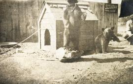
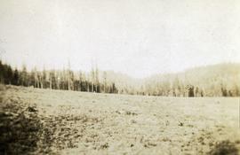
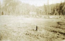
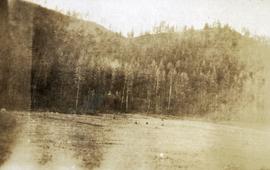
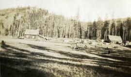
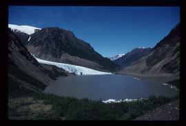
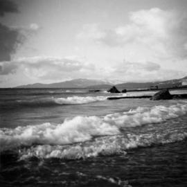
Image depicts Sue Sedgwick with a dog, standing with the Bear Glacier in the background.
Image depicts Sue and Kent Sedgwick with two dogs, standing with the Bear Glacier in the background.
Image depicts a small section of the Bear Glacier.
Image depicts a close-up of a cave-like opening in the Bear Glacier.
Image depicts the Bear Glacier in Bear Glacier Provincial Park, as well as what is possibly Strohn Lake.
Image depicts the Bear Glacier in Bear Glacier Provincial Park.
Image depicts a close-up of the Bear Glacier in Bear Glacier Provincial Park.
Image depicts Bear Glacier in the foreground and a mountain in the background, somewhere in Bear Glacier Provincial Park.
Image depicts the Bear Glacier with a cave-like opening.
Image depicts Bear Glacier in the foreground and numerous mountain peaks in the background in Bear Glacier Provincial Park.
Photograph depicts bears in captivity.
Photograph depicts bears in captivity. The large bear is chained by a neck collar.
Photograph of a long wooden bridge spanning a river. Forest and hills are visible in the background. Printed annotation on recto reads: "#46 Bear Creek Bridge, Stewart, BC."
Handwritten annotation on slide casing reads: “behind hotel Costa do Sol”.
Photograph is one of seven images believed to have been taken on a Canadian University Service Overseas (CUSO) mission in Mozambique; see also items 2009.6.1.483 - 2009.6.1.489.
Photograph depicts Beach Ave. in Vancouver, with the photo taken near the swimming pool and looking west. Photo was taken after a storm.
Image depicts the BCR tracks passing through a mill somewhere near the 100 Mile.
File contains slides depicting views of numerous B.C. Mountains.
File consists of notes and reproductions relating to the Upper Fraser historical geography field trip for the BC Historical Federation by Kent Sedgwick. Includes photographs depicting a group from the BC Historical Federation standing outside at one of the East Line communities listening to a presentation by Kent Sedgwick and Greg Halseth (May 2003).
This map depicts where to find ghost towns, forts, First Nation villages, and sites with supposed hidden treasures in British Columbia.
B.C. Express Steamer, Fraser River. Trees and mountains in background. Printed annotation on recto reads: “B.C. Express Steamer, Fraser River.” Handwritten annotation in pencil on verso reads: “BC Express Fraser River BC”
Postcard photograph depicts sternwheeler, men visible on deck, hills on opposite shore in background.
Printed annotation on recto reads: “B.C. Express Steamer, Fraser River.” Handwritten annotation in pencil on verso reads: “BC Express Fraser River BC”.
Photograph depicts sternwheeler passing through rapids of the Fraser River, B.C. Printed annotation on recto reads: “The B.C. Express Passing through the Grand Canyon B.C.”, handwritten in red ink: “1913”.
Photograph depicts a paddle wheel conveyor believed to be in the Fort George Canyon on the Fraser River. Rocky shore in foreground, trees on opposite shore in background.
Photograph depicts a paddle wheel conveyor believed to be in distress in the Fort George Canyon on the Fraser River. Rocky bank in foreground, trees on opposite shore in background.
Photograph depicts a paddle wheel conveyor believed to be in distress in the Fort George Canyon on the Fraser River. Trees on opposite shore in background.
2 Stern wheelers tied to the river bank. Printed annotation on recto reads: “The B.C. Express mail Steamers No. 102.”
Postcard photograph depicts lofty view of sternwheeler in river, snow capped mountains in background.
Printed annotation on recto reads: “R.M.S. B.C. Express in Upper Canyon Fraser River.”
File contains slides depicting maps from the B.C. Atlas.
Subseries contains material collected and created by Kent Sedgwick for research on various areas in British Columbia and Alberta. Includes written notes by Kent Sedgwick, pamphlets, and newspaper clippings relating to towns and settlements. These areas include Quesnel, Likely, the Yukon Telegraph Trail, Barkerville, Wells, the Cariboo region, Fort Alexandria, Soda Creek, the Chilcotin region, Jasper, the Rocky Mountains, Mackenzie, Tumbler Ridge, the Peace River region, Fort St. James, the Omineca region, Kitimat, Lethbridge, the Bulkley Valley, and Fort Mcleod. These files cover a variety of topics including Chinese people in British Columbia, land settlement, tourism, and historic information on the regions.
Image depicts the Battle Hill National Historic Site in Kitwanga, B.C.. The sign located there says: "The small knoll in the valley was a native fortress. Legends maintain that it was man-made: built to repel marauding coastal tribes. The hill was the scene of local tribal battles, and at one time was crowned with the defenders' buildings. Known as Dhawdezp, the unique mound is a prominent feature in the legends and history of the Indian people."
Photograph depicts three or more people bathing in a stream surrounded by forest.
Item is an original map depicting the Bateman forestry route. Map includes pen markings.
Photograph depicts a newly cleared field, forest and mountains in the background.
Photograph depicts a stump in the foreground, a building in the midground and forested mountains in the background.
Photograph depicts a field in the foreground, forest and mountains in the background.
Photograph depicts a field in the foreground, buildings and stumps in the midground and forest in the background.
Photograph depicts a newly cleared field, forest and mountains in the background.
Photograph depicts packed horses walking in single file across an alpine meadow.
Image depicts a basalt landform somewhere in or near Quesnel, B.C.
Image depicts a section of river located somewhere near Barriere, B.C.
Handwritten caption beside this photo reads: "Elaborate barricades required due to amount of loose rock falling continuously". Three men work in area confined by barricades made of vertical metal rods and horizontal wood planks. Miscellaneous building material and supplies cover the ground. Rock pile in foreground on right.
Image depicts Barkerville, B.C.
Image depicts a forest of bare trees, possibly somewhere near Fort St. John, B.C.
Image depicts numerous logs that have been stripped of their bark at a saw mill in Prince George, B.C.
Item is a photograph of a woman working in a field.
Item is a photograph of tress on a rock covered embankment taken from a moving vehicle.
Item is a photograph of a sail boat hauling logs.
Item is a photograph of people and boats on the shore of a river.