Aperçu avant impression Fermer

Affichage de 54241 résultats

Archival description
21791 résultats avec objets numériques Afficher les résultats avec des objets numériques
Clear Cut Logging
2012.13.1.122.03 · Pièce · Oct. 1975
Fait partie de J. Kent Sedgwick fonds

Image depicts a highway, and a section of mountain in the background which is bare due to clear-cut logging. It is possibly somewhere near Prince George, B.C.

Clear Cut Logging
2012.13.1.122.04 · Pièce · Oct. 1975
Fait partie de J. Kent Sedgwick fonds

Image depicts a logging area, and a section of mountain in the background which is bare due to clear-cut logging. The slide is also labelled "logging show." It is possibly somewhere near Prince George, B.C.

Clear expanse
Pièce · 7/1/1972
Fait partie de Mary Fallis fonds

Branches of <i>Populus</i> frame lake view, Takla Lake, Northern British Columbia

Clearing
Pièce · 8/1/1967
Fait partie de Mary Fallis fonds

Clouds blowing away from mountain peak, Alpine Club of Canada's 1967 Yukon Alpine Centennial Expedition, Kluane National Park, Yukon

Clearwater River, BC
2009.5.3.4 · Pièce · [ca. 1913]
Fait partie de Taylor-Baxter Family Photograph Collection

Photograph depicts opposite shore in background behind river, and close shore in foreground on right. Men can be seen standing and paddling on canoe in distance. Handwritten photo caption on verso and recto of this photograph reads: "On the Clearwater".

Clearwater River, BC
2009.5.3.3 · Pièce · [ca. 1913]
Fait partie de Taylor-Baxter Family Photograph Collection

Photograph depicts opposite shore in midground behind river, tree-covered hills in background. Handwritten photo caption on verso and recto of this photograph reads: "On the Clearwater".

2020.4.6 · Série organique · 1976-2012
Fait partie de G. Gary Runka fonds

Series consists of the client file project records of G.G. Runka Land Sense Ltd., Gary Runka's consultancy business (co-owned with Joan Sawicki until 1991). G.G. Runka Land Sense Limited was incorporated as a company on 30 Nov. 1978 and dissolved on 30 Nov. 2018. Most business activity ceased after Gary Runka's death in July 2013. The company provided comprehensive professional services in land inventory, environmental assessment, integrated resource management, land and water use conflict resolution and interdisciplinary land use planning. Over the course of the company's operation, Gary Runka and his firm consulted on 681 assignments ranging from very large projects (such as the Site C project) to small residential/commercial land capability assessments.

The Land Sense Ltd. client files generally include records such as correspondence, contracts, invoices, project reports, publications, ephemera, memoranda, map excerpts, legal documents, meeting materials, clippings, and handwritten notes. Some client files are accompanied by related maps, photographs, aerial photographs, and/or digital records on storage media.

Cliff Road
2012.13.1.59.12 · Pièce · July 1980
Fait partie de J. Kent Sedgwick fonds

Image depicts a camper parked on the side of a narrow road along a cliff as another car approaches; located somewhere near Bralorne, B.C.

Cliff Road - Overhang
2012.13.1.59.14 · Pièce · July 1980
Fait partie de J. Kent Sedgwick fonds

Image depicts a camper passing under an overhang as it drives along a narrow road near a cliff; located somewhere near Bralorne, B.C.

Climate Change Issue Media Document
2020.4.2.3.119 · Pièce · 2000
Fait partie de G. Gary Runka fonds

This unpublished document from the BC Ministry of Environment, Lands and Parks Communications Branch collates information about the issue of climate change circa the year 2000. Includes polling highlights from a poll of BC residents about climate change in 1998; a summary of points about media interest in climate change circa 1998-2000; and a short listing of supportive business comments on climate change circa 1999-2000.

Climbing
2012.13.1.56.38 · Pièce · 1973
Fait partie de J. Kent Sedgwick fonds

Image depicts a climbing either up or down a rock face.

Climbing the Rockies
2013.6.36.3.02.01 · Pièce · [before 1906?]
Fait partie de David Davies Railway Collection

Postcard depicts Field station in the Rockies. Man standing on the left with a bowler hat was Chris McGregor, a professional (mining?) engineer. Earliest frank seen for the postcard was in July 1906.

Clinton Creek Aerial - Flight Index
2000.1.1.1.4.069 · Pièce · May 1965
Fait partie de Cassiar Asbestos Corporation Ltd. fonds
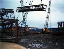
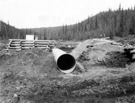
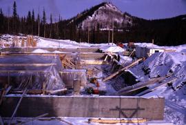
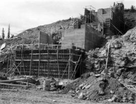
Flight index for 68 aerial photographs accompanying item. Map depicts Clinton Creek area, identifying airfield and mine. Cartographic legend: "CASSIAR ASBESTOS CORP LTD" "FLIGHT INDEX" "DATE OF PHOTOGRAPHY MAY 1965" "SCALE OF PHOTOGRAPHY 1" = 900 APPROX." "McELHANNEY ASSOCIATES VANCOVER B.C." "JOB No C189/6524".