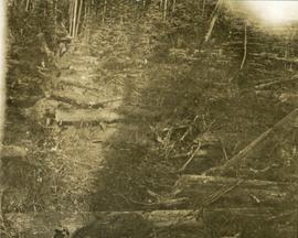
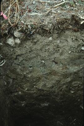
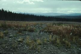
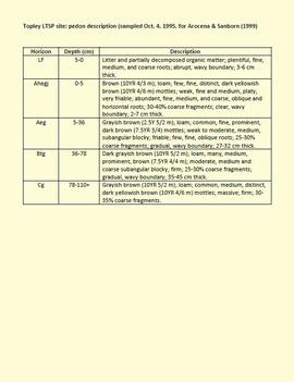
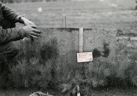
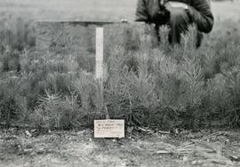
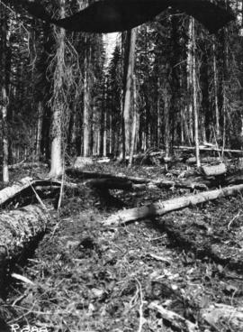
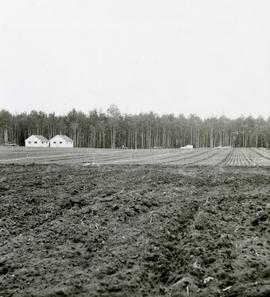
Caption describing photograph: "Foreground cultivated in readiness for establishment of seed or transplant beds. Backgroun is transplant area est. Spring 1966."
Photograph depicts towers and bucket in foreground, plantsite midground in valley, opposite mountains in background. Handwritten annotation on recto of photograph: "GENERAL VIEW VISIBLE TOWERS ARE IN #1 SECTION PLANT IN BACKGROUND". Photograph was glued to cardboard backing with the annotation: "1962".
Photograph depicts towers and buckets in distance. Gravel road in foreground winding through hills of dirt. Handwritten annotation on recto of photograph: "#1 SECTION". Photograph was glued to cardboard backing with the annotation: "1962".
Photograph depicts a tangle of fallen logs and growing trees.
Photograph depicts trail making on summit between John Brown and Kitseucla creeks. Survey of 55th parallel.
Photograph depicts a tug boat hauling a line of small fishing boats across the water with a mountain in the background. Annotation on verso of photograph states: "Tow of Cannery Fishing boats"
Photograph depicts two tall totem poles, buildings and mountain in the background.
This born-digital document provides a description of the Topley LTSP site pedon.
Caption describing photograph: "Top Pruning of 1 1/2 + 1 1/2 Lodgepole Pine at Red Rock Nursery. Block No. 3. Pruned to 8". Control."
Caption describing photograph: "Top Pruning of 1 1/2 + 1 1/2 Lodgepole Pine at Red Rock Nursery. Block No. 1. Pruned to 8". Control."
Footage of Tom Engebretch loading a Honda motorbike with gun and gunny sack and driving off through a creek and up a hill.
Location is believed to be East Ranch, possibly located in near Bella Coola, Tweedsmuir Provincial Park or Chilcotin area.
Map of Timber Sale X9696 shows topography for the area. Location is 4 miles from the Myra Station of the Kettle Valley Railway.
Map of Timber Sale X9696 shows the area for the TSX with spruce balsam timber. Location is 4 miles from the Myra Station of the Kettle Valley Railway.
Photographer's photo number R888. No caption on back of photograph to glean further information. Title provided based on contextual information from related photographs and documents.
Photograph depicts lush undergrowth with tall trees.
Photograph depicts lush forest growth and tall trees.
Photograph depicts tall timber and fallen trees.
Photograph depicts three unidentified men standing in an old ditch cut through a forested environment. Handwritten annotation on verso of photograph reads: "View along old ditch - brushed out & deepened, Germansen Placer Ltd."
Photograph depicts three men standing on a rocky terrain along a creekbed in front of a forested landscape. Annotation on verso of photograph reads: "Taken to show carpest(?) stones seen on Creek. Shows old Five (?) workings of "Upper Toboggan" Claim situated on lower end of Cos' upper Creek leases. Dr. Mathews writing from Germansen Camp - 12/9/71. to Editor colonist mentions "Upper Toboggan Claim is actually paying $30 to $50 per day per wau(?)" - Old timers were able to work this low lying beach owing to shallow and rich gravels -- were stacked by hand. Snow water aided sluicing."
Photograph depicts three men fishing in a boat with a cannery and wooden buildings along the forested shoreline in the background.
Photograph depicts three men at a whaling station with debris on the ground and a large elevated tank in the background.
Item is a photograph of the three tunnels built to divert the Peace River around the Bennett Dam construction site.
Photograph depicts six horses harnessed to a center pole. Three men attend the horses, two men with pitchforks stand atop a wagon loaded with cut grain stocks in the background.
Item is an original report by Ian Hatter entitled "The Woodland Caribou of Northern Tweedsmuir Park". The report is self described as: "a collation of material presently available on the subject of woodland caribou in northern Tweedsmuir Park. It is based upon file information of Parks and Fish & Wildlife Branches, interviews of local residents and discussions with historic users of the Park such as guides, trappers, airplane pilots, Park staff, etc."
Photograph of a small vessel on the ocean with a dock and harbour buildings in the foreground. Tents and piles of lumber can be seen among the buildings. Annotation on recto reads: "The Wharf, Prince Rupert, BC. 1657."
Item is an original report by Gordon C. Haber entitled "The Upper Stikine-Spatsizi Wolf-Ungulate System, Northwestern British Columbia".
File contains a 1921 original copy of "The Talking Trees and Canadian Forest Trees" by James Lawler and the Department of the Interior Forestry Branch.
Item is an original "The Spatsizi and Stikine Rivers: Mainstem System Evaluations of Fishery and Recreation Values" by E.J. Osmond-Jones, Environmental Management Division, B.C. Parks Branch. Includes original photographic prints pasted into the report.
Item is an original issue of Forest Management Notes on "The Results of Stand Treatment in the White Spruce Alpine Fir Type of the Northern Interior of British Columbia" by D.R. Glew.
Item is an issue of "Forest Management Notes" on "The Results of Stand Treatment in the White Spruce Alpine Fir Type of the Northern Interior of British Columbia" by D.R. Glew.
Item is a report entitled "The Result of Stand Treatment in the White Spruce-Alpine Fir Type of the Northern Interior of British Columbia" by D.R. Glew.
This PDF is a digital version of a poster presented by Sanborn and Jull at the 2009 Canadian Quaternary Association conference, Simon Fraser University.
Item is an original "The North Ridge Eco-Trail Guide: Aleza Lake Research Forest" booklet.
Item is "The North Ridge Eco-Trail Guide: Aleza Lake Research Forest".
Photograph depicts a ditch and wooden flume located in a snow covered forest landscape. Handwritten annotation on verso reads: "The new ditch and flume at upper Faloggan (?)"
Item is a photocopied version of G. Griffith's "The Natural Regeneration of Spruce in Central British Columbia" reprinted from The Forestry Chronicle, 1931, Vol. 7, No. 4.
Photograph depicts heavy blanket of snow on fallen logs and forest.
A VHS tape containing "The Mark of Progress" film created by the British Columbia Forest Service and first played for a live audience in 1959 in Prince George, BC.
Photograph is part of a series of photographs depicting Olin Corporation's Fria location.
Publication is entitled "The Kitimat River: Its Use and Its Importance to Residents of the Kitimat District".
Photograph depicts the Empress Hotel in Victoria, BC.
Item is an original report by H.U. Green entitled "The Elk of Banff National Park".
The BC Ministry of Forest's EP 1148 Long-term Soil Productivity (LTSP) study addresses two key factors— soil porosity and site organic matter—that potentially limit tree growth and site productivity in the timber-harvesting land base and that can be affected by forestry operations.
This establishment report for EP 1148, "The effects of soil compaction and organic matter retention on long-term soil productivity in British Columbia (Experimental Project 1148)", is accompanied by a floppy disk containing 12 data sets (see 2023.2.2.11.2).
Item is a photocopied version of Percy Barr's "The Effect of Soil Moisture on the Establishment of Spruce Reproduction in British Columbia" from the Yale University School of Forestry Bulletin No. 26.
Item is an original issue of British Columbia Forest Service Research Notes on "The Durability of Scarified Seedbeds for Spruce Regeneration" by Arlidge.