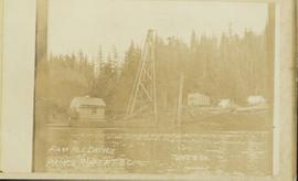
Pile driver situated on Prince Rupert shoreline. Tents and wooden buildings visible on rocky background. Printed annotations on recto of photograph read: "First pile driven at Prince Rupert BC. June 8 '06."
Item is a photocopied version of the "First Nations Integrated Resource Management Discussion Paper" submitted by Integrated Resource Use Planning Committee to Outdoor Recreation Council of BC.
The item is a reproduction of a survey map drafted in January 1910. The reproduction was likely created in 1990. The subdivision is Lot 936 G. I. Cariboo District, B.C. The area covered is North of Twenty First Avenue, East of Quinn Street, South of Eighth Avenue and West of Carney Street. Annotations highlight "Owner Edgar McMickiny," "696" and "Jordan Brothel" written in red pen pointing to a specific location.
Item is a draft typescript of "Field Party Report on Land Capability Studies British Columbia" by D.S. Lacate, J.W.C. Arlidge, M.J. Floate, E. Mackintosh, P.N. Sprout, and G. Runka (B.C. Department of Agriculture).
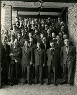
Photograph is a group portrait of the attendees at the Federal-Provincial Canada Land Inventory Coordinators Meeting in Victoria, March 31-April 1, 1971. Starting from the back row, left to right, attendees included: John Senyk, B.C.; Jim Allin, B.C.; Fred Frederickson, B.C.; Red Ward, Ontario; George Rathwell, Saskatchewan; John Foster, Ottawa, Charlie Rowles, B.C.; David Glover, Ottawa; Bill Yeomans, B.C.; Don Coombs, Ottawa; Harold Hoyt, N.B.; Brian King, Ottawa; Art Benson, B.C.; Scott Johnston, Ottawa; Dan Blower, B.C.; Vic Solman, Ottawa; Don Benn, B.C.; Dick Spilsbury, B.C.; Les Lavkulich, B.C.; Doug Lacate, B.C.; John Wilcox, B.C.; Alf Leahey, B.C.; Mike Romaine, Ottawa; Dick Marshall, B.C.; Gary Runka, B.C.; Norm Sprout, B.C.; Ken Beanlands, Newfoundland; Mick Roberts, Ottawa; Paul Lajoie, Ottawa; Pat Duffy, Ottawa; Bert Brink, B.C.; Merv McKay, Manitoba; Rich Goulden, Manitoba; Reg McCormack, Ottawa; Gerry Howell-Jones, B.C.; Marcel Belzile, Quebec; Paul Deane, Ottawa; Laurie Farstad, B.C.; Stu Scott, Alberta.
Item is an original typescript of a BC Department of Agriculture report entitled "Factors that Contribute to Successful and Profitable Bulb Culture".
Item is an original copy of "Explanatory Notes: Natural Resource Tourism Mapping Kamloops Resource Management Area" prepared by G.G. Runka Land Sense Ltd. for the BC Ministry of Development, Trade and Tourism, Sustainable Development Branch.
Item is a 1993 research paper by John T. Pierce, Simon Fraser University and Jacinthe Seguin, Environment Canada entitled "Exclusive Agricultural Zoning in British Columbia and Quebec: Problems and Prospects". This work later appeared as a journal article in Progress in Rural Policy and Planning 3, 287-310.
Item is an original copy of the 1994 "Evaluation of the Effect of Downstream Benefits to Washington State Agriculture Under the Columbia Treaty on the Competitive Positioning of BC Producers" prepared by W.H. Holm and Associates for Provincial Agricultural Land Commission. Includes Volume 1: Summary and Volume 2: Analysis.
Item is an original booklet by Terry R. Chantler of SPEC, the Canadian Scientific Pollution and Environmental Control Society, entitled "Energy... and Us".
Item is an original copy of "Ecosystem-Based Planning: A Practical Tool" by Silva Forest Foundation.
Item is a copy of "Ecology and Food Production" (Vol. 4, No. 14), 1972.
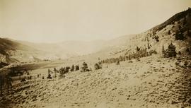
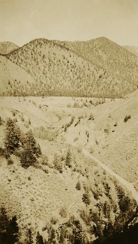
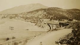
Photograph depicts the Ponderosa Pine and bunch grass dry biogeoclimatic zone near Lytton in October 1936.
Photograph depicts the Ponderosa Pine and bunch grass dry biogeoclimatic zone near Lytton in October 1936.
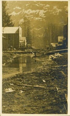
Street view of downtown Stewart, BC. Photograph shows boards propped up over the swampy area of the future road. Wood debris litters the foreground.
Item is an original booklet prepared by law firm Pape & Salter entitled "Delgamuukw: A summary of the Supreme Court of Canada Decision", accompanied by a letter and a photocopied legal summary document of the case.
This booklet, published by the Cunard Steam Ship Company, Ltd., provides an overview of Canada, England's emigration agents in Canada, and of the amenities provided by the Cunard Lines to its passengers immigrating to Canada from England via steamship. Booklet was printed in England.
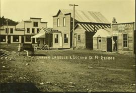
Photograph depicts a street scent at the corner of Laselle and Second St. in Fort George. A wagon is visible in the dirt road and wooden buildings cross the mid ground. Three unidentified men sit on the boardwalk outside Rigg's Restaurant while one man stands in the doorway of The White Laundry.
Item is an original compilation of documents for a "Coordinated Resource Management Plan for Summerland-Peachland".
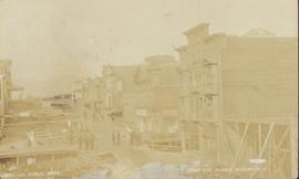
Slightly elevated street view of buildings and sidewalks being constructed in Prince Rupert, BC. Printed annotation on recto reads: "Photo by McRae Bros. Third Ave Prince Rupert, BC." Handwritten annotation on verso reads: "Dear Florence you better [illegible] will try and answer it in a few day I am well I will try and send you some cards I will stay here till in Dec Write[??] me and send me some cards I am 15 mile in the mountains Write your Bro LS Bill." Postcard is addressed to: "Miss Florence Wilson P.O. Box 1178 Worcester Mass U.S.A." A 2 cent Canadian stamp is affixed on verso. Postmark reads: "Prince Rupert BC Jul 1 10."
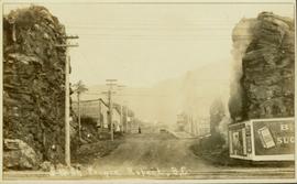
Street view of 5th St. in Prince Rupert BC. The dirt road is flanked by two partially demolished rock faces. Printed annotation on recto reads: "5th St Prince Rupert, B.C."
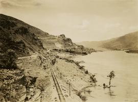
Photograph depicts the confluence of the Fraser and Thompson Rivers at Lytton. Wyness originally misnoted the location as Lillooet, BC.
Item is a June 1997 report entitled "Comprehensive Assessment and Needs Analysis of Resource Inventories for the Cariboo Forest Region" prepared for the BC Ministry of Forests Cariboo Forest Region by Cindy Marven, Wayne Biggs, John Peebles, and Mark Walmsley.
Photograph depicts a railway track along a river in the Columbia River Basin, north of Wenatchee, Washington.
Item is a hand drawn and coloured map by the City of Prince George Planning Department depicting the College Heights and southwest (Vanway) neighbourhood area existing land use in 1976.
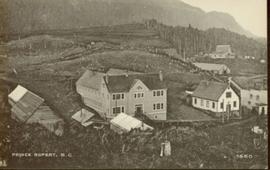
Close up photograph of a large residential building in a freshly clear cut area. To the right of the main building is the church and an unidentified commercial building. Annotation on recto reads: "Prince Rupert, BC 1660."
Item is an original Canada Department of Agriculture Publication 1224 entitled "Climate of the Upper Peace River Region".
Item is an original Canada Department of Agriculture Publication 1434 entitled "Climate of the Lower Peace River Region".
This unpublished document from the BC Ministry of Environment, Lands and Parks Communications Branch collates information about the issue of climate change circa the year 2000. Includes polling highlights from a poll of BC residents about climate change in 1998; a summary of points about media interest in climate change circa 1998-2000; and a short listing of supportive business comments on climate change circa 1999-2000.
Item is an original Canada Department of Agriculture Publication 1190 entitled "Climate and Agriculture in Central British Columbia".
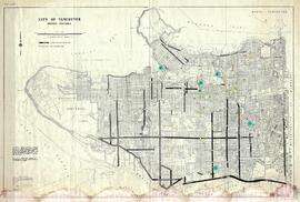
This municipal map of the City of Vancouver from 1987 shows street names and street widening information.
Item is Map 3 of a group of five maps relating to a City of Prince George Study of Construction Aggregates by the firm Willis, Cunliffe, Tair & Company Limited. Map 3 shows geology of the Prince George area and known sources of construction aggregates.
Item is Map 5 of a group of five maps relating to a City of Prince George Study of Construction Aggregates by the firm Willis, Cunliffe, Tair & Company Limited. Map 5 shows drill hole locations.
Item is Map 4 of a group of five maps relating to a City of Prince George Study of Construction Aggregates by the firm Willis, Cunliffe, Tair & Company Limited. Map 4 shows development areas, aggregate sources, and requirements for 1984 and 1994. As the map is undated, it is unclear whether the 1984 and 1994 dates are future estimates.
Item is Map 1 of a group of five maps relating to a City of Prince George Study of Construction Aggregates by the firm Willis, Cunliffe, Tair & Company Limited. Map 1 shows development areas and population for 1984 and 1994. As the map is undated, it is unclear whether the 1984 and 1994 dates are future estimates.
Item is Map 2 of a group of five maps relating to a City of Prince George Study of Construction Aggregates by the firm Willis, Cunliffe, Tair & Company Limited. Map 2 shows development areas and aggregate requirements for 1984 and 1994. As the map is undated, it is unclear whether the 1984 and 1994 dates are future estimates.
This map is part of Schedule B of the 1993 Official Community Plan, Bylaw No. 5909 for the City of Prince George. This particular map depicts the southwest area of the City of Prince George, including College Heights, UNBC, University Heights, and Vanway.
This map is the Schedule A accompanying map for the City of Prince George's Soil Removal and Deposit Bylaw No. 7022 of 1999. It depicts designated soil removal areas and M.O.T.H. gravel reserves.
This map is the October 2006 amendment (Bylaw 7807) of the Schedule C of the 2001 Official Community Plan, Bylaw No. 7281 for the City of Prince George. This Schedule C map shows the long range land use for the City of Prince George.
This map is the May 2008 amendment (Bylaw 8061) of the Schedule C of the 2001 Official Community Plan, Bylaw No. 7281 for the City of Prince George. This Schedule C map shows the long range land use for the City of Prince George.
This map is the May 2006 amendment (Bylaw 7807) of the Schedule C of the 2001 Official Community Plan, Bylaw No. 7281 for the City of Prince George. This Schedule C map shows the long range land use for the City of Prince George.
This map is Schedule C of the 2001 Official Community Plan, Bylaw No. 7281 for the City of Prince George. This Schedule C map shows the long range land use for the City of Prince George.
This map is part of Schedule B of the 1993 Official Community Plan, Bylaw No. 5909 for the City of Prince George. This particular map reflects the 1998 amendment to the Official Community Plan.
This map is part of Schedule B of the 1993 Official Community Plan, Bylaw No. 5909 for the City of Prince George. This particular map reflects the 1998 amendment to the Official Community Plan.
This map depicts the City of Prince George's plan for soil removal and deposit.
This map is part of Schedule B of the 1993 Official Community Plan, Bylaw No. 5909 for the City of Prince George. This particular map depicts the northwest area of the City of Prince George, including the North Nechako neighbourhood and the Hart.
This map is part of Schedule B of the 1993 Official Community Plan, Bylaw No. 5909 for the City of Prince George. This particular map depicts the northeast area of the City of Prince George, including the industrial areas on Prince George Pulpmill Road and Northwood Pulpmill Road along the Fraser River.
This map is part of Schedule B of the 1993 Official Community Plan, Bylaw No. 5909 for the City of Prince George. This particular map depicts the east area of the City of Prince George, including the Prince George Airport (YXS) and the Blackburn area.



![City of Prince George - Schedule C of the Official Community Plan - Long Range Land Use Map [October 2006 Amendment]](/uploads/r/northern-bc-archives-special-collections-1/6/d/6/6d643c10801eba2ac493689972e57429dba42ec7592f54cb55151b96362d7048/2023.5.1.40_-_2006_Oct_-_City_of_Prince_George_Long_Range_Land_Use_Map_JGP85_tb_142.jpg)
![City of Prince George - Schedule C of the Official Community Plan - Long Range Land Use Map [May 2008 Amendment]](/uploads/r/northern-bc-archives-special-collections-1/4/3/a/43a9e75941f1542735d999de340307d163e79dffdadbf4546bb9346b63f7e734/2023.5.1.41_-_2008_May_-_City_of_Prince_George_Long_Range_Land_Use_Map_JPG85_tb_142.jpg)
![City of Prince George - Schedule C of the Official Community Plan - Long Range Land Use Map [May 2006 Amendment]](/uploads/r/northern-bc-archives-special-collections-1/6/5/5/65536bc04aa97580c140131651dc357dfe5c3a1315822394f388d96940bc39cb/2023.5.1.39_-_2006_May_-_City_of_Prince_George_Long_Range_Land_Use_Map_JPG85_tb_142.jpg)

![City of Prince George - Schedule B of the Official Community Plan, Bylaw No. 5909 [2001 Amendment]](/uploads/r/northern-bc-archives-special-collections-1/c/3/6/c36392b90696286cc6281e8cc2efbf7691c2617726495fa28db2cbdcc20e4e4c/2023.5.1.36_-_Official_Community_Plan_City_of_PG_Schedule_B_2001_JPG85_tb_142.jpg)
![City of Prince George - Schedule B of the Official Community Plan, Bylaw No. 5909 [1998 Amendment]](/uploads/r/northern-bc-archives-special-collections-1/d/6/d/d6d1c4e7e37fc948b97b3caa36447b52f7d2b76b13d45e3710aefee7b13840f0/2023.5.1.33_-_1998_Official_Community_Plan_City_of_PG_JPG85_tb_142.jpg)


