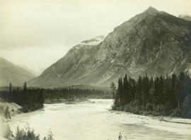
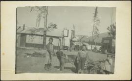
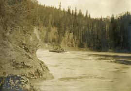
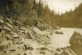
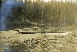
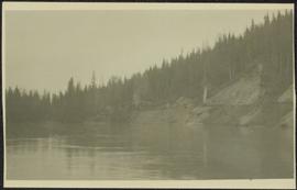
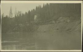
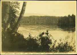
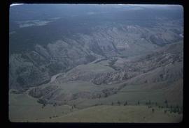
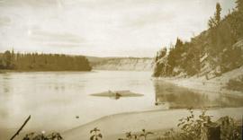
Photograph depicts river and high river bank in the distance.
Fraser River, BC
152 Archival description results for Fraser River, BC
Image depicts the Fraser River and a mountain in Longworth, B.C.
Image depicts four unidentified individuals walking along the bank of the Fraser River in Longworth, B.C.
Image depicts an area around Lillooet, B.C. It is possibly the Fraser River running through the Moran Canyon.
Image depicts a view of the Fraser River and the mountains surrounding Lillooet, B.C.
Image depicts two bridges over the Fraser River, located somewhere in Lillooet, B.C.
Photograph depicts men standing on different deck levels of conveyor on the Fraser River. Wood planks built into shore in foreground, trees on opposite shore in background. Handwritten annotation on verso of photograph reads: "Launching Conveyor", on recto: "Launching the rebuilt steamer Conveyor at Tete Jaune 1912".
Part of a set of 41 original black & white photographs [1908-1933-?]) of the Grand Trunk Pacific Railway line in BC depicting surveying crews, town sites (Prince Rupert and its port, Hazelton and Fort George), and First Nations Peoples.
Image depicts a view of a mountainous landscape, possibly near the Fraser River.
Image depicts an aerial view of the land near the Fraser River. The Fraser River is barely visible on the right side of the image.
Image depicts an aerial view of the land near the Fraser River.
Photograph depicts a lofty view of a river with snow and ice on the shore, forest and snowy mountains in the background.
Photograph depicts Mrs. Houghtaling standing with four small children near doorway of tent building (Gertrude, Mary, Henry, and Charlie). This photograph is believed to have been taken at Sand Creek, BC. Forest trees in background. Handwritten annotation on recto of photograph reads: "Tete Jaune 1912".
Photograph depicts three small children (Henry, Charlie and Mary) standing at Sand Creek settlement. A dog stands beside them pulling a small wagon of firewood. Tent and wood buildings in background, including a cafe on far right. Hillside can be seen in distance. Handwritten annotation on recto of photograph reads: "Houghtaling Sand Creek Bourchier 1912".
Image depicts an aerial view of grooves in the land near the Fraser River, possibly caused by glaciers.
Image depicts a view of grooves in the land near the Fraser River, possibly caused by glaciers.
Photograph depicts several men on a long scow loaded with supplies amidst swirling deep river water.
Photograph depicts several men on the river's edge pulling on a long rope attached to a large scow downstream.
Photograph depicts a long scow on the river's edge, supplies are being loaded. There is a smoke rising from the wood stove at the center of the scow. Several men are assisting.
Photograph depicts what appears to be two trains and a long building on high level of river bank. Fraser river in foreground, forest trees on shore in background.
Photograph depicts a train and long building on high level of river bank. Fraser river in foreground, forest trees on shore in background.
Image depicts the Fraser River, and a sign pointing towards Gang Ranch, in the Upper Fraser Canyon.
Image depicts the Fraser River, and a sign pointing towards Gang Ranch with an unknown individual hugging it, in the Upper Fraser Canyon.
Image depicts the Fraser Valley, looking north, possibly from Marguerite, B.C.
Photograph depicts a large river from a bird's eye view, forest and rocks on the water's edge, snow capped mountains in the background.
Photograph depicts lush forest growth, a tent or tarp is set up on the left of the photo.
Photograph depicts opposite shore in background behind river, bushes and trees in foreground. Handwritten photo caption on verso and recto of this photograph reads: "Fraser River at the mouth of the Clearwater".
Image depicts a rail road bridge over the Fraser River, possibly somewhere in the Lillooet area.
Image depicts a view of the Fraser River, as well as a road and railroad, near the Moran Canyon.
Image depicts the Fraser River near Gang Ranch in the Upper Fraser Canyon.
Image depicts a view of the Fraser River in Lillooet, B.C.
Image depicts the Fraser River from the Moran railway point in the Lillooet area.
Image depicts a bridge over the Fraser River in the Upper Fraser Canyon; possibly near Gang Ranch.
Image depicts an aerial view of the Fraser River.
Image depicts the Fraser River in the Fraser Canyon.
Image depicts the Fraser River in the Lillooet, B.C.
Image depicts a view of the Fraser River near Lillooet, B.C.
Image depicts the Fraser River near Lillooet, B.C.
Image depicts the Fraser River in the upper Fraser Canyon.
Image depicts the Fraser River somewhere in the Lillooet area.
Image depicts the Fraser River near Lillooet, B.C.
Image depicts the Fraser River, south of Soda Creek, B.C.
Image depicts the Fraser River, looking south from Marguerite, B.C.
Image depicts an aerial view of the Fraser River.