Item is a hand drawn and coloured map by the City of Prince George Planning Department depicting North Nechako neighbourhood area existing land use in 1976.
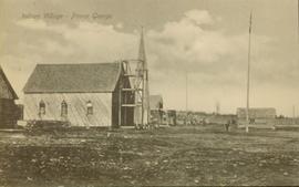
Side view of a wooden church, possibly under construction, and other buildings. Printed annotation on recto reads: "Indian Village- Prince George."
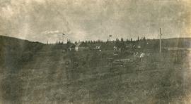
Photograph depicts Lheidli T'enneh Nation burial grounds in foreground, Hudson Bay Company buildings in background.
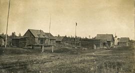
Photograph depicts a cluster of wooden buildings including a flagpole and church spire at a Lheidli T'enneh village site. Original photo identified this image as "Indian Village, Fort George".
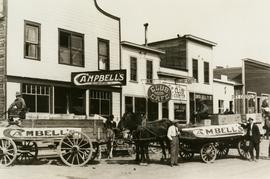
Street view photograph of a commercial section in downtown Prince George with several "Campbell's" delivery carts parked along the road. Visible establishments include "Campbell's All Cash Store" and "Club Cafe." Handwritten annotation in blue ballpoint pen on recto reads: "Howdy from Prince George! Going easy with all these kids- good to see Kathee. Snow here. Have fun at the sports show & don't over do it. Thinking of you guys, love Judy and Vic. P.S. Can't wait to go home to somewhere peaceful and quiet. 2-27-83." Postcard is addressed to: "Mr. & Mrs. Hauffer 8429-221 PL. Sn. Edmonds, WA. U.S. 98020." Verso is affixed with four Canadian 8-cent stamps.
File consists of an audio recording of an interview with Lea Gobbi and Kate Anderson. Includes two original recorded audio cassettes and two copies.
File consists of a transcript of an oral history interview with John and Bernice Trick.
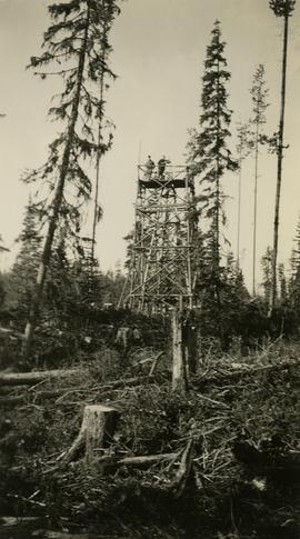
Photograph depicts two surveyors (Jack Lee, Gordon Wyness, or Philip Monckton) taking bearings from Pineview Station tower east of Prince George. Their surveying transit and telescope are visible in the image.
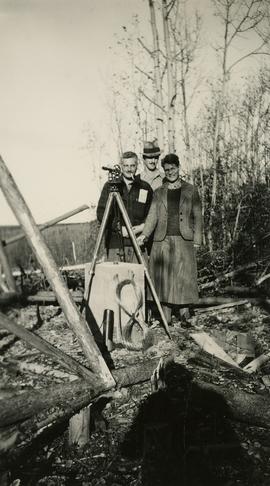
Photograph depicts (from left to right) Philip Monckton, Gordon Wyness, and Lavender Monckton at the Beaverly Geodetic Station, 7 miles west of Prince George. Surveying equipment (tripod, theodolite, and wire) are stationed at centre.
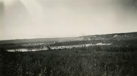
Photograph depicts a view of the city of Prince George looking west from the east hill. The confluence of the Fraser River and Nechako River is visible to the right. The Grand Trunk Pacific Railway bridge is visible at centre. The current location of where this photograph may have been taken is likely somewhere near where Highway 16 rises on the hill past the correctional centre (jail).
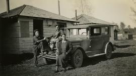
Photograph depicts (from left to right) Jack Lee, Gordon Wyness, and Lavender Monckton sitting on their 1930 Buick Series 40 car in front of their temporary cabin lodgings in Prince George. This photograph was taken before the group left Prince George to head to 6 Mile Lake or Tabor Lake.
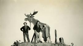
Photograph depicts (from left to right) Jack Lee, Gordon Wyness, and Lavender Monckton standing in front of a wooden moose. The wooden moose was located on top of a hill to the east of Prince George. The wooden moose was an advertisement for John A. Lestin's taxidermy business on Third Avenue in Prince George.
In 1936, Gordon Young Wyness was employed by Philip M. Monckton, a B.C. Land Surveyor. Between June 5 and October 8, Wyness joined Monckton and a group of others on a land survey expedition in northwestern BC. The survey crew travelled to various locations in the area including Telkwa, Hazelton, Burns Lake, Francoise Lake, Vanderhoof, Prince George, Quesnel, Lytton, and Hope. Wyness documented their journey in this photograph album. Based on the photographs, it appears that the crew led by Philip Monckton consisted of Jack Lee and Gordon Wyness; Mrs. Lavender Monckton (nee O'Hara) also accompanied the group.
In addition to the 50 photographs included in the album, this collection also includes five additional unique photographs that accompanied the album.
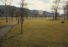
Sin títuloImage depicts the Fort George Park. Map coordinates 53°54'30.2"N 122°43'57.4"W
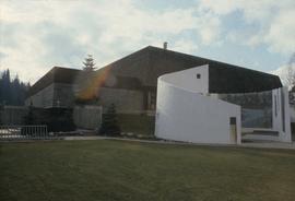
Image depicts the Four Seasons Leisure Pool, and the Centennial Fountain in Prince George, B.C. Map coordinates 53°54'48.5"N 122°44'49.2"W
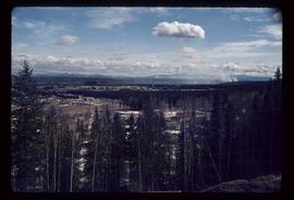
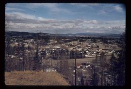
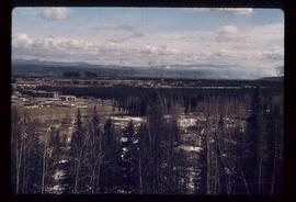
Image depicts a view of Prince George from Gunn Point in the L.C. Gunn Park looking north. Map coordinates 53°54'26.2"N 122°43'35.8"W.
Image depicts a view of Prince George from Gunn Point in the L.C. Gunn Park looking north. Map coordinates 53°54'26.2"N 122°43'35.8"W.
Image depicts a view of Prince George from Gunn Point in the L.C. Gunn Park looking north. Map coordinates 53°54'26.2"N 122°43'35.8"W.
Image depicts a view of Prince George from Gunn Point in the L.C. Gunn Park looking north. Map coordinates 53°54'26.2"N 122°43'35.8"W.
Image depicts a view of Prince George from Gunn Point in the L.C. Gunn Park looking north. Map coordinates 53°54'26.2"N 122°43'35.8"W.
Image depicts a view of Prince George from Gunn Point in the L.C. Gunn Park looking north. Map coordinates 53°54'26.2"N 122°43'35.8"W.
Image depicts a view of Prince George from Gunn Point in the L.C. Gunn Park looking north. Map coordinates 53°54'26.2"N 122°43'35.8"W.
Image depicts a view of Prince George from Gunn Point in the L.C. Gunn Park looking north. Map coordinates 53°54'26.2"N 122°43'35.8"W.
Image depicts a view of Prince George from Gunn Point in the L.C. Gunn Park looking north. Map coordinates 53°54'26.2"N 122°43'35.8"W.
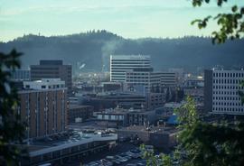
Image depicts the Central Business District of Prince George looking north from Connaught Hill. Map coordinates 53°54'41.4"N 122°44'58.5"W
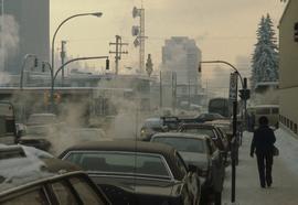
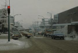
Image depicts Brunswick Street at 3rd Ave in -35 degree weather. Map coordinates 53°55'03.0"N 122°44'51.7"W
Image depicts 3rd Ave at Brunswick Street in -35 degree weather. Map coordinates 53°55'03.0"N 122°44'51.7"W
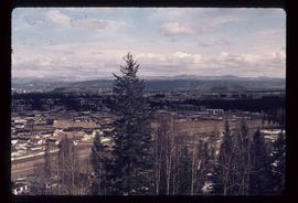
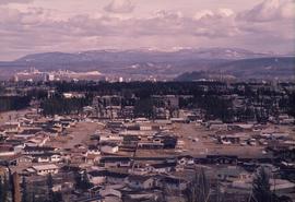
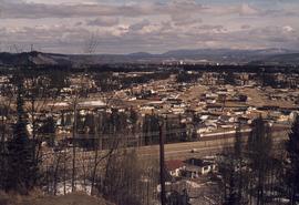
Image depicts a view of Prince George from Cranbrook Hill looking southeast. Map coordinates 53°54'51.5"N 122°49'05.2"W
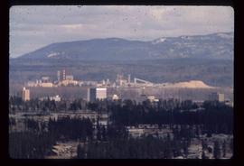
Image depicts a view of Prince George from Cranbrook Hill looking east with pulpmill and downtown in background.
Image depicts a view of Prince George from Cranbrook Hill looking east.
Image depicts a view of Prince George from Cranbrook Hill looking southeast. Map coordinates 53°54'51.5"N 122°49'05.2"W
Image depicts a view of Prince George from Cranbrook Hill looking east. Map coordinates 53°54'51.5"N 122°49'05.2"W
Image depicts a view of Prince George from Cranbrook Hill looking southeast. Map coordinates 53°54'51.5"N 122°49'05.2"W
Image depicts a view of Prince George from Cranbrook Hill looking east. Map coordinates 53°54'51.5"N 122°49'05.2"W
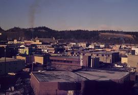
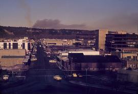
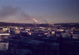
Image depicts a view of Prince George from City Hall looking north. Map coordinates 53°54'46.3"N 122°44'41.9"W
Image depicts a view of Prince George from City Hall looking northeast along George Street. Map coordinates 53°54'46.3"N 122°44'41.9"W
Image depicts a view of Prince George from City Hall looking northeast with the pulp mills in the background. Map coordinates 53°54'46.3"N 122°44'41.9"W
Image depicts a view of Prince George from Gunn Point in the L.C. Gunn Park looking north. Map coordinates 53°54'26.2"N 122°43'35.8"W.
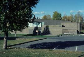
Image depicts the Fort George Regional Museum (now known as The Exploration Place) in Prince George, B.C. Map coordinates 53°54'18.6"N 122°44'09.8"W
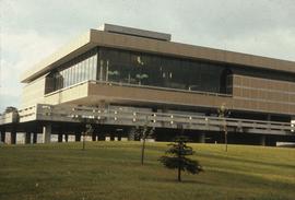
Image depicts the Prince George Public Library (Bob Harkins Branch). Map coordinates 53°54'43.1"N 122°44'56.4"W
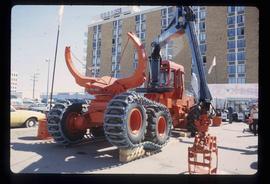
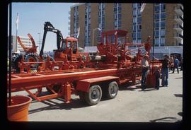
Image depicts several pieces of heavy machinery used in forestry. The Coast Inn of the North is seen in the background.
Image depicts several pieces of heavy machinery used in forestry. The Coast Inn of the North is seen in the background.
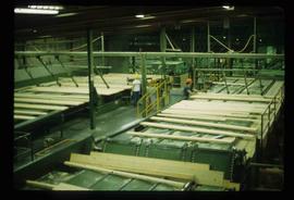
Image depicts wood planks in the interior of a saw mill somewhere in Prince George, B.C.
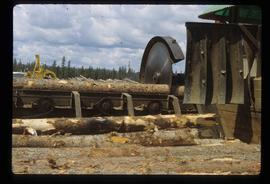
Image depicts logs being cut into planks in the interior of a saw mill somewhere in Prince George, B.C.
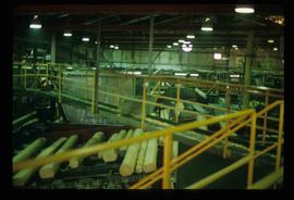
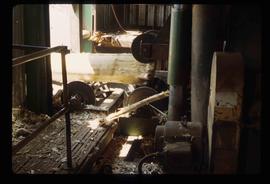
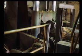
Image depicts the interior of a saw mill somewhere in Prince George, B.C.
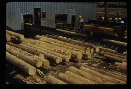
Image depicts numerous stripped logs and several unidentified individuals in hard hats at a saw mill somewhere in Prince George, B.C.
Image depicts machinery stripping a log of its bark in a saw mill somewhere in Prince George, B.C.
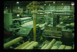
Image depicts machinery in a saw mill somewhere in Prince George, B.C.
Image depicts a saw cutting a log in half at a saw mill in Prince George, B.C.
Image depicts logs being stripped of their bark at a saw mill in Prince George, B.C.

