Showing 4134 results
Archival description
"Cranbrook Hill Greenway Multi-use Trail"
"Cranbrook Hill Greenway Multi-use Trail"
"Salmon River, British Columbia" 1983 map
"Salmon River, British Columbia" 1983 map
"Prince George" 1976 map
"Prince George" 1976 map
"Prince George" 1967 map
"Prince George" 1967 map
"West Lake Pulp Harvesting Forest"
"West Lake Pulp Harvesting Forest"
"Red Rock, British Columbia" 1985 map
"Red Rock, British Columbia" 1985 map
"Saxton Lake, British Columbia" 1987 map
"Saxton Lake, British Columbia" 1987 map
"Punchaw Lake, British Columbia" 1972 map
"Punchaw Lake, British Columbia" 1972 map
"Spakwaniko Creek, British Columbia" 1976 map
"Spakwaniko Creek, British Columbia" 1976 map
"Sinclair Mills, British Columbia" 1961 map
"Sinclair Mills, British Columbia" 1961 map
"Giscome, British Columbia" 1961 map
"Giscome, British Columbia" 1961 map
"Bateman Forestry Route"
"Bateman Forestry Route"
"Giscome" 1961 map
"Giscome" 1961 map
"West Lake Forest"
"West Lake Forest"
"Prince George" map
"Prince George" map
"Prince George" map
"Prince George" map
"West Lake Pulp Harvesting Forest"
"West Lake Pulp Harvesting Forest"
"Isle Pierre, British Columbia" 1974 map
"Isle Pierre, British Columbia" 1974 map
"Isle Pierre, British Columbia" 1952 map
"Isle Pierre, British Columbia" 1952 map
"Nechako River / Isle Pierre"
"Nechako River / Isle Pierre"
"Salmon Valley" 1986 map
"Salmon Valley" 1986 map
"Salmon Valley, British Columbia" 1954 map
"Salmon Valley, British Columbia" 1954 map
"Prince George, British Columbia" 1982 map
"Prince George, British Columbia" 1982 map
"Isle Pierre, British Columbia" 1952 map
"Isle Pierre, British Columbia" 1952 map
"West Lake Pulp Harvesting Forest"
"West Lake Pulp Harvesting Forest"
Topographical Sketch Map of Omineca and Finlay River Basins, British Columbia
Topographical Sketch Map of Omineca and Finlay River Basins, British Columbia
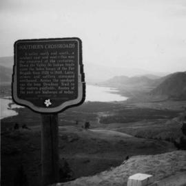
Osoyoos Lake
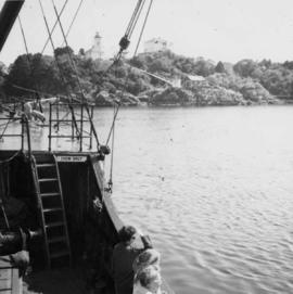
On M.V. Uchuck III in Friendly Cove
On M.V. Uchuck III in Friendly Cove
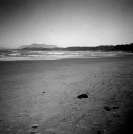
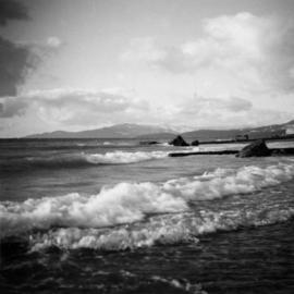
Wickaninnish Beach on Vancouver Island
Beach Ave. in Vancouver, B.C.

Fields cleared at Miracle Beach

Land clearance between Monashee Pass and Lumby

Granite Falls in Vancouver, B.C.
Indian Arm near Vancouver, B.C.

Granite Falls in Vancouver, B.C.
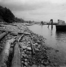
Shoreline of Vancouver Harbour

View from Diamond Head Lodge in Garibaldi Park

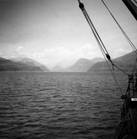
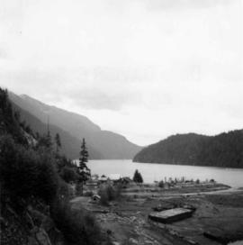
Entrance to Squamish River
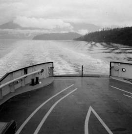
View from the ship the Queen of Powell River
Arthur Holland Land Surveying Collection
Arthur Holland Land Surveying Collection
Arthur Holland Album
Arthur Holland Album
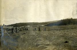
Crops at Fraser Lake
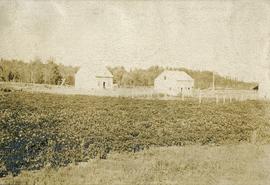
Hudson Bay buildings at Fraser Lake

On the trail from Quesnel to Fort George
Crops at Fraser Lake
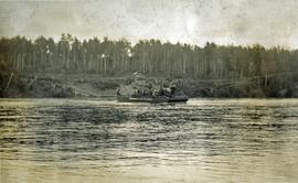
Ferry across Nechako River at Fraser Lake
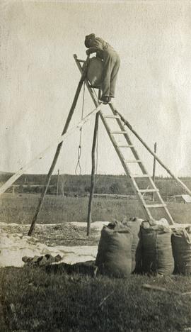
Cleaning grain at Fraser Lake
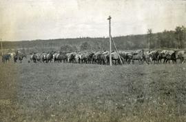
Pack train at Hudson Bay Company, Fraser Lake
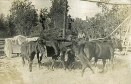
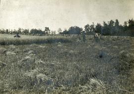
Thrashing grain at Fraser Lake