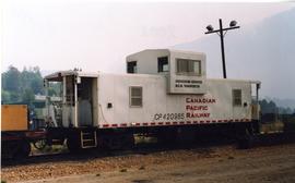
Photograph depicts a CRHA, Vancouver Island Division, lettered caboose at the EN yards in Victoria.
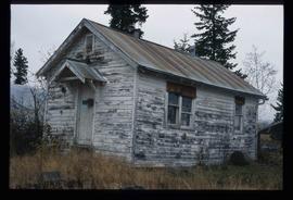
Image depicts a the teacherage building in Red Rock.
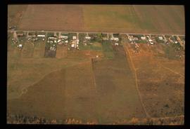
Image depicts an aerial view of what is possibly an outlying area of Prince George, B.C.
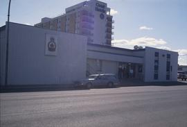
Image depicts the Royal Canadian Legion building on 7th Ave and the Inn of the North Coast Hotel in the background. Map coordinates 53°54'50.6"N 122°44'56.1"W
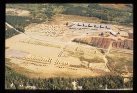
Image depicts a sawmill in the Danson Industrial Park in Prince George, B.C.
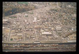
Image depicts an aerial view of downtown Prince George, B.C.
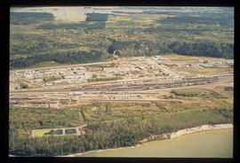
Image depicts an aerial view of the BC Rail, in Prince George, B.C. It is now known as CN Rail.
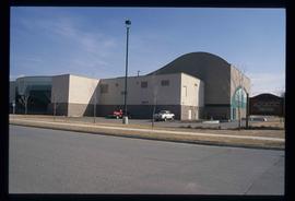
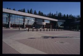
Image depicts the Aquatic Centre in Prince George, B.C.
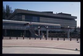
Image depicts the Prince George Civic Centre.
Image depicts the Prince George Public Library.
The item is a photograph depicting a graveyard with flowers at Grassie Plains. Annotation on reverse side of photograph states, "Grassie Plains."
The photograph is of the power house in Prince George before 1999. The power house was built ca. 1916.
File consists of a clippings, notes, and typed documents relating to the Exploration Place Museum in Prince George. Includes a clipped article from the Prince George Citizen newspaper "Museum lands heritage grant" (17 Oct. 2003) and "2003 Co-op Project: The Exploration Place" typed document by Brian Stauffer (29 Oct. 2003).
File consists of notes and clippings relating to the history of Prince George from 1930-1939. Includes the following clipped articles from the Prince George Citizen newspaper: "City council coped with requests for additional relief during Depression" (Nov. 2008); "Means to correct a wounded economy debated in 1933" (Apr. 2007); "City's development continued through Depression-era" (June 2003); and "Depression years weren't pretty ones for most living in P.G". (June 2004).
File consists of notes and reproductions relating to land surveyors working in British Columbia. Includes material on Rupert Williams Haggen who became a land surveyor in 1911 and surveyed Prince George, Quesnel, Bowron River, and the Fraser River area below Quesnel; Henry Fry who worked in Victoria between 1871 and 1897; Otto Julius Klotz who surveyed the Alaska-British Columbia boundary and also surveyed for the Canadian Pacific Railway between 1871 to 1927; James Herrick McGregor who worked in the Kootenays and assisted for the survey of the British Columbia Alberta border between 1891 and 1903; and Forin Campbell who came to Prince George in 1908.
File consists of notes and reproductions relating to the Upper Fraser Historical Geography Project done on the East Line and Upper Fraser in collaboration with the University of Northern British Columbia researchers. Includes a CD titled "Kent's Upper Fraser Files" containing Kent's research files for the Upper Fraser project (7 Jan. 2004) and a computer diskette titled "Oral Histories" containing an oral history interview with a woman (2004).
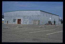
Image depicts the Exhibition Sports Centre, which used to be a drill hall army base, on Keller Street in Prince George, B.C.
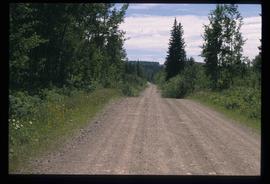
Image depicts Bellos Road, most likely in Red Rock, B.C.
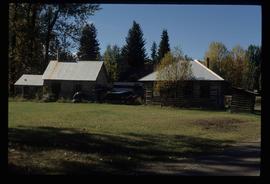
Image depicts a few buildings, possibly an old school and teacherage, in Hixon, B.C.
File consists of the "McGregor Model Forest Association: Annual Report 2003-2004."
File consists of a CD-ROM containing three PDF documents: "Canada's Model Forest Program Publications Catalogue" September 2003, "Canada's Model Forest Program: Advancing Sustainable Forest Management from the Ground Up" c. 2003, "Canadian Model Forest Network Private Woodland Owners-Meeting the Stewardship Challenge" c. 2004. Documents exist in both French and English.
File consists of Dr. Joselito Arocena's promotion package for rising to the rank of full professor at UNBC.
Video is a CG architectural tour of the proposed Northern Medical Program building at UNBC.
Videotape contains footage of: 15-Mar-03 - Northwest Tribal Treaty Nations conference in Prince George - First Nations governance - Monk, Justa / 15-Mar-03 - winter campus shots
Videotape contains footage of: 27-Mar-03 - interview with biology student; very short - Lawrie, Cheyenne
Videotape contains footage of: 4-Aug-03 - New leader of Northern Medical Program leaves PG and bikes to Tumbler Ridge - Snadden, David
Videotape contains footage of: 8-Aug-03 - Northern Medical Program leader arrives in Tumbler Ridge - Snadden, David / 8-Aug-03 - Tumbler Ridge - scenic shots during Murray River boat trip / 9-Aug-03 - Tumbler Ridge mayor on what UNBC means for northern communities - Iles, Clay / 9-Aug-03 - shots of Tumbler Ridge - town, Quintette coal mine
File consists of notes and photocopied photographs depicting historical Prince George that were used by Kent Sedgwick for tours.
Includes draft application to the Canada Council of the Arts and proposal summary.
Includes press release, editorial notes, author reading announcements, press clippings, related correspondence, book cover, request for permission to use front cover, draft manuscript, and handwritten notes.
Floppy consists of G.G. Runka Land Sense Ltd. client file records for jobs.
Floppy directories and file listing:
- 587Keywordsgoogle.doc
- 587VLPlan 2000.doc
- 587WLPlan2000.doc
- LUCID_Executive_Summary.zip
Floppy consists of G.G. Runka Land Sense Ltd. client file records for jobs.
Floppy directories and file listing:
- Other information to consider.doc
- PCAP_Sask.pdf
- ~WRD0000.tmp
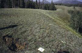
Slide roll contains the following photographs:
Y03-06
Date: August 10, 2003
Location Coordinates: 61° 4’ 1.5” N, 138° 21’ 57.4” W, 825.3 m asl (± 9.5 m)
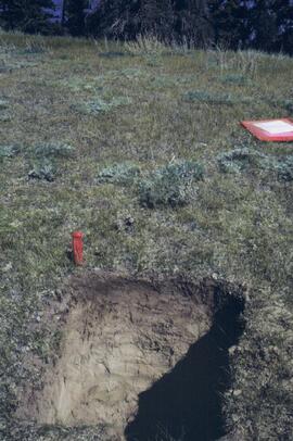
Site Description: top of slope, E aspect
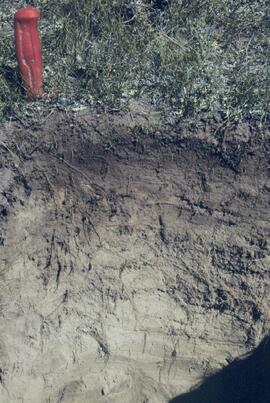
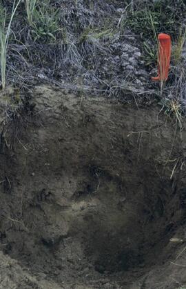
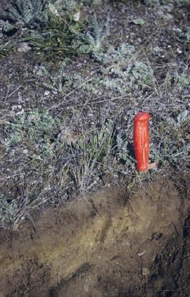
Sample Depths & Descriptions:
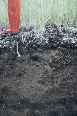
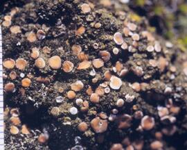
- Y03-06-01 - Crust
- Y03-06-02 - 0-6 cm - Ahk (10YR 3/2 m; strongly effervescent)
- Y03-06-03 - 6-14 cm - Bmk (2.5Y 3/3 m; strongly effervescent)
- Y03-06-04 - 14 cm+ - IICk (strongly effervescent)
Slide roll 3 #36-35 (corresponding prints and negatives: Print roll 4, #1-2)
Y03-07 (peninsula near Kluane visitor centre, Sheep Mt.)
Date: August 11, 2003
Location Coordinates: 61° 1’ 42.8” N, 138° 29’ 36.2” W, 786.7 m asl (± 5.7 m)
Site Description:
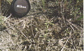
- recent (?) landslide with loess accumulation in pockets, thinner on boulder surfaces, dominated by dark cyanobacteria crusts
- limited loess accumulation due to exposure of site
- crust is calcareous at surface
Sample Depths & Descriptions: - Y03-07-01 - Crust
- Y03-07-02 - 0-6 cm - Ck
- Y03-07-03 - 6-9 cm - Ahkb
- Y03-07-03 - 9 cm+ - Rock
Slide roll 3 #34-30 (corresponding prints and negatives: Print roll 4, #3-10)
Lower Slims River (lookout knoll at parking lot N of visitor centre)
Date: August 11, 2003
Location Coordinates: 60° 59’ 56.4” N, 138° 33’ 36.4” W, 844.8 m asl (± 7.3 m)
Site Description: some fire disturbance, but lower slopes have more intact crusts on loess (calcareous to surface)
Slide roll 3 #29-26 (corresponding prints and negatives: Print roll 4, #11-17)
Lower Slims R (lowest bench below lookout knoll)
Date: August 11, 2003
Location Coordinates: 60° 59’ 51.8” N, 138° 33’ 36.2” W, 814.3 m asl (± 7.9 m)
Site Description: not burned; good intact crust; vegetation: A. frigida, Calamogrostis purpurea, Erigeron caespitosus, Linnaea, Carex filifolia (sparse cover ~ 50%)
Slide roll 3, #25-23 (corresponding prints and negatives: Print roll 4, #18-20)
Slims Soil
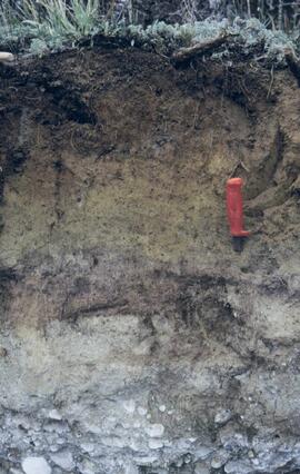
(Holocene paleosol with well-developed B horizon under Neoglacial calcareous loess – location not recorded, but likely from roadcut exposure along main Slims R trail)
Slides roll 3, #22 (corresponding prints and negatives: Print roll 4, #21)
Lower end of Sheep Creek
Date: August 11, 2003
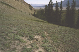
Misc. views of grassland vegetation and landscape (locations not recorded)
Slides roll 3, #21-18 (corresponding prints and negatives: Print roll 4, #26-33)
Overlook at lower end of Sheep Creek canyon
Date: August 11, 2003
Location Coordinates: 60° 59’ 42.2” N, 138° 34’ 38.1” W, 878.0 m asl (± 9.5 m)
Site Description: heavy use by sheep (abundant droppings) but still has ~ 50% crust coverage
Slides roll 3, #17-16 (corresponding prints and negatives: Print roll 4, #34-35)
Slims River delta
Date: August 11, 2003
(location not recorded)
Slides roll 3, #15-14: salt efflorescences (corresponding prints and negatives: Print roll 5, #1-3)
Y03-08 (Cultus Bay Rd. – at top of switchbacks)
Date: August 12, 2003
Location Coordinates: 61° 3’ 43.1” N, 138° 21’ 4.0” W, 833.8 m asl (± 5.1 m)
Site Description: good exposure of loess (35 cm) with Slims Soil over glaciofluvial terrace – pinches out downslope [note: this site was sampled because of development of buried paleosol, and was not part of biological crust study by Marsh et al. (2006)]
Sample Depths & Descriptions:
- Y03-08-01 - 45-48 cm - Ahkb (7.5YR 3/3 d; strongly effervescent)
- Y03-08-02 - 48-56 cm - Bmkb (7.5YR 4/3 d; strongly effervescent)
- Y03-08-03 - 56-70 cm - Ccab (2.5Y 5/2 d; strongly effervescent)
- (not sampled) - 70 cm+ - IICca (glaciofluvial; strongly effervescent)
- Intact sample: 56-36 cm - depth (including Slims Soil)
Slides roll 3, #13-11, 5-4 (corresponding prints and negatives: Print roll 5, #8-10, 17-18)
Y03-09 (cliff top on E. shore of Kluane L. at Christmas Bay)
Date: August 12, 2003
Location Coordinates: 61° 4’ 0.0” N, 138° 22’ 35.3” W, 828.3 m asl (± 7.3 m)
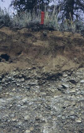
Site Description: ~ 60 cm loess over glaciofluvial gravels
Sample Depths & Descriptions:
- Y03-09-01 - Nostoc crust
- Y03-09-02 - Tortula ruralis – Cetraria crust
- Y03-09-03 - 0-14 cm - ACk (10YR 3\2 d)
- Y03-09-04 - 14-16 cm - Ahkb1 (10YR 2/2 d)
- Y03-09-05 - 16-18 cm - Ck1 (10YR 4/3 d)
- Y03-09-06 - 18-20 cm - Ahkb2 (10YR 3/2 d; discontinuous)
- Y03-09-07 - 20-27 cm - Bmkb1 (10YR 4/3 d)
- Y03-09-08 - 27-33 cm - Bmkb2 (7.5YR 4/3 d)
- Y03-09-09 - 33-46 cm - Bmkb3 (10YR 4/3 d)
- Y03-09-10 - 46-55 cm - Ck2 (2.5Y 5/3 d)
- (not sampled) - 55-60 cm+ - IICk (glaciofluvial gravels)
Slide roll 3, #10-6 (corresponding prints and negatives: Print roll 5, #11-15)
Y03-10 (shore bluff N. of Silver City)
Date: August 12, 2003
Location Coordinates: 61° 2’ 55.0” N, 138° 23’ 17.2” W, 806.7 m asl (± 7.3 m)
Site Description: 70% slope, SW aspect; vegetation: Elymus, Carex, Artemisia, Erigeron
Sample Depths & Descriptions:
- Y03-10-01 - Crust
- Y03-10-02 - 0-18 cm - ACk (10YR 4/2 m; strongly effervescent)
- Y03-10-03 - 18-25 cm - Ahkb(?) (10YR 4/2 m; strongly effervescent)
- Y03-10-04 - 25-40 cm - Ck (2.5Y 5/2.5 m; strongly effervescent)
- (not sampled) - 40 cm+ - IICk (glaciofluvial gravels; strongly effervescent)
Slide roll 3, #3-1 (corresponding prints and negatives: Print roll 5, #19-22)
File consists of Kluane Lake photographs from 2003 in digital format.
File consists of records created and accumulated by Gary Runka over the course of his consultancy work for Morice LRMP Consultation Committee for the "Morice LRMP Consultation" project in Houston. This file was numbered as G.G. Runka Land Sense Ltd. client file #589; that client number may be seen referenced elsewhere in the G. Gary Runka fonds. The Land Sense Ltd. client files generally include records such as correspondence, contracts, invoices, project reports, publications, ephemera, memoranda, maps or map excerpts, legal documents, meeting materials, clippings, and handwritten notes.
Includes the following:
- Morice Land & Resource Management Plan: Economic Development Action Plan. Prepared by Westcoast CED Consulting Ltd. for BC Min. of Sustainable Resource Management, Skeena Region. 2003.
File consists of records created and accumulated by Gary Runka over the course of his consultancy work for Ministry of Sustainable Resource Management & Stuart Gale and Associates Ltd. for the "Preparation of Provincial Sustainable Resource Management Planning Guidelines for Agriculture/Range and Settlement" project. This file was numbered as G.G. Runka Land Sense Ltd. client file #590; that client number may be seen referenced elsewhere in the G. Gary Runka fonds. The Land Sense Ltd. client files generally include records such as correspondence, contracts, invoices, project reports, publications, ephemera, memoranda, maps or map excerpts, legal documents, meeting materials, clippings, and handwritten notes.
