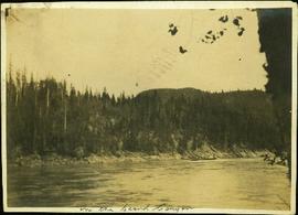
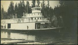
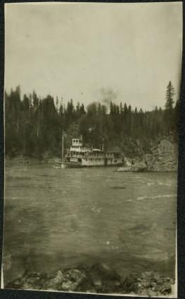
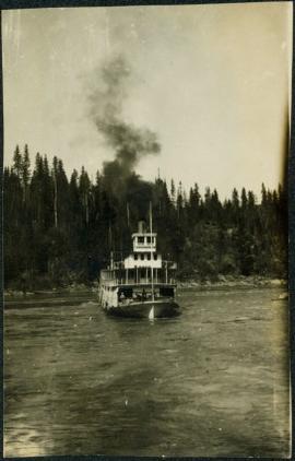
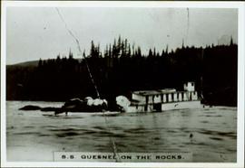
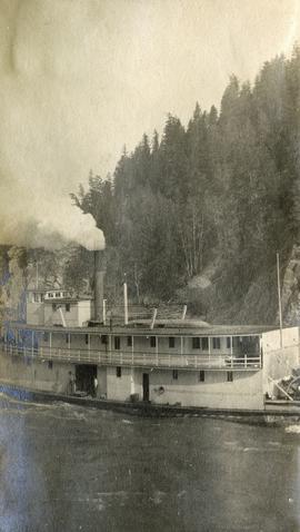
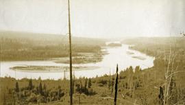
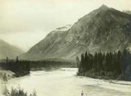
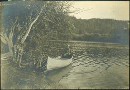
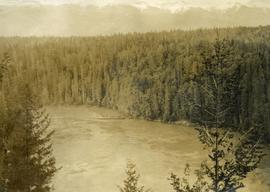
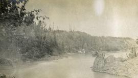
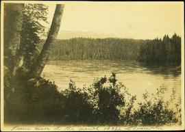
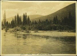
Photograph depicts opposite shore in midground behind river, tree-covered hills in background. Handwritten photo caption on verso and recto of this photograph reads: "On the Clearwater".
Photograph depicts river between opposite shore and rock landings in foreground. Mountaintops visible in background. Handwritten photo caption on verso and recto of this photograph reads: "Opening of the River above the Grand Canyon".
Photograph depicts a river scow in midground, close to opposite shore. Handwritten photo caption on verso and recto of this photograph reads: "In the Grand Canyon."
Photograph depicts men on a scow in distance at bend in river. Unidentified objects or structures on opposite shore in background, rocky shore in foreground. Handwritten photo caption on verso and recto of this photo reads: "Scow coming through upper Grand Canyon".
Photograph depicts men on a scow, maneuvering what is believed to be the Upper Fraser River. Opposite shore in background, close shore in foreground. Handwritten photo caption below this photo reads: "1. Turning above the whirlpool where the dog swam across."
Photograph depicts Mr. Barnett seated in floating canoe tied to tree on shore. Forest on opposite shore in background. Handwritten annotation on verso of this photograph reads: "Billy Barnett". It is speculated that this photograph may have been taken on the Fraser River near Giscome Portage, B.C.
Photograph depicts four men in campsite. Cooking supplies and miscellaneous items in foreground, forest trees in background. Handwritten annotation on verso and recto of this photograph reads: "Camp at Portage in Grand Canyon".
Photograph depicts men on a loaded scow, believed to be floating on the Upper Fraser River. Opposite shore in background.
Photograph depicts men standing on upper deck of conveyor, close to opposite shore, where lumber and buildings can be seen. Canoe in left foreground, trees and mountains in background.
Photograph depicts men standing on different deck levels of conveyor in river. Wood planks built into shore in foreground, trees on opposite shore in background. It is speculated that this photo may have been taken near Tete Jaune Cache shortly after the conveyor was rebuilt. Handwritten annotation on verso of photograph reads: "Str. Conveyor".
Photograph depicts a paddle wheel conveyor believed to be in the Fort George Canyon on the Fraser River. Rocky shore in foreground, trees on opposite shore in background.
Photograph depicts a paddle wheel conveyor believed to be in distress in the Fort George Canyon on the Fraser River. Trees on opposite shore in background.
Photograph depicts creek barely visible at bottom of steep valley in cliffs. Trees and underbrush in foreground. It is believed that this photograph may have been taken near Mt. Robson. Handwritten annotation on recto of photograph reads: "Sand Creek."
Photograph depicts what appears to be a sternwheeler in distress. Water in foreground, trees on opposite shore in background.
Handwritten annotation on verso: “S. S. Quesnel on rocks in Fort George Canyon. 1911 – 1915".
Image depicts the Fraser River, south of Soda Creek, B.C.
Photograph depicts a bird's eye view of a large river, forest and mountains in the background. On the river's edge there is a scow with several persons standing on it.
Photograph depicts a long scow on the river's edge, supplies are being loaded. There is a smoke rising from the wood stove at the center of the scow. Several men are assisting.
Photograph depicts a large river from a bird's eye view, forest and rocks on the water's edge, snow capped mountains in the background.
Photograph depicts a steamboat on the Fraser River.
Photograph depicts a view of rough river waters from the deck of a steamboat.
Photograph depicts misty waters and small islands in the river.
Photograph depicts Fort George Canyon from a lofty view. A small building is situated on the river's edge.
Photograph depicts four men standing on a canoe, loaded with supplies. Calm river water in the background, bluffs in the background.
Photograph depicts open river waters with some patches of ice on the river shore. There are riverbanks and trees in the background.
Photograph depicts a view looking down from a high forested slope to Woodpecker Island on the Fraser River, BC.
Photograph depicts a man and a woman standing in front of a log home and nearby shed. There are stumps in the foreground and tall timber in the background.
Image depicts four unidentified individuals walking along the bank of the Fraser River in Longworth, B.C.
Image depicts the Fraser River in the upper Fraser Canyon.
Image depicts a view of the upper Fraser Canyon. The Fraser River is visible on the left side of the image.
Image depicts a view of the upper Fraser Canyon.
Image depicts a view of the Fraser River in Lillooet, B.C.
Image depicts the Fraser River running through the Moran Canyon near Lillooet, B.C.
Image depicts what is possibly the Fraser River running through the Moran Canyon near Lillooet, B.C.
Image depicts two bridges over the Fraser River, located somewhere in Lillooet, B.C.
Image depicts the Moran Canyon; the Fraser River is visible near the bottom.
Image depicts the Fraser River near Lillooet, B.C.
Image depicts an aerial view of a section of land, likely near the Fraser River, that is possibly either a slump or part of a mining operation. The slide is labelled "slump or mining."
Image depicts an eroding rock face; the river in the right corner of the image is possibly the Fraser River.
Image depicts what is possibly the Fraser River.
Part of a set of 41 original black & white photographs [1908-1933-?]) of the Grand Trunk Pacific Railway line in BC depicting surveying crews, town sites (Prince Rupert and its port, Hazelton and Fort George), and First Nations Peoples.
Photograph depicts opposite shore in background behind river, bushes and trees in foreground. Handwritten photo caption on verso and recto of this photograph reads: "Fraser River at the mouth of the Clearwater".
Photograph depicts opposite shore in background behind river, and close shore in foreground on right. Men can be seen standing and paddling on canoe in distance. Handwritten photo caption on verso and recto of this photograph reads: "On the Clearwater".
Photograph depicts two men standing and paddling in canoe on river, trees stand above rock face on opposite shore in background. Handwritten photo caption on verso and recto of this photograph reads: "Entering the Grand Canyon."
Photograph depicts men on a scow near opposite shore of river. Treetops in foreground. Photograph taken from above. Handwritten photo caption on verso and recto of this photo reads: "in the lower Grand Canyon".