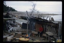
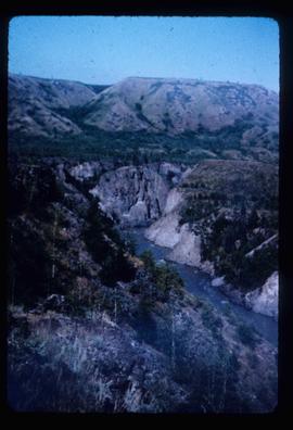
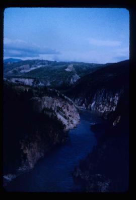
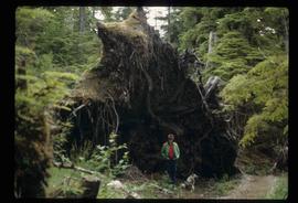
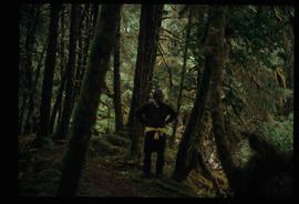
Image depicts an individual standing next to what appears to be the base of a very large, uprooted tree, located somewhere in the coastal forest of Haida Gwaii, B.C.
Image depicts a woman, possibly Sue Sedgwick, sitting in a shack on a beach on Haida Gwaii.
Image depicts numerous buildings on the shore of Haida Gwaii as the ferry approaches.
Image depicts a house with some Firts Nations' art painted on the front, somewhere on Haida Gwaii, B.C.
Image depicts what appears to be a type of log bridge crossing a river somewhere on Haida Gwaii.
Image depicts a river with dense trees on either side.
Image depicts a forest somewhere on Haida Gwaii.
Image depicts Kent Sedgwick standing in a forest somewhere on Haida Gwaii.
Image depicts a forest somewhere on Haida Gwaii.
Image depicts several individuals examining totem poles which are possibly undergoing a restoration process somewhere on Haida Gwaii.
Image depicts a house on the shore somewhere on Haida Gwaii.
Image depicts a view of the coast of Haida Gwaii.
Image depicts a view of the area surrounding Raven Peak.
Image depicts a view of the Sugarbowl Grizzly Den Protected Area from Raven Peak. The slide itself is labelled "towards cabin."
Image depicts an individual sliding down a snowy trail somewhere Raven Peak.
Image depicts Raven Lake.
Image depicts a view of the area surrounding Raven Lake.
Image depicts a lake near Seton Portage; it is likely either Anderson or Seton Lake.
Image depicts a frozen water fall located at a lake near Seton Portage; it is likely either Anderson or Seton Lake.
Image depicts a small stream running through a cluster of trees somewhere in or around Seton Portage, B.C.
Image depicts a church on a hill somewhere in Seton Portage, B.C.
Image depicts a steep mountain road somewhere in the area of Seton Portage, B.C.
Image depicts power lines running alongside Anderson Lake near Seton Portage, B.C.
Image depicts numerous houses and a tractor in Seton Portage, B.C.
Image depicts a small river somewhere in or near Seton Portage, B.C.
Image depicts a type of gate system for the river water, possibly controlling irrigation, located somewhere in Seton Portage, B.C.
Image depicts the main street of Stewart, B.C.
Image depicts a boarded up building in Stewart B.C. There is also a sign that reads: "No U Turns."
Image depicts the old telegraph station in Stewart, B.C.
Image depicts a row of houses in Granduc, near the Granduc Mine and located north of Stewart, B.C.
Image depicts Stewart, with a section of Mt. Shorty Stevenson dominating the background.
Image depicts several buildings along the main street in Stewart, B.C.
Image depicts a view of Bear Pass, likely from Glacier Highway and somewhere in or near Bear Glacier Provincial Park, located north-east of Stewart, B.C.
Image depicts a section of road running through the Bear River Gorge.
Image depicts the Bear River.
Image depicts two individuals and two dogs standing by a stream at an uncertain location, possibly somewhere in Bear Glacier Provincial Park. The woman in purple is possibly Sue Sedgwick.
Image depicts Sue and Kent Sedgwick with two dogs, standing with the Bear Glacier in the background.
Image depicts what is possibly Bear River in the Bear Glacier Provincial Park.
Image depicts a close-up of a cave-like opening in the Bear Glacier.
Image depicts Wells, B.C.
Image depicts a view of the south direction of the grade for the British Columbia Railway, which was formerly known as the Pacific Great Eastern until 1972. It is at an uncertain location, possibly near Woodpecker or Prince George.
Image depicts a creek near Iron Road North, north of Woodpecker, B.C.
Image depicts a ditch near a road somewhere in Woodpecker B.C.
Image depicts a pair of dogs in a forest, possibly somewhere near Woodpecker, B.C.
Image depicts a forest, possibly somewhere near Woodpecker, B.C.
Image depicts a tree line in Woodpecker, B.C.
Image depicts the Telegraph Creek.