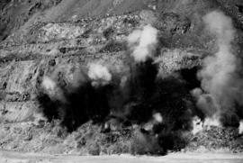
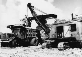
Men working among lumber at crusher building site, various materials scattered throughout. Vertically protruding planks from framework of crusher building are in foreground. Tree-covered valley in background. Construction of a long structure near the edge of the excavation area can be seen in midground; this is speculated to be the section of the crusher building which housed conveyor "B".
Handwritten caption beside this photo reads: "Lunchroom Damaged by Boulder". Large boulder stands to right of small building, walls of right corner partially destroyed. Lumber, upturned saw horse, and various other material lie on ground. Dirt road in foreground, mountainside in background.
Blue sky in background.
Handwritten caption beside this photo reads: "Elaborate barricades required due to amount of loose rock falling continuously". Three men work in area confined by barricades made of vertical metal rods and horizontal wood planks. Miscellaneous building material and supplies cover the ground. Rock pile in foreground on right.
Photograph depicts a construction worker carrying a plank of lumber across a higher level area of the construction site, semi-constructed walls below him. Barricades against loose rock are semi-visible in foreground (see item 2000.1.1.2.352).
Three men work in area confined by barricades made of vertical metal rods and horizontal wood planks (see item 2000.1.1.2.352). Two ladders in foreground, (one being used by construction worker). Lumber and semi-finished walls can be seen at higher level of elevation in background.
Photograph depicts the Cassiar townsite in foreground. Mill, dry rock storage building, and tailings pile can be seen in background. Handwritten annotation on verso of photograph: "1958 [1961 crossed through]."
Photograph depicts the Cassiar plantsite in foreground, including the mill, dry rock storage building, tailings pile, and many other buildings. Townsite in midground, mountains in background. Handwritten annotation on recto of photograph: "Cassiar."
Photograph depicts the mine road in valley below bulldozer parked on edge of mountain. Cassiar plant and town visible in distance, south mountains behind them in background. Photo also depicts what appears to be a cloud rising from the tailings pile in plantsite.
Photograph depicts the primary crushing plant in foreground. Mine road can be seen below, and plant is visible in distance. South mountains in background. Handwritten annotation on recto of photograph: "1961-1962".
Photograph depicts the mine road in valley bellow mine. Cassiar plant and tailings pile in foreground. Handwritten annotation on recto of photograph: "Oct. 25 / 65 4:25 PM."
Photograph depicts the Cassiar mine after extensive strip mining. It is believed that the North and South peak stand in background, and the West peak in foreground. Handwritten annotation on recto of photograph: "1971".
Photograph depicts the Cassiar valley: town in foreground, plant and tailings pile in background. Mountain range visible in distance. Photograph was taken from above, facing east.
Photograph depicts the Cassiar valley: plant and tailings pile on left, town on right. Mountain range visible in distance. Photograph was taken from above, facing south.
Photograph depicts the Cassiar mine. North peak featured in left background, South peak in right background, and West peak in right foreground. Area to left of the mining pit and West peak was called the "cirque waste dump." Mountain range visible in distance.
Photograph depicts the town of Cassiar behind plant and tailings pile in foreground. Mountain range in background.
Photograph depicts the Cassiar mine in foreground, north east mountain range in background. Tramline station and crushing plant visible in foreground in front of pit. Photograph was taken from the air, portion of plane visible in top left of image.
Photograph depicts the Cassiar mine in foreground, north east mountain range in background. Tramline station and crushing plant visible in foreground, west of pit. Photograph was taken from the air, portion of plane visible in top left of image.
File contains portraits and sample photographs of exposed asbestos fibre: in veins of rock outcrops, and loose in talus on McDame Mountain (location of Cassiar mine). Some photographs were printed in Cassiar's Annual Reports, with labels and descriptions.
Photograph depicts a pick hammer hanging from outcrop. Annotations on note glued to recto of photograph: "ASBESTOS"; "Outcrop of fibre bearing serpentine about centre of deposit and vertically over 300 adit on western slope." Areas of image have been labeled "A" and "B". Photo caption under printed copy of image in 1952 Annual Report: "A - indicates asbestos talus. B - indicates asbestos veinlets."
Photograph depicts exposed asbestos fibre in talus and outcrop.
Photograph depicts two unidentified men on road or mining bench at high elevation on mountain, valley in background.
Photograph depicts red truck dumping waste at what is believed to be the tailings pile at the Cassiar plant. Small building and unidentified individual in bottom left foreground, valley and mountains in background. Photo caption next to printed copy of image in 1953 Annual Report: "Stockpile of 80,000 tons of Ore at Mill."
Photograph depicts large dry rock storage building in foreground on left, mill in background, dryer building in right midground. Miscellaneous supplies in far right foreground, mountains visible in background. Handwritten annotation on verso of photograph: "Sept 1954". This photograph was originally stored inside duotang labeled "CASSIAR ASBESTOS CORPORATION LIMITED PHOTOGRAPHS 1954"; photo caption beneath this image: "40,000 Ton Dry Storage Building / Mill / Dryer Building".
File includes six aggregations of photographs which have been assembled in this file in order to maintain the integrity of each group by keeping the photos arranged together, though each group features operations pertaining to multiple files in this subseries. Includes groups featuring photos from 1961, 1965 1971, a helicopter trip, a community album, and a workplace album. Photographs depict images pertaining to the following operations at Cassiar, B.C.: mining, milling, maintenance, labratory tests, and tramline and town operations. Images featuring operations of the company town include the grocery store, bank, churches, school, library, lounge, pool, theater, community center, outdoor recreation, hospital, dentist, cafeteria, bus route, residences, air strip, firehall, laundromat, park, police, and newspaper.
Photograph depicts buildings at various locations in mine: crushing plant (centre?) and what is believed to be the original tramline loading station on left. Mine road featured in center, blasthole drill visible near dump truck in midground. Mine valley in background. Photo believed to have been taken from mine's South Peak. Handwritten annotation on verso of photograph: "1961".
Photograph depicts an Atlas Copco Drillmaster (blasthole drill) near the mine road, mountainside in background. This is a precision hammer drill which had its own power source. It is believed that this photo was taken on the North ridge, near the cirque dump. Handwritten annotation on verso of photograph: "1961".
Photograph depicts a man wearing a hard hat preparing explosive material, mountains in background. Dog stands near edge in midground, large bags of Ammonium Nitrate in right foreground. Handwritten annotation on verso of photograph: "1961".
Photograph depicts explosion, part of the bench-mining process employed at Cassiar. Handwritten annotation on verso of photograph: "1961".
Photograph depicts crawler cable shovel, bucket over box of Kenworth truck in excavation area of mine. Handwritten annotation on verso of photograph: "1961".
Photograph depicts unidentified woman using Bauer Mcnett machine to test length of fibre samples by using water. Woman stands facing wall, away from photographer, unidentified equipment on either side.
Photograph depicts flowing water believed to be Troutline Creek which ran south of Cassiar, B.C. Tailings pile and plant buildings visible behind forest in midground, northern mountain range in background. Handwritten annotation on verso of photograph: "Cassiar June 15 71".
Photograph depicts flowing water speculated to be Troutline Creek which ran south of Cassiar, B.C. Forest on opposite shore and mountains in background. Handwritten annotation on verso of photograph: "Cassiar June 15 71".
Photograph depicts the West Peak of the Cassiar mine on McDame Mountain. Pit area visible between West Peak and road in foreground. Mine valley and north mountain range in background. Photo speculated to have been taken from a point on or near the South or North Peak.
Photograph depicts mine valley and road in foreground. Cassiar plant and tailings pile visible in left midground, townsite in right midground. Mountainside of McDame Mountain in foreground, southern mountain range in background.
Photograph depicts woman wearing safety gear in second floor of mill building, holding unidentified instruments. Helen Joseph took air quality tests in the working areas and town (see item 2000.1.1.3.19.147).
Photograph depicts mobile home modified for Cassiar winters (steeply sloped roof added). Yellow suburban parked in driveway in left foreground. Forest trees and mountainside visible in background. Sign reading "686" posted on tree in left foreground. Believed to be the home of Gerry Cooper.
Photograph depicts group of men and women on rocky shore, pile of fish in foreground. Photo speculated to have been taken in the Telegraph Creek area, possibly at the Tahltan or Stikine River, B.C.
Mill building in left midground. Conveyor believed to be leading to tailings pile can be seen in foreground. Valley and mountains in background.
Cassiar Asbestos Corporation Ltd opened a second mine in 1967 at what became the one-industry town of Clinton Creek, Y.T. File contains photographs depicting different areas of operations at Clinton Creek. Locations include the mine, plant, town, tailings pile, main office, the 40 Mile River, and surrounding area. Town photos depict the grocery store, cafeteria, medical clinic, school, auditorium residential area, Connell Street and power house. File also includes aerial photographs and images depicting forest fighting, photographers capturing the tailings pile, asbestos samples, mining machinery, staff offices, and operations in the mill, lab, and garage.
Additional photographs integrated into file depict Clinton Creek's surrounding area, and three slides of a tailing pile explosion believed to be Clinton Creek.
Reclamation is the process of recovering disturbed land to its former state or other productive uses. This collection of photographs depicts men at work instituting a project on the control of erosion and to restore the mined areas to a condition in keeping with the environmental standards.
Men can be seen working on site. Crusher building in midground, chutes can be seen crossing the different levels of foundation. Lumber is leaning against excavated dirt wall in foreground, as well as a ladder which reaches up to the base level. Large tank can be seen in top level above building construction. Mountaintop and sky in background.
Photograph depicts two construction workers in far right sitting on edge above of excavation area, and two construction workers behind them standing at a higher level with construction of lumber walls behind them. The boom and stick of the "Northwest" excavator are semi-visible on left.
Switchback road, power lines and tramline towers are believed to be visible in the background valley. Construction of a long structure near the edge of the excavation area can be seen in midground; this is speculated to be the section of the crusher building which housed conveyor "B".
Handwritten annotation on recto of photograph: "POURING RIBS JUNE 29/64." Photograph depicts construction workers on large wooden framework structure extending from base of crusher building. Ladders stand parallel to structure against mountainside. The boom of a crane is visible in foreground. Miscellaneous construction equipment and materials throughout.
Handwritten annotation on recto of photograph: "WEST WALL FOOTING AUG 8/64." Photograph depicts a construction worker standing on rebar in forms built for cement footings. A front end loader and backhoe tractor can be seen on wood platform above footings. Mountainside in background.
File contains images depicting various landslides near Cassiar BC. Set of 20 photographs (with 9 corresponding negative strips) date stamped June 1987 depict landslide near creek and dirt road with a Cassiar company truck. Set of 5 black and white photographs found in envelope marked "D. Stewart" are likely from 1988-1989 and depict a rockslide on the south western side of the pit mine, near the tramline. Album entitled “6200 DUMP SLIDE / SPRING, 1979” contains 34 photographs depicting aerial shots of a massive rockslide on the eastern slope of McDame Mountain, originating from the mine waste dump. Several images from album show greenish water pooling in the toe of the slide.
Photograph depicts the mine road in valley, view from mountain above. Plant, tailings pile, and town visible in distance. South mountains in background. Handwritten annotation on recto of photograph: "1961-1962".
Photograph depicts view of mine road in valley, from mountain above. Plant, tailings pile, and town visible in distance. South mountains in background. Handwritten annotation on verso of photograph: "1961", on recto: Townsite and Plantsite from mine."