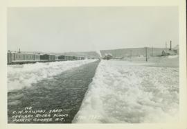
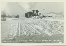
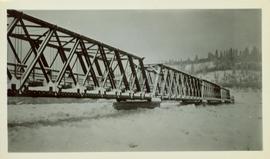
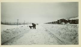
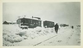
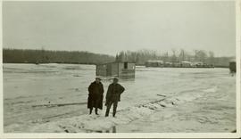
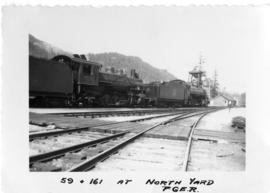
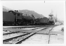
Showing 950 results

Archival description
2002.1.9.3.002 · Item · [ca. 1960]
Part of Prince George Railway & Forestry Museum Collection
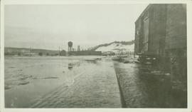
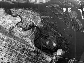
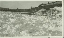
Photograph depicts B.C.R. locomotive # 586 derailed with two men arriving in a company truck. Gravel and switch is visible in the foreground while industrial storage tanks are visible in the background. Photographer: "Brock Gable" stamped in red on verso. Typed note on verso reads: "When we say May Day, we mean May Day.......specifically May1, 1985. Our locomotive, BCR # 586 made the front page of the "Citizen" that day. though not the way anyone intended. In fact, it was downright embarrassing and unflattering. Nearing the end of its career, # 586 was involved in a minor hist and run in the BCR yard and parted company with the rails. As is evident in the picture, BCR's big hook" is standing by and help is on the way. No! we don't know if anyone got the other guy's license. (Photo Credit: Brock Gable ///Citizen). Part of a set of 13 black & white photographs of British Colombia Railway & it's precursor, Pacific Great Eastern Railway (1912 - 2004) in British Columbia. Photos depict locomotives, railroad cars, and crew members. «

2005.3.51 · Item · [ca. 1945]
Part of John Hart Highway Photograph Collection

Handwritten caption below this photo reads: "Bought in Picture Prince George". Photograph depicts a mother grizzly bear standing on her hind legs against tree, so that her facial profile is visible. Two cubs stand on hind legs facing and leaning against her.

Grizzly Bear
2005.3.52 · Item · [ca. 1945]
Part of John Hart Highway Photograph Collection

Handwritten caption below this photo reads: "Bought in Picture Prince George". Photograph depicts a grizzly bear walking on all fours in forest area, slash debris in background.

2005.3.63 · Item · [ca. 1946]
Part of John Hart Highway Photograph Collection

Handwritten annotation on recto of photo reads: "Harry Monson Edmonton Prince George." Harry reclines on bed under window, surrounded by personal effects. Photograph was taken after nightfall. Handwritten caption beside this photo reads: "Harry talked my dad into selling him my boat".

2006.18.1.01 · File · 1990-1996
Part of Aleza Lake Research Forest Society fonds

File consists of:

  • "A Summary of Historical Orders-in-Council affecting the Aleza Lake Forest Reserve", Mike Jull, 18 Dec. 1996
  • Photocopied memorandum from F.S. McKinnon regarding "Transfer of Aleza Lake to D.F. Prince George", 9 Sept. 1963
  • Photocopied 1928 article by P.M. Barr from Forestry Chronicle 4(3) entitled "The Aleza Lake Experiment Station: Its Development and Purpose"
  • "A Brief History of the Aleza Lake Experiment Station", [Tim Decie, 1981?]
  • Contact information for living relatives of Percy Barr, as of 1990
  • Photocopy of 1930 article by Percy Barr entitled "Spruce Reproduction in British Columbia"
  • Photocopy of records from BC Archives from a visit by Harry Coates from the file GR 1348 "The Young Mens Forestry Training Program"
  • Photocopy of excerpt regarding "Amanita Lake/Diameter Limit Logging"
  • Various small-scale maps and charts regarding Aleza Lake
  • "Aleza Lake Research Forest Information Session Notes with Mike Jull, Manager of ALRF"
2006.18.1.12 · File · 2006-2007
Part of Aleza Lake Research Forest Society fonds

File consists of:

  • David Mills, "Aleza Lake Research Forest Historical Internship Summary" (2 Jan. 2007), 26 p. - In print and original digital .doc file
  • David Mills, "Aleza Lake Forest Experiment Station Socio-Economic Time Line 1905-1937" (2007), 68 p. - In print and original digital .doc file
  • ALRFS employment paperwork for David Mills, the ALRFS Natural Resource History Intern
  • Research notes, including a copy of a map of the town of Aleza Lake in the 1920s
2006.18.5.18 · File · 1974
Part of Aleza Lake Research Forest Society fonds

File is a Resource Folio of maps and accompanying information created by Northwood Pulp & Timber regarding Timber Sale Harvesting Licence A01847, Willow River Block, Willow River P.S.Y.U. Includes maps that depict ungulates, waterfowl, recreation areas, special influence areas, and timber types. Most of the sheets have a duplicate, some with very slight variations. The following maps are supposed to be included in the but were missing upon arrival at the Archives: fish & topography, cutting permits & roads, and soils.

2006.18.6.01 · File · [196-?]
Part of Aleza Lake Research Forest Society fonds

Photographs are panoramas taken from the Churchill BC Forest Service Lookout, located at latitude 54°04' and longitude 122°16'. The photographs were bound together and include a transparent grid that was intended to be used for locating forest fires.