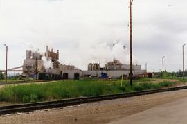
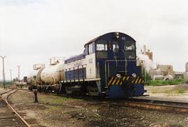
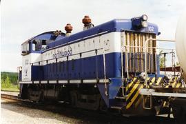
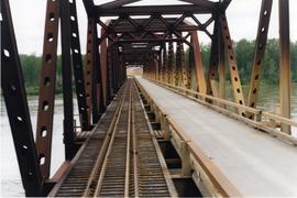
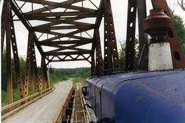
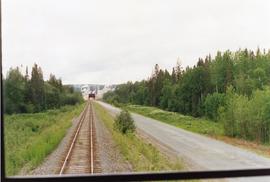
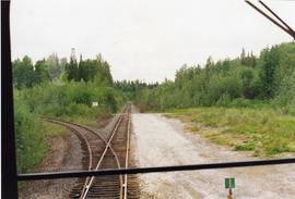
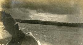
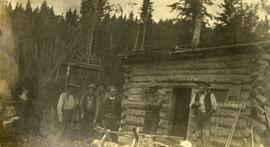
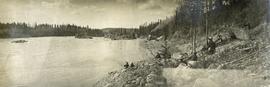
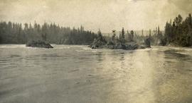
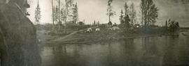
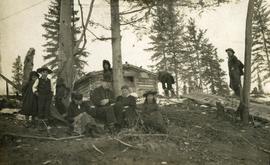
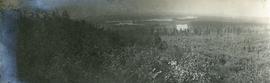
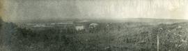
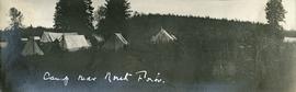
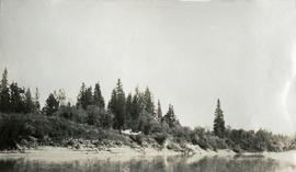
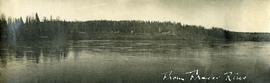
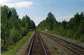
Photograph taken somewhere between Prince George and McBride.
Photograph depicts Northwood Pulp and Timber Ltd, Prince George. Located north of the city, near the BC Rail and CNR mainline tracks. It had its own railway of about 5 miles in length and two diesel switchers.
Photograph taken at the Northwood Pulp and Timber Ltd, Prince George. Visible is a General Motors switcher, built in 1959. Aqcuired in 1981. On private Northwood trackage with the mill in the background.
Photograph taken at the Northwood Pulp and Timber Ltd, Prince George. Visible is a General Motors switcher, built in 1959. Aqcuired in 1981. Its sister locomotive had just returned from some major servicing at CN shops in P.G. Built in 1954 and acquired in 1989. Would not be used until business picked up. Pulp trade in world doldrums at the time the photograph was taken.
Photograph depicts a private rail/road bridge built to serve Northwood Pulp and Timber, Ltd. Crossing Fraser River. Looking west, towards the mill. On private Northwood trackage.
Photograph depicts a switcher running towards a CN interchange. Just left the Fraser River bridge. All private and owned by Northwood Pulp and Timber Ltd.
Photograph taken on a 40 ft. high embankment. Looking towards Fraser River. Northwood Pulp and Timber Ltd. in western direction. All trackage owned and built by the mill. Constructed in 1966.
Photograph taken in front of the 'main line' that led to a pulp mill and river crossing. To the left was a lesser used connector to the CN main line. Behind the camera was a 4-track interchange yard. Beyond that, the CN line to Alberta could be found.
Photograph depicts two people and a dog team on a snowy river bank with a narrow passage of open water and a snowy bluff in the background.
Photograph depicts a four-dog team harnessed to a loaded sleigh. Two people stand near the loaded sleigh on a snowy forest path.
Photograph depicts a small cluster of buildings near the river bank.
Photograph depicts a cluster of wooden buildings including a flagpole and church spire at a Lheidli T'enneh village site. Original photo identified this image as "Indian Village, Fort George".
Photograph depicts a large white building surrounded by a fence.
Photograph depicts Lheidli T'enneh Nation burial grounds in foreground, Hudson Bay Company buildings in background.
Photograph depicts four men pinning a "Union Jack" flag to the exterior of a building.
Photograph depicts several men standing on the river bank. Possibly A.H. Holland in center of photo.
Photograph depicts view of the river from a boat. There is a silhouette of a person wearing a hat in the foreground.
Photograph depicts four men paddling a long canoe. The canoe is loaded with supplies and a dog, river and forest in the background.
Photograph depicts six men standing outside a small log building. A sawhorse in the foreground, a tall pole "cache" and forest in the background.
Photograph depicts one man standing on the bank of a river, forest in the background. The image is not in focus or possibly a double exposure.
Photograph depicts nine or more people watching a steamer navigate the rough waters of Fort George Canyon from the river shore.
Photograph depicts the rough waters and rocks at Fort George Canyon.
Photograph depicts a view of the river shore, a few scattered buildings and tents are near the shore. A footpath leads from the water's edge between the dwellings and through the newly cleared land.
Photograph depicts six adults and three or more children sitting on the ground with a log cabin in the background. Snow scatters the ground in small patches.
Photograph depicts twenty-eight or more people standing on the river's edge, a stack of wood is ready for loading on the steamer that is anchored near the shore.
Photograph depicts eighteen or more canvas tents scattered on the river shore next to rough cabins and an outhouse.
Photograph depicts scattered buildings, an outhouse, and tents on a rough clearing. A river and its cutbacks are in the background.
Photograph depicts several people in a large field. There are buildings and trees in the background.
Photograph depicts a tarp spread out on the grass, two men sit nearby the tarp. There is a canvas tent in the background with a man standing beside it. Behind the tent is a low hill with a fence bordering the top of the hill. There are blankets drying on the fence.
Photograph depicts a view from a high hill looking down on the Nechako river. There is forest and low rolling hills in the background.
Photograph depicts a view from a high hill, looking down on the Nechako river. There is forest and low rolling hills in the background.
Photograph depicts a view from a hill of a river winding through the forest with marshlands nearby.
Photograph depicts a view from a hill of a river winding through the forest with marshlands nearby. This may be a double exposure and there is an indiscernible image in the center of the photo.
Photograph depicts a view of a lake from a row boat. The back of one male boat passenger and oars are in the foreground.
Photograph depicts several canvas tents set in lush vegetation near dusk.
Photograph depicts seven or more men relaxing near a canvas tent. Some of the men appear to be whittling wood. Long underwear dry on a tent rope and wood smoke drifts past the men and tent to the forest behind.
Photograph depicts a man bathing himself while standing in a small metal tub. Photograph description in album notes this as "His 'Semi Annual'" [bath]. On the left is a log structure, presumably a cache building. A large clearing surrounds the building and bathing man. There is a forest and bluff in the background. Possibly located near Giscome Portage.
Photograph depicts a view from the river looking at the river bank. There is a canvas tent with forest in the background.
Photograph depicts a wide expanse of river in the foreground looking across the water to a narrow clearing along the opposite riverbank. A few building are scattered across the clearing. There is forest in the background.
Photograph depicts four men pulling a long canoe across a clearing on a wheeled trailer.
In 1936, Gordon Young Wyness was employed by Philip M. Monckton, a B.C. Land Surveyor. Between June 5 and October 8, Wyness joined Monckton and a group of others on a land survey expedition in northwestern BC. The survey crew travelled to various locations in the area including Telkwa, Hazelton, Burns Lake, Francoise Lake, Vanderhoof, Prince George, Quesnel, Lytton, and Hope. Wyness documented their journey in this photograph album. Based on the photographs, it appears that the crew led by Philip Monckton consisted of Jack Lee and Gordon Wyness; Mrs. Lavender Monckton (nee O'Hara) also accompanied the group.
In addition to the 50 photographs included in the album, this collection also includes five additional unique photographs that accompanied the album.
Wyness, Gordon YoungPhotograph depicts (from left to right) Jack Lee, Gordon Wyness, and Lavender Monckton standing in front of a wooden moose. The wooden moose was located on top of a hill to the east of Prince George. The wooden moose was an advertisement for John A. Lestin's taxidermy business on Third Avenue in Prince George.
Photograph depicts (from left to right) Jack Lee, Gordon Wyness, and Lavender Monckton sitting on their 1930 Buick Series 40 car in front of their temporary cabin lodgings in Prince George. This photograph was taken before the group left Prince George to head to 6 Mile Lake or Tabor Lake.
Photograph depicts a view of the city of Prince George looking west from the east hill. The confluence of the Fraser River and Nechako River is visible to the right. The Grand Trunk Pacific Railway bridge is visible at centre. The current location of where this photograph may have been taken is likely somewhere near where Highway 16 rises on the hill past the correctional centre (jail).
Photograph depicts (from left to right) Philip Monckton, Gordon Wyness, and Lavender Monckton at the Beaverly Geodetic Station, 7 miles west of Prince George. Surveying equipment (tripod, theodolite, and wire) are stationed at centre.
Photograph depicts two surveyors (Jack Lee, Gordon Wyness, or Philip Monckton) taking bearings from Pineview Station tower east of Prince George. Their surveying transit and telescope are visible in the image.
Item is a hand drawn and coloured map by the City of Prince George Planning Department depicting North Nechako neighbourhood area existing land use in 1976.
Item is a hand drawn and coloured map by the City of Prince George Planning Department depicting Hart Highway neighbourhood area existing land use in 1976.
City of Prince GeorgeItem is a hand drawn and coloured map by the City of Prince George Planning Department depicting the College Heights and southwest (Vanway) neighbourhood area existing land use in 1976.
Item is a hand drawn and coloured map by the City of Prince George Planning Department depicting the North Nechako and Hart neighbourhood area proposed land use in 1976.