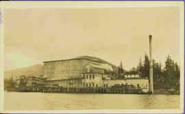
Photograph of a large explosion next to a huge pile of debris. Buildings are visible on either side and railroad track can be seen in the foreground. Printed annotation on recto reads: "The Last Big Blast, Prince Rupert BC 21 Jan 1914 McRae Bros. Photo"
Photograph of a large explosion next to a huge pile of debris. Buildings are visible on either side and railroad track can be seen in the foreground. Annotation on recto reads: "The Last Big Blast, Prince Rupert BC 21 Jan 1914 McRae Bros. Photo"
Photograph depicts four men bathing in a backwater or lake. One clothed man stands on the shore.
Photograph depicts two men wading and bathing in shallow water with lily pads.
Photograph depicts a woman and two men standing outdoors near a newly constructed log cabin. Tree stumps in foreground, forest in background.
Photograph depicts looking across a muskeg meadow.
Photograph depicts Shannon Falls near Squamish, which was formerly named Fairy Falls.
Photograph depicts a cluster of canvas tents on the edge of an alpine meadow.
Photograph depicts a view of sparsely forested rolling hills with low mountains in the background.
Photograph depicts a view from a high ridge looking over vast forest.
Photograph depicts three men standing on the banks of a backwater or lake, with clothing piled on the ground.
Photograph depicts river and high river bank in the distance.
Photograph depicts tall timber and fallen trees.
Colour-coded map depicting lands open for preemption, in “University Reserve,” or reserved for public auction. Depicts land recording divisions, communities, bodies of water, and transport routes.
Overhead view of downtown Prince George with a forested area in the background. Printed annotation on recto reads: "South Fort George- 1914."
View from water of large industrial building (cannery?). Handwritten annotation in pencil on verso reads: “Seal Cove BC P. Rupert BC.” Handwritten message in ink on verso is addressed to “Miss Belding 33 Marlbro Avenue Hull Josks Eng.” 2 cancelled Canadian postage stamps read: “Vancouver B.C. Jul 4, 8 PM 1914”
Winter landscape taken from behind railroad track. Cleared land in foreground, buildings in midground, low hills in background.
Handwritten annotation on recto: “PRINCE GEORGE 3-15-14”.
Winter landscape taken from behind railroad track. Cleared land in foreground, buildings in midground, low hills in background.
Handwritten annotation on recto: “PRINCE GEORGE 3-15-14”.
Photograph depicts a view of sparsely forested hillsides with a creek in the center of the photo, low mountains in the background.
Photograph depicts a small one window cabin within a rustic clearing. There is a fenced area (possibly garden) near the cabin and forest in the background.
Photograph depicts lush undergrowth with tall trees.
Photograph depicts canvas tents set near the banks of the Fraser River, sparse forest in the foreground, river in the middle ground and low forested hills in the background.
Photograph depicts looking across a muskeg meadow.
Photograph depicts two men standing in center foreground, forested flat land in background.
Photograph depicts forest growth near Woodpecker Island and Stone Creek.
Photograph depicts the Mamquam River near Squamish.
Consists of legal records and documents related to the holdings and activities of J. B. Henderson-Roe and his father, C.H. Henderson-Roe, including a hand-drawn map of Prince George, Fort George, and South Fort George, as well as a surveyor's plan for a subdivision.
The Fort Fraser Historical Photograph Collection consists of 1 photograph album featuring 86 black and white photographs of Fort Fraser and area during the pre World War I era.
Photograph album contains 86 black and white photographs depicting various aspects of life and construction in Fort Fraser in the pre World War I era.
Photograph depicts large buildings on shore. Three unidentified individuals can be seen walking on dock in foreground.
Printed on image: "METLAKATLA B.C. / McRAE BROS"; handwritten annotation on verso reads: "A section of Metlakahtla, showing Church & Schoolhouse." See also item 2009.7.1.58 for similar image also featuring the new church building at Metlakatla, B.C.
Photograph depicts a cluster of tents on the edge of a meadow. Four or more people stand or sit amongst the tents. Smoke rises from a wood fire and drifts amongst the stub alpine trees in the background.
Photograph depicts lush forest growth and tall trees.
Photograph depicts a view looking down from a high forested slope to Woodpecker Island on the Fraser River, BC.
Photograph depicts a man and a woman standing in front of a log home and nearby shed. There are stumps in the foreground and tall timber in the background.
Photograph depicts several canvas tents set on rocky, newly cleared ground. Tall trees in the background, a creek on the right.
Photograph depicts a large concrete post with dirt mounded around.
Photograph depicts forest growth with fallen trees and remnants of a forest fire.
Photograph depicts a view of Squamish, which was named Newport between 1911-1914. This photograph was taken from the Squamish Smoke Bluffs, looking south. Mamquam River blind channel visible in foreground.
Photograph depicts a view of the east end of Seton Lake. The Seton Lake sawmill and Seton Lake fish hatchery are visible in the foreground. The PGE railway grade alongside the lake has not yet been constructed, dating this photograph at or before 1914.
Elevated photograph of Prince Rupert taken from a hill. Printed annotation on recto reads: "Prince Rupert BC McRae Bros." Handwritten annotation on verso reads: "11/June c/o PG Prince Rupert, B.C. Dear Rae[??], How about a letter. Love for all, Frank." Postcard is addressed to: "Miss R Boew. Bernie PG [illegible]." Postmark on verso reads: "Prince Rupert BC Jun 11 1 PM 1915."
Stern wheeler in river. Printed annotation on recto reads: “S.S. “Charlotte,” Quesnel. B.C.” Handwritten message on verso is addressed to “Mr. O. Winter 1016 V Park St. Victoria B.C.” The dates on the canceled 1 cent Canadian stamp on verso are not readable.
Photograph depicts Henry Alexander, son of Marion and Archdeacon W.H. Collison, leaning on walking stick on top of rocky hill. Mountains in background.
Handwritten annotation on verso reads: "Henry Collison on prospecting trip. Portland Canal."
Photograph depicts a large ship behind dock buildings. Railroad crosses foreground, hills visible on shore in background.
Handwritten annotation on verso reads: "Drydock Prince Rupert".
Photograph depicts buildings visible through clearing in trees. Water crosses foreground, hills visible in background.
Handwritten annotation on verso reads: "Dry dock / Prince Rupert B.C."
Photograph depicts totem poles (crest poles?) in front of lodge buildings on river shore. Canoes can be seen floating in foreground, hills in background.
Handwritten annotation on verso reads: "Chapter XII. Number 1. Section of Indian Village on Nass River showing lodges and totems".
Handwritten annotation on verso reads: "Nass River canyon at flood water". A building is visible on shore in distance, and mountains can be seen in background.
Photograph features a steep cliff across still water.
Handwritten annotation on verso reads: "Place of Scalps / Kincolith BC"
Totem poles (crest poles?) stand in front of wooden houses on right. Hills on shoreline visible in background.
Handwritten annotations on verso read: "West Coast QCIs."; "[Old?] Kassan Alaska."
Photograph depicts the steam-operated sawmill at Seton Lake and a fish weir at the mouth of the creek. The railway grade alongside the lake, constructed circa 1914-1915, is visible in the background. The Seton Lake fish hatchery, which built and used the fish weir, ceased operations in 1915, dating this photograph sometime around 1914 or 1915.