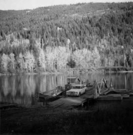
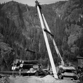
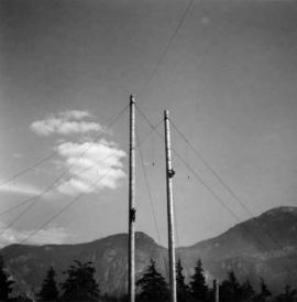
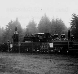
Showing 3379 results

Archival description
2013.6.36.1.003.069 · Item · Aug. 1965
Part of David Davies Railway Collection

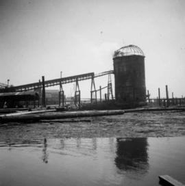
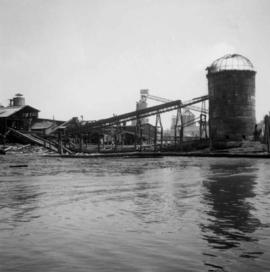
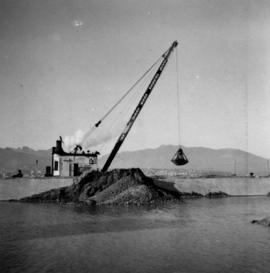
Photograph depicts a steam grab belonging to the Vancouver Pile Driving & Contracting Co. Ltd, mounted on a scow and transferring gravel from another scow on the seaward side and rear of the wall. The portion in the foreground will become solid ground but it is now exposed to tides. The construction of the new pier is to the west of the Centennial Pier on the site of the original Hastings Mill.

2013.6.36.1.003.075 · Item · Oct. 1965
Part of David Davies Railway Collection

Photograph depicts a reaction ferry at Blackpool, near Clearwater on the north Thompson River, about 65 miles north of Kamloops. At least 3 such ferries exist north of Kamloops. In freshet the trip takes 1 minute, in low water 15-20 minutes. The other two ferries are equipped with outboard motors in 1964. The ferry broke loose in flood water in approximately 1960.

2013.6.36.1.003.084 · Item · Jan. 1966
Part of David Davies Railway Collection

Photograph depicts Nelson St., facing west between Bidwell and Denman St. Photo, and was taken during snowfalls between 23 December 1965 and 5 January 1966. During this period 40 inches of snow fell on the west end. The lampstands are typical of this area and are about to be replaced by February 1966 by a newer type.

2013.6.36.1.003.087 · Item · Jan. 1966
Part of David Davies Railway Collection

Photograph depicts a swimming pool at Second Beach in Stanley Park, Vancouver, B.C. The snow in the foreground is 16 inches deep and there is a gathering snowstorm in the background coming in from the west.

Entrance to Squamish River
2013.6.36.1.003.089 · Item · Sept. 1965
Part of David Davies Railway Collection

Photograph depicts the entrance to the Squamish River at Squamish, looking upstream. The pier on the left belongs to the original logging railway, circa 1909-1925.

Downtown Vancouver, B.C.
2013.6.36.1.003.093 · Item · Mar. 1966
Part of David Davies Railway Collection

Photograph depicts a view of downtown Vancouver taken from the east end of False Creek at the foot of Terminal Ave. The view is looking northwest. In the middle distance on the left is the pier of a railway bridge taking the Great Northern Railway line into the city. It was demolished in about 1915-1920 when a new Great Northern station was constructed.

2013.6.36.1.003.094 · Item · Apr. 1966
Part of David Davies Railway Collection

Photograph depicts the Hospital Cottage on Main St. in Sechelt, B.C. which also appears to have been home to the Magistrates and Small Debts Court at one point. A large central hospital for the whole of the Sechelt Peninsula was opened in 1965 at Sechelt.

Lund Harbour
2013.6.36.1.003.099 · Item · Apr. 1966
Part of David Davies Railway Collection

Photograph depicts Lund Harbour, looking north, 12 miles north of Powell River. It is the most northerly point on the mainland accessible by car, on this part of the coast. Lund is 92 car miles north of the ferry terminal at Langdale.

2013.6.36.1.003.101 · Item · [May 1966]
Part of David Davies Railway Collection

Photograph depicts a view of the Fraser River from the Albion Ferry from Haney to Fort Langley. The ferry is approaching the south bank of Fort Langley. Gulls sat on logs floating downstream; too heavy to rise after eating candlefish.

2013.6.36.1.003.103 · Item · [May 1966]
Part of David Davies Railway Collection

Photograph depicts the B.C. Hydro station at Shalalth, 15 miles southeast of Lillooet on Seton Lake. Photograph shows penstocks carrying water from Bridge River to the powerhouse.