File consists of issues of the literary periodical entitled "Alcheringa", including issue 2.
Detail of Alnus catkin
File consists of Alderdice's handwritten notes regarding various aspects of the Alcan-Nechako River controversy.
Photograph depicts a view from the water looking at the cannery built on the dock at Alert Bay. Handwritten annotation below photograph reads, "Alert Bay cannery".
Photograph depicts several carved totem poles and house posts in a clearing with a forested area in the background. Photographer’s stamp on verso: “W.E. Nicholson, 268 E. 10th, Vancouver 10, B.C.”
Photograph depicts sparse buildings, cleared forest, water in the foreground. Handwritten annotation below photograph reads, "Alert Bay".
Item is a photograph of two men in bathing suits standing beside a Californian beach.
Item is a photograph of Alex Moffat dressed as a prospector holding gold nuggets he salted into a gravel bed and later panned out and gave to Princess Margaret.
File contains correspondence from Brian Fawcett to Alex Wilson. Includes a letters from Brian Fawcett to Alex Wilson, regarding Alex Wilson's non-fiction grant. Letters dated January 15; November 4, 25, 1992.
File contains correspondence to Brian Fawcett, at the Globe & Mail, from Alexa Cartwright. Includes letters dated February 5, April 7, 1991.
File consists of documentation regarding Alexander Caulfield Anderson, a British Hudson's Bay Company (HBC) fur-trader, explorer of British Columbia, and civil servant. Includes reproductions of Alexander Caulfield Anderson correspondence from the BC Archives.
Twin Falls Territorial Park, Hay River, Northwest Territories
Alexander Graham Bell National Historic Site of Canada, Baddeck village, Nova Scotia
File contains 1 photocopy of “Alexander Mackenzie as Surveyor” by F.C. Swannell.
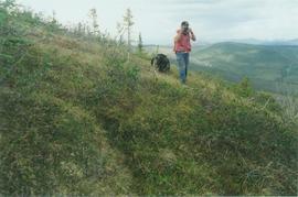
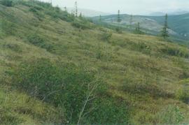
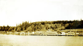
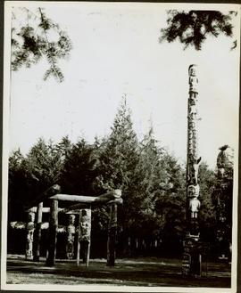
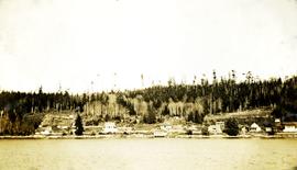
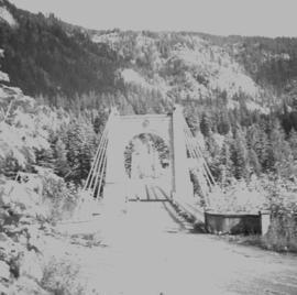
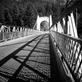
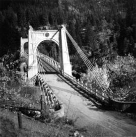
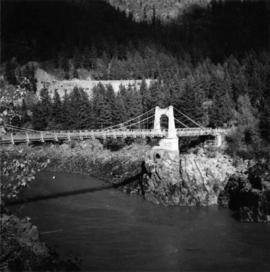
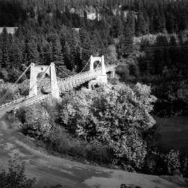
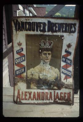
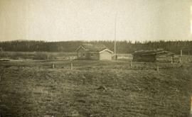
File consists of material relating to the Alexander Mackenzie Heritage Trial also known as the Nuxalk-Carrier Route, Blackwater Trail, or the Grease Trail. The trail is a 420 km (260 mi) historical overland route between Quesnel and Bella Coola. Materials include a postcard, booklet, pamphlets, newspaper clippings, journals, correspondence, a map, a magazine, and reproductions of articles. Highlights include:
- British Columbia Historical News, "Surveying B.C. Since 1793", Vol. 26 No. 2, 1993
- Government of Canada Minister of State for Youth, "The Sir Alexander Mackenzie 'Canada Sea-to-Sea' bicentennial expeditions, 1989-1993", 1993 (pamphlet)
- Alexander Mackenzie Trail Association, "Alexander Mackenzie Heritage Trail", [198-?] (pamphlet)
- Blackwater-Ootsa Community Association, "Safeguarding The Future For The Unspoiled Wild lands, Waters, Fish, Wildlife and Lifestyles of The West Chilcotin", [198-?] (pamphlet)
- Alexander Mackenzie Trail Association, "The Alexander Mackenzie Voyageur Route", 1993 (pamphlet)
- Canadian Geographical Journal with feature article "Tracking Mackenzie to the West Coast", Vol. 93 No. 2, 1976
- Alexander Mackenzie Heritage Trail, "Following in the footsteps of Sir Alexander Mackenzie and his Nuxalk-Carrier Guides", 1988 (pamphlet)
- Alexander Mackenzie Heritage Trail, "Including Day Trips at the Blackwater Bridge", [198-?] (pamphlet)
- Alexander Mackenzie Heritage Trail, "Including Day Trips at Burnt Bridge Creek", [198-?] (pamphlet)
- Alexander Mackenzie Heritage Trail, "Including Day Trips at the Euchineko River and Titetown Lake", [198-?] (pamphlet)
- Alexander Mackenzie Heritage Trail, "Including Day Trips at the Blackwater Bridge", [198-?] (pamphlet)
- Beautiful British Columbia Magazine, Vol. 31 No. 2, 1989
- BC Ministry of Forests, "Kluskus Recreation Area", (map)
- Province of British Columbia, "Tweedsmuir Provincial Park (South)", 1984 (pamphlet)
- The Alexander Mackenzie Trail Association newsletter, 1985-1994
- Canadian Geographic with feature article "Following Mackenzie's footsteps to the Pacific" by Brian Patton, 1990 (magazine)
- United States Department of Agriculture Forest Service, "A Guide to Your National Forests", [198-?] (pamphlet)
- B.C Ministry of Land, Parks and Housing, "Tweedsmuir Provincial Park North", 1985 (pamphlet)
- National Forests and Grasslands, "Outdoor Recreation Guide", 1989 (pamphlet)
- National Park Service, "Lewis and Clark Trail", 1988 (pamphlet)
- Blackwater-Ootsa Community Association, "Safeguarding the Future for the Unspoiled Wild Lands, Waters, Fish, Wildlife and Lifestyles of the West Chilcotin", [198-?] (pamphlet)
- Blackwater-Ootsa Community Bulletin, Vol. 2 No. 1, Jan. 1991
- Lewis and Clark Trail, "Following Lewis and Clark Across the Clear water National Forest", 1982 (pamphlet)
- Recreation, Parks and Wildlife Foundation of Alberta, "Sir Alexander Mackenzie in Alberta", 1983 (pamphlet)
- Provincial Parks Branch, "Tweedsmuir Provincial Park", 1977 (pamphlet)
- Ministry of Lands, Parks and Housing, "Tweedsmuir Provincial Park South", 1984 (pamphlet)
- Tourism British Columbia, "British Columbia Road Map and Parks Guide", 1989 (pamphlet)
- The Royal Canadian Mint, "The Complete 1989 Canadian Coin Collection" featuring an Alexander Mackenzie commemorative silver dollar, 1989 (pamphlet)
- Beautiful British Columbia magazine. Vol. 24 No. 2, 1981
- Province of British Columbia Ministry of Lands, Parks and Housing, "British Columbia Agreement for Recreation and Conservation on the Alexander Mackenzie Heritage Trail", 1985 (booklet)
- The Alexander Mackenzie Trail Association newsletter, 1992
- The Alexander Mackenzie Trail Association, "Following in the footsteps of Sir Alexander Mackenzie and his Nuxalk-Carrier Guides", 1988 (pamphlet)
- Ministry of Forests Ministry of Tourism and Ministry Responsible for Culture, "Management Plan for Trail Portions on Public Forest Lands", 1993 (booklet)
- The Bella Coola 1993 Committee, "Follow the Trail to Bella Coola and Retrace the Adventure", 1993 (pamphlet)
- Heritage Research Group [Parks Canada?], "An Interpretive Study of the Alexander Mackenzie Heritage Trail", 1986 (reproduction)
Subseries consists of material created and collected by Kent Sedgwick during his involvement with the Alexander Mackenzie Heritage Trail Association. Sedgwick was the treasurer and later the president of the Alexander Mackenzie Voyageur Route Association. The association was formed to create the first official heritage trail in British Columbia. The trail is now called the Nuxalk-Carrier Grease Trail and is part of the route across Canada followed by Alexander Mackenzie in 1789 to 1793. The association aided in having the route recognized by each provincial government and the federal government. The files primarily consist of management plans, summary documents, booklets, and pamphlets created by the association, the provincial government, and Parks Canada.
File consists of a spiral bound booklet titled "Alexander Mackenzie Heritage Trail Draft Management Plan" prepared by the Province of British Columbia.
File consists of a spiral bound booklet titled "Alexander Mackenzie Heritage Trail Management Plan" prepared by the Province of British Columbia.
File consists of a booklet titled "Alexander Mackenzie Heritage Trail Master Development Plan" prepared by Parks Canada.
File consists of bound documents, plans, and reproductions. Includes: "Public input summary" spiral bound book from Parks Canada (Dec. 1985) and "Alexander Mackenzie Heritage Trail" bound book published by Parks Canada (17 July 1985).
File consists of notes, clippings, and reproductions relating to the Alexander Mackenzie monument in Prince George. Includes a photograph depicting Judge Howay at the unveiling of the original National Historic Monument to Alexander Mackenzie in Prince George on 13 June 1925 (reproduced 2009).
File consists of notes, clippings, and reproductions relating to the new Alexander Mackenzie monument in Fort George Park (renamed Lheidli T'enneh Memorial Park). Includes: "British Columbia Heritage Brigade Journey" pamphlet from Parks Canada and Canoe Sport B.C. (1985); "Alexander Mackenzie Trail Association" newsletter No. 9 (1987); "Alexander Mackenzie Voyageur Association" newsletter No. 36 (1994); and correspondence letters between John D. Adams, Supervisor of Interpretation and Heritage Site operations for the Province of British Columbia and Kent Sedgwick (Apr.- May 1986). Also includes photographs depicting the new Alexander Mackenzie monument and people at the unveiling (1985).
Handwritten annotation on verso: "11 Sep 1935, The monument is 18 feet high, they say. Some 16th century Chinese coins were found when the foundations were being dug. I heard of this the day before I left Victoria, and it seems worth enquiring into. Yours Sincerely, R (?) Bishop"; "I received medal for Bishop in 1935 in London from the Royal Geographical Society".
Photograph of a stone monument atop a small hill on a forested shoreline. Annotation on recto reads: "Alexander Mackenzie Monument, Dean Channel, Near Ocean Falls, BC."
File contains correspondence from Kent Sedgwick, President, of the Alexander Mackenzie Trail Association to Brian Fawcett.
Includes a letter of invitation to the Mackenzie Bicentennial events held in Prince George, B.C.
File consists of typed documents, letters, and reports relating to the Alexander Mackenzie voyageur route near Vanderhoof. Includes: "Nuxalk-Carrier Grease Trail / Alexander Mackenzie Voyageur route" management plan annual report from the Vanderhoof Forest District (Jan.-Dec. 1994) and "RE: Alexander Mackenzie Heritage Trail" letter to the regional managers of the Prince George Forest Region and Cariboo Forest Region and the Director of the Archaeology Branch from Greg Nicoholls, the chair of the Alexander Mackenzie Heritage Trail Coordinating Committee (19 Apr. 1995).
The Alexander Manson Mining Collection consists of 133 loose photographs documenting various aspects of the mining industry in Northern British Columbia between 1930-1940. Photographs show images of Manson Creek and Germansen Landing.
Manson, AlexanderPhotograph depicts Alexandra Bridge that crossed the Fraser Canyon.
Photograph depicts the Alexandra Bridge in the Fraser Canyon. It is closed to wheeled traffic and has a grid iron deck. Photo looks east.
Photograph depicts the Alexandra Bridge in the Fraser Canyon. It is closed to traffic but is possible to drive a vehicle across but the road is blocked on the east bank. The bridge is in good condition. Photo looks east.
Photograph depicts the Alexandra Bridge in the Fraser Canyon. The view is looking northeast and depicts the Fraser River running downstream to the right of the photo. There is First Nations salmon net pole in the bottom left-hand corner.
Photograph depicts the Alexandra Bridge in the Fraser Canyon, about 20 miles north of Hope. Photo looks to east bank.
Twin Falls Territorial Park, Hay River, Northwest Territories
File consists of reproduced copy of "To the Memory of Alexander Mackenzie's Granddaughter and last Descendant Mrs. Heald (Alexandra Isabel Mackenzie)" originally published in 1933.
Image depicts some farmland near Alexandria, B.C.
Image depicts an old beer advertisement for Alexandria Lager, somewhere in Wells, B.C.
Photograph depicts an open field with a fence, house and shed in the midground, low treed hills in the background.
File consists of notes, clippings, and reproductions relating to Aleza Lake. Includes photographs depicting the Aleza Lake Cemetery (2001).
Floppy contains flag files (AL52-65F.dat, AL66-80F.dat) and Fortran programs (AES.for, AESEXT.for, AESFLG.for).
Floppy contains the following files: AL52-55.dat, AL56-60.dat, AL61-65.dat, AL66-70.dat, AL71-75.dat, AL76-80.dat
Floppy contains the following files: AL52-55.wk1, AL56-60.wk1, AL61-65.wk1, AL66-70.wk1, AL71-75.wk1, AL76-80.wk1, ALX52-80.wk1
File contains Aleza Lake Experiment Station Climate Station data from 1952 to 1980 and three accompanying floppies with weather data and Fortran programs.
Floppy contains the following files: AL94ENV.DAT, AL94VEG.DAT, ALZZ95.DOC, GISDAT.XLS.