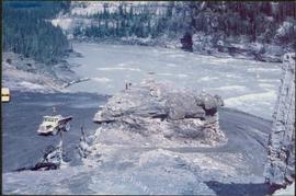
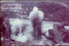
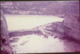
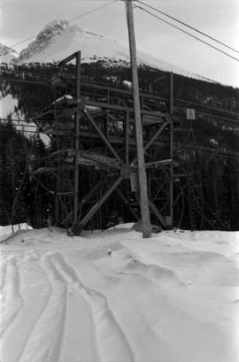
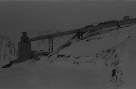
Photograph depicts steel tower. Snow in foreground, mountainside in background.
Photograph depicts tramline conveyor in centre of image (located west of mine). Conveyor ran from crusher plant to tramline loading station. Building on left believed to be the crusher reject plant. Mine valley and northwestern mountain range in background.
Photograph depicts tramline conveyor (located west of mine). Conveyor ran from crusher plant to tramline loading station. Mine valley and northwestern mountain range in background.
Mill building in left midground. Conveyor believed to be leading to tailings pile can be seen in foreground. Valley and mountains in background.
Plant buildings stand in midground. Conveyor believed to be leading to tailings pile can be seen in foreground. Valley and mountains in background.
Cassiar Asbestos Corporation Ltd opened a second mine in 1967 at what became the one-industry town of Clinton Creek, Y.T. File contains photographs depicting different areas of operations at Clinton Creek. Locations include the mine, plant, town, tailings pile, main office, the 40 Mile River, and surrounding area. Town photos depict the grocery store, cafeteria, medical clinic, school, auditorium residential area, Connell Street and power house. File also includes aerial photographs and images depicting forest fighting, photographers capturing the tailings pile, asbestos samples, mining machinery, staff offices, and operations in the mill, lab, and garage.
Additional photographs integrated into file depict Clinton Creek's surrounding area, and three slides of a tailing pile explosion believed to be Clinton Creek.
- File contains photographs done to item level description, depicting miscellaneous people and locations at or around Cassiar, B.C. This includes a photograph of renowned prospector William (“Bill”) Storie, Bill Pratt with a fox, a community gathering in a someone's home, and a hockey game.
- Also included but not to item level is a photo of "David Madore" as part of his application to Cassiar, photo of "William Field" a local hire maintenance mechanic, and photos of a RNWMP Post sign (Royal North West Mounted Police) that depicts annotations "Indian grave" , "Miners Cabin" , "Road House" , "Customs House" , "St. James Church" , "Swansons Store" etc., and 15 negatives of various individuals at what appears to be someone's home.
- Also included is cabin at Boya Lake, which used to be named Chain lake, located off the Stewart-Cassiar highway. This land of this cabin may have been involved legal issues , which was related to people at Cassiar.
Photograph depicts William (Bill) Storie at location known as Limestone Mountain, southwest of Cassiar, B.C. Photo features profile of Bill, hands in pocket, Cassiar valley and mountains in background. Storie was a renowned prospector in the Cassiar area, and the new school at Cassiar was named for him in 1992.
Photograph depicts wood houses behind stand of trees in Cassiar valley. Truck, power poles, and road in foreground, mountains in background. Typed caption below photo in original duotang album: "Two Bedroom Pan-Abode Houses - Cassiar Townsite". Handwritten annotation on verso: "Sept 1954".
Photograph depicts snow-plowed road lined with trees, valley and mountain in background. Believed to have been taken from vehicle. Handwritten annotation on recto of photograph: "Approach to Quartz Rock Creek".
Photograph depicts snow-plowed road in foreground, Cassiar mountians in background. Road is lined with trees and power poles, and vehicle is visible in distance. Handwritten annotation on recto of photograph: "Looking west from townsite".
Photograph depicts unidentified individual and cars on street in foreground, snow banks, trees, and power poles on either side. Buildings can be seen on far right, mountains visible in background. Handwritten annotation on recto of photograph: "townsite Looking East".
File contains photographs depicting four different tours that took place at the mine, plant, and towns owned by Cassiar Asbestos Corporation Ltd. Tours include Prime Minister Pierre Trudeau's visit to Clinton Creek in 1968 and Member of Parliament Iona Campagnolo's visit to Cassiar in 1978. Photographs also depict a party of ambassadors touring Cassiar in 1970, and the dedication of a building in the Cassiar plant in the late 1970s.
Photograph depicts group of eight men standing in line in the Cassiar valley. Left to right: Charles Rainforth Elliot, John Drybrough, John E. Kennedy, Fred Martin Connell, W. Harold Connell, Ken A. Creery, George Washington Smith, Tam Zimmermann. Power lines and mountains in background.
Photograph depicts group of eleven men standing in line in the Cassiar valley. Left to right: Jack Christian, Charles Rainforth Elliot, John Drybrough, John E. Kennedy, Fred Martin Connell, W. Harold Connell, Ken A. Creery, George Washington Smith, Tam Zimmermann, [Fred Murray]?, Nick Gritzuk. Power lines and mountains in background. Most men featured in photo are believed to be members of Cassiar's Board of Directors. Photograph was originally framed with note "Summer 1961" written on cardboard backing.
Photograph depicts group of eleven men standing in line in the Cassiar valley. Left to right: Jack Christian, Charles Rainforth Elliot, John Drybrough, John E. Kennedy, Fred Martin Connell, W. Harold Connell, Ken A. Creery, George Washington Smith, Tam Zimmermann, [Fred Murray]?, Nick Gritzuk. Creery looks through his own camera, appearing to photograph the photographer. Power lines and mountains in background. Most men featured in photo are believed to be members of Cassiar's Board of Directors.
The topographic map shows mine and campsite holdings within the proposed mine site. Asbestos deposits, the tramline and water bodies, such as Troutline Creek, are also included.
Annotations include certain lot titles being crossed out as well as as indication of missing survey information.
Fonds consists of photographs, scrapbooks of newspaper clippings and memorabilia, correspondence, reports and other textual material. The photographs relate to Mr. Williston’s life from childhood to the late 1990s, the scrapbooks document Mr. Williston’s years in political office, and the textual materials relate to both Mr. Williston’s public life and private interests.
Williston, Ray GillisItem is a photograph of a bulldozer removing debris from train tracks on August 27, 1956 location unknown.
Item is a photograph of a forested area with a partially frozen river, exact location unknown.
Item is a photograph of a truck hauling logs from the shores of a lake.
Item is a photograph of the construction of the WAC Bennett Dam.
Item is a photograph of the construction of the W.A.C. Bennett Dam
Item is a photograph of construction of the W.A.C. Bennett Dam.
Item is a photograph of forests and farms from the air.
Item is a photograph of the Lloyd Bros. Cluculz Lake Operation in April 1964.
Item is a photograph of tress on a rock covered embankment taken from a moving vehicle.
Item is a photograph of a fishing boat with the net deployed with other boats and people on shore.
Item is a photograph of a house under construction. Unknown individual sits on ground in foreground.
Item is a photograph of a river bend and the surrounding country taken from the air.
Item is a photograph of the Chittagong Research Institute buildings.
Item is a photograph of people fishing in a boat with nets.
Item is a photograph of a rural area taken from the air.
Item is a photograph of people and boats on a river’s edge.
Item is a photograph of a forested area with man riding a elephant with two others nearby.
Item is a photograph of a woman working in a field.
Item is a photograph of a forested area.
Item is a photograph of people in a boat on a river with another boat in the background.
Item is a photograph of people and boats on the shore of a river.
Item is a photograph of a sail boat hauling logs.
Item is a photograph of Prince George taken from the air.
Item is a photograph of Prince George taken from the air on August 2, 1965.
Item is a photograph of Prince George taken from the air.
Item is a photograph of Prince George taken from the air, looking east with the Cameron Street Bridge in the foreground.
Item is a photograph of the diversion tunnel as engineers plan to blast the plug to allow the Peace River to be diverted for construction of the W.A.C. Bennett Dam.
Item is a photograph of the explosion which opened up the diversion route for the Peace River during construction of the W.A.C. Bennett Dam.
Item is a photograph of the construction of a temporary river bed to divert the Peace River during construction of the W.A.C. Bennett Dam.