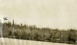
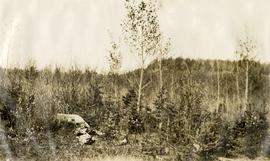
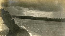
Map reproduction depicts major areas of the Aleza Lake Experiment Forest.
Series consists of photographs created or accumulated by the Aleza Lake Research Forest Society.
Photographs are panoramas taken from the Churchill BC Forest Service Lookout, located at latitude 54°04' and longitude 122°16'. The photographs were bound together and include a transparent grid that was intended to be used for locating forest fires.
Slide depicts a man operating heavy equipment in a forest, likely at the Aleza Lake Experiment Station.
Slide depicts a heavily forested area with fallen logs, likely at the Aleza Lake Experiment Station.
Slide depicts a sawmill in operation, likely located in the Upper Fraser area, with a pile of burning wood products and a beehive burner.
Slide depicts a black bear eating garbage by wooden outbuildings, possibly at the Aleza Lake Experiment Station.
Slide depicts the original wooden BC Forest Service sign for the Aleza Lake Forest Experiment Station.
Slide depicts a detonation in an area of cleared ground in a forested area, likely the Aleza Lake Experiment Station. Work may have been undertaken for roadbuilding activities at the Experiment Station.
Slide depicts a cleared area in a forest, likely at the Aleza Lake Experiment Station.
Slide depicts a burning building at the Aleza Lake Experiment Station on the date it was shut down by the BC Forest Service.
Slide depicts a cleared area at the Aleza Lake Experiment Station with plant regeneration.
Slide depicts a view of what is possibly the Upper Fraser River.
Slide depicts the Ranger Station at the Aleza Lake Experiment Station.
Slide depicts cleared ground and felled trees in a forested area, likely at the Aleza Lake Experiment Station.
Slide depicts a bulldozer clearing ground, likely at the Aleza Lake Experiment Station.
Photograph depicts Harry Coates, Ted Baker, and John Revel at Aleza Lake Research Forest re-opening ceremony on July 9, 1992.
Aerial photograph depicts a view overlooking the Georges farm. Note on back stated that this photograph was presented in a frame to the Georges in 2008.
File consists of 1 audiocassette of people interviewed by Bob Harkins. Side A consists of interviews with Bill Jones of the Fort George Railway Society, Walter Gill formerly of the BC Provincial Police, and Bob Sebastian, of the Carrier First Nation. Side B consists of interviews with Ella Fry, a trapper from Valemount and Prince George boxer Harold Mann.
File consists of 1 audiocassette of public presentation hosted by Bob Harkins discussing the history of sawmilling in Prince George Region. Introduces several people involved in sawmilling industry and also discusses history of the Northern Interior Lumbermen's Association. Also shows a historical film about sawmilling and provides commentary.
Sem títuloFile consists of 1 audiocassette of interviews by Bob Harkins with John Backhouse, city librarian discussion of referendum on construction of new library. Also contains interview with Don Thatcher, conservation officer.
Original photographic print included in "Northern Interior Forest Experiment Station: Report of Preliminary Investigations" by Percy Barr.
Series consists of 7 mini DVs recording "Exploring Our Roots: Forest History in Our Communities Annual Conference of the Forest History Association of BC" at UNBC in Prince George, September 18-19, 2009. Harry Gairns and Mike Apsey spoke and conference panel topics include:
- Looking to the Past to Inform the Future? Forest History within a Contemporary Context
- Applying Traditional Knowledge to Future Initiatives: First Nations Historical and Future Relationships with the Forests
- Forestry History in Our Communities: Robson Valley & Prince George
- Exploring Our Roots: Forest History Research Methodology
- From Exploration to Development: Bringing Forest History Forward.
File consists of Harry Gairns' speaking notes for his 18 Sept. 2009 banquet talk at the "Exploring Our Roots: Forest History in Our Communities Annual Conference of the Forest History Association of BC" at UNBC in Prince George, September 19, 2009. Gairns' speech was entitled "Prince George Forest History - The 50s and the 60s".
Image depicts an area undergoing logging somewhere in Prince George, B.C.
Image depicts the Northwood pulpmill in Prince George B.C.
Image depicts the Lakeland Sawmill in Prince George, B.C, identified by the beehive burners; the one with white smoke belonged to Pas Lumber Co. which was bought out by Lakeland in 1987.
Image depicts the Lakeland Sawmill in Prince George, B.C.
Image depicts Prince George, possibly with the Northwood Pulpmill in the background.
Image depicts a sawmill, possibly Lakeland Sawmill, in Prince George B.C.
Image depicts a pulpmill, likely Northwood, in Prince George, B.C.
Image depicts the Prince George Sawmill from the Northwood Bridge.
Image depicts Prince George Sawmill taken from across the Nechako River looking southwest. Map coordinates 53°56'00.0"N 122°44'29.7"W
Image depicts the Northwood Pulpmill in Prince George, B.C. taken from above the Nechako River looking east. Map coordinates 53°56'00.0"N 122°44'29.7"W
Photograph depicts two people and a dog team on a snowy river bank with a narrow passage of open water and a snowy bluff in the background.
Photograph depicts a four-dog team harnessed to a loaded sleigh. Two people stand near the loaded sleigh on a snowy forest path.
Photograph depicts a small cluster of buildings near the river bank.
Photograph depicts a cluster of wooden buildings including a flagpole and church spire at a Lheidli T'enneh village site. Original photo identified this image as "Indian Village, Fort George".
Photograph depicts a large white building surrounded by a fence.
Photograph depicts Lheidli T'enneh Nation burial grounds in foreground, Hudson Bay Company buildings in background.
Photograph depicts four men pinning a "Union Jack" flag to the exterior of a building.
Photograph depicts several men standing on the river bank. Possibly A.H. Holland in center of photo.
Photograph depicts view of the river from a boat. There is a silhouette of a person wearing a hat in the foreground.
Photograph depicts four men paddling a long canoe. The canoe is loaded with supplies and a dog, river and forest in the background.