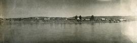
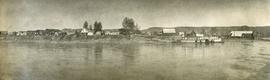
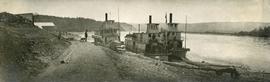
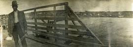
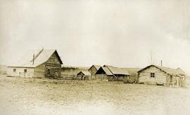
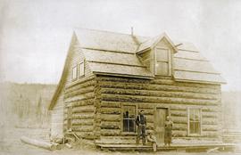
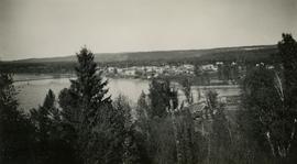
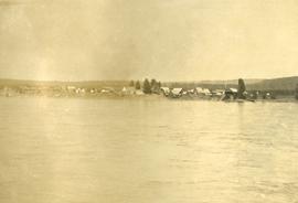
Photograph depicts a long row of buildings bordering a river.
Photograph depicts a group of men standing near a building with the sign, "James Reid Ltd. General Merchants". There are a few fences and buildings in the background.
Photograph depicts several buildings lining the river bank at Quesnel BC.
Photograph depicts a view of buildings lining the river bank, a steamship is anchored near shore.
Photograph depicts three steamboats anchored near the shore of the Fraser river at Quesnel, BC.
Photograph depicts a man standing on the deck of a ferry boat. A long row of building line the riverbank in the background.
Photograph depicts a cluster of log buildings with fences and corrals. A field in the foreground, trees and low hills in the distance. On the road from Quesnell to Fraser Lake 1911.
Photograph depicts three men standing and sitting on a porch deck in front of a log house, trees in the background.
In 1936, Gordon Young Wyness was employed by Philip M. Monckton, a B.C. Land Surveyor. Between June 5 and October 8, Wyness joined Monckton and a group of others on a land survey expedition in northwestern BC. The survey crew travelled to various locations in the area including Telkwa, Hazelton, Burns Lake, Francoise Lake, Vanderhoof, Prince George, Quesnel, Lytton, and Hope. Wyness documented their journey in this photograph album. Based on the photographs, it appears that the crew led by Philip Monckton consisted of Jack Lee and Gordon Wyness; Mrs. Lavender Monckton (nee O'Hara) also accompanied the group.
In addition to the 50 photographs included in the album, this collection also includes five additional unique photographs that accompanied the album.
Sin títuloPhotograph depicts a view of Front Street and Quesnel Hotel from Fraser River Bridge in Quesnel. Visible buildings include the Quesnel Hotel Cafe, the Quesnel Hotel, and John A. Fraser & Co. Ltd.
Photograph depicts Gordon Wyness sitting on a historic boat, which he described as built ca. 1860 and could carry "7 Indians" and 5000 lbs of freight up the river. Located nearby is a telegraph cairn erected to commemorate the Collins Overland Telegraph lines that began in Quesnel in 1865. Until 1907, Quesnel was the terminus for the telegraph line. Behind Wyness is a replica of a Cornish water wheel that was originally located at Williams Creek in Barkerville. This location is now called Ceal Tingley Memorial Park-Heritage Corner and is located along Front Street in Quesnel, near the Fraser River Bridge. The cairn and water wheel still stand in this location, however the boat was removed around 1941.
According to additional information from Quesnel & District Museum & Archives, Wyness may have been provided with inaccurate information about the canoe depicted. The canoe believed to have been located at that spot was actually created in 1905 to pack out the Grand Trunk Preliminary Survey Team, which was led by J.M. Rolston.
Photograph depicts a view of the town of Quesnel from a southeast hill. Fraser River and the Fraser River Bridge are visible at left, the Quesnel River at right.