Annotation on photograph verso: "D-4 tracked skidder at Start of B Road. 15/1/92. Summit Lake Selection Trial"
Annotation on photograph verso: D-4 tracked skidder at "Start of B Road. 15/1/92. Summit Lake Selection Trial"
Annotation on slide: "Summit Lake D4H highdrive"
Annotation on slide: "Summit Lake D4H highdrive skidder"
Annotation on slide: "Summit Lake D4H highdrive"
Annotation on slide: "Summit Lake D4H on skid road"
Annotation on slide: "Summit Lake D4H on skid road"
Annotation on slide: "Summit Lake, D4H on narrow skid road".
Annotation on slide: "Summit Lake, D4H skidding logs".
Annotation on photograph verso: "D6 grapple skidder used for road development only. 27/12/91. Summit Lake Selection Trial"
File consists of copy of data published in unknown source. Includes daily discharge and water level data for Nechako and Fraser Rivers.
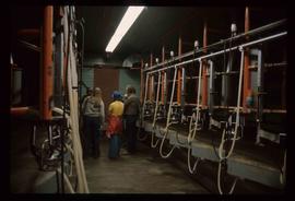
Image depicts numerous pieces of machinery in the interior of a building at a dairy farm, located somewhere near Quesnel, B.C. Several unknown individuals are present.
File consists of a photocopy of a report prepared by consultants Karl English and T. Webb entitled "Data Assessment and Definition of a Chinook Production Model for the Nechako River".
Data sets associated with the Cluculz retrospective study (E.P. 886.10):
- 082036.xls -- Elemental analysis (XRF) for mineral horizon samples from profile at Cluculz EP 886.10 site
- CLUCINC.xls -- Summary chemical properties for composite samples in aerobic incubation
- Cluculz Ck 2002 Foliar Analysis.xls -- Analyzed for individual single-tree plots
- Cluculz Ck 2002 Forest Floor.xls -- Forest floor mass data
- Cluculz composite list (2003 samples).xls -- Composite groups (3 original samples in each) used for organic & mineral soils
- Cluculz composite list (incubation experiment).xls -- Composite groups (3 original samples in each) used for organic & mineral soils
- Cluculz composite list for incubations (2003 samples).xls -- Composite groups (3 original samples in each) used for organic & mineral soils
- Cluculz Creek S mineralization - initial fractions (2).xls -- S fractions - organic & mineral soil composites
- Cluculz Creek S mineralization - initial S fractions.xls -- S fractions - organic & mineral soil composites
- Cluculz Creek S mineralization (IC).xls -- S mineralization data for aerobic incubation - organic & mineral soils
- Cluculz foliar and soil data.xls -- Chemical properties of foliage, composite forest floors, composite mineral soils
- Cluculz pH.xls -- pH - organic & mineral soil composites
- Cluculz S fraction graphs.xls -- S fractions - organic & mineral soil composites
- Elemental Analysis of Standard by XRF (2005).xls -- Published & XRF analysis of CANMET TILL-1 soil standard (used in Cluculz XRF analysis)
During a year away from studies in 1987-88, Dr. Paul Sanborn developed a successful grant proposal to the Science Council of BC (SCBC) to pursue a postdoctoral project with Dr. Tim Ballard in relation to sulphur-deficient soils in BC and prescribed fire. This project built on an existing broadcast burning study conducted by Macmillan Bloedel Ltd. near Port Alberni on Vancouver Island, led by Bill Beese (later at Vancouver Island University). Dr. Sanborn's work addressed sulphur forms and amounts in the soils at these sites, and the chemical processes influencing sulphur availability in relation to prescribed fire.
Only one part of this work was eventually published:
Sanborn, P.T. and T.M. Ballard. 1991. Combustion losses of sulphur from conifer foliage: Implications of chemical form and soil nitrogen status. Biogeochemistry 12: 129–134.
https://doi.org/10.1007/BF00001810
The remainder of the work was documented in this Project Completion Report to SCBC, dated February 28, 1990, and entitled "Effects of Prescribed Fire on Sulphur in Forest Soils".
Thirty-four data files were selected for archival retention. There is some redundancy of content among these, with some formatted for incorporation as tables in the report appendices, and others containing some of the same data, but set up as input files for a statistics program. These account for almost all of the data listed in the Project Completion Report appendices. No glossary of variable names is provided, but these should be identifiable by referring to the Report.
Data sets for the Sulphur stable isotope tracer study (E.P. 886.15) include:
- 03-095 UNBC PS-For.xls Particle size analyses (Kenneth Creek 0-20 & 20-40 cm)
- 03-096 UNBC PS-For.xls Particle size analyses (Holy Cross 0-20 & 20-40 cm)
- 082037.xls XRF elemental analysis (Holy Cross pedon)
- 082038.xls XRF elemental analysis (Kenneth Creek pedon)
- 084996.xlsx XRF elemental analysis (HC & KC parent materials)
- EP 886 15 S isotope data (2001-2005) - foliage_completed (Feb 18).xls Pine foliage d34S (total S & total SO4-S)
- EP 886.15 2003 Foliage & Soil Chemistry Summary.xls
- EP 886.15 Foliar Analyses (selected) 2001-2006.xls Total N & S, SO4-S
- EP 886.15 Holy Cross & Kenneth Creek 2005 foliage.xls
- EP 886.15 Holy Cross & Kenneth Creek 2006 foliage.xls
- EP 886.15 Holy Cross 2001 FH (S516FINL).xls
- EP 886.15 Holy Cross 2001 Foliage (T727FINL).xls
- EP 886.15 Holy Cross 2001 Litter (S515FINL).xls
- EP 886.15 Holy Cross 2001 Mineral Soil (0-20 cm) (S507FINL).xls
- EP 886.15 Holy Cross 2002 Foliage (T785FINL).xls
- EP 886.15 Holy Cross 2003 FH (S642FINL).xls
- EP 886.15 Holy Cross 2003 Foliage (T836FINL).xls
- EP 886.15 Holy Cross 2003 Litter (S641FINL).xls
- EP 886.15 Holy Cross 2003 Mineral Soil (0-20 cm) (S643FINL).xls
- EP 886.15 Holy Cross 2004 FH (S702FINL).xls
- EP 886.15 Holy Cross 2004 Foliage (T904FINL).xls
- EP 886.15 Holy Cross 2004 Litter (S701FINL).xls
- EP 886.15 Holy Cross 2004 Mineral Soil (0-20 cm) (S703FINL).xls
- EP 886.15 Kenneth Creek 2001 FH (S521FINL).xls
- EP 886.15 Kenneth Creek 2001 Foliage (T727FINL).xls
- EP 886.15 Kenneth Creek 2001 Litter (S520FINL).xls
- EP 886.15 Kenneth Creek 2001 Mineral Soil (0-20 cm) (S508FINL).xls
- EP 886.15 Kenneth Creek 2001 Mineral Soil (20-40 cm) (S509FINL).xls
- EP 886.15 Kenneth Creek 2002 Foliage (T785FINL).xls
- EP 886.15 Kenneth Creek 2003 FH (S645FINL).xls
- EP 886.15 Kenneth Creek 2003 Foliage (T837FINL).xls
- EP 886.15 Kenneth Creek 2003 Litter (S644FINL).xls
- EP 886.15 Kenneth Creek 2003 Mineral Soil (0-20 cm) (S646FINL).xls
- EP 886.15 Kenneth Creek 2003 Mineral Soil (20-40 cm) (S647FINL).xls
- EP 886.15 Kenneth Creek 2004 FH (S705FINL).xls
- EP 886.15 Kenneth Creek 2004 Foliage (T905FINL).xls
- EP 886.15 Kenneth Creek 2004 Litter (S704FINL).xls
- EP 886.15 Kenneth Creek 2004 Mineral Soil (0-20 cm) (S706FINL).xls
- EP 886.15 Kenneth Creek 2004 Mineral Soil (20-40 cm) (S707FINL).xls
- EP 886.15 Sample Inventory.xls Listing of MoF Lab Job No.'s
- Fertilizer March 2003.xls d34S data for commercial fertilizer S sources
- hc_2002.xls Initial (2002) pine tree measurement data - Holy Cross
- kc_2002.xls Initial (2002) pine tree measurement data - Kenneth Creek
Data sets associated with the Arocena & Sanborn 1999 regional soil mineralogy study:
- S234FINL.XLS [data report for mineral horizons from MoF Analytical Chemistry Laboratory, June 20 1996]
- S235FINL.XLS [data report for organic horizons from MoF Analytical Chemistry Laboratory, June 20 1996]
- SAMPLIST.XLS [conversion table for sample numbers used in MoF lab data reports]
- Fe Al extractions.xlsx [assembled from lab data report by L. Arocena for oxalate & dithionite extractions; pyrophosphate extraction data from MoF lab]
- MINSTUDY.XLS [consolidated lab data for organic & mineral horizons, except for BaCl2 exchangeable cations]
- MINCEC.XLS [BaCl2 exchangeable cations & Morgan’s extraction for organic & mineral horizons]
Data set "Yukon-AK 2004 soils data (Lost Chicken).xls" consists of Pliocene Rego Humic Gleysol (peaty) data from the Lost Chicken Mine site.
File consists of the remaining data tables that were not included in the draft of Woodward-Clyde Consultants' report entitled "Task 4 Technical Memorandum: Sensitivity of Weighted Usable Area Predictions to Variance in the Input Criteria".
Item is an interview about Allie Vibert's career, her involvement with the International Federation of University Women and her activities at Queen's University, during which she pushed for the enrolment of women into the Faculty of Medicine.
File consists of a draft copy of an article for the Bulletin of Marine Science by Slaney et al. entitled "Debris Structure Placements and Whole-River Fertilization for Salmonids in a Large Regulated Stream in British Columbia".
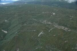
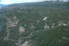
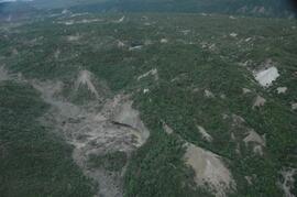
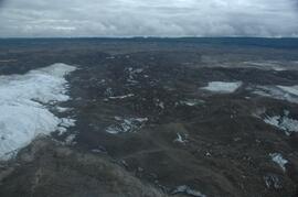
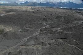
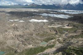
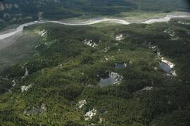
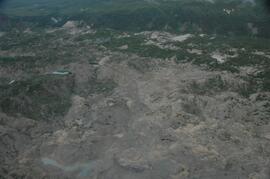
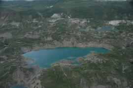
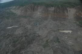
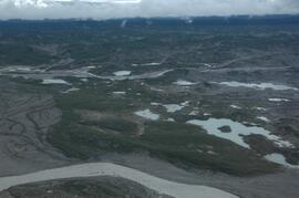
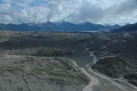
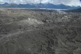
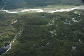
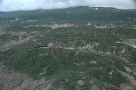
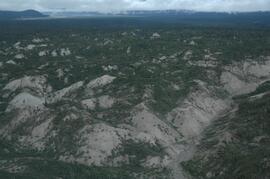
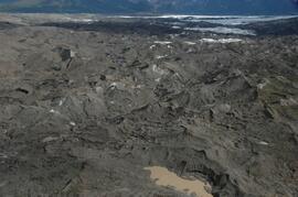
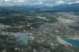
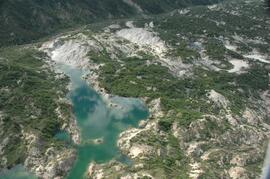
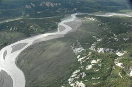
This image is part of the outbound sequence of aerial images obtained on the helicopter flight to the Klutlan Glacier study site. The sequence starts from the base camp at the White River crossing on the Alaska Highway and heads south, to a point just upvalley of the debris-covered terminus (approx. 10-15 km from Alaska border), and turning back north to the landing spot on the Generc River floodplain close to the study site (see Fig. 1 in paper).
This image is part of the outbound sequence of aerial images obtained on the helicopter flight to the Klutlan Glacier study site. The sequence starts from the base camp at the White River crossing on the Alaska Highway and heads south, to a point just upvalley of the debris-covered terminus (approx. 10-15 km from Alaska border), and turning back north to the landing spot on the Generc River floodplain close to the study site (see Fig. 1 in paper).
This image is part of the outbound sequence of aerial images obtained on the helicopter flight to the Klutlan Glacier study site. The sequence starts from the base camp at the White River crossing on the Alaska Highway and heads south, to a point just upvalley of the debris-covered terminus (approx. 10-15 km from Alaska border), and turning back north to the landing spot on the Generc River floodplain close to the study site (see Fig. 1 in paper).
This image is part of the outbound sequence of aerial images obtained on the helicopter flight to the Klutlan Glacier study site. The sequence starts from the base camp at the White River crossing on the Alaska Highway and heads south, to a point just upvalley of the debris-covered terminus (approx. 10-15 km from Alaska border), and turning back north to the landing spot on the Generc River floodplain close to the study site (see Fig. 1 in paper).
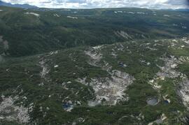
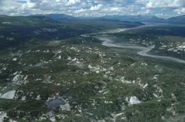
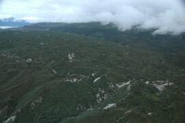
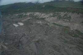
This image is part of the return trip sequence of aerial images obtained on the helicopter flight leaving the Klutlan Glacier study site. On the return leg at the end of the day, the flight initially went upvalley to pick up another party.
This image is part of the return trip sequence of aerial images obtained on the helicopter flight leaving the Klutlan Glacier study site. On the return leg at the end of the day, the flight initially went upvalley to pick up another party.
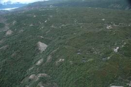
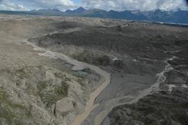
This image is part of the return trip sequence of aerial images obtained on the helicopter flight leaving the Klutlan Glacier study site. On the return leg at the end of the day, the flight initially went upvalley to pick up another party. This image was taken after the helicopter turned north to return to base camp.
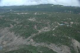
This image is part of the outbound sequence of aerial images obtained on the helicopter flight to the Klutlan Glacier study site. The sequence starts from the base camp at the White River crossing on the Alaska Highway and heads south, to a point just upvalley of the debris-covered terminus (approx. 10-15 km from Alaska border), and turning back north to the landing spot on the Generc River floodplain close to the study site (see Fig. 1 in paper).
This image is part of the outbound sequence of aerial images obtained on the helicopter flight to the Klutlan Glacier study site. The sequence starts from the base camp at the White River crossing on the Alaska Highway and heads south, to a point just upvalley of the debris-covered terminus (approx. 10-15 km from Alaska border), and turning back north to the landing spot on the Generc River floodplain close to the study site (see Fig. 1 in paper).
This image is part of the outbound sequence of aerial images obtained on the helicopter flight to the Klutlan Glacier study site. The sequence starts from the base camp at the White River crossing on the Alaska Highway and heads south, to a point just upvalley of the debris-covered terminus (approx. 10-15 km from Alaska border), and turning back north to the landing spot on the Generc River floodplain close to the study site (see Fig. 1 in paper).
This image is part of the outbound sequence of aerial images obtained on the helicopter flight to the Klutlan Glacier study site. The sequence starts from the base camp at the White River crossing on the Alaska Highway and heads south, to a point just upvalley of the debris-covered terminus (approx. 10-15 km from Alaska border), and turning back north to the landing spot on the Generc River floodplain close to the study site (see Fig. 1 in paper).
This image is part of the return trip sequence of aerial images obtained on the helicopter flight leaving the Klutlan Glacier study site. On the return leg at the end of the day, the flight initially went upvalley to pick up another party.
This image is part of the return trip sequence of aerial images obtained on the helicopter flight leaving the Klutlan Glacier study site. On the return leg at the end of the day, the flight initially went upvalley to pick up another party.
This image is part of the return trip sequence of aerial images obtained on the helicopter flight leaving the Klutlan Glacier study site. On the return leg at the end of the day, the flight initially went upvalley to pick up another party. This image was taken after the helicopter turned north to return to base camp.
This image is part of the return trip sequence of aerial images obtained on the helicopter flight leaving the Klutlan Glacier study site. On the return leg at the end of the day, the flight initially went upvalley to pick up another party. This image was taken after the helicopter turned north to return to base camp.
This image is part of the return trip sequence of aerial images obtained on the helicopter flight leaving the Klutlan Glacier study site. On the return leg at the end of the day, the flight initially went upvalley to pick up another party. This image was taken after the helicopter turned north to return to base camp.
This image is part of the outbound sequence of aerial images obtained on the helicopter flight to the Klutlan Glacier study site. The sequence starts from the base camp at the White River crossing on the Alaska Highway and heads south, to a point just upvalley of the debris-covered terminus (approx. 10-15 km from Alaska border), and turning back north to the landing spot on the Generc River floodplain close to the study site (see Fig. 1 in paper).
This image is part of the outbound sequence of aerial images obtained on the helicopter flight to the Klutlan Glacier study site. The sequence starts from the base camp at the White River crossing on the Alaska Highway and heads south, to a point just upvalley of the debris-covered terminus (approx. 10-15 km from Alaska border), and turning back north to the landing spot on the Generc River floodplain close to the study site (see Fig. 1 in paper).
This image is part of the outbound sequence of aerial images obtained on the helicopter flight to the Klutlan Glacier study site. The sequence starts from the base camp at the White River crossing on the Alaska Highway and heads south, to a point just upvalley of the debris-covered terminus (approx. 10-15 km from Alaska border), and turning back north to the landing spot on the Generc River floodplain close to the study site (see Fig. 1 in paper).
This image is part of the outbound sequence of aerial images obtained on the helicopter flight to the Klutlan Glacier study site. The sequence starts from the base camp at the White River crossing on the Alaska Highway and heads south, to a point just upvalley of the debris-covered terminus (approx. 10-15 km from Alaska border), and turning back north to the landing spot on the Generc River floodplain close to the study site (see Fig. 1 in paper).
This image is part of the outbound sequence of aerial images obtained on the helicopter flight to the Klutlan Glacier study site. The sequence starts from the base camp at the White River crossing on the Alaska Highway and heads south, to a point just upvalley of the debris-covered terminus (approx. 10-15 km from Alaska border), and turning back north to the landing spot on the Generc River floodplain close to the study site (see Fig. 1 in paper).
This image is part of the outbound sequence of aerial images obtained on the helicopter flight to the Klutlan Glacier study site. The sequence starts from the base camp at the White River crossing on the Alaska Highway and heads south, to a point just upvalley of the debris-covered terminus (approx. 10-15 km from Alaska border), and turning back north to the landing spot on the Generc River floodplain close to the study site (see Fig. 1 in paper).
This image is part of the return trip sequence of aerial images obtained on the helicopter flight leaving the Klutlan Glacier study site. On the return leg at the end of the day, the flight initially went upvalley to pick up another party.
This image is part of the return trip sequence of aerial images obtained on the helicopter flight leaving the Klutlan Glacier study site. On the return leg at the end of the day, the flight initially went upvalley to pick up another party.
This image is part of the return trip sequence of aerial images obtained on the helicopter flight leaving the Klutlan Glacier study site. On the return leg at the end of the day, the flight initially went upvalley to pick up another party. This image was taken after the helicopter turned north to return to base camp.
This image is part of the return trip sequence of aerial images obtained on the helicopter flight leaving the Klutlan Glacier study site. On the return leg at the end of the day, the flight initially went upvalley to pick up another party. This image was taken after the helicopter turned north to return to base camp.
This image is part of the return trip sequence of aerial images obtained on the helicopter flight leaving the Klutlan Glacier study site. On the return leg at the end of the day, the flight initially went upvalley to pick up another party. This image was taken after the helicopter turned north to return to base camp.
This image is part of the return trip sequence of aerial images obtained on the helicopter flight leaving the Klutlan Glacier study site. On the return leg at the end of the day, the flight initially went upvalley to pick up another party. This image was taken after the helicopter turned north to return to base camp.
This image is part of the outbound sequence of aerial images obtained on the helicopter flight to the Klutlan Glacier study site. The sequence starts from the base camp at the White River crossing on the Alaska Highway and heads south, to a point just upvalley of the debris-covered terminus (approx. 10-15 km from Alaska border), and turning back north to the landing spot on the Generc River floodplain close to the study site (see Fig. 1 in paper).


