Showing 441 results

Archival description
190 results with digital objects Show results with digital objects
François Lake Ferry
2020.05.51 · Item · Sept. 1936
Part of Gordon Wyness Album

Photograph depicts the Francois Lake Ferry. Gordon Wyness stands next to the survey crew's Buick car in the middle of the boat. Jack Lee leans on the railing at the back of the boat.

François Lake from ferry
2020.05.49 · Item · 1936
Part of Gordon Wyness Album

Photograph depicts a view of François Lake taken from the ferry going to Northbank Point on right-hand side. The survey crew camped there in June 1936.

2020.05.15 · Item · [Sept. or Oct. 1936]
Part of Gordon Wyness Album

Photograph depicts (from left to right) Gordon Wyness and Jack Lee at a camp scene "at Bobtail" (possibly Bobtail Lake) near Vanderhoof. As noted in the album caption, the crew had "just returned from Vanderhoof". The telegraph cabin roof and their 1930 Buick Series 40 car is visible at right.

2020.05.11 · Item · [Sept. or Oct. 1936]
Part of Gordon Wyness Album

Photograph depicts (from left to right) Gordon Wyness and Jack Lee in front of the Fort St. James sign, which reads "First white settlement in British Columbia. Established by the North West Company in 1806 by Simon Fraser and John Stuart and taken over by the Hudson's Bay Company in 1821. - General Merchandise Visitors Welcome".

2020.05.44 · Item · 1936
Part of Gordon Wyness Album

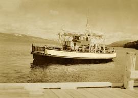
Photograph depicts Gordon Wyness sitting on a historic boat, which he described as built ca. 1860 and could carry "7 Indians" and 5000 lbs of freight up the river. Located nearby is a telegraph cairn erected to commemorate the Collins Overland Telegraph lines that began in Quesnel in 1865. Until 1907, Quesnel was the terminus for the telegraph line. Behind Wyness is a replica of a Cornish water wheel that was originally located at Williams Creek in Barkerville. This location is now called Ceal Tingley Memorial Park-Heritage Corner and is located along Front Street in Quesnel, near the Fraser River Bridge. The cairn and water wheel still stand in this location, however the boat was removed around 1941.

According to additional information from Quesnel & District Museum & Archives, Wyness may have been provided with inaccurate information about the canoe depicted. The canoe believed to have been located at that spot was actually created in 1905 to pack out the Grand Trunk Preliminary Survey Team, which was led by J.M. Rolston.

2020.05.10 · Item · Sept. 1936
Part of Gordon Wyness Album

Photograph depicts (from left to right) Gordon Wyness, Philip Monckton, and Lavender Monckton by their 1930 Buick Series 40 car in the Williams Lake area. In this image, the car may be broken down; Wyness noted that they "were forced to spend the nite in a school house due to condenser burning out in the car". Wyness also noted that they had "just finished tying in Fraser Mtn", suggesting that they had just completed survey work in the Fraser Mountain area.

2000.16.2.4 · Item · 1906
Part of Prince Rupert Empire collection

Item is a copy print of a photograph of a group of people in a cleared area with a small tent in the background in Prince Rupert on June 1, 1906. The people in the photograph are identified as: Mrs. J.L. Williams, Jack or Jock Williams, Mrs. Porter, Miss Mai Johnston, Mrs. R.L. McIntosh, J.H. Pillsbury, Mr. Pinder ? (Engineer), Captain Jenner ?, Mrs. S.G. Harris, and Cannon Rushbrook.

2020.05.55 · Item · 1936
Part of Gordon Wyness Album

Photograph depicts a group of people leaning up against the survey crew's Buick car in Francois Lake. Based on the transcription on the photograph verso, from left to right the individuals are: "Mrs. Hunter", "Bobby", Jack Lee, "Edna", "Verna", "Banker's wife", and Gordon Wyness.

2009.7.1.268 · Item · 28 September 1920
Part of Archdeacon W. H. Collison fonds

Photograph of a partially sunken sailboat near a harbour. Individuals on debris and in a rowboat are surveying the damage. Annotation on recto reads: "GTP. SS Prince Rupert Sept 28th 1920 McRae." Handwritten annotation on verso reads "CTP "Prince Rupert" Sunk at Prince Rupert BC 1920."

"Guide to Placer Staking"
2020.4.2.3.056 · Item · 1982
Part of G. Gary Runka fonds

Item is an original BC Ministry of Energy, Mines and Petroleum Resources publication entitled "Guide to Placer Staking".

2020.4.6.663.1 · Item · 2010-2011
Part of G. Gary Runka fonds

DVD disc contains two documents:

  • "KCB Design Update for L-L Dam Crest Elevation 1279 m.pdf"
  • "Piteau 2605-R02-FINAL_Revised_Sep2010.pdf" which is a Piteau Associates report for the Highland Valley Copper mine at Logan Lake regarding "Open Pit Geotechnical Assessments and Slope Design Criteria for the Lornex Pit L16 Expansion"
Hudson's Hope
2000.19.2.33 · Item · 29 Aug. 1927-26 Sept. 1927
Part of Prentiss Gray Collection

Photograph depicts the townsite of Hudson's Hope featuring a number of small wooden buildings clustered in a field. The Hudson's Bay post is building visible on far left.

2020.4.2.2.11 · Item · Apr. 1979
Part of G. Gary Runka fonds

Item is an original copy of "Interior Program Feasibility Study: A report submitted to Dr. W. D. Kitts, Dean of Faculty of Agricultural Sciences by the Dean's Interior Program Committee". The report was prepared in consultation with G. G. Runka Land Sense Ltd.

2020.05.41 · Item · 1936
Part of Gordon Wyness Album

Photograph depicts Jack Lee (front) and Gordon Wyness drinking lakeside in Marble Canyon. The survey crew had been travelling along Marble Canyon Road, which is now Highway 99. The lakes in Marble Canyon are now named Turquoise Lake, Crown Lake, and Pavilion Lake. Wyness notes the blueness of these lakes and the white mountains of this area.

2020.05.52 · Item · 1936
Part of Gordon Wyness Album

Photograph depicts (from left) Jack Lee and Gordon Wyness sitting on a car next to their equipment while surveying at an Indian Reserve. A cabin on the reserve is also depicted. According to the transcription on the photograph verso, they were surveying road through an "Indian Reserve South of South bank François Lake".