File consists of copy of "Kemano Completion Project - Nechako River Summary Statement" with annotations and Alderdice's notes relating to the statement.
Collection consists of records regarding the Kemano Completion Project collected by four scientists that were involved in the Department of Fisheries and Oceans review of Alcan’s project. The majority of the material consists of copies of publications related to the scientists’ research and activities, many of which were written or annotated by them, such as reprints of journal articles, draft scientific reports, government publications, and newspaper clippings. Original scientific research records comprise raw data, field notes, memoranda, and draft reports. Includes correspondence regarding the Nechako River court action between DFO, Alcan, and the province and scientific reports that were created in anticipation of the case. Also includes significant material emanating from the British Columbia Utilities Commission Kemano Completion Project Public Review, such as correspondence, BCUC newsletters and news releases, exhibits and evidence submitted to the review panel, documents produced for the hearings, and final reports. In addition, includes records and publications relating to various other groups affected by the Kemano Completion Project or arising because of it, such as the Cheslatta Carrier Nation, the Rivers Defense Coalition, the Nechako Fisheries Conservation Program, the Nechako Watershed Council, the Nechako Environmental Enhancement Fund, and the Nechako River Alliance.
Alderdice, DonFile consists of copies of memoranda, notes and reports relating to the Department of Fisheries and Oceans' response to the Kemano Completion Project, including mention of the Kemano Task Force Report and the Nechako court case.
File consists of photocopied documents from various sources sent to Shirvell from John Hummel, a researcher for the Cheslatta Band. Includes copies of internal DFO memoranda; the "Story of the Surrender of the Cheslatta Reserves on April 21, 1952" by Mike Robertson"; anti-Kemano material written by Dana Wagg and John Hummel, Cheslatta Band researchers; a photocopy of correspondence from the Standing Joint Committee for the Scrutiny of Regulations containing "Comment on the Kemano Completion Project Guidelines Order"; a copy of a "Proposal for an Agreement between the Government Commission of the Gitksan Wet'suwet'en People and the Vera Corporation regarding the Nanika River Project: A Plan for Partial Development of the Hydroelectric Power Potential of the Nanika River in Northwestern British Columbia"; copies of newspaper clippings, news releases, and backgrounders; the 1993 "Cheslatta Band Submission to the Standing Committee on Forestry and Fisheries"; and copies of documents received by the Cheslatta Band through Access to Information legislation.
File consists of an original Klohn Leonoff report prepared for Alcan entitled "Kemano Completion Project: Nechako Reservoir Flood Forecasting and Operating Study".
File consists of the "Kemano Completion Project Outline" that Alcan prepared for the British Columbia Utilities Commission Public Review of the Kemano Completion Project.
File consists of a correspondence file collated by the BCUC staff involved in the Kemano Completion Project Review. Includes incoming correspondence regarding concerns about the review, correspondence regarding submissions to the community hearings, and copies of oral presentations given at the community hearings along with accompanying correspondence.
File consists of Alcan's "Kemano Completion Project Review: Information Request No. 2" prepared for the British Columbia Utilities Commission.
File consists of an original copy of the British Columbia Utilities Commission's "Kemano Completion Project Review: Report and Recommendations to the Lieutenant Governor in Council".
File consists of Dr. Hartman's annotated copy of the British Columbia Utilities Commission's "Kemano Completion Project Review: Report and Recommendations to the Lieutenant Governor in Council". Also includes accompanying correspondence.
File consists of Dr. Don Alderdice's submissions to the British Columbia Utilities Commission Kemano Completion Project Public Review. Includes Alderdice's expert witness testimony "Kemano Completion Project--Nechako River: A Summary Statement". Also includes written evidence filed with the Commission in relation to his expert witness testimony: copies of his CV, his affidavit filed in the court proceedings between Rivers Defense Coalition and Alcan, and a copy of "Assessment of the Influence of Gas Supersaturation on Salmonids in the Nechako River in Relation to Kemano Completion".
File consists of correspondence and other records relating to the DFO Kemano Completion Task Force. Includes a proposal to establish a Kemano Completion Task Force, internal DFO memoranda, and a report entitled "Activities of Fisheries and Oceans Associated with Alcan's Kemano Project in British Columbia".
File consists of "Kemano II Environmental Studies: Nechako River". Item is a photocopy of an annotated draft. Includes copies of pull-out maps and figures.
File consists of an issue of British Columbia Report (vol. 6, no. 9) featuring the cover story "Kemano: It's more than just 'jobs vs. fish'".
File consists of a 1994 copy of a report from 1952 entitled "Kemano River Survey - 1950: Biological Investigations". Authorship is attributed to an unknown Department of Fisheries biologist.
File consists predominately of memoranda between members of the Department of Fisheries and Oceans Kemano Task Force and outgoing correspondence from the Task Force members. The Kemano Completion Task Force was directed by R. Bell-Irving. Includes a draft outline of "Resource Activities Required for the Nechako Court Case and Possible Joint Technical Meetings" from F.C. Boyd. Also includes various records regarding the Kemano Task Force Report.
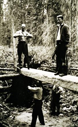
Item is a photograph of a copy print that has been reproduced as a slide, resulting in low photographic quality. Location of original photograph unknown.
"Ken McCannel, a forester in the Surveys Division was in charge of the YMFTP for the entire province. He dropped in at Aleza Lake on an inspection trip at the same time as Malcolm Knapp. Professor Knapp of the forestry department of UBC went from camp to camp giving lectures on forestry to the YMFTP crews. They posed for this picture. Sills were being whip-sawn for foundations on the older buildings." -- from the notes of Ralph Schmidt in accompanying file
File consists of a copy of a Klohn-Crippen Consultants report prepared for the Nechako Environmental Enhancement Fund Management Committee entitled "Water Release Facility at Kenney Dam Updated Conceptual Layout and Cost Estimate".
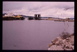
Image depicts a boat on the Nechako Reservoir at Kenny Dam.
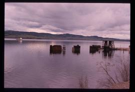
Image depicts a boat dock on the Nechako Reservoir at Kenny Dam.
Photograph depicts ore haul truck at dump in mine, driver visible, mountain range in background. Handwritten annotation on recto of photograph: "Kenworth - Model 802 dumping stripping waste at 6565 Elevation", on verso: "1961".
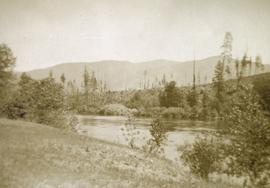
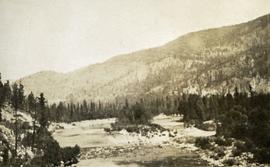
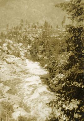
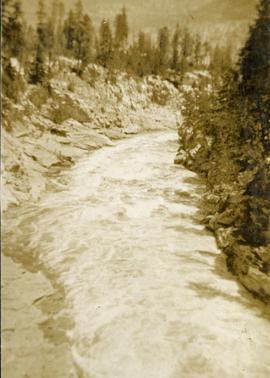
Photograph depicts a view of the Kettle River with sparse vegetation in the background and a mountain range in the background.
Photograph depicts a view of the Kettle river with mountains in the background.
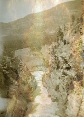
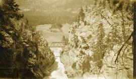
Photograph depicts looking down on a canyon, steep cliffs on either side, a traffic bridge crosses the chasm. Near Cascade BC.
Photograph depicts a view of the Kettle River canyon and traffic bridge.
Photograph depicts a view of the Kettle River canyon and traffic bridge.
Photograph depicts Kettle River canyon near Cascade, BC.
Photograph depicts a lofty view of the Kettle river near Cascade, BC.
Keynote Address by Mike Apsey and first part of the panel on "Looking to the Past to Inform the Future? Forest History within a Contemporary Context" at the the "Exploring Our Roots: Forest History in Our Communities Annual Conference of the Forest History Association of BC" at UNBC in Prince George, September 19, 2009.
Item is an original copy of "Kitamaat River 1995 Oolichan (Thaleicthys pacificus) Study: Draft Final Report" prepared for the BC Ministry of Forests by John Kelson of the Haisla Fisheries Commission.
File consists of schedules for the Kitimat community hearings, along with submissions for the presentations at the hearing.
Map depicts the Kitlope range, Kimsquit Watershed, and area around Kitlope Lake. Includes Indigenous place names, grease trails, Indigenous village sites, and wildlife information.
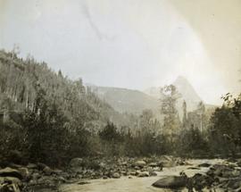
Photograph depicts Kitseucla creek, trees and a mountain peak in the distance.
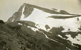
Photograph depicts view of Kitseucla mountain summit with snow patches and a rocky peak.
Item is an original report believed to be written or co-written by Grant Hazelwood entitled "Kitsumkalum Chinook Weights". Includes original photographic prints pasted into the report.
File consists of Kluane Lake photographs from 2003 in digital format.
This file contains the following photographs in both print photograph and negative format:
Slims River delta
Date: August 10, 2003
Location Coordinates: 61° 00’ 16.5” N, 138° 30’ 45.6” W, 790 m asl (± 11.0 m)
Print roll 3, #5A-6A: delta surface with salt efflorescences (Deschampsia caespitosa, Puchinella nuttalli, Aster siberica, Triglauca palustre); Juncus & Ranunculus on more active surface near river.
7A-9A: moister Deschampsia site, polygonal cracking patterns (W side of highway)
10A-12A: closeups of efflorescences
Cultus Bay / Rat Lake
Date: August 10, 2003
Location Coordinates: 61° 09’ 57.1” N, 138° 25’ 25.5” W, 806 m asl (± 6.2 m)
Slides #17-15: Rat Lake area (corresponding prints and negatives: Print roll 3, #13A-16A)
Print roll 3, #17A-19A: Collema & Psora crusts on exposed ridge on coarser substrate where loess has blown off (Corresponding slides: Slide Roll 2 #14-13)
Y03-03 (Rat Lake)
Date: August 10, 2003
Location Coordinates: 61° 10’ 3.5” N, 138° 25’ 37.2” W, 798.3 m asl (± 13.0 m)
Site Description: SW aspect, 45% slope; vegetation: Carex filifolia, A. frigida, Elymus trachycaulis
Sample Depths & Descriptions:
- Y03-03-01 - Crust
- Y03-03-02 - 0-9 cm - Ahk (10YR 4/2 m; weak-moderate, fine granular)
- Y03-03-03 - 9-53 cm+ - Ck (2.5Y 6/3 m; massive)
Print roll 3, #20A-22A (Corresponding slides: Slide Roll 2: #12-10)
Y03-04 (Rat Lake)
Date: August 10, 2003
Location Coordinates: 61° 10’ 10.5” N, 138° 26’ 3.7” W, 800.2 m asl (± 8.7 m)
Site Description: S aspect, 40% slope; vegetation: Elymus, Artemisia, flax, Penstemon, Linum lewisii
Sample Depths & Descriptions:
- Y03-04-01 - Crust
- Y03-04-02 - 0-6 cm - Ck (strongly effervescent)
- Y03-04-03 - 6-16 cm - Ahkb
- Y03-04-04 -16-75 cm+ - Ck (strongly effervescent; includes Bmk pockets)
Print roll 3, #25A-28A (Corresponding Slides: Slide Roll 2: #9-7)
Y03-05 (SE of Rat Lake)
Date: August 10, 2003
Location Coordinates: 61° 9’ 43.2” N, 138° 25’ 34.8” W, 811.5 m asl (± 8.9 m)
Site Description: upper slope / crest; recent local sandy eolian veneer over older loess; vegetation: Carex, Elymus, Poa, Erigeron
Sample Depths & Descriptions:
- Y03-05-01 - Crust
- Y03-05-02 - 0-5 cm - Ahk
- Y03-05-03 - 5-19 cm - Ck1
- Y03-05-04 - 19-31 cm - Ahkb (siltier)
- Y03-05-05 - 31-50 cm+ - Ck2
Print roll 3, #34A-#E (Corresponding Slides: Slide Roll 2: Slides #6-1)
This file contains the following photographs in both print photograph and negative format:
Y03-06
Date: August 10, 2003
Location Coordinates: 61° 4’ 1.5” N, 138° 21’ 57.4” W, 825.3 m asl (± 9.5 m)
Site Description: top of slope, E aspect
Sample Depths & Descriptions:
- Y03-06-01 - Crust
- Y03-06-02 - 0-6 cm - Ahk (10YR 3/2 m; strongly effervescent)
- Y03-06-03 - 6-14 cm - Bmk (2.5Y 3/3 m; strongly effervescent)
- Y03-06-04 - 14 cm+ - IICk (strongly effervescent)
Print roll 4, #1-2 (Corresponding slides: Slide roll 3 #36-35)
Y03-07 (peninsula near Kluane visitor centre, Sheep Mt.)
Date: August 11, 2003
Location Coordinates: 61° 1’ 42.8” N, 138° 29’ 36.2” W, 786.7 m asl (± 5.7 m)
Site Description:
- recent (?) landslide with loess accumulation in pockets, thinner on boulder surfaces, dominated by dark cyanobacteria crusts
- limited loess accumulation due to exposure of site
- crust is calcareous at surface
Sample Depths & Descriptions: - Y03-07-01 - Crust
- Y03-07-02 - 0-6 cm - Ck
- Y03-07-03 - 6-9 cm - Ahkb
- Y03-07-03 - 9 cm+ - Rock
Print roll 4, #3-10 (Corresponding slides: Slide roll 3 #34-30)
Lower Slims River (lookout knoll at parking lot N of visitor centre)
Date: August 11, 2003
Location Coordinates: 60° 59’ 56.4” N, 138° 33’ 36.4” W, 844.8 m asl (± 7.3 m)
Site Description: some fire disturbance, but lower slopes have more intact crusts on loess (calcareous to surface)
Print roll 4, #11-17 (Corresponding slides: Slide roll 3 #29-26)
Lower Slims R (lowest bench below lookout knoll)
Date: August 11, 2003
Location Coordinates: 60° 59’ 51.8” N, 138° 33’ 36.2” W, 814.3 m asl (± 7.9 m)
Site Description: not burned; good intact crust; vegetation: A. frigida, Calamogrostis purpurea, Erigeron caespitosus, Linnaea, Carex filifolia (sparse cover ~ 50%)
Print roll 4, #18-20 (Corresponding slides: Slide roll 3, #25-23)
Slims Soil
(Holocene paleosol with well-developed B horizon under Neoglacial calcareous loess – location not recorded, but likely from roadcut exposure along main Slims R trail)
Print roll 4, #21 (Corresponding slides: Slides roll 3, #22)
S-facing opening above main trail
Date: August 11, 2003
Location Coordinates: 60° 59’ 53.1” N, 138° 34’ 9.0” W, 822.9 m asl (± 15.0 m)
Site Description:
- Nostoc crust, also with Collema
- calcareous to surface
- site has later successional stage, with Arctostaphylos & Juniperus starting to move in
Print roll 4, # 22-25
Lower end of Sheep Creek
Date: August 11, 2003
Misc. views of grassland vegetation and landscape (locations not recorded)
Print roll 4, #26-33 (Corresponding slides: Slides roll 3, #21-18)
Overlook at lower end of Sheep Creek canyon
Date: August 11, 2003
Location Coordinates: 60° 59’ 42.2” N, 138° 34’ 38.1” W, 878.0 m asl (± 9.5 m)
Site Description: heavy use by sheep (abundant droppings) but still has ~ 50% crust coverage
Print roll 4, #34-35 (Corresponding slides: Slides roll 3, #17-16)
Downvalley view toward Slims R delta, near Sheep Creek (?)
Date: August 11, 2003
(location not recorded)
Print roll 4, #36-E
This file contains the following photographs in both print photograph and negative format:
Slims River delta
Date: August 11, 2003
(location not recorded)
Print roll 5, #1-3 (Corresponding slides: Slides roll 3, #15-14)
Grizzly bear
Date: August 12, 2003
(beside Cultus Bay Rd.; location not recorded)
Print roll 5, #6-7
Y03-08 (Cultus Bay Rd. – at top of switchbacks)
Date: August 12, 2003
Location Coordinates: 61° 3’ 43.1” N, 138° 21’ 4.0” W, 833.8 m asl (± 5.1 m)
Site Description: good exposure of loess (35 cm) with Slims Soil over glaciofluvial terrace – pinches out downslope [note: this site was sampled because of development of buried paleosol, and was not part of biological crust study by Marsh et al. (2006)]
Sample Depths & Descriptions:
- Y03-08-01 - 45-48 cm - Ahkb (7.5YR 3/3 d; strongly effervescent)
- Y03-08-02 - 48-56 cm - Bmkb (7.5YR 4/3 d; strongly effervescent)
- Y03-08-03 - 56-70 cm - Ccab (2.5Y 5/2 d; strongly effervescent)
- (not sampled) - 70 cm+ - IICca (glaciofluvial; strongly effervescent)
- Intact sample: 56-36 cm - depth (including Slims Soil)
Print roll 5, #8-10, 17-18 (Corresponding slides: Slides roll 3, #13-11, 5-4)
Y03-09 (cliff top on E. shore of Kluane L. at Christmas Bay)
Date: August 12, 2003
Location Coordinates: 61° 4’ 0.0” N, 138° 22’ 35.3” W, 828.3 m asl (± 7.3 m)
Site Description: ~ 60 cm loess over glaciofluvial gravels
Sample Depths & Descriptions:
- Y03-09-01 - Nostoc crust
- Y03-09-02 - Tortula ruralis – Cetraria crust
- Y03-09-03 - 0-14 cm - ACk (10YR 3\2 d)
- Y03-09-04 - 14-16 cm - Ahkb1 (10YR 2/2 d)
- Y03-09-05 - 16-18 cm - Ck1 (10YR 4/3 d)
- Y03-09-06 - 18-20 cm - Ahkb2 (10YR 3/2 d; discontinuous)
- Y03-09-07 - 20-27 cm - Bmkb1 (10YR 4/3 d)
- Y03-09-08 - 27-33 cm - Bmkb2 (7.5YR 4/3 d)
- Y03-09-09 - 33-46 cm - Bmkb3 (10YR 4/3 d)
- Y03-09-10 - 46-55 cm - Ck2 (2.5Y 5/3 d)
- (not sampled) - 55-60 cm+ - IICk (glaciofluvial gravels)
Print roll 5, #11-15 (Corresponding slides: Slide roll 3, #10-6)
Y03-10 (shore bluff N. of Silver City)
Date: August 12, 2003
Location Coordinates: 61° 2’ 55.0” N, 138° 23’ 17.2” W, 806.7 m asl (± 7.3 m)
Site Description: 70% slope, SW aspect; vegetation: Elymus, Carex, Artemisia, Erigeron
Sample Depths & Descriptions:
- Y03-10-01 - Crust
- Y03-10-02 - 0-18 cm - ACk (10YR 4/2 m; strongly effervescent)
- Y03-10-03 - 18-25 cm - Ahkb(?) (10YR 4/2 m; strongly effervescent)
- Y03-10-04 - 25-40 cm - Ck (2.5Y 5/2.5 m; strongly effervescent)
- (not sampled) - 40 cm+ - IICk (glaciofluvial gravels; strongly effervescent)
Print roll 5, #19-22 (Corresponding slides: Slide roll 3, #3-1)
Silver City ghost town (location not recorded)
Date: August 12, 2003
Print roll 5, #23-24
Y03-11 (Silver City road section)
Date: August 12, 2003
Location Coordinates: 61° 2’ 3.6” N, 138° 22’ 48.8” W, 806.7 m asl (± 8.7 m)
Site Description: roadcut through SW-facing hill exposes loess over glaciofluvial gravel, with 4 paleosols in colluviated loess
Sample Depths & Descriptions:
- Y03-11-01 - 0-18 cm - ACk (fresh loess)
- Y03-11-02 - 18-47 cm - Soil 1 – Bmk
- Y03-11-03 - 47-100 cm - Loess
- Y03-11-04 - 100-110 cm - Soil 2 – includes charcoal
- Y03-11-05 - 110-160 cm - Loess with secondary carbonate in root channel
- Y03-11-06 - 160-170 cm - Soil 3 – Ahk with charcoal
- Y03-11-07 - 160-170 cm - Soil 3 – Bmk
- Y03-11-08 - 170-198 cm - Loess with secondary carbonate in root channel
- Y03-11-09 - 198-202 cm - Soil 4 – Ahk – laterally continuous for ~ 1.5 m
- Y03-11-10 - 202-230 cm - Loess with secondary carbonates in roots
- Y03-11-11 - 230-255 cm - Soil 5 – Ahk – includes abundant charcoal bands
- Y03-11-12 - 230-255 cm - Soil 5 – Bmk – infilled squirrel burrows immediately below
- Y03-11-13 - 255-300 cm+ - Loess
Additional notes on modern soil & paleosols:
Soil 1 - consists of Bmk horizon material with 2 distinct colours: 7.5YR 4/3 d & 10YR 4/3 d
- loess between Soils 1 & 3 is sandier
Soil 2 - 90% Ahk material, 2-10 cm thick
- Ahk – 10YR 3/2 d
- Bmk – 7.5YR 4/2 d
- less abundant carbonate than in paleosols & loess below
Soil 3 - most of exposure has Ahk (2-5 cm thick) over Bmk (4-10 cm thick), with carbonates as for Soil 5
Soil 4 - mostly Ahk (10YR 3/2 d) material 2-8 cm thick, some Bmk (10YR 4/2 d) < 2 cm thick, with carbonates as for Soil 5
Soil 5 - complex intermixing of Ahk & Bmk material, charcoal most abundant in Ahk
- individual colour bands 2-10 cm thick
- overall dip of horizons (10° to W) is parallel to surface
- similar size & density of secondary carbonates as in loess above & below; associated with root channels, < 5 mm diameter, covering ~ 5% of surface
Print roll 5, #26-30 (Corresponding slides: Slide roll 4, #36-32)
Slide roll contains the following photographs:
Cultus Bay / Rat Lake
Date: August 10, 2003
Location Coordinates: 61° 09’ 57.1” N, 138° 25’ 25.5” W, 806 m asl (± 6.2 m)
Slides #17-15: Rat Lake area (corresponding prints and negatives: Print roll 3, #13A-16A)
Slides #14-13: Collema & Psora crusts on exposed ridge on coarser substrate where loess has blown off (Corresponding prints and negatives: Print roll 3, #17A-19A)
Y03-03 (Rat Lake)
Date: August 10, 2003
Location Coordinates: 61° 10’ 3.5” N, 138° 25’ 37.2” W, 798.3 m asl (± 13.0 m)
Site Description: SW aspect, 45% slope; vegetation: Carex filifolia, A. frigida, Elymus trachycaulis
Sample Depths & Descriptions:
- Y03-03-01 - Crust
- Y03-03-02 - 0-9 cm - Ahk (10YR 4/2 m; weak-moderate, fine granular)
- Y03-03-03 - 9-53 cm+ - Ck (2.5Y 6/3 m; massive)
Slides #12-10 (corresponding prints and negatives: Print roll 3, #20A-22A)
Y03-04 (Rat Lake)
Date: August 10, 2003
Location Coordinates: 61° 10’ 10.5” N, 138° 26’ 3.7” W, 800.2 m asl (± 8.7 m)
Site Description: S aspect, 40% slope; vegetation: Elymus, Artemisia, flax, Penstemon, Linum lewisii
Sample Depths & Descriptions:
- Y03-04-01 - Crust
- Y03-04-02 - 0-6 cm - Ck (strongly effervescent)
- Y03-04-03 - 6-16 cm - Ahkb
- Y03-04-04 -16-75 cm+ - Ck (strongly effervescent; includes Bmk pockets)
Slides #9-7 (corresponding prints and negatives: Print roll 3, #25A-28A)
Y03-05 (SE of Rat Lake)
Date: August 10, 2003
Location Coordinates: 61° 9’ 43.2” N, 138° 25’ 34.8” W, 811.5 m asl (± 8.9 m)
Site Description: upper slope / crest; recent local sandy eolian veneer over older loess; vegetation: Carex, Elymus, Poa, Erigeron
Sample Depths & Descriptions:
- Y03-05-01 - Crust
- Y03-05-02 - 0-5 cm - Ahk
- Y03-05-03 - 5-19 cm - Ck1
- Y03-05-04 - 19-31 cm - Ahkb (siltier)
- Y03-05-05 - 31-50 cm+ - Ck2
Slides #6-1 (corresponding prints and negatives: Print roll 3, #34A-#E)
Slide roll contains the following photographs:
Y03-06
Date: August 10, 2003
Location Coordinates: 61° 4’ 1.5” N, 138° 21’ 57.4” W, 825.3 m asl (± 9.5 m)
Site Description: top of slope, E aspect
Sample Depths & Descriptions:
- Y03-06-01 - Crust
- Y03-06-02 - 0-6 cm - Ahk (10YR 3/2 m; strongly effervescent)
- Y03-06-03 - 6-14 cm - Bmk (2.5Y 3/3 m; strongly effervescent)
- Y03-06-04 - 14 cm+ - IICk (strongly effervescent)
Slide roll 3 #36-35 (corresponding prints and negatives: Print roll 4, #1-2)
Y03-07 (peninsula near Kluane visitor centre, Sheep Mt.)
Date: August 11, 2003
Location Coordinates: 61° 1’ 42.8” N, 138° 29’ 36.2” W, 786.7 m asl (± 5.7 m)
Site Description:
- recent (?) landslide with loess accumulation in pockets, thinner on boulder surfaces, dominated by dark cyanobacteria crusts
- limited loess accumulation due to exposure of site
- crust is calcareous at surface
Sample Depths & Descriptions: - Y03-07-01 - Crust
- Y03-07-02 - 0-6 cm - Ck
- Y03-07-03 - 6-9 cm - Ahkb
- Y03-07-03 - 9 cm+ - Rock
Slide roll 3 #34-30 (corresponding prints and negatives: Print roll 4, #3-10)
Lower Slims River (lookout knoll at parking lot N of visitor centre)
Date: August 11, 2003
Location Coordinates: 60° 59’ 56.4” N, 138° 33’ 36.4” W, 844.8 m asl (± 7.3 m)
Site Description: some fire disturbance, but lower slopes have more intact crusts on loess (calcareous to surface)
Slide roll 3 #29-26 (corresponding prints and negatives: Print roll 4, #11-17)
Lower Slims R (lowest bench below lookout knoll)
Date: August 11, 2003
Location Coordinates: 60° 59’ 51.8” N, 138° 33’ 36.2” W, 814.3 m asl (± 7.9 m)
Site Description: not burned; good intact crust; vegetation: A. frigida, Calamogrostis purpurea, Erigeron caespitosus, Linnaea, Carex filifolia (sparse cover ~ 50%)
Slide roll 3, #25-23 (corresponding prints and negatives: Print roll 4, #18-20)
Slims Soil
(Holocene paleosol with well-developed B horizon under Neoglacial calcareous loess – location not recorded, but likely from roadcut exposure along main Slims R trail)
Slides roll 3, #22 (corresponding prints and negatives: Print roll 4, #21)
Lower end of Sheep Creek
Date: August 11, 2003
Misc. views of grassland vegetation and landscape (locations not recorded)
Slides roll 3, #21-18 (corresponding prints and negatives: Print roll 4, #26-33)
Overlook at lower end of Sheep Creek canyon
Date: August 11, 2003
Location Coordinates: 60° 59’ 42.2” N, 138° 34’ 38.1” W, 878.0 m asl (± 9.5 m)
Site Description: heavy use by sheep (abundant droppings) but still has ~ 50% crust coverage
Slides roll 3, #17-16 (corresponding prints and negatives: Print roll 4, #34-35)
Slims River delta
Date: August 11, 2003
(location not recorded)
Slides roll 3, #15-14: salt efflorescences (corresponding prints and negatives: Print roll 5, #1-3)
Y03-08 (Cultus Bay Rd. – at top of switchbacks)
Date: August 12, 2003
Location Coordinates: 61° 3’ 43.1” N, 138° 21’ 4.0” W, 833.8 m asl (± 5.1 m)
Site Description: good exposure of loess (35 cm) with Slims Soil over glaciofluvial terrace – pinches out downslope [note: this site was sampled because of development of buried paleosol, and was not part of biological crust study by Marsh et al. (2006)]
Sample Depths & Descriptions:
- Y03-08-01 - 45-48 cm - Ahkb (7.5YR 3/3 d; strongly effervescent)
- Y03-08-02 - 48-56 cm - Bmkb (7.5YR 4/3 d; strongly effervescent)
- Y03-08-03 - 56-70 cm - Ccab (2.5Y 5/2 d; strongly effervescent)
- (not sampled) - 70 cm+ - IICca (glaciofluvial; strongly effervescent)
- Intact sample: 56-36 cm - depth (including Slims Soil)
Slides roll 3, #13-11, 5-4 (corresponding prints and negatives: Print roll 5, #8-10, 17-18)
Y03-09 (cliff top on E. shore of Kluane L. at Christmas Bay)
Date: August 12, 2003
Location Coordinates: 61° 4’ 0.0” N, 138° 22’ 35.3” W, 828.3 m asl (± 7.3 m)
Site Description: ~ 60 cm loess over glaciofluvial gravels
Sample Depths & Descriptions:
- Y03-09-01 - Nostoc crust
- Y03-09-02 - Tortula ruralis – Cetraria crust
- Y03-09-03 - 0-14 cm - ACk (10YR 3\2 d)
- Y03-09-04 - 14-16 cm - Ahkb1 (10YR 2/2 d)
- Y03-09-05 - 16-18 cm - Ck1 (10YR 4/3 d)
- Y03-09-06 - 18-20 cm - Ahkb2 (10YR 3/2 d; discontinuous)
- Y03-09-07 - 20-27 cm - Bmkb1 (10YR 4/3 d)
- Y03-09-08 - 27-33 cm - Bmkb2 (7.5YR 4/3 d)
- Y03-09-09 - 33-46 cm - Bmkb3 (10YR 4/3 d)
- Y03-09-10 - 46-55 cm - Ck2 (2.5Y 5/3 d)
- (not sampled) - 55-60 cm+ - IICk (glaciofluvial gravels)
Slide roll 3, #10-6 (corresponding prints and negatives: Print roll 5, #11-15)
Y03-10 (shore bluff N. of Silver City)
Date: August 12, 2003
Location Coordinates: 61° 2’ 55.0” N, 138° 23’ 17.2” W, 806.7 m asl (± 7.3 m)
Site Description: 70% slope, SW aspect; vegetation: Elymus, Carex, Artemisia, Erigeron
Sample Depths & Descriptions:
- Y03-10-01 - Crust
- Y03-10-02 - 0-18 cm - ACk (10YR 4/2 m; strongly effervescent)
- Y03-10-03 - 18-25 cm - Ahkb(?) (10YR 4/2 m; strongly effervescent)
- Y03-10-04 - 25-40 cm - Ck (2.5Y 5/2.5 m; strongly effervescent)
- (not sampled) - 40 cm+ - IICk (glaciofluvial gravels; strongly effervescent)
Slide roll 3, #3-1 (corresponding prints and negatives: Print roll 5, #19-22)
Slide roll contains the following photographs:
Y03-11 (Silver City road section)
Date: August 12, 2003
Location Coordinates: 61° 2’ 3.6” N, 138° 22’ 48.8” W, 806.7 m asl (± 8.7 m)
Site Description: roadcut through SW-facing hill exposes loess over glaciofluvial gravel, with 4 paleosols in colluviated loess
Sample Depths & Descriptions:
- Y03-11-01 - 0-18 cm - ACk (fresh loess)
- Y03-11-02 - 18-47 cm - Soil 1 – Bmk
- Y03-11-03 - 47-100 cm - Loess
- Y03-11-04 - 100-110 cm - Soil 2 – includes charcoal
- Y03-11-05 - 110-160 cm - Loess with secondary carbonate in root channel
- Y03-11-06 - 160-170 cm - Soil 3 – Ahk with charcoal
- Y03-11-07 - 160-170 cm - Soil 3 – Bmk
- Y03-11-08 - 170-198 cm - Loess with secondary carbonate in root channel
- Y03-11-09 - 198-202 cm - Soil 4 – Ahk – laterally continuous for ~ 1.5 m
- Y03-11-10 - 202-230 cm - Loess with secondary carbonates in roots
- Y03-11-11 - 230-255 cm - Soil 5 – Ahk – includes abundant charcoal bands
- Y03-11-12 - 230-255 cm - Soil 5 – Bmk – infilled squirrel burrows immediately below
- Y03-11-13 - 255-300 cm+ - Loess
Additional notes on modern soil & paleosols:
Soil 1 - consists of Bmk horizon material with 2 distinct colours: 7.5YR 4/3 d & 10YR 4/3 d
- loess between Soils 1 & 3 is sandier
Soil 2 - 90% Ahk material, 2-10 cm thick
- Ahk – 10YR 3/2 d
- Bmk – 7.5YR 4/2 d
- less abundant carbonate than in paleosols & loess below
Soil 3 - most of exposure has Ahk (2-5 cm thick) over Bmk (4-10 cm thick), with carbonates as for Soil 5
Soil 4 - mostly Ahk (10YR 3/2 d) material 2-8 cm thick, some Bmk (10YR 4/2 d) < 2 cm thick, with carbonates as for Soil 5
Soil 5 - complex intermixing of Ahk & Bmk material, charcoal most abundant in Ahk
- individual colour bands 2-10 cm thick
- overall dip of horizons (10° to W) is parallel to surface
- similar size & density of secondary carbonates as in loess above & below; associated with root channels, < 5 mm diameter, covering ~ 5% of surface
Slide roll 4, #36-32 (corresponding prints and negatives: Print roll 5, #26-30)
Y03-12 (island off Slims River delta)
Date: August 13, 2003
Location Coordinates: 61° 1’ 9.1” N, 138° 29’ 27.9” W, 819 m asl (± 6.0 m)
Site Description: good grassland development on undulating aeolian veneer over bedrock, SW aspect; vegetation: A. frigida, C. purpurescens, P. glauca, Erigeron, Plantago, Oxytropis; good crust cover, mossy on more northerly aspects
Sample Depths & Descriptions:
- Y03-12-01 - Crust
- Y03-12-02 - 0-10 cm - ACk
Slide roll 4, #31-10 (miscellaneous site views of Y03-12 & Slims R delta island)
This file contains the following photographs in both print photograph and negative format:
Kluane Lake (S. shore, near Kluane Lake Research Station)
Print roll 10, # 34-36
This file contains the following photographs in both print photograph and negative format:
Thorsen Bay
Print roll 11, #01-2A
Corresponding slides: slide roll 6, #12-10
Y04-19 (27.5 km on Cultus Bay Rd., near Thorsen Bay)
Date: July 22, 2004
Location Coordinates: 61º 12’ 3.0” N, 138º 28’ 58.3’ W, 819 m asl (± 18.9 m)
Site Description: Roadcut at base of 30º, E-facing slope. Colluviated loess overlies sandy glaciofluvial at 120 cm. Prominent paleosol with “cumulic” B horizon at 80-120 cm, with strong effervescence throughout exposure.
Print roll 11, #3A-5A (profile), #6A-10A (landscape)
Corresponding slides: slide roll 6, #9-7 (profile), #6-1 (landscape)
Sample Depths & Descriptions: Y04-19-01 – charcoal at 95 cm
Roadcut opposite ~ 30 m to NE on grassy S aspect (10° slope) with 15-20 cm of calcareous loess and sand over 2 cm White River ash; strongly effervescent throughout.
Print roll 11, #11A-12A (profile)
Corresponding slides: slide roll 7, #36-35 (profile)
Thorsen Bay landscape
Print roll 11, #13A-16A
Corresponding slides: Slide roll 7, #34-32
Y04-20B
Date: July 22, 2004
Location Coordinates: 61º 10’ 16.5” N, 138º 26’ 18.7’ W, 797.5 m asl (± 5.9 m)
Site Description: wind-eroded Slims soil on glaciolacustrine with contorted bedding (exposed on blown-out roadcut); calcareous to surface; White R ash pockets at 10-20 cm; S aspect, 5° slope.
Print roll 11, #17A-21A
Corresponding slides: Slide roll 7, #31-26
Y04-22
Date: July 22, 2004
Location Coordinates: 61º 9’ 39.24” N, 138º 25’ 7.8’ W, 790.6 m asl (± 6.4 m)
Site Description: toe of 30° slope, W aspect (grassy slope with poplar at toe); 1.0-1.2 of colluviated loess over gravelly glaciofluvial with buried soil at 70-80 cm
Print roll 11, #22A-24A
Corresponding slides: Slide roll 7, #25-24
This file contains the following photographs in both print photograph and negative format:
Cultus Bay Rd.
(landscape views looking W from road; lake is likely at ~61°4’ 10.5”N, 138°22’ 31.5”)
Print roll 12, #0A-2A
Corresponding slides: Slide roll 7, #23-22
Keyhole Pond (landscape views)
Print roll 12, #3A-4A
Y04-23 (Saddle W of Keyhole Pond)
Date: July 22, 2004
Location Coordinates: 61º 4’ 46.5” N, 138º 22’ 32.2’ W, 828 m asl (± 8.0 m)
Site Description: 7º, NW-facing slope. Cumulic profile in colluviated loess with White River tephra at 10 cm, brownish paleosol at 23-27 cm, glaciofluvial sand at 50 cm.
Sample Depths & Descriptions: Y04-23-01 – charcoal at 23-27 cm, immediately above paleosol
Print roll 12, #5A-6A
(Location not recorded: Print roll 12, #7A-8A)
Y04-24 (W side of Rat Lake)
Date: July 22, 2004
Location Coordinates: 61º 9’ 54.6” N, 138º 25’ 41.6” W, 807.7 m asl (± 13.5 m)
Site Description: 23° slope, NE aspect; cumulic profile with White R ash at 20 cm; no obvious charcoal bands.
Print roll 12, #9A-10A (9A print is missing)
"Ian's Lake"(W of NW corner of Rat Lake)
Location Coordinates: 61º 10’ 1.4” N, 138º 25’ 47.7” W, 773.4 m asl (± 9.8 m) (coordinates are for ridge crest on NE side of lake)
Site Description: basal date 700 BP in terrestrial sediments; NE side has grassy 30°slope
Print roll 12, #11A
Y04-25 (S shore of “Ian’s Lake”, NW of Rat Lake)
Date: July 22, 2004
Location Coordinates: 61º 10’ 0.7” N, 138º 25’ 49.2” W, 781.8 m asl (± 8.8 m)
Site Description: 35 cm of colluviated loess over gravelly sandy glaciofluvial; no visible charcoal bands; buried soil at 25-35 cm; White R ash at 6-8 cm.
Print roll 12, #12A-13A
Y04-26 (EW)
Date: July 23, 2004
Location Coordinates: 61º 1’ 59.8” N, 138º 21’ 53.6” W, 836.1 m asl (± 7.7 m)
Site Description: grassland at crest of 33° terrace scarp, S aspect.
Sample Depths & Descriptions: Y04-26-01 – 0-10 cm
Print roll 12, #14A-15A
Corresponding slides: Slide roll 7, #21-20
Y04-27
Date: July 23, 2004
Location Coordinates: 61º 2’ 0.9” N, 138º 21’ 53.6” W, 843.6 m asl (± 5.8 m) (~ 35 m N of Y04-26)
Site Description: spruce forest on terrace surface; level.
- 0-8 cm - Loess-rich forest floor; strongly calcareous.
- 8-13 cm - Bmk
- 13-15 cm - Discontinuous pockets of White R ash
- 15-35 cm - Bmk (Slims soil) – no charcoal visible
- 35-75 cm - Gray calcareous loess.
- 75 cm+ - Gravelly sandy glaciofluvial deposit.
Print roll 12, #16A-17A
Corresponding slides: Slide roll 7, #19-18
Y04-28 (EW)
Date: July 23, 2004
Location Coordinates: 61º 2’ 34.4” N, 138º 21’ 57.0” W, 820.2 m asl (± 6.1 m)
Site Description: grassland on esker crest W of Jenny L; 30° slope, SW aspect
Sample Depths & Descriptions: Y04-28-01: 0-10 cm
Print roll 12, #18A-19A
Corresponding slides: Slide roll 7, #17-16
Y04-30 (between eskers, W of Jenny Lake)
Date: July 23, 2004
Location Coordinates: 61º 2’ 31.6” N, 138º 21’ 52.3’ W, 817.6 m asl (± 6.1 m)
Site Description: Level (base of saddle). Colluviated loess to 90 cm+, with White River tephra at 15-17 cm, brownish paleosol at 17-35 cm, underlain by turbated Bmku with multiple charcoal-rich bands.
Sample Depths & Descriptions:
- Y04-30-01 – charcoal at 13 cm (above WR tephra)
- Y04-30-02 – charcoal at 22 cm (below WR tephra)
- Y04-30-03 – charcoal at 75 cm
Print roll 12, #20A-22A
Corresponding slides: Slide roll 7, #15-13
Jenny Lake (landscape views)
Print roll 12, #23A-24A
This file contains the following photographs in both print photograph and negative format:
Y04-31 (EW)
Date: July 23, 2004
Location Coordinates: 61º 3’ 9.2” N, 138º 21’ 30.3’ W, 837.2 m asl (± 6.4 m)
Site Description: crest of N-S esker ridge
Sample Depths & Descriptions: Y04-31-01: 0-10 cm
Print roll 13, #1-3
Corresponding slides: Slide roll 7, #12-11
Y04-32
Date: July 23, 2004
Location Coordinates: 61º 3’ 7.4” N, 138º 21’ 27.7’ W, 823.7 m asl (± 13.7 m)
Site Description: toeslope on NE side of same ridge as for Y04-31; 20° slope, NE aspect; Cryosol with permafrost at 34 cm; 30 cm of forest floor organic horizons; abundant charred wood fragments at top of mineral soil & in lowest part of organic horizon.
Print roll 13, #4-5
Corresponding slides: Slide roll 7, #10-9
Y04-34
Date: July 23, 2004
Location Coordinates: 61º 3’ 47.7” N, 138º 21’ 2.5’ W, 838 m asl
Site Description: Toe of 30º, W-facing grassland slope. Colluviated loess with White River tephra at 8-9 cm, brownish paleosol (9-35 cm), overlying sandy glaciofluvial at 35-70 cm+.
Sample Depths & Descriptions: Y04-34-01: charcoal at 34 cm
Print roll 13, #6-7
Corresponding slides: Slide roll 7, #8-7
Y04-35 (EW)
Date: July 23, 2004
Location Coordinates: 61º 3’ 49.9” N, 138º 21’ 1.1” W, 854.4 m asl (± 6.3 m)
Sample Depths & Descriptions: Y04-35-01: 0 – 10 cm
Print roll 13, #8-10 (Location not recorded: Print roll 13, #11-12)
Corresponding slides: Slide roll 7, #6-5
Y04-36
Date: July 23, 2004
Location Coordinates: 61º 8’ 11.5” N, 138º 25’ 50.8” W, 825.6 m asl (± 14.5 m)
Site Description:
- 10-0 cm - LF
- 0-15 cm - Bmk1 (7.5YR 4/6 m)
- 15-28 cm - Bmk2 (2.5Y 4/3 m)
- 28-48 cm - Ck
- 48-55 cm+ - IICk (sandy gravelly glaciofluvial)
- No charcoal visible in mineral horizons
Print roll 13, #13-14
Corresponding slides: Slide roll 7, #4-3
Y04-37
Date: July 23, 2004
Location Coordinates: (roadcut adjacent to Y04-36)
Site Description: multiple colour bands in Slims soil; some charcoal blobs (not sampled) which are right size to have been roots.
Print roll 13, #15-19
Corresponding slides: Slide roll 7, # 2-1
Slide roll contains the following photographs:
Thorsen Bay
Print roll 11, #01-2A; slide roll 6, #12-10
Y04-19 (27.5 km on Cultus Bay Rd., near Thorsen Bay)
Date: July 22, 2004
Location Coordinates: 61º 12’ 3.0” N, 138º 28’ 58.3’ W, 819 m asl (± 18.9 m)
Site Description: Roadcut at base of 30º, E-facing slope. Colluviated loess overlies sandy glaciofluvial at 120 cm. Prominent paleosol with “cumulic” B horizon at 80-120 cm, with strong effervescence throughout exposure.
Slide roll 6, #9-7 (profile), #6-1 (landscape)
Corresponding prints and negatives: Print roll 11, #3A-5A (profile), #6A-10A (landscape)
Slide roll contains the following photographs:
Y04-19 (27.5 km on Cultus Bay Rd., near Thorsen Bay)
Date: July 22, 2004
Location Coordinates: 61º 12’ 3.0” N, 138º 28’ 58.3’ W, 819 m asl (± 18.9 m)
Site Description: Roadcut at base of 30º, E-facing slope. Colluviated loess overlies sandy glaciofluvial at 120 cm. Prominent paleosol with “cumulic” B horizon at 80-120 cm, with strong effervescence throughout exposure.
Sample Depths & Descriptions: Y04-19-01 – charcoal at 95 cm
Roadcut opposite ~ 30 m to NE on grassy S aspect (10° slope) with 15-20 cm of calcareous loess and sand over 2 cm White River ash; strongly effervescent throughout.
Slide roll 7, #36-35 (profile)
Corresponding prints and negatives: Print roll 11, #11A-12A (profile)
Thorsen Bay landscape
Slide roll 7, #34-32
Corresponding prints and negatives: Print roll 11, #13A-16A
Y04-20B
Date: July 22, 2004
Location Coordinates: 61º 10’ 16.5” N, 138º 26’ 18.7’ W, 797.5 m asl (± 5.9 m)
Site Description: wind-eroded Slims soil on glaciolacustrine with contorted bedding (exposed on blown-out roadcut); calcareous to surface; White R ash pockets at 10-20 cm; S aspect, 5° slope.
Slide roll 7, #31-26
Corresponding prints and negatives: Print roll 11, #17A-21A
Y04-22
Date: July 22, 2004
Location Coordinates: 61º 9’ 39.24” N, 138º 25’ 7.8’ W, 790.6 m asl (± 6.4 m)
Site Description: toe of 30° slope, W aspect (grassy slope with poplar at toe); 1.0-1.2 of colluviated loess over gravelly glaciofluvial with buried soil at 70-80 cm
Slide roll 7, #25-24
Corresponding prints and negatives: Print roll 11, #22A-24A
Cultus Bay Rd.
(landscape views looking W from road; lake is likely at ~61°4’ 10.5”N, 138°22’ 31.5”)
Slide roll 7, #23-22
Corresponding prints and negatives: Print roll 12, #0A-2A
Y04-26 (EW)
Date: July 23, 2004
Location Coordinates: 61º 1’ 59.8” N, 138º 21’ 53.6” W, 836.1 m asl (± 7.7 m)
Site Description: grassland at crest of 33° terrace scarp, S aspect.
Sample Depths & Descriptions: Y04-26-01 – 0-10 cm
Slide roll 7, #21-20
Corresponding prints and negatives: Print roll 12, #14A-15A
Y04-27
Date: July 23, 2004
Location Coordinates: 61º 2’ 0.9” N, 138º 21’ 53.6” W, 843.6 m asl (± 5.8 m) (~ 35 m N of Y04-26)
Site Description: spruce forest on terrace surface; level.
- 0-8 cm - Loess-rich forest floor; strongly calcareous.
- 8-13 cm - Bmk
- 13-15 cm - Discontinuous pockets of White R ash
- 15-35 cm - Bmk (Slims soil) – no charcoal visible
- 35-75 cm - Gray calcareous loess.
- 75 cm+ - Gravelly sandy glaciofluvial deposit.
Slide roll 7, #19-18
Corresponding prints and negatives: Print roll 12, #16A-17A
Y04-28 (EW)
Date: July 23, 2004
Location Coordinates: 61º 2’ 34.4” N, 138º 21’ 57.0” W, 820.2 m asl (± 6.1 m)
Site Description: grassland on esker crest W of Jenny L; 30° slope, SW aspect
Sample Depths & Descriptions: Y04-28-01: 0-10 cm
Slide roll 7, #17-16
Corresponding prints and negatives: Print roll 12, #18A-19A
Y04-30 (between eskers, W of Jenny Lake)
Date: July 23, 2004
Location Coordinates: 61º 2’ 31.6” N, 138º 21’ 52.3’ W, 817.6 m asl (± 6.1 m)
Site Description: Level (base of saddle). Colluviated loess to 90 cm+, with White River tephra at 15-17 cm, brownish paleosol at 17-35 cm, underlain by turbated Bmku with multiple charcoal-rich bands.
Sample Depths & Descriptions:
- Y04-30-01 – charcoal at 13 cm (above WR tephra)
- Y04-30-02 – charcoal at 22 cm (below WR tephra)
- Y04-30-03 – charcoal at 75 cm
Slide roll 7, #15-13
Corresponding prints and negatives: Print roll 12, #20A-22A
Y04-31 (EW)
Date: July 23, 2004
Location Coordinates: 61º 3’ 9.2” N, 138º 21’ 30.3’ W, 837.2 m asl (± 6.4 m)
Site Description: crest of N-S esker ridge
Sample Depths & Descriptions: Y04-31-01: 0-10 cm
Slide roll 7, #12-11
Corresponding prints and negatives: Print roll 13, #1-3
Y04-32
Date: July 23, 2004
Location Coordinates: 61º 3’ 7.4” N, 138º 21’ 27.7’ W, 823.7 m asl (± 13.7 m)
Site Description: toeslope on NE side of same ridge as for Y04-31; 20° slope, NE aspect; Cryosol with permafrost at 34 cm; 30 cm of forest floor organic horizons; abundant charred wood fragments at top of mineral soil & in lowest part of organic horizon.
Slide roll 7, #10-9
Corresponding prints and negatives: Print roll 13, #4-5
Y04-34
Date: July 23, 2004
Location Coordinates: 61º 3’ 47.7” N, 138º 21’ 2.5’ W, 838 m asl
Site Description: Toe of 30º, W-facing grassland slope. Colluviated loess with White River tephra at 8-9 cm, brownish paleosol (9-35 cm), overlying sandy glaciofluvial at 35-70 cm+.
Sample Depths & Descriptions: Y04-34-01: charcoal at 34 cm
Slide roll 7, #8-7
Corresponding prints and negatives: Print roll 13, #6-7
Y04-35 (EW)
Date: July 23, 2004
Location Coordinates: 61º 3’ 49.9” N, 138º 21’ 1.1” W, 854.4 m asl (± 6.3 m)
Sample Depths & Descriptions: Y04-35-01: 0 – 10 cm
Slide roll 7, #6-5
Corresponding prints and negatives: Print roll 13, #8-10
(Location not recorded: Print roll 13, #11-12)
Y04-36
Date: July 23, 2004
Location Coordinates: 61º 8’ 11.5” N, 138º 25’ 50.8” W, 825.6 m asl (± 14.5 m)
Site Description:
- 10-0 cm - LF
- 0-15 cm - Bmk1 (7.5YR 4/6 m)
- 15-28 cm - Bmk2 (2.5Y 4/3 m)
- 28-48 cm - Ck
- 48-55 cm+ - IICk (sandy gravelly glaciofluvial)
- No charcoal visible in mineral horizons
Slide roll 7, #4-3
Corresponding prints and negatives: Print roll 13, #13-14
Y04-37
Date: July 23, 2004
Location Coordinates: (roadcut adjacent to Y04-36)
Site Description: multiple colour bands in Slims soil; some charcoal blobs (not sampled) which are right size to have been roots.
Slide roll 7, # 2-1
Corresponding prints and negatives: Print roll 13, #15-19
