Showing 4534 results

Archival description
3113 results with digital objects Show results with digital objects
2006.25.1.80 · Item · Apr. 1966
Part of Al Elsey Moving Images Collection

The first portion of the film begins with a map of Tweedsmuir Provincial Park and then cuts to a motor boat on a lake, possibly Fenton Lake, and men fishing on the lake. The next clip is of more men fly-fishing on a river, possibly the Bella Coola River or the Dean River. A short clip follows of two children in a boat with a man pushing them along with a rod. There is footage of the scenic landscape, which is most likely the Bella Coola Valley, and a cabin, which is believed to be Elsey's. A woman believed to be Mrs. Elsey sits on the porch and then arranges her flowers. The film shows some ducks on the lake, two squirrels playing and the Elsey's dog in a boat. Mrs. Elsey pulls the boat ashore in the next clip and then the film shows her working in her vegetable garden. There is more scenic filming of the valley and a man cutting down a tree with a chain saw. There is footage of a grouse beating it's wings, chipmunk looking for seeds, birds in a marsh, three moose in a marsh, and a bald eagle perched and flying.

There is a break in the film and the second portion begins with footage of cabin in the mountains, a baby in a cradle, an elder First Nations woman, and a gathering of First Nations peoples by a tent. There is a shot of a picnic site sign labelled "Burnt Bridge Picnic site Parks Branch" and another sign that reads "Kalyskt Creek." There is then footage of the creek and a truck driving down a dirt road. There is then a group of people boarding a motor boat in a river and driving up and down the river, which could possibly be the Dean River or the Bella Coola River. There is then more filming of a cabin in the mountains, possibly Elsey's, and a man cleaning a large fish he caught. Then there is footage of men in a rubber raft floating down a river and fishing from the raft, and then some other men traveling in a motor boat.

There is an another break and the third portion of the film begins with footage of birds on a lake and footage from a boat showing the mountains. On land there is filming of two bears walking, men hunting the bear, killing the bear, and skinning the bear. The film cuts back to the boat and the filming the mountains along the water. The people on the boat then pull up crab traps from the water and cook the crabs on the boat. The film ends with footage of salmon jumping and a man filleting his fish catch.
Flooded Railway Camp
2009.5.3.96 · Item · [1936?]
Part of Taylor-Baxter Family Photograph Collection

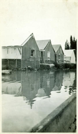
Photograph depicts lane in front of tent buildings flooded with water, forest trees in background. Photograph taken from canoe, portion of canoe visible in foreground. It is believed that this photograph may depict the Island Cache in flood, at Prince George, BC.

Flooded Railway Camp
2009.5.3.97 · Item · [1936?]
Part of Taylor-Baxter Family Photograph Collection

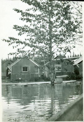
Photograph depicts lane in front of tent buildings flooded with water. Tree in midground, forest trees in background. A man can be seen between first and second row of tent buildings. Photograph taken from canoe, portion of canoe visible in right foreground. It is believed that this photograph may depict the Island Cache in flood, at Prince George, BC.

Flooded Area
2012.13.1.87.002 · Item · [between 1975 and 1995]
Part of J. Kent Sedgwick fonds

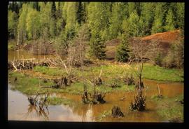
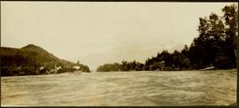
Image depicts a flooded area with an old sawdust pile in the background. Likely near McGregor, B.C.

Fishing on McCleary Lake
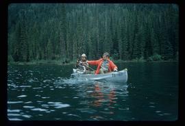
2012.13.1.55.19 · Item · 1971
Part of J. Kent Sedgwick fonds

Image depicts two individuals fishing in a canoe on McCleary Lake. The slide is also labelled "dolly," likely meaning the fish in the net is a Dolly Varden trout.

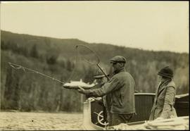
Fishing at Stuart Lake, BC
2004.6.10 · Item · [between 1920 and 1940]
Part of Stuart Lake Photograph Collection

Typed annotation on recto: "Fishing Stuart Lake B.C." Two men and one woman stand on boat with fishing gear, and a rainbow trout caught in net. Trees on hill in background. It is believed that Mr. and Mrs. Factor are present on the boat (see item 2004.6.28).

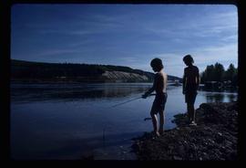
Fishing
2012.13.1.23.15 · Item · 1973
Part of J. Kent Sedgwick fonds

Image depicts two youths fishing from the bank of the Nechako River on Cottonwood Island.

Fishing
2012.13.1.84.39 · Item · 1994
Part of J. Kent Sedgwick fonds

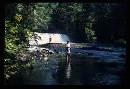
Image depicts a few unidentified individuals fishing in a river at an uncertain location.

2009.7.1.248 · Item · ca. 1880-1920
Part of Archdeacon W. H. Collison fonds

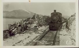
Head on shot of steam engine traveling through a pass with mountains in the background. Handwritten annotation in pen on verso reads: "First Passenger Engine to reach Prince Rupert." Annotation on recto reads: "First Passenger Engine at Prince Rupert." Photographer' stamp in bottom right corner of recto reads : "Allen Photo."

2012.13.1.3.149 · Item · Apr. 1999
Part of J. Kent Sedgwick fonds

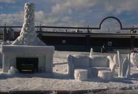
Image depicts a snow sculpted fire place and couch on a skating rink, possibly during the Winter City Conference, in Prince George, B.C. Taken at the Prince George Civic Center. Map coordinates 53°54'45.6"N 122°44'59.6"W

Finish Line
2012.13.1.129.01 · Item · 1971
Part of J. Kent Sedgwick fonds

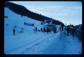
Image depicts numerous skiers standing near a finish line somewhere on Tabor Mountain in Prince George, B.C.

Final submissions
1996.7.4.11 · File · 1994
Part of BCUC Kemano Completion Project Review Collection

File consists of final submissions submitted to the BCUC public review of the Kemano Completion Project. Includes final submissions and accompanying correspondence for the Nechako Environmental Coalition; the District of Vanderhoof/Regional District of Bulkley Nechako/The River Forever/Vanderhoof District Chamber of Commerce; Sustainable BC; J.M. Black; and Rediscovery Prince George. Also includes the Nechako Environmental Coalition's "Rebuttal to Final Submissions of Alcan & the Government of Canada"; the "Final Argument of the Province of British Columbia"; and the "British Columbia Hydro and Power Authority 1993 Revenue Requirements Application Final Argument".

Final arguments
1996.7.4.12 · File · 1994
Part of BCUC Kemano Completion Project Review Collection

File consists of final arguments submitted to the BCUC public review of the Kemano Completion Project. Includes final arguments and accompanying correspondence for the Rivers Defense Coalition; the Nechako Valley Regional Cattlemen's Association and the Nechako Valley Dairymen's Association; the Nechako Environmental Coalition; Ben B. Meisner; the Province of British Columbia; the Government of Canada; Ecology Circle Prince George; Rediscovery Prince George; and Rick Berry.

2003.4.4.2.12 · File · [ca. 1986]
Part of Kemano Completion Project Dispute Collection

File consists of various maps, figures, and graphs generated in conjunction with Nechako River scientific studies. Includes a map of dune areas at a site in the Nechako River entitled "Comparison of areas predicted by ALCAN's habitat model to be used by chinook salmon for spawning in Reach 2-1 with areas that they have historically used", a graph of "Habitat Predictions for Pre-Migrant Juvenile Chinook Salmon in the Nechako River", an annotated graph of "Upper, Lower and Optimum Temperature for Nechako River Chinook Salmon", a hand drawn graph of "Water temperatures at the margins of the Nechako River during the warmest part of the year at three locations downstream from Cheslatta Falls", a hand drawn graph of "Lethal water temperature distribution in a river", a "Nechako River Salmon Study Area Base Map", maps of Nechako River temperature/TGP transects, and a hand drawn graph of maximum usable area for pre-migrant juvenile chinook salmon in the Nechako River.