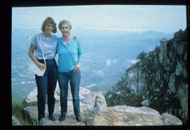
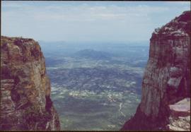
Geographic Features

Elements area

Taxonomy

Code

Scope note(s)

  • Includes both natural and artificial features
  • Physical landscape, built landscape
  • Urban and industrial landscapes
  • Topography
  • Site plans
  • Boundaries, districts, reserves, parks, sanctuaries, towns, etc.
  • NOTE: Mainly but not exclusively pertaining to photographic and cartographic records
  • SEE ALSO: Land, Settlement and Immigration

Source note(s)

  • MemoryBC Subject Groups

Display note(s)

    Hierarchical terms

    Geographic Features

      Equivalent terms

      Geographic Features

        Associated terms

        Geographic Features

          4134 Archival description results for Geographic Features

          4134 results directly related Exclude narrower terms
          Willow River - Lloyd Edwards
          2012.13.1.89.131 · Item · 1985
          Part of J. Kent Sedgwick fonds

          Image depicts a group of people somewhere in Willow River, B.C. The man in the plaid shirt and beige cap is identified on the slide as being Lloyd Edwards.

          P.G. Plan
          2012.13.1.001 · Subseries · [between 1985 and 2003]
          Part of J. Kent Sedgwick fonds

          File contains slides depicting maps and site plans for the city of Prince George.

          Other Town Plans
          2012.13.1.030 · Subseries · [between 1985 and 1988]
          Part of J. Kent Sedgwick fonds

          File contains slides depicting old town site plans for various cities.

          2012.13.1.133.04 · Item · 1985
          Part of J. Kent Sedgwick fonds

          Image depicts a group of trees in the Cottonwood Park, with a sign which reads: "This is the primary plantation for the 'Forest for the World' project. These trees were planted on August 5, 1985, commemorating Prince George's 70th birthday by the citizens of Prince George & Expo 86'."

          2012.13.2.09.04 · File · 1986-2004
          Part of J. Kent Sedgwick fonds

          File consists of notes, clippings, and reproductions relating to bibliographic references about the central interior of British Columbia. Includes: "Pioneers of the Central Interior" pamphlet from the Prince George Public Library (Nov. 1986) and "Manitoba Department of Tourism and Cultural Affairs" typescript letter from Shirlee Anne Smith to Frank Leonard (9 May 1980).

          "Salmon Valley" 1986 map
          2012.13.6.81 · File · 1986
          Part of J. Kent Sedgwick fonds

          Item is an original 1986 map depicting Salmon Valley in British Columbia and was published by the Department of Energy, Mines and Resources Ottawa Canada.

          South Fort George townsite
          2012.13.2.02.47 · File · 1986-2006
          Part of J. Kent Sedgwick fonds

          File consists of notes, clippings, and reproductions relating to the South Fort George townsite. Includes "Name change from Glenora Park to Paddlewheel Park" typescript letter from Kent Sedgwick to The Mayor and Council (12 Sept. 1988).

          River Ferry
          2012.13.1.66.01 · Item · June 1987
          Part of J. Kent Sedgwick fonds

          Image depicts a ferry on a river, possibly the Fraser River in the Lillooet area.

          River Ferry
          2012.13.1.66.02 · Item · June 1987
          Part of J. Kent Sedgwick fonds

          Image depicts a ferry on a river, possibly the Fraser River in the Lillooet area.

          Maps of Prince George
          2012.13.2.11.03 · File · 1987-1996
          Part of J. Kent Sedgwick fonds

          File consists of notes and reproductions relating to maps and creating maps of Prince George. File predominantly includes photocopies and reproductions of maps of Prince George and neighbourhoods in Prince George. Includes: "Planning division inventory of land use plans and sector plans" typescript document (5 Dec. 1989); "Prince George community planning council" typed letter to Kent Sedgwick attached to multiple maps depicting Prince George (11 Dec. 1996); and "Downtown revitalization committee map loan" typed document and photocopied maps lent to the Downtown Revitalization Committee from Kent Sedgwick (11 Dec. 1996).

          Gravel Pit
          2000.1.1.3.18.013 · Item · June 1987
          Part of Cassiar Asbestos Corporation Ltd. fonds

          Photograph depicts close up view of gravel pit, ruler displayed for scale. Photograph speculated to have been taken at the plant or near the Cassiar airstrip. Stamped annotation on recto of photograph: "JUN. 1987".

          2009.6.1.496 · Item · November 1987
          Part of The Honourable Iona Campagnolo fonds

          Photograph is one of seven images orginally included within a diary dated 12-22 November 1987. Photos depict a day to day account of Canadian University Service Overseas (CUSO) mission to establish whether or not a Canadian presence is justified in the fight against Apartheid and for the liberation of Namibia within a Soviet Sphere Socialist State. See also items 2009.6.1.490 - 2009.6.1.495.

          Water in Gravel Pit
          2000.1.1.3.18.011 · Item · June 1987
          Part of Cassiar Asbestos Corporation Ltd. fonds

          Photograph depicts an unidentified man standing to left of large puddle in gravel pit, mountain peaks in background. Photo speculated to have been taken on the plant, or near the Cassiar airstrip, facing south west. Stamped annotation on recto of photograph: "JUN. 1987".

          2000.1.1.3.18.012 · Item · June 1987
          Part of Cassiar Asbestos Corporation Ltd. fonds

          Photograph depicts yellow conveyor belt in foreground over gravel pit, dump truck behind in midground. Mountains visible in background. Photo speculated to have been taken at the plant or near the Cassiar airstrip. Stamped annotation on recto of photograph: "JUN. 1987".

          2009.6.1.495 · Item · November 1987
          Part of The Honourable Iona Campagnolo fonds

          Photograph is one of seven images orginally included within a diary dated 12-22 November 1987. Photos depict a day to day account of Canadian University Service Overseas (CUSO) mission to establish whether or not a Canadian presence is justified in the fight against Apartheid and for the liberation of Namibia within a Soviet Sphere Socialist State. See also items 2009.6.1.490 - 2009.6.1.496.

          Kootenay Plains
          2012.13.1.096 · Subseries · [between 1987 and 2004]
          Part of J. Kent Sedgwick fonds

          File contains slides depicting the Kootenay Plains and surrounding areas in Alberta.

          Hat Creek Ranch - Road
          2012.13.1.58.12 · Item · June 1987
          Part of J. Kent Sedgwick fonds

          Image depicts the road leading to the historic Hat Creek Ranch site north of Ashcroft, B.C. Several individuals are sitting on the front porch of the Ranch house.

          2012.13.2.14.09 · File · 1987-1989
          Part of J. Kent Sedgwick fonds

          File consists of notes, reproductions, and letters relating to L.C. Gunn Park in Prince George. Includes: "Signage for Gunn Park" letter from Kent Sedgwick to the Mayor and Council (21 Dec. 1989); "L.C. Gunn viewpoint a proposal" documents within a duotang (1987); and "Donation to the City of Prince George" typescript letter from Graham Farstad to the Administration Committee ( 1 June 1988). Includes photographs depicting the opening of L.C. Gunn Park and the sign unveiling (3 Oct. 1988).