Agriculture

Elements area

Taxonomy

Code

Scope note(s)

  • Includes: farming and ranching; agribusiness; horticulture and gardening; agricultural academic research; agricultural professional groups; agricultural cooperatives and organizations; irrigation; agricultural fairs and markets.

Source note(s)

  • MemoryBC Subject Groups

Display note(s)

    Hierarchical terms

    Agriculture

      Equivalent terms

      Agriculture

        Associated terms

        Agriculture

          919 Archival description results for Agriculture

          919 results directly related Exclude narrower terms
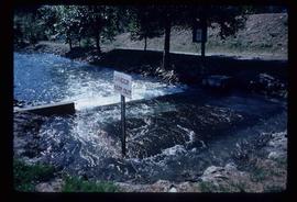
          Orchard Irrigation
          2012.13.1.82.27 · Item · 1981
          Part of J. Kent Sedgwick fonds

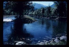
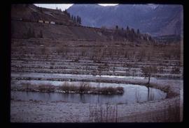
          Image depicts water flowing through an irrigation channel in an orchard, somewhere in or near Seton Portage, B.C.

          Optical Discs
          2020.4.9.2 · Subseries · 1995-2013
          Part of G. Gary Runka fonds

          Series consists of digital records on optical disc media (CDs and DVDs) created or collected by Gary Runka and Joan Sawicki for personal and professional purposes. Includes computer back-ups, film documentaries, and digital publications on disc.

          2020.4.9.2.19 · File · 2011
          Part of G. Gary Runka fonds

          This CD-ROM contains digital records compiled for Gary Runka in relation to the OCP for Rural Graham Island, possibly for his consultancy work for client job 664, Misty Isles Economic Development Society's "Food Planning Presentations on Haida Gwaii" project or another Haida Gwaii based project. Includes correspondence, Canada Land Inventory maps for Haida Gwaii, the draft 2009 Official Community Plan for Rural Graham Island, Graham Island zoning documents, and population information for Graham Island and Tlell.

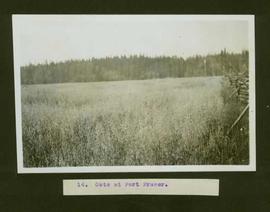
          Oats at Fort Fraser
          2004.5.1.11 · Item · ca. 1914
          Part of Fort Fraser historical photograph collection

          Typed caption glued to album page directly below photograph reads: "14. Oats at Fort Fraser." Photograph depicts a field of oats edged by a wooden fence. Photographer: Dominion Stock & Bond Corporation.

          2020.4.2.1.13 · File · [ca. 1975]
          Part of G. Gary Runka fonds

          File consists of notes written by Joan Sawicki for an untitled pending speech by Gary Runka.

          Commentary on this speech by Barry Smith of the Ministry of Agriculture and Lands:
          "Despite this being only 4 pages of rough notes, its focus on the initial work of the Commission and challenges of designating the ALR make it an historically important document.

          For example it was initially thought the ALR would be guided by class 1 - 4 CLI ratings but this proved impractical in the north and range areas. An additional challenge was that parts of the province only had the benefit of 1:50000 mapping. This presented a very real problem for establishing the ALR.

          One concern with this document is that because it is written in point form and consists of rough notes, it could be open to a degree of misinterpretation if not considered by an individual with experience in the administration of the ALR. For a much more refined statement on the B.C. Agricultural Land Preservation program and the designation of the ALR see Items [2020.4.2.1.23, 2020.4.2.1.24, and 2020.4.2.1.25]."

          2020.4.2.3.019 · Item · 1966
          Part of G. Gary Runka fonds

          Item is a copy of the "North American Water and Power Alliance (NAWAPA)" presentation to Cornell University Water Resources Center, Ithaca, New York by Roland P. Kelly, Edward R. Trapnell, and Ralph M. Parsons Company.

          Mount Boucherie orchards
          2020.4.8.1.0005 · Item · May 1968
          Part of G. Gary Runka fonds

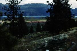
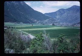
          Slide depicts orchards surrounding Mount Boucherie. The Okanagan Lake and mountains can be seen in the background. Original slide index description: "Orchards & sunflowers from Mt. Boucherie."

          Mission Flats
          2020.4.8.1.0003 · Item · May 1968
          Part of G. Gary Runka fonds

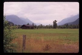
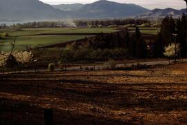
          Slide depicts Mission Flats from South East Kelowna. Photograph taken from an empty field and depicts a developed field and a wooden house. Mountains and the Okanagan Lake can be seen in the background. Original slide index description: "Mission Flats from SE Kel."

          2020.4.9.3.025 · File · 1991-1995
          Part of G. Gary Runka fonds

          Floppy consists of G.G. Runka Land Sense Ltd. client file records for jobs.

          Floppy directories and file listing:

          • 152REF
          • 306
          • 319TBL.CNT
          • 363LYN.FIL
          • 376WRK.PLN
          • 390
          • APP12
          • APPCALC
          • BCA1
          • BEHOLD
          • CAVELEG.DOC
          • COMM329
          • CR306
          • DACY.MAP
          • ED306
          • EVALCR
          • GEOL101
          • LAND.MAP
          • LANDSENS.MAP
          • LEG&REG.DOC
          • LUND.MAP
          • LYN.MAP
          • LYND.MAP
          • MSWORD.DOC
          • MSWORD.STY
          • REF
          • REF306
          • REFERENC
          • RUNKA.MAP
          • TC101
          • THESIS
          • TODAY.MAP
          2020.4.9.3.026 · File · 1991-1995
          Part of G. Gary Runka fonds

          Floppy consists of G.G. Runka Land Sense Ltd. client file records for jobs.

          Floppy directories and file listing:

          • 152REF
          • 152REF.BK!
          • 306
          • 306.BK!
          • 319TBL.CNT
          • 363LYN.FIL
          • 376WRK.BK!
          • 376WRK.PLN
          • 390
          • 390.BK!
          • APP12
          • APP12.BK!
          • APPCALC
          • APPCALC.BK!
          • BCA1
          • BEHOLD
          • CAVELEG.DOC
          • COMM329
          • CR306
          • DACY.MAP
          • ED306
          • ED306.BK!
          • EVALCR
          • EVALCR.BK!
          • GEOL101
          • GEOL101.BK!
          • LAND.MAP
          • LANDSENS.MAP
          • LEG&REG.DOC
          • LUND.MAP
          • LYN.MAP
          • LYND.MAP
          • MSWORD.DOC
          • MSWORD.STY
          • REF
          • REF306
          • REFERENC
          • RUNKA.MAP
          • TC101
          • TC101.BK!
          • THESIS
          • THESIS.BK!
          • TODAY.MAP
          2020.4.9.3.023 · File · 1995-1997
          Part of G. Gary Runka fonds

          Floppy consists of G.G. Runka Land Sense Ltd. client file records for jobs.

          Floppy directories and file listing:

          • 346RESGN.LTR
          • ATNARK.AGR
          • ATNARK.DOC
          • ATNARKO.LTR
          • BCMAFF.PRO
          • BNGIFT.LTR
          • BULKLEY.LTR
          • BURNABY.QTE
          • CARRNOV.LTR
          • COLBASIN.LTR
          • CURTIS.LTR
          • GAERTNER.LTR
          • GARTH.DOC
          • GGRTAX.LTR
          • GIBSON.EST
          • GLOVER.FAX
          • GREATA.LTR
          • GREEN.DOC
          • HANNA.LTR
          • INSUR.DOC
          • INSURE.TBL
          • ISRAEL.DOC
          • JOHNS.LTR
          • JUL10ROB.LTR
          • JUL3ROB.LTR
          • KOCHMAR8.LTR
          • MAYO.LTR
          • MOFPROJ.LST
          • MOFSPE9.LTR
          • OKNOV8.FAX
          • OVTFAOCT.LTR
          • PHILLIPS.FAX
          • PRIORITY.MGT
          • RBFNOV22.FAX
          • RFIFEB7.FAX
          • ROSSNO20.FAX
          • SCHNARE.TBL
          • SEVERES.DOC
          • SFU.FAX
          • STEWART.LTR
          • WESAPR30.LTR
          • ZBEETNOF.FAX
          Miscellaneous
          2020.4.3.28 · File · 1995
          Part of G. Gary Runka fonds

          File consists of various papers, communications, correspondence, pamphlets, and publications. Includes the following:

          • "Speaking Notes - Joan Sawicki, MLA, Parl. Sec. Georgia Basin Initiative to Planning 425 - Dr. Alan Artibise - UBC - September 20, 1995"
          • "Principles of Sustainability" (ca. 1995)
          • "Preliminary Working Draft of a Background Report on Agriculture and Sustainability in the Fraser Basin" by Wendy R. Holm (1996)
          • Agriculture and Sustainability in the Fraser Basin workshop materials from Fraser Basin Management Program
          • 1995 Fraser Basin Management Program Board Report Card
          • "Speaking Notes for Joan Sawicki, MLIA Burnaby-Willingdon & Parliamentary Secretary, Georgia Basin Initiative, "Peatlands for People": A Conference sponsored by the Burns Bog Conservation Society" (27 January 1996)
          • BC Mining Watch! Fact Sheets
          • A letter to Gary Runka from Burnaby RCMP regarding a marijuana cultivation report
          • Newspaper article "Views sought on land claims" by Joan Sawicki
          • Newsletters from the Valhalla Wilderness Society including updates on their local, boreal, and Spirit Bear campaigns
          • A letter from David Anderson, Minister of Fisheries and Oceans
          • "Drinking Canada Dry: The Threat to Canada's Water under the Proposed Multilateral Agreement on Investment" by Wendy R. Holm
          • "Tulsequah Chief Mine Re-opening Project: Report and Recommendations of the Taku River Tlingit First Nation" (1998)
          • "1998 British Columbia Electoral Boundaries Commission" pamphlet
          • Correspondence and Runka's interview transcript for his participation in the UBC study "Building Consensus in a Complex World: A Study of the Theory and Practice of Participatory Multistakeholder Decision-Making" (1999)
          • Winter 1999 newsletter for the Northwest Institute for Bioregional Research in Smithers
          • "Knox McCusker: Dominion Land Surveyor" article from BC Historical News (Summer 1999)
          • SkyTrain development informational newsletter (Spring 1999)
          • Letter from Paul Sanborn to Gary Runka & Joan Sawicki (2002)
          • Email from Joan Sawicki to Bella Coola Valley residents regarding the Nascall Power Project
          • BC Hydro pamphlet about marijuana grow ops (2006)
          • Bella Coola Airport Dike Upgrade Referendum informational documents
          • Tweedsmuir-Wright Creek Crossing Rehabilitation and Flood Protection Plan
          2009.7.1.016 · Item · [ca. 1910]
          Part of Archdeacon W. H. Collison fonds

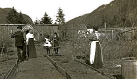
          Photograph depicts Marion and William Henry Collison standing on left with shovel, Bertha Collison on right, and young Muriel and Katherine Collison in centre with shovel (eldest daughters of W.E. Collison). Wood buildings cross midground, trees and hills visible in background.

          Handwritten annotation on verso reads: "Garden at Kincolith / Grandad, Grannie / Mimi, Katie / Mother".

          2009.7.1.017 · Item · [ca. 1910]
          Part of Archdeacon W. H. Collison fonds

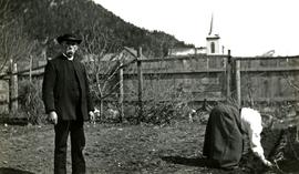
          Photograph depicts Archdeacon William Henry Collison to left of wife Marion, who stands bent over garden on right. Church steeple visible behind wood fence in background. Hills can be seen in distance.

          Handwritten annotation on verso reads: "Grandad & Grannie in garden at Kincolith".

          Maps & Oversize
          2020.4.7 · Series · 1965-2009
          Part of G. Gary Runka fonds

          Series consists of maps, technical drawings, and other oversize material collected by Gary Runka that are not associated with specific Land Sense Ltd. client jobs.

          2020.4.2.2.12 · Item · Mar. 1981
          Part of G. Gary Runka fonds

          Item is an original copy of the "Manitoba Land Use Conference Proceedings" on March 11-12, 1981 in Winnipeg. Gary Runka presented on his paper, "Expanding Needs from a Finite Resource: The Necessity for Sound Land Use Planning".

          2020.4.2.1.08 · File · 21 Aug. 1973
          Part of G. Gary Runka fonds

          File consists of a speech given by Gary Runka to the Agricultural Institute of Canada entitled "Managing Our Land Resources for Survival and Pleasure".

          Commentary on this speech by Barry Smith of the Ministry of Agriculture and Lands:
          "This speech is aimed at land use planning and planners, and GGR provides his definition of "ecology" which includes:
          "...the basic characteristics of the land - its geology, soils, climate, vegetation, and animal life, including the devil that does the most damage, man. It also includes the interrelationships within these basic characteristics and of course this is where the word "complexities" comes in. There are no two places where these components combine in exactly the same manner and each ecological unit, if you like, is unique."

          GGR mentions the importance of considering options.

          This package includes a copy of the speech as well as a second, 2 page document, with the same title in which GGR is noted as 'Manager of the BC Land Commission'. This second document is largely a summary of the more formal speech."

          2020.4.2.1.67 · File · Sept. 2009
          Part of G. Gary Runka fonds

          File consists of a speech given by Gary Runka entitled "Managing Conservation Lands to keep Nature's Pulse Beating" for the BC Trust for Public Lands.

          Commentary on this speech by Barry Smith of the Ministry of Agriculture and Lands:
          "GGR's was the opening address at the workshop. While this speech is focused on the issue of Best Management Practices (BMP), comments about the ALR are woven into the presentation. This copy of the speech appears to be a draft version and includes several hand-written amendments with some points crossed out.

          In the opening, mention is made of the grounding that the 2008 document "Taking Nature's Pulse: the Status of Biodiversity in British Columbia" has provided the workshop.

          This speech provides an historical overview of the broader provincial context of BMP's drawn from 40 years of GGR's experience. The following is a selection of his comments:

          • BMP's are part of the "tool kit" of policy and management mechanisms that have been experimented with over the decades to try to rationalize human economic activities with the needs of other species and overall ecosystem well-being.
          • Historically the 1960s and 70s Canada Land Inventory program that emerged from the Resources for Tomorrow conferences was a significant benchmark mapping land capability for agriculture, forestry, recreation, wildlife and waterfowl use (of which GGR was centrally involved).
          • Within BC, using the CLI, the 1973 Land Commission Act authorized the establishment of a provincial zone to protect those sacred lands with the biophysical capability to grow food.

          One point was not used in the speech (crossed out). The speaking notes, however, include a reference to the Land Commission legislation originally having a complimentary conservation objective that had since been removed. GGR makes the point that still having the conservation function may have contributed positively to current struggles to preserve natural habitat. Regardless, it is noted that the concept of the ALR has been a unique, effective and, most importantly a lasting management practices tool for conserving lands identified as biophysically significant.

          A further selection of points made:

          • We need to evolve BMP tools that are adaptable yet resilient in the face of changing knowledge, climate change and ever-evolving social priorities.
          • Traditionally, planning has been most associated with local governments in the form of official community, regional and neighbourhood plans and as an outgrowth of the ALR - Agricultural Area Plans.
          • Environment Farm Planning - by agreeing to engage in the conservation planning process, participating farmers and ranchers have qualified for funding to carry out farm improvements benefitting conservation and biodiversity.
          • The work of the Delta Farmland and Wildlife Trust is outlined (p. 8)
          • "My final words of wisdom are - Be focused and be pragmatic"
          • "Many of the best intentions to standardize land management practices for conservation lands have been great on paper - but never quite make it on the ground."
          • And, if BMP are not implemented effectively on the ground, they cannot play the critical role they need to play in 'keeping nature's pulse beating'."
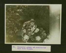
          Man and boy with cauliflower
          2004.5.1.37 · Item · ca. 1914
          Part of Fort Fraser historical photograph collection

          Typed caption glued to album page directly below photograph reads: "37. Wonderful growth of Cauliflower near Fort Fraser." Photograph depicts an elderly man holding two large cauliflower heads, a small boy stands next to him. Photographer: Dominion Stock & Bond Corporation.

          2008.26 · Collection · 1939 - 1956

          The Mabel Rutherford Photograph Collection consists of 8 photographs depicting images of Red Rock and region: family, road and rail construction, landscape, farming equipment.

          Rutherford, Mabel
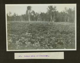
          Large crop of potatoes
          2004.5.1.14 · Item · ca. 1914
          Part of Fort Fraser historical photograph collection

          Typed caption glued to album page directly below photograph reads: "43. Large crop of Potatoes." Photograph depicts a large field of potatoes in the fore and mid ground and a fence and stand of trees in the background. Photographer: Dominion Stock & Bond Corporation.

          2020.4.4.33 · Item · 2000
          Part of G. Gary Runka fonds

          Item is a report entitled "Landscaped Buffer Investigation" a summary prepared by BC Ministry of Agriculture, Fisheries and Food for the Land Reserve Commission.

          2020.4.2.1.62 · File · [June 1994]
          Part of G. Gary Runka fonds

          File consists of a speech given by Gary Runka entitled "Landscape Level Planning - Fitting People into the Watershed" at the Stewarding Our Watersheds Conference.

          Commentary on this speech by Barry Smith of the Ministry of Agriculture and Lands:
          "The first half of this speech takes a very broad sweep in defining landscape units and the provincial planning system. In the second section "Entering the People Use Maze", the paper focuses more locally on the Salmon River watershed and discusses the findings of a survey associated with the Langley Rural Plan.

          The survey results demonstrated that for both rural and non-rural residents in Langley, 'the country atmosphere' was why they had chosen to live in Langley. Residents also disagreed with the statement that it was unpleasant to live in an agriculture area.

          The third section - "Techniques of Integrating Balanced, Sustainable People Use" into the Watershed" considers eight tools that will assist achieving "landscape level" planning, one of which is the ALC Act.

          Besides these direct references to agriculture, country atmosphere and ALC Act; the Langley Rural Plan drew heavily on the survey that GGR refers to and the Plan, which was largely comprised of agricultural lands, was inspirational in the development of the Commission of work "Planning for Agriculture".