The David Davies Railway Collection encompasses all facets of railway history specifically in the province of British Columbia and the Yukon territory. The collection consists of research material accumulated over the course of more than fifty years, and includes monographs, periodicals, articles, clippings, railway timetables, photographs, maps and plans, and excerpts. Material covers public, tourist, and private (industrial) railways, including: CPR, KVR, E&N; CNR, CNoR, GTPR; and PGER, BCR. The collection excludes material regarding streetcar systems and rapid transit, but includes long distance electric interurbans.
Series consists of graphic material depicting railways in British Columbia. Includes prints, negatives, and postcards.
Subseries consists of prints and negatives depicting railways in British Columbia separated from the textual records of the David Davies Railway Collection.
Subseries consists of prints and negatives depicting railways in British Columbia, as well as a small selection of other subjects such as historical ships, buildings, vehicles, and bridges. All photographs created by David Davies.
Subseries consists of printed and photograph postcards depicting railways, buildings, ships, and other transportation in British Columbia.
Fonds consists of ledgers recording accounts and maintenance notes of the S. B. Trick Lumber Co. and one photograph of the Ambrose Trick Sawmill.
S. B. Trick Lumber Co.File contains photographs of The Pas Lumber Company Ltd. Includes other northern BC forestry industry images, including Number 5 Timber Ltd. CP625 Block 101, bridge construction, and heavy machinery. Also includes a graphic postcard of Prince George circa 1970s.
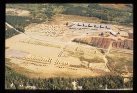
Image depicts a sawmill in the Danson Industrial Park in Prince George, B.C.
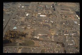
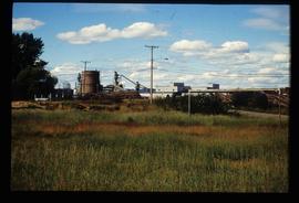
Image depicts the Carter Industrial Area in Prince George, B.C.
Image depicts a the Danson Industrial Park in Prince George, B.C.
Fonds consists of photographs, scrapbooks of newspaper clippings and memorabilia, correspondence, reports and other textual material. The photographs relate to Mr. Williston’s life from childhood to the late 1990s, the scrapbooks document Mr. Williston’s years in political office, and the textual materials relate to both Mr. Williston’s public life and private interests.
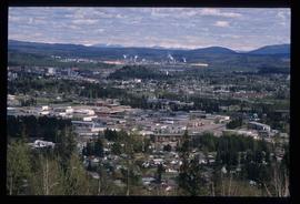
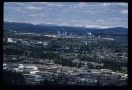
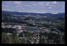
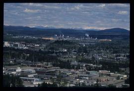
Williston, Ray GillisImage depicts Prince George from University Way, with the P.G.I pulp mill in the distance.
Image depicts Prince George from University Way, with the P.G.I. Pulp Mill in the distance.
Image depicts Prince George from University Way, with the P.G.I. Pulp Mill in the distance.
Collection consists of records created and collected by Robert "Bob" Stowell (1922-2018) and his son Bill Stowell over the course of their careers in the British Columbia forestry industry.
Bob Stowell spent the majority of his 50+ year forestry career with The Pas Lumber Co. (B.C.) Ltd. in Prince George, BC as their Woodlands Manager between 1965-1991. Bob Stowell's records from The Pas Lumber Co. (B.C.) Ltd. include photographs, company histories, speeches, memoranda, correspondence, reports, and news clippings.
Bill Stowell worked for numerous forestry companies across British Columbia over the course of his forestry career (1977-2018). His collected material predominantly consists of forestry-related clippings from newspapers and periodicals, along with forestry-related publications like pamphlets, booklets, and reports. Represented among Bill Stowell's records are correspondence, memoranda, reports, and ephemera from Tolko Industries Ltd. and other various forestry companies.
Stowell, RobertImage depicts Prince George from University Way, with the P.G.I. Pulp Mill in the distance.
Fonds consists of textual records, photographic items and published reports related to professional life and career of Bob Harkins, broadcaster, local historian, and former city councilor. Includes textual and photographic items related to development and history of city of Prince George and the Central Interior of BC region history and development in late 20th century. Items includes an unpublished manuscript on the life of Ray Williston by Eileen Williston, an unpublished paper on the history of technological change in logging industry; an unpublished paper on the history of radio and television in Prince George; a report related to the creation of a university for Northern British Columbia (1989) and proofs of the publication "Wild Liard Waters: Canoeing Canada's Historic Liard River" by Ferdi Wenger, c.1998. Also includes photographic files including CKPG Radio Studio photographic items c.1953; and photographs and correspondence regarding guide outfitter Skook Davidson c.1975.
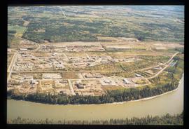
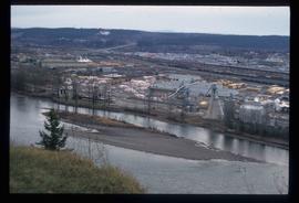
Harkins, BobImage depicts the Northwood Pulpmill in Prince George, B.C. taken from above the Nechako River looking east. Map coordinates 53°56'00.0"N 122°44'29.7"W
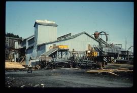
Image depicts a sawmill in Prince George, B.C.
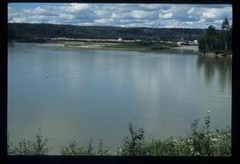
Image depicts Prince George Sawmill taken from across the Nechako River looking southwest. Map coordinates 53°56'00.0"N 122°44'29.7"W
Image depicts Prince George Sawmill taken from across the Nechako River looking southwest. Map coordinates 53°56'00.0"N 122°44'29.7"W
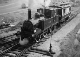
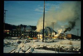
Image depicts the Giscome mill site in Giscome, B.C. The bunkhouse is the large building with many windows. A train and railroad tracks are in the foreground. Map coordinates 54°04'17.6"N 122°22'06.1"W
The Prince George Railway & Forestry Museum Society Collection consists primarily of textual, photographic, and cartographic records related to the regional developments of the railway industry in Northern BC. A predominant portion of the collection is made up of material from the Canadian National Railway; other railways represented include the Pacific Great Eastern Railway, the British Columbia Railway (BC Rail), the Grand Trunk Pacific Railway, the Grand Trunk Railway, the Intercolonial Railway, and the Okanagan Express. Significant geographical areas covered include Prince George, the Peace River Region, Terrace, Bulkley Valley, Hazelton and Prince Rupert.
The forestry industry is represented in the collection with operational and financial records from Fyfe Lake Sawmill Ltd., which operated southwest of Prince George in the 1950s.
The collection has been organized into series according to creator, each of which also has been arranged to subseries, file and item level, where applicable. This collection consists of eight series, as follows:
1) Canadian National Railway
2) Grand Trunk Railway
3) Pacific Great Eastern Railway
4) British Columbia Railway (BC Rail)
5) Canadian Pacific Railway (CPR)
6) Intercolonial Railway
7) Fyfe Lake Sawmill ltd.
8) PGRFM
9) Photographs
Image depicts the Prince George Sawmill from the Northwood Bridge.
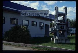
Image depicts the office at the Northwood Upper Fraser Saw Mill and a sign which reads "Have a safe, quality day." Map coordinates 54.117916, -121.943351
Image depicts a sawmill, possibly Lakeland Sawmill, in Prince George B.C.
Image depicts a pulpmill, likely Northwood, in Prince George, B.C.
Series consists of photographs relating to Ray Williston's life from childhood to recent times, air photographs of Prince George, photographs of Bangladesh, and a listing of photographs slated for use in Mr. Williston's biography "Forests, power and policy: the legacy of Ray Williston" written by Eileen Williston and Betty Keller.
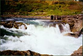
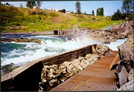
Photograph depicts white rapids at bottom of waterfall in Bulkley River, B.C. Fishing territory visible on far right; hill on opposite shore in background.
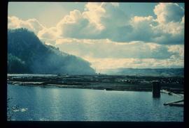
Image depicts numerous tree logs floating on a body of water. The location is uncertain, but is likely Eaglet Lake.
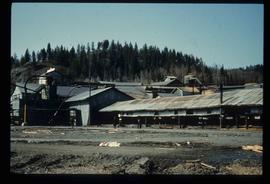
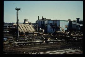
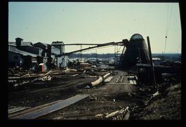
Image depicts the mill site at Giscome, B.C. Map coordinates 54°04'19.7"N 122°22'04.7"W
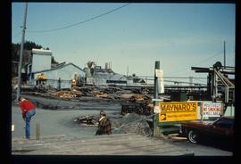
Image depicts the mill site at Giscome, B.C. A sign in the foreground reads "Maynard's Industrial Auctioneers." Map coordinates 54°04'19.7"N 122°22'04.7"W
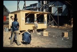
Image depicts a food stand at the mill site at Giscome, B.C. Map coordinates 54°04'19.7"N 122°22'04.7"W
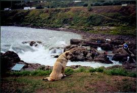
Photograph depicts dog seated on grass in foreground. Unidentified individuals visible below with fishing nets in waterfall area at Moricetown Canyon.
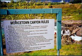
Photograph depicts sign in foreground outlining rules and restrictions for behaviour at Moricetown Canyon. Traditional fishing territory visible behind sign at waterfall in the Bulkley River, B.C. Highway and buildings can be seen in background.
Photograph depicts an unidentified individual standing on cliff above waterfall at Bulkley River, B.C. Fishing territory visible below; highway, buildings, and hills visible in background.
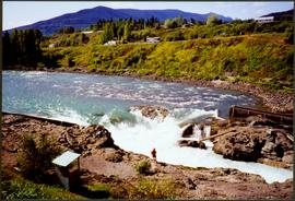
Photograph depicts fishing territory at waterfall rapids in Bulkley River, B.C. Highway and buildings on opposite shore in background.
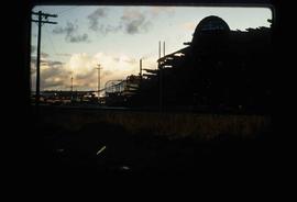
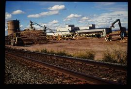
Image depicts Upper Fraser mill yard with log deck and beehive burner in silhouette across railroad tracks. Located in Upper Fraser, B.C. Map coordinates 54°07'01.5"N 121°56'29.6"W
Image depicts numerous log decks at the Upper Fraser sawmill. Map coordinates 54°07'10.8"N 121°56'51.7"W
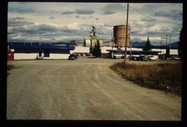
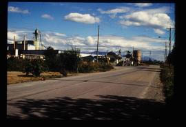
Image depicts the mill site at Giscome, B.C. Map coordinates 54°04'19.7"N 122°22'04.7"W
Image depicts the mill site at Giscome, B.C. Map coordinates 54°04'19.7"N 122°22'04.7"W
Image depicts the entrance to the Upper Fraser mill yard in Upper Fraser, B.C. Map coordinates 54°07'10.8"N 121°56'51.7"W
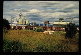
Image depicts the Upper Fraser mill yard with a CN train in Upper Fraser, B.C. Map coordinates 54°07'10.8"N 121°56'51.7"W
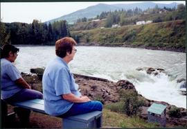
Photograph depicts Moran seated to right of woman on bench in foreground. Waterfall area at Moricetown Canyon can be seen below, behind booth labeled "MONITER BOOTH". Highway and houses visible on opposite shore in background.
Image depicts the entrance to the Upper Fraser mill yard in Upper Fraser, B.C. Map coordinates 54°07'10.8"N 121°56'51.7"W
Image depicts the Upper Fraser Road running through Upper Fraser, B.C. A newer style round burner is seen in the background. Map coordinates 54°07'05.7"N 121°56'38.9"W
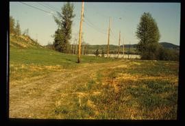
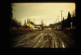
Image depicts the remains of a street of houses in Giscome, B.C. The quarry is slightly visible in the background. Map coordinates 54°04'20.9"N 122°21'53.1"W
Image depicts numerous buildings at an uncertain location. A beehive burner and what appears to be a large pile of wood is visible in the background.
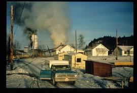
Image depicts several houses and the Giscome saw mill in Giscome, B.C. in the background. Map coordinates 54°04'20.9"N 122°21'53.1"W
Image depicts the mill site at Giscome and its beehive burner. Map coordinates 54°04'19.7"N 122°22'04.7"W
