Mostrar 53 resultados

Archival description
5 resultados com objetos digitais Mostrar resultados com objetos digitais
Prince George Railway & Forestry Museum Collection
2002.1 · Coleção · 1887-1999

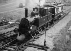
The Prince George Railway & Forestry Museum Society Collection consists primarily of textual, photographic, and cartographic records related to the regional developments of the railway industry in Northern BC. A predominant portion of the collection is made up of material from the Canadian National Railway; other railways represented include the Pacific Great Eastern Railway, the British Columbia Railway (BC Rail), the Grand Trunk Pacific Railway, the Grand Trunk Railway, the Intercolonial Railway, and the Okanagan Express. Significant geographical areas covered include Prince George, the Peace River Region, Terrace, Bulkley Valley, Hazelton and Prince Rupert.

The forestry industry is represented in the collection with operational and financial records from Fyfe Lake Sawmill Ltd., which operated southwest of Prince George in the 1950s.

The collection has been organized into series according to creator, each of which also has been arranged to subseries, file and item level, where applicable. This collection consists of eight series, as follows:

1) Canadian National Railway
2) Grand Trunk Railway
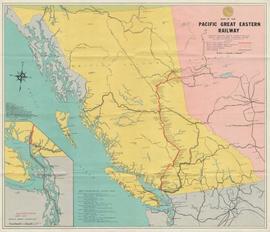
3) Pacific Great Eastern Railway
4) British Columbia Railway (BC Rail)
5) Canadian Pacific Railway (CPR)
6) Intercolonial Railway
7) Fyfe Lake Sawmill ltd.
8) PGRFM
9) Photographs
"Canadian National Railway System"
2013.6.35.09 · Item · [between 1948 and 1968]
Parte de David Davies Railway Collection

Map depicts the Canadian National Railway system, including trackage for the Central Vermont Railway, the Detroit & Toledo Shore Line Railroad, the Grand Trunk Western Railroad, the Duluth Winnipeg & Pacific Railway, and the Northern Alberta Railway.

"Map of Lower Mainland Railways"
2013.6.35.16 · Item · Mar. 1971
Parte de David Davies Railway Collection

Map depicts rail lines in the BC lower mainland, including BC Hydro Railway, Burlington Northern Railway, the Canadian Pacific Railway, the Canadian National Railway, and the Pacific Great Eastern Railway.

Oilweek: Pipeline Wall Map
2009.6.13.45.14 · Item · Nov. 1976
Parte de The Honourable Iona Campagnolo fonds

Map depicts existing oil lines, oil lines proposed or under construction, product lines, existing gas lines, gas lines proposed or under construction, LPG lines, and LPG lines proposed in Canada and Northern USA.

Major Oil and Gas Fields and Pipelines in Canada
2009.6.13.45.09 · Item · 1976
Parte de The Honourable Iona Campagnolo fonds

Map depicts the whole of Canada and notes: gas pipelines, gas gathering lines, proposed gas pipelines, oil pipelines, oil gathering lines, proposed oil pipelines, gas fields, oil fields, refining centres, extraction plants, and oil sands. There is a smaller subsequent map of Alberta highlighting these features in greater detail.

British Columbia Freight Routes
2009.6.13.45.20 · Item · [between 1974 - 1979]
Parte de The Honourable Iona Campagnolo fonds

Map depicts annotations of the freight-way routes throughout British Columbia. These routes include: the Garnet Enterprise Truck Haul from Vancouver to Terrace, the Canadian Freightways from Vancouver to Edmonton to Alaska; the Lindsay Transfer from Terrace to Dease Lake and Telegraph Creek; and the Northland Navigation roll-on and roll-off service.

David Davies Railway Collection
2013.6 · Coleção · [before 2020]

The David Davies Railway Collection encompasses all facets of railway history specifically in the province of British Columbia and the Yukon territory. The collection consists of research material accumulated over the course of more than fifty years, and includes monographs, periodicals, articles, clippings, railway timetables, photographs, maps and plans, and excerpts. Material covers public, tourist, and private (industrial) railways, including: CPR, KVR, E&N; CNR, CNoR, GTPR; and PGER, BCR. The collection excludes material regarding streetcar systems and rapid transit, but includes long distance electric interurbans.

"Cowichan Lake, British Columbia"
2013.6.35.25 · Item · 1955
Parte de David Davies Railway Collection

Map depicts the Cowichan Lake area, including rail trackage for the Western Forest Industries Logging Railway, the Canadian National Railway, and the BC Forest Products Logging Railway.

Cassiar Asbestos Corporation Ltd. fonds
2000.1 · Fundo · 3 April 1952 - 15 March 1993

Fonds consists of textual, photographic, cartographic, electronic and promotional films/video recordings related to the mining operations of Cassiar Asbestos Mining Corporation (CAMC) and creation of Cassiar townsite. CAMC records primarily consist of records related to mining operations including construction, engineering, daily mining operations, administration of CAMC, tallies of extractions, labour and union activities, corporate events and visits by dignitaries. Townsite records are primarily visual representations of townsite construction, including the creation of health, education and community services including Cassiar's private hospital, school, library, as well as townsite images. Photographs include documentation of natural and man-made landscapes within the Cassiar region of Northern BC. Other holdings include a near complete run of Cassiar's community newspaper.

Sem título
Mining in the Cariboo
2007.17.1 · Dossiê/Processo · [ca. 1933-1942]
Parte de James Joseph Claxton Photograph Collection

This file consists of 10 photographs pertaining to the Hixon Creek Cariboo Gold Company, and the Quesnel Quartz Mine; as well as two sheets of letterhead from the "Hixon Gold Recovery Ltd." a handwritten speech re: a mineral claim, and a hand drawn map and overlay pertaining to the Wellington and Highland (Belle or Lass) mineral claims.

Cartographic Materials Series
2009.7.3 · Série · 1878-1929
Parte de Archdeacon W. H. Collison fonds

Maps within this series document the placer streams, islands and harbours of the Queen Charlotte Islands; as well as the mining properties located within the vicinity of Stewart, BC.

"British Columbia Railway Belt"
2013.6.35.01 · Item · 1 July 1909
Parte de David Davies Railway Collection

Government map depicts railway lands, lands "disposed of", grazing leases, and timber berths. Shows the British Columbia 'railway belt' running from Greater Vancouver to Field, B.C.

Arctic Offshore Oil and Gas Areas
2009.6.13.45.10 · Item · [between 1974 and 1979]
Parte de The Honourable Iona Campagnolo fonds

Map depicts proven on & offshore oil & gas areas, and probable oil & gas areas in less then 1000' water. The map conveys the North Pole in the centre and spans out to include Canada, Europe and the "Union of Soviet Socialist Republics."

Regional District of Kitimat-Stikine
2009.6.13.45.18 · Item · 1976
Parte de The Honourable Iona Campagnolo fonds

Map depicts the regional district of Kitmat, but is extensively annotated showing the proposed route of the Kitmat Truck Ferry, running through Terrace and up into the "Yukon Markets," and the Kispiox Connector, running from Prince Rupert to Hazelton and further East along Highway 16 and north along the Kispiox River.

Oversize Material
2013.6.35 · Série · 1909-2011
Parte de David Davies Railway Collection

Series consists of large format maps and plans relating to railways in British Columbia and Canada. Also includes oversize documents.