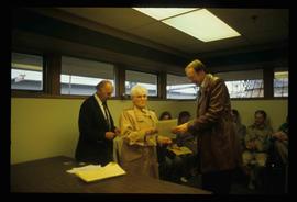
Affichage de 13 résultats

Archival description
11 résultats avec objets numériques Afficher les résultats avec des objets numériques
"The Canada Chart"
2012.13.2.01.07.1 · Pièce · 1983
Fait partie de J. Kent Sedgwick fonds

The Canada Chart depicts Canadian federal and provincial and government information and graphics.

Cottonwood Park Opening
2012.13.1.133.12 · Pièce · 1985
Fait partie de J. Kent Sedgwick fonds

Image depicts Elmer Mercier, a former mayor of Prince George, B.C., cutting the ribbon to open Cottonwood Park's Heritage Trail.

Map Board?
2012.13.1.133.11 · Pièce · 1985
Fait partie de J. Kent Sedgwick fonds

Image depicts a man holding up a board which appears to have maps of the Cottonwood Park on it.

Woman with a Paper
2012.13.1.133.10 · Pièce · 1985
Fait partie de J. Kent Sedgwick fonds

Image depicts a woman holding a sheet of paper in a room with numerous other unidentified individuals. The man standing behind her is possibly Elmer Mercier, a former Mayor of Prince George, B.C.

Handshake
2012.13.1.133.09 · Pièce · 1985
Fait partie de J. Kent Sedgwick fonds

Image depicts a man and woman shaking hands in a building at an uncertain location, possibly in Cottonwood Park. The man standing behind the two is possibly Elmer Mercier, a former mayor of Prince George, B.C.

George Street
2012.13.1.7.220 · Pièce · May 2001
Fait partie de J. Kent Sedgwick fonds

Image depicts a view of George Street with the Prince George City Hall at the corner of George Street and 7th Avenue.

City Hall
2012.13.1.3.165 · Pièce · May 2001
Fait partie de J. Kent Sedgwick fonds

Image depicts Prince George City Hall. Map coordinates 53°54'46.3"N 122°44'41.9"W