Photograph depicts crowd, horses, tents and flag pole in foreground with buildings and trees in background.
Annotation on verso: “Fourth Fall Fair Prince George, Sept 1915".
Photograph depicts crowd, horses, tents and flag pole in foreground with buildings and trees in background.
Annotation on verso: “Fourth Fall Fair Prince George, Sept 1915".
Aerial view of Prince George featuring roadways and the confluence of the Fraser and Nechako rivers.
Annotation on verso: “Prince George from air 1936”.
Image depicts a group of people in Cottonwood Park with an individual, possibly former mayor Elmer Mercier, making an announcement.
Photograph depicts group of men and women eating on deck attached to unknown house. Photo believed to have been taken during event held to celebrate Bridget Moran receiving an Honourary Law Degree from the University of Northern British Columbia in Prince George, B.C.
Photograph depicts crowd gathered to watch a baseball game in rustic field. Handwritten annotation on recto reads: “BASE-BALL FORT GEORGE BC” added annotation in ink reads: “1910”.
Handwritten annotation on verso of photograph: "PRINCE GEORGE B.C. FARMERS TAKING DELIVERY OF CATERPILLAR TRACTORS." Bob sits on first tractor in line of three. Fifteen men stand in a line against street buildings. "THE SALVATION ARMY" building stands in background on right. This photograph was taken at the corner of 4th and George St.
Fonds consists of textual records, photographic items and published reports related to professional life and career of Bob Harkins, broadcaster, local historian, and former city councilor. Includes textual and photographic items related to development and history of city of Prince George and the Central Interior of BC region history and development in late 20th century. Items includes an unpublished manuscript on the life of Ray Williston by Eileen Williston, an unpublished paper on the history of technological change in logging industry; an unpublished paper on the history of radio and television in Prince George; a report related to the creation of a university for Northern British Columbia (1989) and proofs of the publication "Wild Liard Waters: Canoeing Canada's Historic Liard River" by Ferdi Wenger, c.1998. Also includes photographic files including CKPG Radio Studio photographic items c.1953; and photographs and correspondence regarding guide outfitter Skook Davidson c.1975.
Harkins, Bob
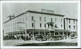
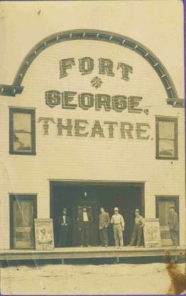
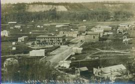
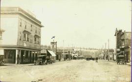
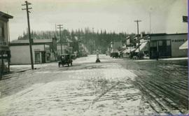
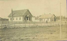
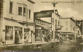
This fonds illustrates Bridget Moran’s careers as a writer, a social worker and a social activist primarily within the Prince George region of British Columbia. This fonds also contains records pertaining to her personal relationships with family and friends and her receipt of various honours and awards.
Types of records reflective of her career as a writer include: published articles and unpublished manuscripts, drafts and front cover mock-ups, correspondence with editors from Arsenal Pulp Press, grant applications, notebooks, background material, writer’s workshop invitations and overviews, photographs, oral history interviews and transcripts, and VHS recordings of classroom talks given by Bridget Moran, Mary John and Justa Monk re: her publications.
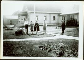
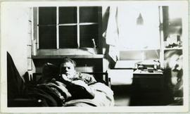
Types of records reflective of her career as a social worker and social activist include: annual reports, work journals, correspondence and published newspaper articles re: social policy, photographs, and general background material. Correspondence, photographs and newspaper clippings highlight her personal relationships, while her receipt of honours and awards is demonstrated through copies of letters of recommendation, newspaper clippings, photographs, VHS recordings of award ceremonies, event itineraries, congratulatory correspondence, and invitations.
The Bridget Moran fonds has been divided into the following four series:
Street view photograph of a commercial section in downtown Prince George with several "Campbell's" delivery carts parked along the road. Visible establishments include "Campbell's All Cash Store" and "Club Cafe." Handwritten annotation in blue ballpoint pen on recto reads: "Howdy from Prince George! Going easy with all these kids- good to see Kathee. Snow here. Have fun at the sports show & don't over do it. Thinking of you guys, love Judy and Vic. P.S. Can't wait to go home to somewhere peaceful and quiet. 2-27-83." Postcard is addressed to: "Mr. & Mrs. Hauffer 8429-221 PL. Sn. Edmonds, WA. U.S. 98020." Verso is affixed with four Canadian 8-cent stamps.
Photograph depicts large crowd gathered in front of three story building.
Printed annotation on recto of photograph: "CARIBOO STAGE AT SOUTH FT. GEORGE B.C. OCT 19 -1911".
Printed annotation on recto reads: “Central Avenue Fort George B.C. Copyright Canada June 25th 1913”. Handwritten annotation in ink on recto reads: “Hotel Fort George; Pool room; Men’s furnishing; General store; Bank Vancouver; Telephone office; Temperance House; Trust-company; Grand stand & fair grounds; Hospital; Ware house and general store.” Cancelled 1 cent Canadian stamp on verso is dated: "Fort George BC Jul 14 13". Handwritten message in ink on verso is addressed to Mr. Chas H Wilson 94 Gould St Toronto: "Fort George. B.C> Box 65, July 13/ 13. Dear Father, This is a 'bird's eye view' of our main street - ha! ha! some class alright. We live right behind the bakery lunch room on the right hand side of the picture, on 1st avenue, some people eh? Will be moving to Cassiar Ave soon. How are all the folks. Mae is writing. Peace. M."
Photograph depicts landscape with cleared land in foreground, river in middle, building and trees in background.
Handwritten annotation on verso: "Central Fort George 1911".
Street view photograph of a large brick with a vehicle parked in front. Printed annotation on recto reads: "C.N.R. Station Prince George, B.C."
Series contains material created and collected by Kent Sedgwick over the course of his work with the Prince George Heritage Commission, the Alexander Mackenzie Heritage Trail Association, and other local organizations. The files primarily consist of meeting minutes, typescript documents, and correspondence between Sedgwick and the organizations.
File consists of records created and collected by Kent Sedgwick regarding Cottonwood Island in connection with his employment with the City of Prince George Planning Department. Includes briefs, proposals, memoranda, correspondence, newspaper clippings, questionnaires, legal correspondence, meeting minutes, and photocopied excerpts from maps/plans. Also includes two polaroid photo prints depicting garbage in Cottonwood Island Park circa 1979. Highlights include:
Photograph depicts hotel on corner of street, crowd and cars in foreground.
Handwritten annotation on verso “Albert Johnson’s 'Northern Hotel' South Fort George 1914".
Row of buildings with path and poles. Rough cleared land in foreground, men visible in far left background.
Subseries consists of material collected by Kent Sedgwick for research regarding the communities along the East Line of the Grand Trunk Pacific Railway in Central British Columbia, particularly between Prince George and McBride. These communities and locations include, among others, Shelley, Willow River, Sinclair Mills, Longworth, Dunster, Tete Jaune, Valemount, Mount Robson, and the Yellowhead Pass. Research on these communities was conducted during Kent Sedgwick's involvement in the UNBC-led Upper Fraser Historical Geography Project. The files primarily consist of research notes, audio and transcripts of oral interviews, and photographs of the East Line communities.
Series consists of records reflecting the activities of the Dezell and Rustad families. Series include mayoral records from Bea and Garvin Dezell when Garvin served as Mayor of Prince George. Series includes materials celebrating Bea Dezell's life created by her family. Series also includes fundraising efforts for the Northern Medical Programs Trust. Finally, series includes a collection of "spruce" dollars and commemorative coins.
Photograph depicts lane in front of tent buildings flooded with water, forest trees in background. Photograph taken from canoe, portion of canoe visible in foreground. It is believed that this photograph may depict the Island Cache in flood, at Prince George, BC.
Photograph depicts lane in front of tent buildings flooded with water. Tree in midground, forest trees in background. A man can be seen between first and second row of tent buildings. Photograph taken from canoe, portion of canoe visible in right foreground. It is believed that this photograph may depict the Island Cache in flood, at Prince George, BC.
Six men stand on boardwalk in front of theatre.
Photographs within this file document natural and artificial features across the landscape of Northern British Columbia. This landscape also includes the physical, built, urban and industrial landscapes; topography; site plans; boundaries, districts, reserves, parks, sanctuaries, towns, villages and cities, etc.
Printed annotation on recto reads: “George St. Prince George B.C.”, handwritten in pencil on verso reads: “CA. 1915”
Photograph of George Street in Prince George B.C. Cars, people, and signage are visible. Printed annotation on recto reads: “George St. Prince George B.C. 1921 R7 by Moore” There is an “X” in ink over the fire hall. Handwritten annotation in ink on verso reads: “This view is also looking north and where I have put the X is the one and only fire hall and you can see the fire engine in the street. This is the main street.”
Photograph depicts buildings and vehicles lining street, and hill in background. There is snow on the road and several store signs are visible. Printed annotation on recto reads: “GEORGE ST. PRINCE GEORGE B.C.”
This photograph collection consists of 53 photographs featuring primarily Giscome with a few of Prince George. Subjects include the Eagle Lake Sawmill, Eagle Lake, Giscome townsite (including specific buildings and general road perspectives), Giscome School, Division II class photos (1950-51), and the Giscome School teacherage.
Photo of buildings behind street, fenced on either side. Man and horse can be seen on street. Printed annotation on verso reads: “The Government buildings Fort George B. C.” Handwritten annotation on recto reads: “This is the place I receive my patent from next June.”
Photograph depicts two women with flowers and three men standing on grass and boardwalk in foreground, large building in background.
Handwritten annotation on verso: “Government Agency at S. Fort George 1922."
Image depicts a group of individuals standing on the corner of 3rd Ave in Prince George, B.C.
View of 5 buildings and 4 tents on land that has been cleared to stumps. Printed annotation on verso reads: “HAMILTON AVE. FORT GEORGE”, added handwritten annotation in ink reads: “1910”.
Street scene showing people, dog, team of horses & wagon. Signage reads: “Beds; Mecca Café; Hardware.” Printed annotation on recto reads: “Hamilton Avenue, South Fort George, B. C. No. 110.” Verso displays cancelled 1 cent Canadian Postage Stamp and handwritten message in ink is addressed to Mr. Eathan Villard Burt Mish, U.S.A.
Handwritten annotation on recto of photo reads: "Harry Monson Edmonton Prince George." Harry reclines on bed under window, surrounded by personal effects. Photograph was taken after nightfall. Handwritten caption beside this photo reads: "Harry talked my dad into selling him my boat".
Image depicts Highway 97 at 15th Ave. looking north. Map coordinates 53°54'36.0"N 122°46'55.5"W
Image depicts Highway 97 at 15th Ave. looking north. Map coordinates 53°54'42.1"N 122°46'53.1"W
Photograph depicts Hotel Fort George with people, cars and power pole in foreground. Handwritten annotation on verso reads: “Hotel Fort George - 1913”.
Photograph depicts street corner view of Hotel Fort George with people and utility pole in foreground.
Handwritten annotation on verso “Hotel Fort George Central Fort George 1913".
Photograph of Prince George Hotel with several early model cars and a few people. Printed annotation on recto reads: “Hotel Prince George, Prince George, B. C.”
Collection consists of material resulting from Dr. Mike Evan's Island Cache Recovery Project Collection. Includes oral history interviews of former Island Cache (Cottonwood Island) residents on recording media (cassette and VHS) as well as transcripts of the oral histories. Also includes administrative records for the project and photocopies of background research material used for the project, such as Prince George city records, newspaper clippings, photographs, and correspondence.
Evans, Michael JohnThis fonds consists of material created and collected by Kent Sedgwick, author, professor, Prince George urban planner, and prominent local historian. This body of records documents Sedgwick’s research interests in the history and geography of the Central Interior of British Columbia. The fonds also reflects his work as a Prince George Senior City Planner, his involvement in local community organizations, and his teaching at the College of New Caledonia and the University of Northern British Columbia.
The fonds includes:
1) Photographs taken by Kent Sedgwick across British Columbia, predominantly in the Central Interior region;
2) Research subject files consisting of original research documentation and collected reference material, predominantly focusing on topics relating to local history, city planning, and geography in the Prince George area and the British Columbia Central Interior;
3) Documentation of Kent Sedgwick’s community involvement, including records created over the course of his work with the Prince George Heritage Commission, , the Alexander Mackenzie Heritage Trail Association, and other local organizations;
4) Writings, publications, and lectures written, edited, or conducted by Kent Sedgwick;
5) Professorial records consisting of lectures and material relating to Sedgwick’s teaching appointments at the College of New Caledonia and the University of Northern British Columbia;
6) Maps collected by Kent Sedgwick covering historical and contemporary British Columbia.
Collection consists of 73 photographs featuring the construction of the John Hart Highway in Prince George, BC from 1945-1946. Images depict construction, machinery, workers, bunkhouses, persons, wildlife, and buildings all associated with this construction project around the Summit Lake region of the city.
John Hart HighwayCane floats in flooded area of camp, tent buildings and forest trees in background. It is believed that this photograph may depict the Island Cache in flood, at Prince George, BC.
Photograph depicts lane in front of tent buildings flooded with water, and a man standing near doorway to first building. It is believed that this photograph may depict the Island Cache in flood, at Prince George, BC.
Image depicts a marching band with numerous other unidentified individuals. One man is carrying a Canadian flag with the depiction of men in a boat and the words "Canada Sea-to-Sea" on it.
Image depicts a marching band with numerous other unidentified individuals. One man is carrying a Canadian flag with the depiction of men in a boat and the words "Canada Sea-to-Sea" on it, and there is a mascot beside him that appears to be a chipmunk in an RCMP uniform.
Photograph depicts young girls dressed in white, walking in front of crowd. One girl holding bouquet wears a long train carried by smaller girls, and is escorted by older man wearing suit. Buildings and decorations can be seen in background.
Handwritten annotation on verso: “The May Queen, Maude Renwich attendants and Mayor Patterson".
Item is a photograph of Mr. Williston washing dishes with Mrs. Evelyn Yost, Dormitory Matron, and Mrs. Houghtaling, Chief Cook, in the kitchen of the renovated army barracks which became the Prince George School’s first dormitory. The dormitory was the first of its kind in B.C.