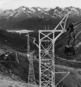
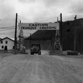
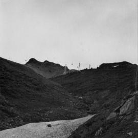
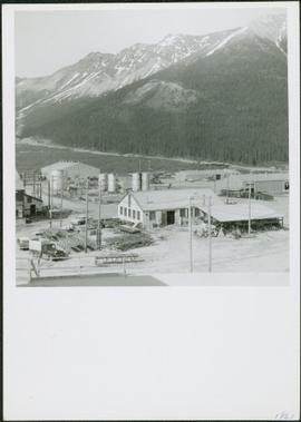
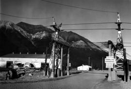
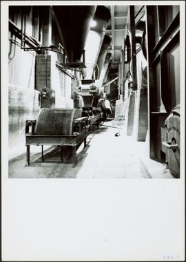
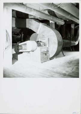
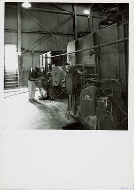
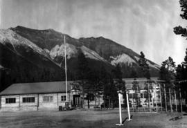
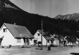
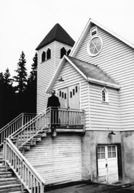
The file contains photographs originally found in an unmarked and undated black binder depicting colour-coded mill equipment and machinery. Several of these images are annotated “Bell”, “Bell Asbestos”, and “National”. It is speculated that these images originate from the underground asbestos mine in Thetford Mines, Quebec operated by Bell Asbestos Mines Ltd. and the National Mine in Quebec. One image appears to be, or looks similar to the new mill at Cassiar, built in 1971.
File contains photographs annotated Nordenham, presumably indicating that these images were taken in the Asbestos Corporation's plant in Nordenham Germany. The images depict bagging machinery in the mill, including a palletizer, automatic sewing machine, packer, shrinkwrap machine, glue applicator and cement bags. Some of the images include detailed annotations.
Collection of photographs of the construction of the crushing plant and related services at Cassiar in 1963. The work was contracted out to V.B. Humphrey Construction Ltd based out of North Vancouver. The photographs depict the foundation, installation of machinery, erection of steel frame building, and conveyor system. D.G Garret Foreman was in charge of the project.
Handwritten photo captions below this item and item 2000.1.1.2.2.2: "ELEVATION OF SITE: 6000' " "Two views of completed Crusher Bldg." Man in white hard hat stands beside steel drums in front of garage door on side of crusher building. Mountainside road to crusher in foreground, mountain range in background.
Photograph depicts man driving bulldozer in front of framework for Crusher building, view facing into the mountain. Excavated dirt in foreground.
View facing into mountainside and showing various levels of foundations. Men can be seen working on site. Unidentified machinery and pile of long metal rods in foreground.
Photograph depicts a round bucket attached to the main hook line of a crane (crane not visible in image) suspended over building framework in crusher construction site. Four construction workers stand around the bucket. Two men can be seen on roof of long building in background believed to be the section of the crusher building which housed conveyor B. Dirt road crosses midground.
Photograph depicts one man standing on framework of crusher building and a second man leaning over on a lower level. Lumber and hose in foreground.
Handwritten caption beside this photo reads: "View of Crusher Base." Wood and metal framework throughout, lumber and scaffolding in foreground. View facing into mountainside.
View showing various levels of foundations. Men can be seen working on site. Vertically protruding planks from framework in foreground. A long building believed to be housing conveyor "B" can be seen in background, as well as the tree-covered valley.
Photograph depicts four construction workers in front of tall wood structure extending to top level of construction area. Building material and supplies cover the ground: lumber, saw horses etc. Barricades against loose rock enclose area in midground (see item 2000.1.1.2.352). Plastic-covered pile sits at top level in background.
Photograph depicts different levels of crusher foundations built into mountainside. Dirt piles and unidentified machinery in foreground, power lines and mountain range in background.
Two men bent over ground (one with a shovel) inside semi-finished wood structure. Mountainside in background.
Handwritten caption beside this photo reads: "Lowering Crusher Base into place." Square crusher base in foreground is being lowered by a traveler crane on wheels. Two construction workers stand watching on left. Crane stands against mountainside in background.
Handwritten caption beside this photo reads: "Moving the sides of Bin into place. Weight nine tons". Two construction workers on right of a large steel bin side. Steel framework and sheeting in background.
Handwritten annotation on recto of photograph: "RETAINING RIBS JUNE 29/64". Photograph depicts construction workers on and near wooden framework structure extending from base of crusher building. Crane in background against mountainside. Miscellaneous construction equipment and materials throughout.
Photographs of miniature models for new mill.
Photograph depicts large square model of the new mill building that was built at the Cassiar plant site in 1970. Model is displayed outdoors on a platform that stands on four saw horses. Machinery modeled inside the structure is colour-coded. Plant buildings and mountains in background.
Photograph depicts extreme close up of colour-coded machinery modeled inside large square model of the new mill building that was built at the Cassiar plant site in 1970.
Photograph depicts large square model of the new mill building that was built at the Cassiar plant site in 1970. Model is displayed on platform draped with green material. Machinery modeled inside the structure is colour-coded.
File contains photographs of a report completed in 1980 depicting the ambulance garage, as well as the interior and exterior of the hospital building in Cassiar, B.C. Each room is captured, as well as medical equipment such as the X-ray, audiometer, lung function apparatus, and autoclave. A doctor, two nurses, and several patients are shown. Accompanying report contains a description of the medical facilities in Cassiar including a detailed budget, description of staffing and utility requirements, and a floor plan of the facilities.
In addition there are two albums of Cassiar Hospital and Pharmacy Staff engaging in social functions. These photographs appear to be informal and depict staff parties, people at work and some of the patients, including their thank you notes to the Cassiar Hospital staff.
File contains images depicting the underground mine at Cassiar, showing structural damages, repaired damage ground support, and mining and repair processes.
The file contains a photo inventory entitled “Underground Mine Structural Inspection, Rock Mechanics Dept. Foto Documentation” with a complete file inventory linking the picture number to a location, title, and dated film. This photographic documentation was assembled for the purposes of liaising with a underground mining consultant located in South Africa.
- Images document structural ground support including steel cables, support arches, metal mesh, shotcrete, rockbolts, wooden beams.
- Images show ground support damaged through ground movement, but some depict newly installed or repaired support.
- Images depict ventilation ducting that was crushed or torn.
- Mining processes depicted include miners installing a rock breaker, miners paving the adit floor with concrete, miners inspecting a damaged section of mine, miner loading drill or blastholes with ANFO (ammonium nitrate / fuel oil mixture) explosives, and long hole drilling.
- Technical elements of the underground mine depicted include a mining device and ore in a chute (annotated ‘1290 crusher’), the conveyor, ‘LH drill’, ore processing machine annotated ‘1350 breaker’, and an electrical box titled ‘Weighometer’.
- Specific locations shown include ore draw points, ore passes, access drifts, a hatch and door titled “Fuel station 1415”, and a dead end drift with a stack of equipment and an orange cable annotated “1335 access electrical stations”.
File contains images depicting room by room view of a house in Cassiar identified as house 288. Handwritten annotation on verso of photographs: "288 June-9-1992". Photographs originally found in file labeled "TOWN ADMINISTRATION Small Business 1981"; it is likely that these images form part of the process documentation for a small business license.
Photograph depicts the Cassiar townsite behind shadow in foreground. Plantsite can be seen including the mill, dry rock storage building, tailings pile, and many other buildings. Mountains in background. Handwritten annotation on recto: "<- 13 1/2" ->". (This photograph was made into a promotional poster.)
Photograph depicts the North peak of McDame mountain after extensive strip mining, South peak unmined in background. Old mine garage visible on right of West peak in foreground. Crusher plant partially visible on far right. Photograph believed to have been taken just prior to the development of the pit mine between the North and West peak.
Photograph depicts the Cassiar valley: town on left, plant on right, mine valley in background. Photograph was taken from above, facing north east.
Photograph depicts the Cassiar plantsite behind tailings pile in foreground. Mine road runs north though valley bellow mine, strip mining barely visible in background. Photograph was taken from above, facing north.
Photograph depicts the Cassiar valley: town in left foreground, plant and tailings pile in midground, mountains in background. Photograph was taken from the air, portion of plane visible in top left of image.
Photograph depicts the Cassiar valley: town on left, plant and tailings pile on right, mountains in background. Mine road can be seen from plant to mine valley in top left of image.
Photograph depicts the town of Cassiar, mountain base in background. Mine road visible in top right of image.
Photograph depicts the town of Cassiar, mountain base in background.
Photograph depicts the town of Cassiar in foreground, mountain base in background. Photograph was taken from the air, portion of plane visible in top left of image.
Photograph depicts view of pit mine, taken facing east. Town of Cassiar can be seen in distance at foot of south mountain range. Photograph was taken from the air, portion of plane visible in top left of image.
Photograph depicts the Cassiar valley: plant and tailings pile in left foreground, west end of town in right foreground. South mountain range stands in background.
Photograph depicts the Cassiar mine, crusher plant visible in centre foreground in front of West peak. North east mountain range in background.
Photograph depicts a portion of the pit in foreground at the Cassiar mine. Crushing plant visible in centre below base of West peak. Footwall road in midground, mine valley in background. Building near trucks at top of pit was called the "shifter shack," where crews were relieved or dropped off for work.
Photograph depicts a portion of the Cassiar pit in right foreground. Crushing plant visible to left of pit, West peak visible in right background. Mountain range can be seen in distance.
Photograph depicts towers and bucket in foreground, plantsite midground in valley, opposite mountains in background. Handwritten annotation on recto of photograph: "GENERAL VIEW VISIBLE TOWERS ARE IN #1 SECTION PLANT IN BACKGROUND". Photograph was glued to cardboard backing with the annotation: "1962".
Handwritten annotation on recto of photograph: "MINE DRY ON LEFT". Photograph was glued to cardboard backing with the annotation: "1962".
Gravel road in foreground, mountain in background. Sign over road reads: "CAUTION TRAMLINE CROSSING".
Photograph depicts towers and buckets in distance. Gravel road in foreground winding through hills of dirt. Handwritten annotation on recto of photograph: "#1 SECTION". Photograph was glued to cardboard backing with the annotation: "1962".
Photograph depicts large dry rock storage building on left, mill in background, dryer building on far right. Road and power poles cross foreground, mountains stand in background. Photo caption next to printed copy of image in 1953 Annual Report: "Completed dry rock storage and dryer buildings."
Photograph depicts mine area at Cassiar, crushing plant visible on left. Various mine buildings visible midground. Blasthole drills, shovels, dozers, and dump trucks can be seen on bench in foreground at 6430 elevation. Handwritten annotations on recto of photograph: "6"; "View looking NW from top of S. peak 6790 elev. on 6430 stripping bench on it and 6050 ore bench further down on left."; "July 1961".
Photograph depicts various buildings in plantsite, vehicles and electricity lines throughout. Equipment garage stands in left background behind tank farm, carpenter shop in right background, machine and electrical shop in building semi-visible on far right. Mine road can be seen at foot of mountain in background. Handwritten annotation on verso of photograph: "1961".
Photograph depicts a gravel road passing under crossing. Sign posted to pole reads "CAUTION TRAMLINE CROSSING CAUTION AVIOD PASSING UNDER MOVING BUCKETS". Garage stands in left midground, mountains in background. Handwritten annotation on verso of photograph: "1961".
Photograph depicts interior of mill. Handwritten annotation on verso of photograph: "1961".
Photograph depicts fan-driven air system used to transport fibre throughout the mill system. It is believed that this photograph was taken on the top floor of the mill. Handwritten annotation on verso of photograph: "1961".
Photograph depicts a man near the diesel-fired burners of the ore dryers. The large pipes and valves above were part of the fuel supply system fed by Cassiar's fuel tank farm which also supplied the power house generators. The dryer section of the mill received ore from the crushing plant by tramline and truck. These burners blasted the ore with hot air, and dried ore to desired moisture content before it was sent to the dry rock storage building and stored for mill use. Handwritten annotation on verso of photograph: "1961".
Photograph depicts long wood building speculated to be the Community Centre at Cassiar, B.C. Sports net stands in right foreground. Flag pole, barrel, and stand of trees can be seen in front of building. Mountains in background. Handwritten annotation on verso of photograph: "1961".
Photograph depicts four houses in line behind trees and steel drums. Road in foreground, mountains in background. Handwritten annotation on verso of photograph: "1961".
Photograph depicts priest wearing black cassock on front steps of Cassiar Catholic Church. Bell tower and trees in background. Handwritten annotation on recto of photograph: "FATHER POULET".