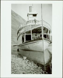
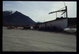
Photograph depicts the multi-level steamship "Tutshi" anchored near a rocky shoreline. Stamped annotation on verso: “Yukon Archives, Whitehorse. Print No. No. 82/378 #3; Please credit: Poirer Collection, Yukon Archives”
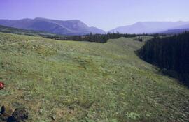
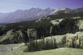
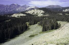
In July 2009, Dr. Paul Sanborn undertook the first soils field research at the Fort Selkirk volcanic field in central Yukon, with helicopter support and funding from the Yukon Geological Survey. This file consists of prints of aerial photographs that depict the area accessed for the study, upstream from the confluence of the Yukon River and the Pelly River.
Air photographs include:
Flight line A17210, Photo Nos. 54-60 (taken 1960)
Flight line A22354, Photo Nos. 43-45, 47-48 (taken 1971)
Flight line A27516, Photo Nos. 48-52 (taken 1989)
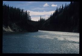
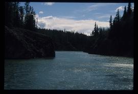
Image depicts a river in the Miles Canyon near Whitehorse Y.T.
Image depicts a river in the Miles Canyon near Whitehorse Y.T.
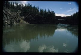
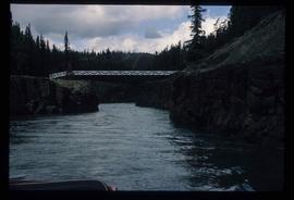
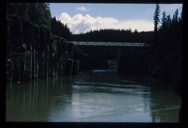
Image depicts a river in the Miles Canyon near Whitehorse Y.T. The Robert Lowe Bridge, built in 1922, can be seen over the canyon.
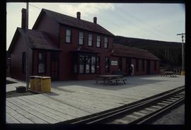
Image depicts the train station in Carcross, Y.T.
Image depicts the river which runs through Miles Canyon, located near Whitehorse Y.T.
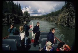
Image depicts several unidentified individuals on a boat in the Miles Canyon near Whitehorse Y.T.
Image depicts the Robert Lowe Bridge, built in 1922, in the Miles Canyon near Whitehorse Y.T.
File contains slides depicting locations along the White Pass railway through Alaska, British Columbia, and the Yukon Territories.
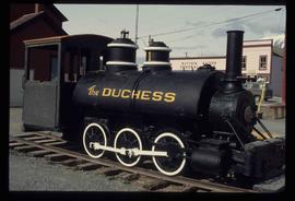
Image depicts the Duchess engine, which was built in 1878 and taken out of service in 1919. It was part of a matched set with the Duke and is now a tourist attraction in Carcross, Y.T.
Image depicts a small section of the Alaska Highway somewhere near Whitehorse, Y.T. The slide also appears to be labelled "army washing" for unknown reasons.
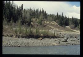
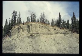
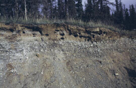
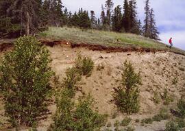
Image depicts what appears to be an eroding rock face. The slide itself is labelled "ash loger at top" for unknown reasons. Possibly located somewhere near Whitehorse, Y.T.
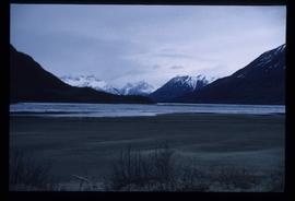
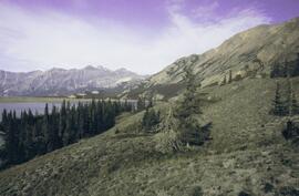
Image depicts Bennett Lake near Carcross, Y.T.
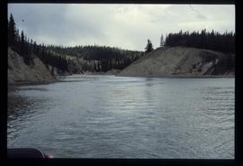
Image depicts a river at an uncertain location, but possibly in Miles Canyon near Whitehorse, Y.T.
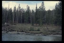
Image depicts numerous trees on the bank of a river, possibly in Miles Canyon near Whitehorse, Y.T. The slide is labelled "canyon city."
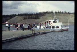
Image depicts numerous unidentified individuals getting off a boat which bears the name "Schwatka." It is located somewhere in Miles Canyon.
Image depicts the Robert Lowe Bridge, built in 1922, in the Miles Canyon near Whitehorse Y.T.
Image depicts half of a ship, which is named the Tutshi, in Carcross, Y.T.
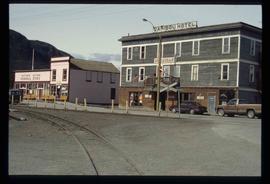
Image depicts the Caribou Hotel and the Matthew Watson General Store in Carcross, Y.T.
This file contains the following photographs in both print photograph and negative format:
Slims River delta
Date: August 11, 2003
(location not recorded)
Print roll 5, #1-3 (Corresponding slides: Slides roll 3, #15-14)
Grizzly bear
Date: August 12, 2003
(beside Cultus Bay Rd.; location not recorded)
Print roll 5, #6-7
Y03-08 (Cultus Bay Rd. – at top of switchbacks)
Date: August 12, 2003
Location Coordinates: 61° 3’ 43.1” N, 138° 21’ 4.0” W, 833.8 m asl (± 5.1 m)
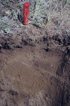
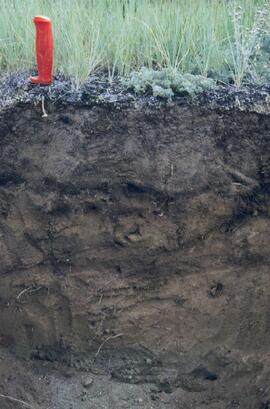
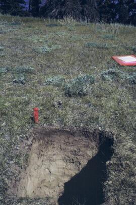
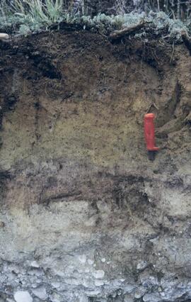
Site Description: good exposure of loess (35 cm) with Slims Soil over glaciofluvial terrace – pinches out downslope [note: this site was sampled because of development of buried paleosol, and was not part of biological crust study by Marsh et al. (2006)]
Sample Depths & Descriptions:
- Y03-08-01 - 45-48 cm - Ahkb (7.5YR 3/3 d; strongly effervescent)
- Y03-08-02 - 48-56 cm - Bmkb (7.5YR 4/3 d; strongly effervescent)
- Y03-08-03 - 56-70 cm - Ccab (2.5Y 5/2 d; strongly effervescent)
- (not sampled) - 70 cm+ - IICca (glaciofluvial; strongly effervescent)
- Intact sample: 56-36 cm - depth (including Slims Soil)
Print roll 5, #8-10, 17-18 (Corresponding slides: Slides roll 3, #13-11, 5-4)
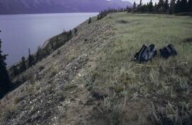
Y03-09 (cliff top on E. shore of Kluane L. at Christmas Bay)
Date: August 12, 2003
Location Coordinates: 61° 4’ 0.0” N, 138° 22’ 35.3” W, 828.3 m asl (± 7.3 m)
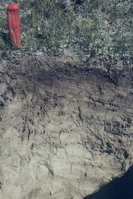
Site Description: ~ 60 cm loess over glaciofluvial gravels
Sample Depths & Descriptions:
- Y03-09-01 - Nostoc crust
- Y03-09-02 - Tortula ruralis – Cetraria crust
- Y03-09-03 - 0-14 cm - ACk (10YR 3\2 d)
- Y03-09-04 - 14-16 cm - Ahkb1 (10YR 2/2 d)
- Y03-09-05 - 16-18 cm - Ck1 (10YR 4/3 d)
- Y03-09-06 - 18-20 cm - Ahkb2 (10YR 3/2 d; discontinuous)
- Y03-09-07 - 20-27 cm - Bmkb1 (10YR 4/3 d)
- Y03-09-08 - 27-33 cm - Bmkb2 (7.5YR 4/3 d)
- Y03-09-09 - 33-46 cm - Bmkb3 (10YR 4/3 d)
- Y03-09-10 - 46-55 cm - Ck2 (2.5Y 5/3 d)
- (not sampled) - 55-60 cm+ - IICk (glaciofluvial gravels)
Print roll 5, #11-15 (Corresponding slides: Slide roll 3, #10-6)
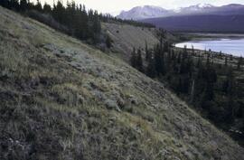
Y03-10 (shore bluff N. of Silver City)
Date: August 12, 2003
Location Coordinates: 61° 2’ 55.0” N, 138° 23’ 17.2” W, 806.7 m asl (± 7.3 m)
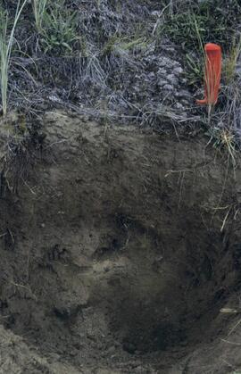
Site Description: 70% slope, SW aspect; vegetation: Elymus, Carex, Artemisia, Erigeron
Sample Depths & Descriptions:
- Y03-10-01 - Crust
- Y03-10-02 - 0-18 cm - ACk (10YR 4/2 m; strongly effervescent)
- Y03-10-03 - 18-25 cm - Ahkb(?) (10YR 4/2 m; strongly effervescent)
- Y03-10-04 - 25-40 cm - Ck (2.5Y 5/2.5 m; strongly effervescent)
- (not sampled) - 40 cm+ - IICk (glaciofluvial gravels; strongly effervescent)
Print roll 5, #19-22 (Corresponding slides: Slide roll 3, #3-1)
Silver City ghost town (location not recorded)
Date: August 12, 2003
Print roll 5, #23-24
Y03-11 (Silver City road section)
Date: August 12, 2003
Location Coordinates: 61° 2’ 3.6” N, 138° 22’ 48.8” W, 806.7 m asl (± 8.7 m)
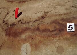
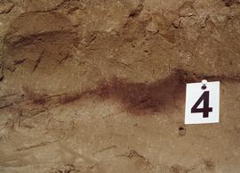
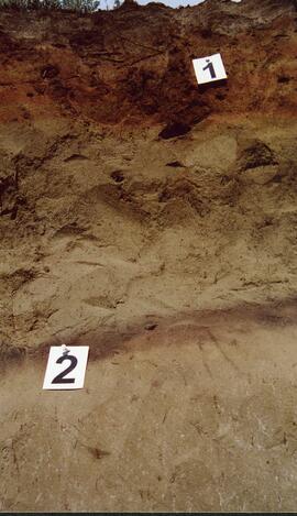
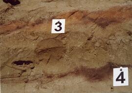
Site Description: roadcut through SW-facing hill exposes loess over glaciofluvial gravel, with 4 paleosols in colluviated loess
Sample Depths & Descriptions:
- Y03-11-01 - 0-18 cm - ACk (fresh loess)
- Y03-11-02 - 18-47 cm - Soil 1 – Bmk
- Y03-11-03 - 47-100 cm - Loess
- Y03-11-04 - 100-110 cm - Soil 2 – includes charcoal
- Y03-11-05 - 110-160 cm - Loess with secondary carbonate in root channel
- Y03-11-06 - 160-170 cm - Soil 3 – Ahk with charcoal
- Y03-11-07 - 160-170 cm - Soil 3 – Bmk
- Y03-11-08 - 170-198 cm - Loess with secondary carbonate in root channel
- Y03-11-09 - 198-202 cm - Soil 4 – Ahk – laterally continuous for ~ 1.5 m
- Y03-11-10 - 202-230 cm - Loess with secondary carbonates in roots
- Y03-11-11 - 230-255 cm - Soil 5 – Ahk – includes abundant charcoal bands
- Y03-11-12 - 230-255 cm - Soil 5 – Bmk – infilled squirrel burrows immediately below
- Y03-11-13 - 255-300 cm+ - Loess
Additional notes on modern soil & paleosols:
Soil 1 - consists of Bmk horizon material with 2 distinct colours: 7.5YR 4/3 d & 10YR 4/3 d
- loess between Soils 1 & 3 is sandier
Soil 2 - 90% Ahk material, 2-10 cm thick
- Ahk – 10YR 3/2 d
- Bmk – 7.5YR 4/2 d
- less abundant carbonate than in paleosols & loess below
Soil 3 - most of exposure has Ahk (2-5 cm thick) over Bmk (4-10 cm thick), with carbonates as for Soil 5
Soil 4 - mostly Ahk (10YR 3/2 d) material 2-8 cm thick, some Bmk (10YR 4/2 d) < 2 cm thick, with carbonates as for Soil 5
Soil 5 - complex intermixing of Ahk & Bmk material, charcoal most abundant in Ahk
- individual colour bands 2-10 cm thick
- overall dip of horizons (10° to W) is parallel to surface
- similar size & density of secondary carbonates as in loess above & below; associated with root channels, < 5 mm diameter, covering ~ 5% of surface
Print roll 5, #26-30 (Corresponding slides: Slide roll 4, #36-32)
Slide roll contains the following photographs:
Y03-06
Date: August 10, 2003
Location Coordinates: 61° 4’ 1.5” N, 138° 21’ 57.4” W, 825.3 m asl (± 9.5 m)
Site Description: top of slope, E aspect
Sample Depths & Descriptions:
- Y03-06-01 - Crust
- Y03-06-02 - 0-6 cm - Ahk (10YR 3/2 m; strongly effervescent)
- Y03-06-03 - 6-14 cm - Bmk (2.5Y 3/3 m; strongly effervescent)
- Y03-06-04 - 14 cm+ - IICk (strongly effervescent)
Slide roll 3 #36-35 (corresponding prints and negatives: Print roll 4, #1-2)
Y03-07 (peninsula near Kluane visitor centre, Sheep Mt.)
Date: August 11, 2003
Location Coordinates: 61° 1’ 42.8” N, 138° 29’ 36.2” W, 786.7 m asl (± 5.7 m)
Site Description:
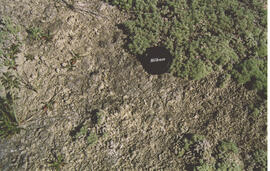
- recent (?) landslide with loess accumulation in pockets, thinner on boulder surfaces, dominated by dark cyanobacteria crusts
- limited loess accumulation due to exposure of site
- crust is calcareous at surface
Sample Depths & Descriptions: - Y03-07-01 - Crust
- Y03-07-02 - 0-6 cm - Ck
- Y03-07-03 - 6-9 cm - Ahkb
- Y03-07-03 - 9 cm+ - Rock
Slide roll 3 #34-30 (corresponding prints and negatives: Print roll 4, #3-10)
Lower Slims River (lookout knoll at parking lot N of visitor centre)
Date: August 11, 2003
Location Coordinates: 60° 59’ 56.4” N, 138° 33’ 36.4” W, 844.8 m asl (± 7.3 m)
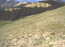
Site Description: some fire disturbance, but lower slopes have more intact crusts on loess (calcareous to surface)
Slide roll 3 #29-26 (corresponding prints and negatives: Print roll 4, #11-17)
Lower Slims R (lowest bench below lookout knoll)
Date: August 11, 2003
Location Coordinates: 60° 59’ 51.8” N, 138° 33’ 36.2” W, 814.3 m asl (± 7.9 m)
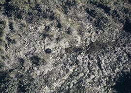
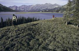
Site Description: not burned; good intact crust; vegetation: A. frigida, Calamogrostis purpurea, Erigeron caespitosus, Linnaea, Carex filifolia (sparse cover ~ 50%)
Slide roll 3, #25-23 (corresponding prints and negatives: Print roll 4, #18-20)
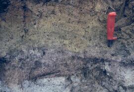
Slims Soil
(Holocene paleosol with well-developed B horizon under Neoglacial calcareous loess – location not recorded, but likely from roadcut exposure along main Slims R trail)
Slides roll 3, #22 (corresponding prints and negatives: Print roll 4, #21)
Lower end of Sheep Creek
Date: August 11, 2003
Misc. views of grassland vegetation and landscape (locations not recorded)
Slides roll 3, #21-18 (corresponding prints and negatives: Print roll 4, #26-33)
Overlook at lower end of Sheep Creek canyon
Date: August 11, 2003
Location Coordinates: 60° 59’ 42.2” N, 138° 34’ 38.1” W, 878.0 m asl (± 9.5 m)
Site Description: heavy use by sheep (abundant droppings) but still has ~ 50% crust coverage
Slides roll 3, #17-16 (corresponding prints and negatives: Print roll 4, #34-35)
Slims River delta
Date: August 11, 2003
(location not recorded)
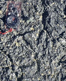
Slides roll 3, #15-14: salt efflorescences (corresponding prints and negatives: Print roll 5, #1-3)
Y03-08 (Cultus Bay Rd. – at top of switchbacks)
Date: August 12, 2003
Location Coordinates: 61° 3’ 43.1” N, 138° 21’ 4.0” W, 833.8 m asl (± 5.1 m)
Site Description: good exposure of loess (35 cm) with Slims Soil over glaciofluvial terrace – pinches out downslope [note: this site was sampled because of development of buried paleosol, and was not part of biological crust study by Marsh et al. (2006)]
Sample Depths & Descriptions:
- Y03-08-01 - 45-48 cm - Ahkb (7.5YR 3/3 d; strongly effervescent)
- Y03-08-02 - 48-56 cm - Bmkb (7.5YR 4/3 d; strongly effervescent)
- Y03-08-03 - 56-70 cm - Ccab (2.5Y 5/2 d; strongly effervescent)
- (not sampled) - 70 cm+ - IICca (glaciofluvial; strongly effervescent)
- Intact sample: 56-36 cm - depth (including Slims Soil)
Slides roll 3, #13-11, 5-4 (corresponding prints and negatives: Print roll 5, #8-10, 17-18)
Y03-09 (cliff top on E. shore of Kluane L. at Christmas Bay)
Date: August 12, 2003
Location Coordinates: 61° 4’ 0.0” N, 138° 22’ 35.3” W, 828.3 m asl (± 7.3 m)
Site Description: ~ 60 cm loess over glaciofluvial gravels
Sample Depths & Descriptions:
- Y03-09-01 - Nostoc crust
- Y03-09-02 - Tortula ruralis – Cetraria crust
- Y03-09-03 - 0-14 cm - ACk (10YR 3\2 d)
- Y03-09-04 - 14-16 cm - Ahkb1 (10YR 2/2 d)
- Y03-09-05 - 16-18 cm - Ck1 (10YR 4/3 d)
- Y03-09-06 - 18-20 cm - Ahkb2 (10YR 3/2 d; discontinuous)
- Y03-09-07 - 20-27 cm - Bmkb1 (10YR 4/3 d)
- Y03-09-08 - 27-33 cm - Bmkb2 (7.5YR 4/3 d)
- Y03-09-09 - 33-46 cm - Bmkb3 (10YR 4/3 d)
- Y03-09-10 - 46-55 cm - Ck2 (2.5Y 5/3 d)
- (not sampled) - 55-60 cm+ - IICk (glaciofluvial gravels)
Slide roll 3, #10-6 (corresponding prints and negatives: Print roll 5, #11-15)
Y03-10 (shore bluff N. of Silver City)
Date: August 12, 2003
Location Coordinates: 61° 2’ 55.0” N, 138° 23’ 17.2” W, 806.7 m asl (± 7.3 m)
Site Description: 70% slope, SW aspect; vegetation: Elymus, Carex, Artemisia, Erigeron
Sample Depths & Descriptions:
- Y03-10-01 - Crust
- Y03-10-02 - 0-18 cm - ACk (10YR 4/2 m; strongly effervescent)
- Y03-10-03 - 18-25 cm - Ahkb(?) (10YR 4/2 m; strongly effervescent)
- Y03-10-04 - 25-40 cm - Ck (2.5Y 5/2.5 m; strongly effervescent)
- (not sampled) - 40 cm+ - IICk (glaciofluvial gravels; strongly effervescent)
Slide roll 3, #3-1 (corresponding prints and negatives: Print roll 5, #19-22)
