2008.2.048
·
Item
·
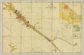
1919
Part of NBCA Maps and Plans Collection
Map depicting surveyed lands, statutory timber lands, land recording divisions, game reserves, communities, bodies of water, and transport routes. Includes inset of McBride townsite.