2008.2.1.02
·
Item
·
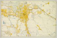
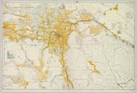
1916
Parte de Northern BC Cartographic Collection
Colour-coded map depicting lands open for pre-emption, lands in “University Reserve,” and lands reserved for public auction. Depicts land recording divisions, communities, bodies of water, transport routes, and game reserves.