Map depicts British Columbia in its entirety as-well as smaller subsequent maps of Vancouver, Victoria and Vicinity, Prince George, Kamloops, Nelson, and Vancouver Island.
Map depicts annotations of the freight-way routes throughout British Columbia. These routes include: the Garnet Enterprise Truck Haul from Vancouver to Terrace, the Canadian Freightways from Vancouver to Edmonton to Alaska; the Lindsay Transfer from Terrace to Dease Lake and Telegraph Creek; and the Northland Navigation roll-on and roll-off service.
Map depicts the city of Vancouver, including the electoral districts of Comox-Powell River, Capilano, North Vancouver-Burnaby, Mission-Port Moody, Burnaby, Fraser Valley West, New Westminster-Coquitlam, Surrey-White Rock-North Delta, Richmond-South Delta, Vancouver South, Vancouver Kingsway, Vancouver Quadra, Vancouver Centre, and Vancouver East.
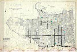
This municipal map of the City of Vancouver from 1987 shows street names and street widening information.
Map depicts the city of Vancouver and its railways.
