Fonds consists of ledgers recording accounts and maintenance notes of the S. B. Trick Lumber Co. and one photograph of the Ambrose Trick Sawmill.
S. B. Trick Lumber Co.Series consists of one black and white photograph of S. B. Trick Lumber Company Sawmill.
Fonds consists of records Harry Coates created or received and retained during his career as a BC Forest Service Research Technician and into his retirement as a Sustainable Forest Management activist. Fonds includes materials from his work at the Aleza Lake Research Forest.
Coates, HarryFile consists of 35 photographs of trees, cleared forest land, experimental plots sites, plantations, equipment, and one photograph of Harry Coates.
- 8 photos in folder "FES [Forest Experiment Station] [Stem?] Mapping"; photos include pictures of the Aleza Lake Research Forest Sign, trees, 3 photos from CP 410 Oct. 1992, and photo of Aleza Lake E loop [trail?] 1992
- Black and white photo of a young Harry Coates
- 5 photos in folder "SHEEP July 1990" include 2 photos of cleared land (back of each photo reads "Sheep penny?") and 3 photos of a an unknown piece of forestry equipment
- 8 photos in folder "Fire" of various locations of fire damaged forests in 1992
- 13 photos in "More Planting" envelope; photos include 1 from Red Rock plantation in 1971; 2 from Cedar Plot in Valemont in Fall 1992; 2 from Cedar Goat R[oad] Fall 1992; 2 from [Compan Plantation?], Spittal Creek Fall 1992; Douglas Fir, Valemount - Cedar [Creal?]; Spaced Aspen Spittal Creek Fall 1992; 2 Cedar Plot, Spittal Creek, Fall 1992; Whit Pine Spittal Creek Fall 1992; Buckhorn B. Spruce 1978.
File consists of 26 photographs including: 10 images of Aleza Lake Research Forest aerial photos; 4 images of packed cones from Red Rock to Duncan 1970; 11 black and white forestry photographs; photo of J. Revel.
File consists of 19 photographs depicting Harry Coates, experiments, landscapes, and air photos, including:
- Photo pf Harry Coates ca. 1958 at Aleza lake Experiment Station
- Photo of Lloyd Brothers at Cluculz Lake, Gordon Talbot
- 3 photos: including a photo of pine trees, a photo of Harry Coates with a damaged tree, and a photo of a damaged pine
- 1 photo of a young man in safety gear sitting in the back of a parked pickup struck, holding circular saw and smiling at the camera
- 3 photos of cleared forest in the winter
- 2 photos from EP 442 Wansa Lake, P. 60, 61 and 70
- 3 photos of Fire Study June 1984
- 1 photo of EP 657.03 Squirral Damage, June 1984
- 1 photo EP 868.07 McBride May 1984
- 3 photos of Bobtail Demo 660 in 1992, EP 657.03.
Series consists of photographs created or accumulated by the Aleza Lake Research Forest Society.
Photographs are panoramas taken from the Churchill BC Forest Service Lookout, located at latitude 54°04' and longitude 122°16'. The photographs were bound together and include a transparent grid that was intended to be used for locating forest fires.
File consists of 17 slides of Aleza Lake Research Forest.
File consists of a licence and framed certificates and photographs for Harry Coates. File includes:
- Scaling Licence (1962)
- two certificates celebrating Harry Coates' 25 years of service with the Forest Service (1982)
- photograph of Harry Coates, [Ted or Jed?] Baker, and John Revel at Aleza Lake Research Forest Re-opening July 9, 1992.
- Photograph of Harry Coates and John Revel, identifying plaque reads "Buckhorn Lake E.P. 660".
Slide depicts a black bear eating garbage by wooden outbuildings, possibly at the Aleza Lake Experiment Station.
Slide depicts a detonation in an area of cleared ground in a forested area, likely the Aleza Lake Experiment Station. Work may have been undertaken for roadbuilding activities at the Experiment Station.
Slide depicts a cleared area at the Aleza Lake Experiment Station with plant regeneration.
File consists of slides depicting the Aleza Lake Research Forest and area taken by John Revel.
Slide depicts a heavily forested area with fallen logs, likely at the Aleza Lake Experiment Station.
Slide depicts the original wooden BC Forest Service sign for the Aleza Lake Forest Experiment Station.
Slide depicts a burning building at the Aleza Lake Experiment Station on the date it was shut down by the BC Forest Service.
Slide depicts a view of what is possibly the Upper Fraser River.
Slide depicts the Ranger Station at the Aleza Lake Experiment Station.
Slide depicts a man operating heavy equipment in a forest, likely at the Aleza Lake Experiment Station.
Slide depicts a sawmill in operation, likely located in the Upper Fraser area, with a pile of burning wood products and a beehive burner.
Slide depicts a bulldozer clearing ground, likely at the Aleza Lake Experiment Station.
Slide depicts a cleared area in a forest, likely at the Aleza Lake Experiment Station.
Slide depicts cleared ground and felled trees in a forested area, likely at the Aleza Lake Experiment Station.
File contains slides depicting places along the east line of the BC Railway.
Subseries consists of material collected by Kent Sedgwick for research regarding the communities along the East Line of the Grand Trunk Pacific Railway in Central British Columbia, particularly between Prince George and McBride. These communities and locations include, among others, Shelley, Willow River, Sinclair Mills, Longworth, Dunster, Tete Jaune, Valemount, Mount Robson, and the Yellowhead Pass. Research on these communities was conducted during Kent Sedgwick's involvement in the UNBC-led Upper Fraser Historical Geography Project. The files primarily consist of research notes, audio and transcripts of oral interviews, and photographs of the East Line communities.
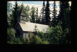
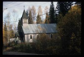
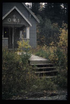
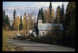
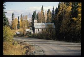
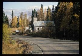
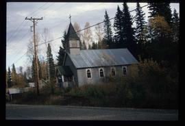
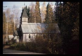
Image depicts the Oblates of Mary Immaculate Catholic Church in Aleza Lake, B.C. Map coordinates 54°07'08.2"N 122°02'00.0"W
Image depicts the Oblates of Mary Immaculate Catholic Church in Aleza Lake, B.C. Map coordinates 54°07'08.2"N 122°02'00.0"W
Image depicts the Oblates of Mary Immaculate Catholic Church in Aleza Lake, B.C. Map coordinates 54°07'08.2"N 122°02'00.0"W
Image depicts the Oblates of Mary Immaculate Catholic Church in Aleza Lake, B.C. Map coordinates 54°07'08.2"N 122°02'00.0"W
Image depicts the Oblates of Mary Immaculate Catholic Church in Aleza Lake, B.C. Map coordinates 54°07'08.2"N 122°02'00.0"W
Image depicts the Oblates of Mary Immaculate Catholic Church in Aleza Lake, B.C. Map coordinates 54°07'08.2"N 122°02'00.0"W
Image depicts the Oblates of Mary Immaculate Catholic Church in Aleza Lake, B.C. Map coordinates 54°07'08.2"N 122°02'00.0"W
Image depicts the Oblates of Mary Immaculate Catholic Church in Aleza Lake, B.C. Map coordinates 54°07'08.2"N 122°02'00.0"W
Image depicts the Oblates of Mary Immaculate Catholic Church in Aleza Lake, B.C. Map coordinates 54°07'08.2"N 122°02'00.0"W
File consists of slides depicting the Aleza Lake Research Forest and area taken by Michael Jull.
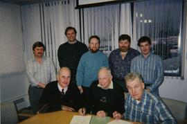
File consists of a photograph commemorating the signing of the first Aleza Lake Research Forest Management Plan. Front row, left to right: Ken Pendergast, BC Forest Service Prince George District Manager; Harry Coates, BCFS Forest Research Technician (1957-1993); John Revel, BCFS Silviculture Forester (1960-1993). Back row, left to right: Mike [?], BCFS Prince George Silviculture Manager; Henry Benskin, BCFS Research Branch; Michael Jull, BCFS Research Silviculturist, Prince George Region; Dan Lousier, BCFS Prince George Region Research Section Head; Brian Harding, Northwood Pulp & Timber Ltd. Woodlands Manager.
Photograph depicts Harry Coates, Ted Baker, and John Revel at Aleza Lake Research Forest re-opening ceremony on July 9, 1992.
Aerial photograph depicts a view overlooking the Georges farm. Note on back stated that this photograph was presented in a frame to the Georges in 2008.


