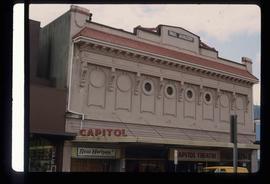
Image depicts an old theatre owned by Paul Aivazoff in Prince Rupert, B.C. It opened in 1935 and was closed in 1981; it has since been renovated for retail use.
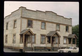
Image depicts a condominium, possibly in Prince Rupert, B.C.
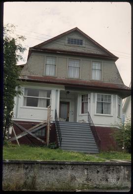
Image depicts a house which is possibly in Prince Rupert, B.C.
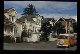
Image depicts a row of houses; it is possibly in Prince Rupert, B.C.
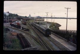
Image depicts the rail yards in Prince Rupert.
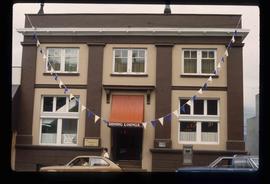
Image depicts an old building with a sign labelling it as a "Dining Lounge," it is possibly in Prince Rupert, B.C.
The Archdeacon W.H. Collison fonds consists of textual materials, maps, published materials and photographs all documenting Collison’s life and work with North Coastal First Nations communities in British Columbia. Types of records found within this fonds include manuscripts, sermon notes, correspondence, oral history summaries, monographs, cartographic items, photographs and postcards. The Collison fonds also includes some records created by his children and grandchildren as well as a family tree created in 1986. The Collison fonds has been divided into four series.
Zonder titelSeries consists of journals, draft manuscripts, correspondence, CMS documents and orders, speeches, sermons all written by or to Archdeacon W. H. Collison. Series also contains correspondence to W.E. Collison and Joyce Collison, genealogical information on the Collison family, newspaper clippings and a school paper written by Archdeacon Collison's grandaughter Katy.
Series consists of images pertaining the Collison family, North Coastal First Nations communities, means of transportation along North Coastal British Columbia, and various church structures and religious events.
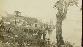
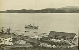
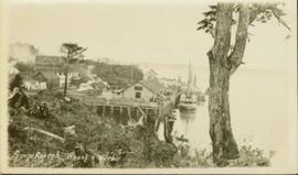
Photograph of the Prince Rupert wharf. A small vessel is docked, and a large tree is in the foreground. Annotation on recto reads: "Prince Rupert Wharf & Harbor. Allen Photo." Handwritten annotation on verso reads: "766[?]"
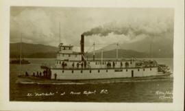
Photograph of the SS "Distributor" in the open water, with another vessel and mountains in the background. Several passengers and/or crew are visible on deck. Annotation on recto reads: "SS 'Distributor' at Prince Rupert, BC Allen Photo 5/June/0[?]."
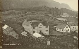
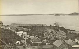
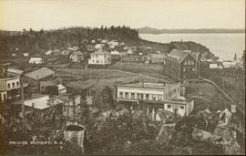
Close up photograph of a large residential building in a freshly clear cut area. To the right of the main building is the church and an unidentified commercial building. Annotation on recto reads: "Prince Rupert, BC 1660."
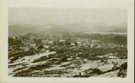
Wide angle photograph of Prince Rupert sometime during the winter. There is snow on the ground and a marge mountain range is visible in the background. Annotation on recto reads: "Prince Rupert looking East from Waterworks J.D.A Pho 5/2."
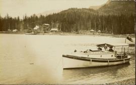
Archdeacon W.H. Collison and an unidentified man on the "Dawn," Collison's boat. Forested hills and several buildings are visible in the background. Handwritten annotation on verso reads: "The 'Dawn' Archdeacon Collison's boat."
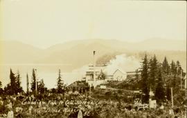
Photograph of a factory on the shoreline amidst a forested area. The factory is emitting steam or smoke and has a white exterior. Annotation on recto reads "Canadian Fish & Cold Storage Co. Prince Rupert BC."
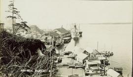
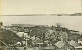
Photo of the Prince Rupert harbour. Many buildings are visible along the shoreline. Annotation on recto reads: "Harbour, Prince Rupert BC. 1658." Handwritten annotation on verso reads: "Early Prince Rupert. Good view of Metlakatla Passage in distance- showery[?] Wolf Island."
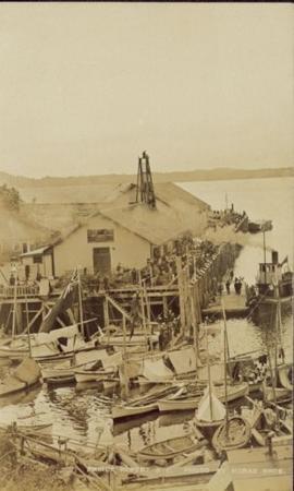
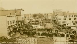
Large crowd is gathered around main building in a harbor. Many boats visible in foreground. Smoke from tugboat partially obscures the scene. Annotation on recto reads: "Prince Rupert BC. Photo by MCrae Bros."
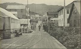
Photograph of residents in motion on Centre Street in Prince Rupert. Buildings are visible on either side of the street and a railway track runs down the length of the road. Annotation on recto reads: "Centre Street, Prince Rupert, BC. 1664."
Photograph of the Prince Rupert wharf. Many vessels are docked next to small buildings along the water. Annotation on recto reads: "Prince Rupert BC."
Photograph of a small vessel on the ocean with a dock and harbour buildings in the foreground. Tents and piles of lumber can be seen among the buildings. Annotation on recto reads: "The Wharf, Prince Rupert, BC. 1657." Printed annotation on verso reads "The Wharf, Prince Rupert, BC J. Howard A. Chapman, Victoria. BC. 1657."
Wide angle photograph of many buildings scattered in a clear cut area. Foreground shows several businesses, including "Kelly Carruther's Supply" and "Prince Rupert Hardware and Supply Co." Some remaining forest is visible in the background. Annotation on recto reads: "Prince Rupert, BC 1659."
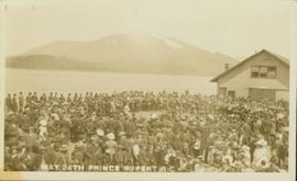
Photograph of large crowd spanning the frame of the photograph. A large marching band is visible along the edges of a small clearing in the centre. Annotation on recto reads: "May 24th Prince Rupert BC."
Photo of the Prince Rupert harbour. Many buildings are visible along the shoreline. Annotation on recto reads: "Harbour, Prince Rupert, BC. 1658."
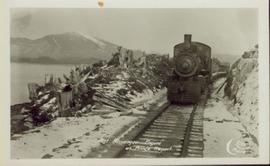
Head on shot of steam engine traveling through a pass with mountains in the background. Handwritten annotation in pen on verso reads: "First Passenger Engine to reach Prince Rupert." Annotation on recto reads: "First Passenger Engine at Prince Rupert." Photographer' stamp in bottom right corner of recto reads : "Allen Photo."
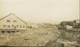
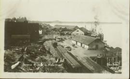
Several large buildings on a rocky shore. Wood piles and a crane are visible in the background. Annotation on recto reads: "Prince Rupert BC"
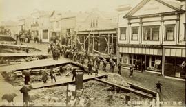
Photograph of a marching band performing down a wooden road. Spectators can be seen in the foreground and various businesses are in the background. Annotation on recto reads: "Prince Rupert BC."
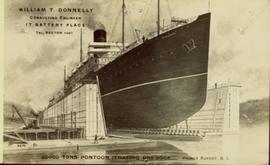
Illustration of a large ocean liner in dry dock. The name "Minnesota" is inscribed on the top right side of vessel. Annotation on recto reads: "William T. Donnelly Consulting Engineer 17 Battery Place Tel. Rector 1491 20000 tons pontoon floating dry dock Prince Rupert, BC"
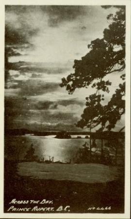
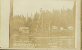
Photograph of the bay at dusk. Trees and distant machinery are silhouetted against a cloudy sky and dark waterfront. Annotation on recto reads: "Across the Bay, Prince Rupert, BC No 4466."
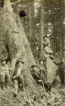
Photograph of Archdeacon WH Collison reclining against a large tree with a group of friends and family. Handwritten annotation on verso reads: "Arch. Collison with sons Max & Arthur & friends in mountains above Portland [?] Canal Me."
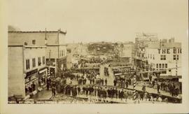
Photograph of a small marching band parading down Second Avenue in Prince Rupert. A large crowd is gathered. Annotation on recto reads: "Photo by MacRae Bros Prince Rupert BC 2nd Ave Prince Rupert BC."
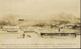
Photo of entire ship building plant, including several vessels in the foreground. Hills are visible in the background. Annotation on recto reads: "Prince Rupert Ship Repair and Ship Building Plant. Prince Rupert BC. Frank E Kirby, William T Donnelly, Engineers. 17 Battery Place. NYC."
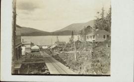
View of the road descending to the waterfront. Buildings and forested area are visible on either side of street. Mountains clear in the background.
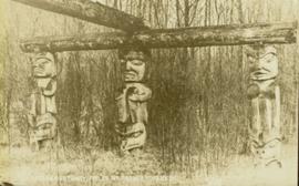
Photograph of three Tsimshian mortuary poles. Two crossed logs rest atop the three poles. Annotation on recto reads: "Indian Mortuary Poles Nr Prince Rupert BC McRae Bros."
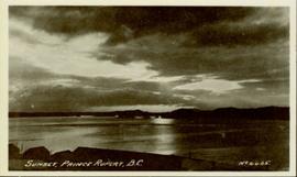
Wide angled photograph of a sunset on the waterfront in Prince Rupert. Several buildings are silhouetted in the foreground. Annotation on recto: "Sunset, Prince Rupert, BC No. 4465."
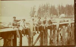
Members of the Collison family casually fishing from a large dock. Handwritten annotation on verso reads: "Collison family fishing from dock (Portland[?] Canal) {Max Elsie Henry Will Arthur Herbert}."
Photograph of several floats parading down Second Avenue in Prince Rupert. A large crowd is gathered. Annotation on recto reads: "Photo by MacRae Bros Prince Rupert BC Prince Rupert B."
Photograph of the Prince Rupert wharf. A small vessel is docked, and a large tree is in the foreground. Annotation on recto reads: "Prince Rupert Wharf & Harbor. Allen Photo."
The Prince George Railway & Forestry Museum Society Collection consists primarily of textual, photographic, and cartographic records related to the regional developments of the railway industry in Northern BC. A predominant portion of the collection is made up of material from the Canadian National Railway; other railways represented include the Pacific Great Eastern Railway, the British Columbia Railway (BC Rail), the Grand Trunk Pacific Railway, the Grand Trunk Railway, the Intercolonial Railway, and the Okanagan Express. Significant geographical areas covered include Prince George, the Peace River Region, Terrace, Bulkley Valley, Hazelton and Prince Rupert.
The forestry industry is represented in the collection with operational and financial records from Fyfe Lake Sawmill Ltd., which operated southwest of Prince George in the 1950s.
The collection has been organized into series according to creator, each of which also has been arranged to subseries, file and item level, where applicable. This collection consists of eight series, as follows:
1) Canadian National Railway
2) Grand Trunk Railway
3) Pacific Great Eastern Railway
4) British Columbia Railway (BC Rail)
5) Canadian Pacific Railway (CPR)
6) Intercolonial Railway
7) Fyfe Lake Sawmill ltd.
8) PGRFM
9) Photographs
Photographs within this file pertain to modes of transportation and transportation routes (including construction, surveying and traveling).
Consists of 165 black and white photographs depicting Northwest Coast communities including Bella Bella, Rivers Inlet, Port Simpson, and Prince Rupert between approximately 1900 and 1920. Also includes postcard images of ships and boats on the North Coast belonging to the Large family, from Reverend Large's son Dr. R.G. Large. Also includes 39 colour slides ca. 1960 of ship scenes and weather balloon launches from the Dr. R.G. Large family.
Zonder titelThis photograph album consists of photographs, membership cards and correspondence of Herbert F. Glassey. Subjects identified in this album include: automobiles, landscape vistas, hunting scenes, snowshoeing, dog sledding, provincial government offices and waterscapes. Identified geographic locations include: Nesutlane Trading Post, Atlin, Teslin Lake, Atlin Lake, McKee Creek, Taku Glacier and Otter Creek. The following of Mr. Glassey’s membership cards are also included within this album: “White Pass & Yukon Route, No. 308: Government Agent, Atlin account, 1939-1940”; “White Pass & Yukon Route, No. 283: Government Agent account, 1941-1942”; “Registration Certificate, 1940”; “The Wartime Prices and Trade Board, no.1305, 1942”; “Dominion Bureau of Statistics, no.252”; “The Society of Notaries Public Membership Card, 1956”; and “Prince Rupert Liberal Association, 1953”.
Zonder titelA collection of postcard photographs of Port Essington BC, Port Simpson BC, Atlin, Quesnel, McBride, Hagwilget Village, Giscome, Likely, Kitwanga, Smithers, Prince Rupert BC, Prince (Fort) George BC Images depict street scenes, water scenes, community events, businesses, buildings, and aerials of the towns. Collection also depicts a number of Northern BC paddle wheelers.
Photograph of a train traveling through Prince Rupert. Several people are gathered on the dock and around various buildings. Two small vessels are docked in the harbour. Annotation on recto reads: "Prince Rupert, Waterfront. Allen Photo May '4."
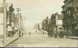
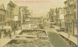
Street scene depicting people, boardwalks, horse & wagons, and delivery truck. Printed annotation on recto reads: “3rd Ave. Prince Rupert. B.C.”
Typed annotation in red ink on recto reads: “3rd Ave. Prince Rupert. B.C.” People, boardwalks, horse & wagons and store signs are visible. Rubble and unknown material lies on ground between boardwalks. Typed annotation in red ink on recto reads: “3rd Ave. Prince Rupert. B.C.”
The collection consists of 9 photographs and copies of photographs showing scenes of Prince Rupert and area, groups of townspeople, a stone totem pole at Metlakatla, and a man poling a dug-out canoe probably on the Skeena River. It includes two newspaper clippings, one from the BC Saturday Sunset dated September 14, 1912 and another from The Globe dated Saturday March 23, 1907. The bound volumes of the Prince Rupert Empire newspaper were transferred to Special Collections. See accompanying note.
Zonder titelItem is a print of a photograph of a stone totem pole at Metakatla taken between 1906 and 1908.
Item is a print of a photograph of tents and newly cleared land in Prince Rupert taken between 1906 and 1908.
Pile driver situated on Prince Rupert shoreline. Tents and wooden buildings visible on rocky background. Printed annotations on recto of photograph read: "First pile driven at Prince Rupert BC. June 8 '06."
Series consists of nine photographs of Prince Rupert scenery, buildings, residents and surrounding area. Includes image of totem and dugout canoe.
