Showing 1022 results

Archival description
815 results with digital objects Show results with digital objects
2003.11 · Collection · 1998-2000

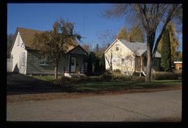
Collection consists of material resulting from Dr. Mike Evan's Island Cache Recovery Project Collection. Includes oral history interviews of former Island Cache (Cottonwood Island) residents on recording media (cassette and VHS) as well as transcripts of the oral histories. Also includes administrative records for the project and photocopies of background research material used for the project, such as Prince George city records, newspaper clippings, photographs, and correspondence.

Evans, Michael John
2001.58 · Collection · 1997-1999

Collection consists of oral histories gathered as part of Dr. Mike Evan's oral history project with the Prince George Metis Elders Society. Includes consent forms, transcripts, and the recorded oral histories on their original cassette tapes.

Evans, Michael John
2012.13.2.21.06 · File · 1973-1980
Part of J. Kent Sedgwick fonds

File consists of records created and collected by Kent Sedgwick regarding Cottonwood Island in connection with his employment with the City of Prince George Planning Department. Includes briefs, proposals, memoranda, correspondence, newspaper clippings, questionnaires, legal correspondence, meeting minutes, and photocopied excerpts from maps/plans. Also includes two polaroid photo prints depicting garbage in Cottonwood Island Park circa 1979. Highlights include:

  • Prince George Kiwanis Club, "Brief to City Council, City of Prince George, re: Nechako Riverfront Park", 12 Mar. 1973.
  • New Caledonia Institute of Environmental Studies, "Proposal for Cottonwood Island as a Park Reserve", Summer 1973.
  • "Cottonwood Island Study", [before 1975] (photocopy).
  • Mary Fallis, "Letter to the Editor of The Citizen", 5 Mar. 1976 (photocopy).
  • City of Prince George Planning Department, "Ownership, Legal and Assessment Data - Private and School District Properties within the Proposed Replot Area [Island Cache]", 11 Oct. 1978.
  • "Assessed Values for City and Crown Lands within the Proposed Replot Area North of First Ave" (handwritten table), 16 Oct. 1978.
2023.5 · Fonds · 1976-2008

Fonds consists of maps, plans, and drawings collected by faculty in the UNBC School of Planning and Sustainability. The majority of these maps reflect the planning history of the City of Prince George and include large format, hand-drawn plans created by the City Planning Department from the 1970s and 1980s. Maps from City of Prince George Official Community Plans are also included.

Maps, plans, and drawings
2023.5.1 · Series · 1976-2020
Part of UNBC School of Planning and Sustainability fonds

Series consists of maps, plans, and drawings collected by faculty in the UNBC School of Planning and Sustainability. The majority of these maps reflect the planning history of the City of Prince George and include large format, hand-drawn plans created by the City Planning Department from the 1970s and 1980s. Maps from City of Prince George Official Community Plans are also included.

Research Subject Files
2012.13.2 · Series · 1937-2011
Part of J. Kent Sedgwick fonds

Kent Sedgwick’s research subject files contain original research notes, interviews and oral histories, news clippings, and collected primary and secondary sources. The series also includes both original and reproduction photographs, audio recordings, and maps. The subject files primarily relate to the history, urban planning, and historical geography of the Central Interior of British Columbia, especially Prince George area and the East Line communities over the course of the 20th century. They also include extensive notes on geographic features, landscapes, interpretative trails, architectural history, industrial history, history of Western exploration and land survey, and the First Nations history of the region.

J. Kent Sedgwick fonds
2012.13 · Fonds · 1937-2011

This fonds consists of material created and collected by Kent Sedgwick, author, professor, Prince George urban planner, and prominent local historian. This body of records documents Sedgwick’s research interests in the history and geography of the Central Interior of British Columbia. The fonds also reflects his work as a Prince George Senior City Planner, his involvement in local community organizations, and his teaching at the College of New Caledonia and the University of Northern British Columbia.

The fonds includes:
1) Photographs taken by Kent Sedgwick across British Columbia, predominantly in the Central Interior region;
2) Research subject files consisting of original research documentation and collected reference material, predominantly focusing on topics relating to local history, city planning, and geography in the Prince George area and the British Columbia Central Interior;
3) Documentation of Kent Sedgwick’s community involvement, including records created over the course of his work with the Prince George Heritage Commission, , the Alexander Mackenzie Heritage Trail Association, and other local organizations;
4) Writings, publications, and lectures written, edited, or conducted by Kent Sedgwick;
5) Professorial records consisting of lectures and material relating to Sedgwick’s teaching appointments at the College of New Caledonia and the University of Northern British Columbia;
6) Maps collected by Kent Sedgwick covering historical and contemporary British Columbia.

Sedgwick, J. Kent
2012.13.2.11 · Subseries · 1937-2011
Part of J. Kent Sedgwick fonds

Subseries consists of materials collected by Kent Sedgwick for research on the geography and natural resources in Prince George and its region. Includes material on the natural resource industry, including the opening of the McArthur Sawmill, the W. Lamb and Sons Lumber Sawmill, and mining; photocopied aerial photographs of Prince George; the climate, temperatures, and flooding; and the geographical features of Prince George.

2012.13.2.02 · Subseries · 1941-2011
Part of J. Kent Sedgwick fonds

Subseries includes research material created and collected by Kent Sedgwick relating to land survey, development, and settlement in Prince George and British Columbia. Land surveys were conducted in British Columbia by surveyors George Dawson, the North Coast Land Company, Alfred R.C. Selwyn, and the Geological Survey of Canada during the late 19th and early 20th centuries. James C. Anderson and engineer J. Gill conducted topographical surveys for the Grand Trunk Pacific Railway on Fort George and the Indian Reserve. Surveyors and land plot companies developed the land for sale to promote settlement in the area. Also includes materials regarding the continued development of the City of Prince George throughout the 20th century. The files primarily consist of newspaper clippings, research notes, and photocopied documents.

2012.13.1.135.01.11 · Item · [between 1980 and 2000]
Part of J. Kent Sedgwick fonds

Photograph depicts a residential building at 1612 12th Avenue, the building was used as "Prince Realty". Annotation on verso: "1612 - 12th Ave., NW corner of Vancouver."

2012.13.1.135.01.05 · Item · [between 1980 and 2000]
Part of J. Kent Sedgwick fonds

Photograph depicts Rosel's restaurant at 1624 7th Avenue. Rosel's restaurant was owned and operated by Wilfred and Rosel Vogt from 1981 to 1997. The building was built in 1916 and was originally owned by Dr. Carl Ewart and later owned by Hubert King of Wilson, King and Company, the oldest law firm in Prince George, after 1946. The building is now a designated heritage building.

2012.13.1.135.01.03 · Item · [between 1980 and 2000]
Part of J. Kent Sedgwick fonds

Photograph depicts a residential building at 1601 6th Avenue, the corner of 6th Avenue and Vancouver Street. Annotation on verso: "CUTE c-7, union, Vancouver/ 6th".

2012.13.1.135.01.26 · Item · [between 1980 and 2000]
Part of J. Kent Sedgwick fonds

Photograph depicts the old post office and federal government building at 1299 3rd Avenue prior to the coat of arms removal. Annotation on verso: "fed. govt bldg, (post office), c. 1990, before, coat of arms, removal".

Businesses along 3rd Avenue
2012.13.1.135.01.24 · Item · [between 1980 and 2000]
Part of J. Kent Sedgwick fonds

Photograph depicts various businesses along 3rd Avenue. The businesses include the Europe Hotel and The Bay in the background. Annotation on verso: "left Europe Hotel, right shearer bldg".

Shearer building
2012.13.1.135.01.23 · Item · [between 1980 and 2000]
Part of J. Kent Sedgwick fonds

Photograph depicts the Shearer building in Prince George. Annotation on verso: "Shearer bldg".

2013.04.01 · File · 1958-1961
Part of Howard Foot collection

This scrapbook, entitled "My Two Year Term on the Teen Town Council", was created by Howard Foot to document his involvement in the Prince George Teen Town Council. Howard Foot was the elected "mayor" of the Prince George Teen Town Council for the 1958-1959 term. The British Columbia centennial year was 1958; Teen Town was involved in centennial event planning. The scrapbook includes newspaper clippings from the Prince George Citizen relating to Prince George Teen Town events and the Teen Town Council. These clippings include mention of other Teen Town Council members, including Brian Fawcett who later became a nationally-recognized Canadian writer.

Original photographic prints and reproduced photographs relating to Prince George Teen Town are pasted in and interleaved into the scrapbook. Also interleaved into the scrapbook is a 26 February 1959 issue of the Prince George Echo newspaper. The newspaper issue has a feature article about a Prince George custom car show organized by Howard Foot.

Foot, Howard
Family Records series
2014.6.1 · Series · 1953-2017
Part of Rustad & Dezell Family fonds

Series consists of records reflecting the activities of the Dezell and Rustad families. Series include mayoral records from Bea and Garvin Dezell when Garvin served as Mayor of Prince George. Series includes materials celebrating Bea Dezell's life created by her family. Series also includes fundraising efforts for the Northern Medical Programs Trust. Finally, series includes a collection of "spruce" dollars and commemorative coins.

1690 Dogwood Street
2012.13.1.24.32 · Item · 2000
Part of J. Kent Sedgwick fonds

Image depicts 1690 Dogwood Street, on the corner of 17th Ave and Dogwood St. in Prince George, B.C. Also depicts a portion of 1670 Dogwood Street at left.

"The Canada Chart"
2012.13.2.01.07.1 · Item · 1983
Part of J. Kent Sedgwick fonds

The Canada Chart depicts Canadian federal and provincial and government information and graphics.