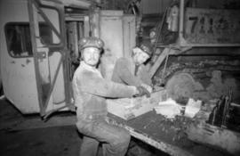
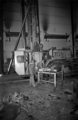
Photograph depicts two unidentified men wearing coveralls, hard hats, and headphones, while working at table in garage. Blasthole drill stands behind them in background.
Photograph depicts two unidentified men in coveralls and hard hats, working in garage. Blasthole drill stands behind them in midground, walls in background.
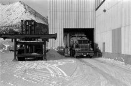
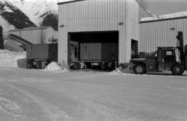
Photograph depicts large trailer truck parked at what is believed to be the loading station on the Cassiar plant (possibly in mill building).
Photograph depicts large trailer truck parked at what is believed to be the loading station on the Cassiar plant (possibly in mill building).
Photograph depicts large trailer truck parked at what is believed to be the loading station on the Cassiar plant (possibly in mill building).
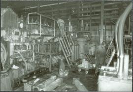
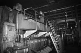
Photograph depicts Ruston Hornsby diesel engines which turned the generators in the power house on the Cassiar plant. Two unidentified men wearing coveralls can be seen in image.
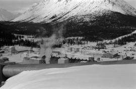
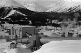
Plant buildings stand in midground. Conveyor believed to be leading to tailings pile can be seen in foreground. Valley and mountains in background.
Mill building in left midground. Conveyor believed to be leading to tailings pile can be seen in foreground. Valley and mountains in background.
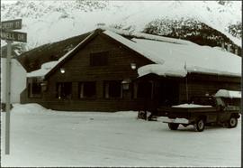
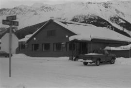
Photograph depicts the old company store located at corner of Connell Driver and Creery Street. Retail store was located under company cafeteria "the Cookery", with butcher shop in back. The Cookery was known for serving good food and providing excellent service.
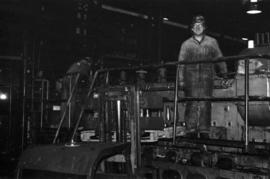
Photograph depicts two unidentified men standing on Ruston Hornsby diesel engine which turned the generators in the power house on the Cassiar plant.
Photograph depicts unidentified man standing on Ruston Hornsby diesel engine which turned the generators in the power house on the Cassiar plant.
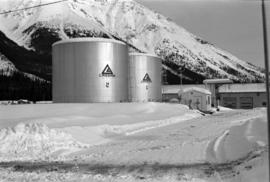
Photograph depicts two large tanks with Cassiar logo on front, labeled "1" and "2". Road in foreground, garage in background. Mountain base also visible in background.
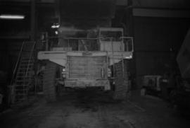
Photograph depicts what appears to be a Euclid ore haulage truck at entrance of building speculated to be the truck dumping station at crusher plant in mine.
Photograph depicts a building with a truck parked in front on the corner of Connell Drive and Creery Street.
Photograph depicts four large buildings behind power lines, believed to be located on Malozemoff Avenue. Trucks in foreground, forest and mountains in background.
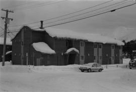
Photograph depicts large building behind power lines, car in right foreground.
Handwritten caption beside this photo reads: "Work crew eating in open at 10˚ below zero, evicted from Lunchroom, due to damage to, from falling rock." Men are shown sitting in snow. Various metal materials in foreground, snow-covered mountainside in background. It is believed that power lines are also visible in background.
Photograph depicts two similar wood structures built into mountainside in snowy area. Unidentified machinery in foreground on far left. Power lines or other cables above in background.
Handwritten annotation on recto of photograph: "FOOTING WEST WALL AUG 8/64." Photograph depicts a construction worker near freshly poured cement footings. Building is semi-visible in background on left, tall steel framework behind footings on right. The hard had of a second worker is visible behind footings.
Handwritten annotation on recto of photograph: "WEST WALL FOOTING AUG 8/64." Photograph depicts a construction worker standing on rebar in forms built for cement footings. A front end loader and backhoe tractor can be seen on wood platform above footings. Mountainside in background.
File contains 3 strips of negatives depicting water control structures inluding pipes, culverts, and holding ponds. The strips were found in a photo lab pouch annotated "Sedimentation Pond Sept 1991" and addressed to "Cassiar Mining Corp. Attn; R. Tyne."
Photograph depicts Wabco in left foreground in front of shop building, tractor, and miscellaneous supplies. Mine valley and mountains in background. Handwritten annotation on recto of photograph: "Cassiar B.C. 1970 June 23 by Tom Kiefer".
Handwritten caption beside this photo reads: "View of Pinion & three sections of Crusher". Red rectangular equipment stands enclosed in wood frame, which is also enclosed in the much larger steel frame of the crusher building. Traveler crane on right.
One man can be seen on crusher building framework, unidentified equipment and long metal rods in foreground. Power lines, a large tank, and other small buildings are semi-visible on a level in the mountainside just above the crusher building. Sky can be seen in background.
Men can be seen working on site. Crusher building in midground, chutes can be seen crossing the different levels of foundation. Lumber is leaning against excavated dirt wall in foreground, as well as a ladder which reaches up to the base level. Large tank can be seen in top level above building construction. Mountaintop and sky in background.
View showing various levels of foundations. Men can be seen working on site. Vertically protruding planks from framework in foreground. A long building believed to be housing conveyor "B" can be seen in background, as well as the tree-covered valley.
View facing into mountainside and showing various levels of foundations. Men can be seen working on site. Unidentified machinery and pile of long metal rods in foreground.
Men can be seen working on site, building tools and supplies scattered throughout. Handwritten caption beside this photo reads: "View showing various levels of foundations". A chute of some kind extends from high level to men near bottom. Dirt road at site, and tree-covered valley can be seen in background. Construction of a long structure near the edge of the excavation area can be seen in midground; this is believed to be conveyor "B".
Handwritten caption beside this photo reads: "View of Bin and Pan Feeder". Interior view of crusher building. A square, snow-covered object is being lowered by crane into building.
File contains images depicting the underground mine at Cassiar, showing structural damages, repaired damage ground support, and mining and repair processes.
The file contains a photo inventory entitled “Underground Mine Structural Inspection, Rock Mechanics Dept. Foto Documentation” with a complete file inventory linking the picture number to a location, title, and dated film. This photographic documentation was assembled for the purposes of liaising with a underground mining consultant located in South Africa.
- Images document structural ground support including steel cables, support arches, metal mesh, shotcrete, rockbolts, wooden beams.
- Images show ground support damaged through ground movement, but some depict newly installed or repaired support.
- Images depict ventilation ducting that was crushed or torn.
- Mining processes depicted include miners installing a rock breaker, miners paving the adit floor with concrete, miners inspecting a damaged section of mine, miner loading drill or blastholes with ANFO (ammonium nitrate / fuel oil mixture) explosives, and long hole drilling.
- Technical elements of the underground mine depicted include a mining device and ore in a chute (annotated ‘1290 crusher’), the conveyor, ‘LH drill’, ore processing machine annotated ‘1350 breaker’, and an electrical box titled ‘Weighometer’.
- Specific locations shown include ore draw points, ore passes, access drifts, a hatch and door titled “Fuel station 1415”, and a dead end drift with a stack of equipment and an orange cable annotated “1335 access electrical stations”.
Handwritten annotation on recto of photograph: "MINE DRY ON LEFT". Photograph was glued to cardboard backing with the annotation: "1962".
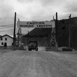
Gravel road in foreground, mountain in background. Sign over road reads: "CAUTION TRAMLINE CROSSING".
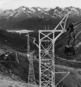
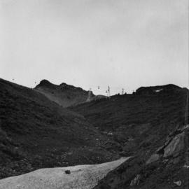
Photograph depicts towers and bucket in foreground, plantsite midground in valley, opposite mountains in background. Handwritten annotation on recto of photograph: "GENERAL VIEW VISIBLE TOWERS ARE IN #1 SECTION PLANT IN BACKGROUND". Photograph was glued to cardboard backing with the annotation: "1962".
Photograph depicts towers and buckets in distance. Gravel road in foreground winding through hills of dirt. Handwritten annotation on recto of photograph: "#1 SECTION". Photograph was glued to cardboard backing with the annotation: "1962".
File contains photographs featuring the tramline at Cassiar which ran from the crushing plant at the mountain mine to the plantsite in the valley (a drop of 427 meters). The first ore was originally transported by truck to the plant until the gravity chute was built in 1953. This chute was replaced with the first aerial tramline model in 1956, which was succeeded by the second model in 1975. This file also includes one photo of the original gravity chute, and one photo depicting a tramline worker.
Additionally there is a collection of eighteen photographs of tramline cars that were being surveyed for damage and condition, and another collection of six photographs of tramline study. The results of this study determined that there was variances in load sizes of the buckets caused by extra material falling off the panfeeder.
File contains 20 slides date stamped between July and August 1976 and annotated “TRAILER SERVICE SUMMER 1976", depicting the construction and renovation of a mobile home, excavations, and structures believed to be wells or water boxes. File also contains 9 additional slides with no annotations, depicting mobile home and houses in winter. These 9 images are associated with materials dated Nov. – Dec. 1976 and it is likely that these photographs were taken in the winter of 1975-1976.
Photograph depicts the Cassiar valley. Handwritten annotation on verso of photograph: "1958 [1961 crossed through]", on recto: "Cassiar Asbestos Corporation Limited. Cassiar B.C. Townsite in foreground mill and ore storage in left middle ground," "Toronto set". It is believed that this photograph was made into a post card.
Photograph depicts the Cassiar plantsite in foreground, including the mill, dry rock storage building, tailings pile, and many other buildings. Townsite in midground, mountains in background. Handwritten annotation on recto of photograph: "Cassiar."
Photograph depicts the Cassiar plantsite including the mill, dry rock storage building, tailings pile, and many other buildings. A portion of the townsite can be seen on left.
Photograph depicts the Cassiar townsite in foreground. Mill, dry rock storage building, and tailings pile can be seen in background. Handwritten annotation on verso of photograph: "1958 [1961 crossed through]."
Photograph depicts the town of Cassiar in foreground, mountain base in background. Photograph was taken from the air, portion of plane visible in top left of image.
Photograph depicts the town of Cassiar, mountain base in background.
Photograph depicts the town of Cassiar behind plant and tailings pile in foreground. Mountain range in background.
Photograph depicts the Cassiar valley: town on left, plant on right, mine valley in background. Photograph was taken from above, facing north east.
Photograph depicts the town of Cassiar, mountain base in background. Mine road visible in top right of image.
Photograph depicts the town of Cassiar, mountain base in background. Mine road visible in top right of image.
Photograph depicts the town of Cassiar behind plant buildings in left foreground. Mountain base in background. Photograph was taken from the air, portion of plane visible in top left of image.
Photograph depicts the Cassiar valley: plant and tailings pile on left, town on right. Mountain range visible in distance. Photograph was taken from above, facing south.
Photograph depicts the Cassiar valley: town in foreground, plant and tailings pile in background. Mountain range visible in distance. Photograph was taken from above, facing east.
Photograph depicts the Cassiar valley: town in foreground, plant and tailings pile in background. Mountain range visible in distance. Photograph was taken from above, facing east.
Photograph depicts the Cassiar valley: town in left foreground, plant and tailings pile in midground, mountains in background. Photograph was taken from the air, portion of plane visible in top left of image.
