Mostrando 4951 resultados
Archival description
"Quesnel, British Columbia" 1966 map
"Quesnel, British Columbia" 1966 map
Caving - West Virgina - 1965
Caving - West Virgina - 1965
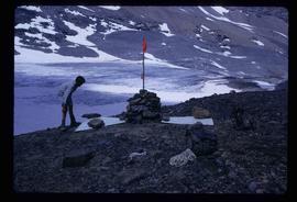
Peyto Glacier
Peyto Glacier
"The Indian History of British Columbia"
"The Indian History of British Columbia"
"Giscome, British Columbia" 1961 map
"Giscome, British Columbia" 1961 map
"Prince George" map
"Prince George" map
"Sinclair Mills, British Columbia" 1961 map
"Sinclair Mills, British Columbia" 1961 map
"Giscome" 1961 map
"Giscome" 1961 map
"Prince George Echo" newspaper vol. 1 no. 50
"Prince George Echo" newspaper vol. 1 no. 50
"Prince George Echo" newspaper vol. 1 no. 8
"Prince George Echo" newspaper vol. 1 no. 8
"Prince George Echo" newspaper vol. 1 no. 49
"Prince George Echo" newspaper vol. 1 no. 49
"Prince George Echo" newspaper vol. 1 no. 34
"Prince George Echo" newspaper vol. 1 no. 34
"The Islander" magazine, Feb. 1958 issues
"The Islander" magazine, Feb. 1958 issues
Kitimat photographs
Kitimat photographs
"Surficial Geology, Anahim Lake, British Columbia"
"Surficial Geology, Anahim Lake, British Columbia"
"Salmon Valley, British Columbia" 1954 map
"Salmon Valley, British Columbia" 1954 map
Architectural plans by J.F. Watson and W. Ralph Brownlee in Prince George
Architectural plans by J.F. Watson and W. Ralph Brownlee in Prince George
"Floor & roof plans"
"Floor & roof plans"
"Found plan & sects."
"Found plan & sects."
"Elevations & sects."
"Elevations & sects."
"Addition to Goglin Building"
"Addition to Goglin Building"
"Addition to the Goglin Building 4th Avenue"
"Addition to the Goglin Building 4th Avenue"
"Isle Pierre, British Columbia" 1952 map
"Isle Pierre, British Columbia" 1952 map
"Isle Pierre, British Columbia" 1952 map
"Isle Pierre, British Columbia" 1952 map
"Chilcotin" 1950 map
"Chilcotin" 1950 map
"Eagle Lake Sawmills Ltd. Giscome BC Plan of Sawmill and Adjacent Buildings"
"Eagle Lake Sawmills Ltd. Giscome BC Plan of Sawmill and Adjacent Buildings"
"Pre-Emptor's Map Fort George Sheet" 1949
"Pre-Emptor's Map Fort George Sheet" 1949
P.G. Air Photos
P.G. Air Photos
Riverside, Nechako River flood 1948, Prince George
Riverside, Nechako River flood 1948, Prince George
Nechako River flood 1948, Prince George
Nechako River flood 1948, Prince George
Nechako River flood 1948, Prince George
Nechako River flood 1948, Prince George
Nechako Bridge, Nechako River flood 1948, Prince George
Nechako Bridge, Nechako River flood 1948, Prince George
Nechako River flood 1948, Prince George
Nechako River flood 1948, Prince George
Nechako River flood 1948, Prince George
Nechako River flood 1948, Prince George
Riverside, Nechako River flood 1948, Prince George
Riverside, Nechako River flood 1948, Prince George
Nechako River flood 1948, Prince George
Nechako River flood 1948, Prince George
"A Study of Land Settlement in the Prince George-Smithers area, British Columbia"
"A Study of Land Settlement in the Prince George-Smithers area, British Columbia"
"Fort George" 1944 map
"Fort George" 1944 map
"Fort George" 1944 map
"Fort George" 1944 map
"Pre-Emptor's Map Fort George Sheet" 1943
"Pre-Emptor's Map Fort George Sheet" 1943
"Land Settlement: A Report"
"Land Settlement: A Report"
Nechako River flood 1937, Prince George
Nechako River flood 1937, Prince George
Nechako River flood 1937, Prince George
Nechako River flood 1937, Prince George
CN Railway Yard, Nechako River flood 1937, Prince George
CN Railway Yard, Nechako River flood 1937, Prince George
CN Railway Yard, Nechako River flood 1937, Prince George
CN Railway Yard, Nechako River flood 1937, Prince George
Nechako River flood 1937, Prince George
Nechako River flood 1937, Prince George
Nechako River flood 1937, Prince George
Nechako River flood 1937, Prince George
Nechako Bridge, Nechako River flood 1937, Prince George
Nechako Bridge, Nechako River flood 1937, Prince George
CN Railway Yard, Nechako River flood 1937, Prince George
CN Railway Yard, Nechako River flood 1937, Prince George
