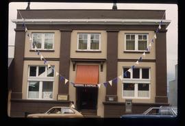
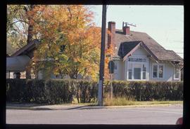
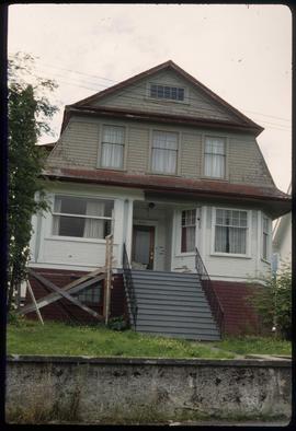
Image depicts a house on the corner of 7th Ave and Vancouver Street in Prince George, B.C.
Image depicts a bridge in Prince George, B.C.
Image depicts the demolition of the Europe Hotel in Prince George, B.C.
Image depicts the Fort George Regional Museum in Prince George, B.C.
Image depicts the BC Liquor Store in Prince George, B.C.
Image depicts the Prince George Hotel.
Image depicts a powerhouse in Prince George, B.C.
Image depicts the north side of 3rd Ave in Prince George, B.C.
Image depicts the Canadian Forces Recruiting Centre on the north side of 3rd Ave in Prince George, B.C.
Image depicts the Columbus Hotel in Prince George, which was destroyed by a fire in 2008.
Image depicts the Europe Hotel on the south side of 3rd Ave in Prince George, B.C.
Image depicts the south side of 3rd Ave in Prince George, B.C.
Image depicts a cemetery in the South Fort George suburb of Prince George, B.C.
Image depicts an old building with a sign labelled "Northern Rooms" in an uncertain location somewhere in Prince George, B.C.
Image depicts a bee-hive burner beside a rail-road track at an unidentified mill somewhere in Prince George, B.C.
File contains slides depicting images of Prince George ranging from 1975 to 2003.
Image depicts Bobtail Lake.
Image depicts a house which is possibly in Prince Rupert, B.C.
Image depicts a row of houses; it is possibly in Prince Rupert, B.C.
Image depicts an old building with a sign labelling it as a "Dining Lounge," it is possibly in Prince Rupert, B.C.
Image depicts a condominium, possibly in Prince Rupert, B.C.
Image depicts an old theatre owned by Paul Aivazoff in Prince Rupert, B.C. It opened in 1935 and was closed in 1981; it has since been renovated for retail use.
Image depicts a train track and several buildings in an unknown location.
Image depicts the rail yards in Prince Rupert.
Image depicts a shed in an unknown location.
Image depicts two rows of houses in an unknown location.
Image depicts several old log cabins, possibly at McLeod Lake.
Image depicts a log house at an uncertain location.
Image depicts the Alkali Lake Ranch in Akali Lake, B.C.
Image depicts the Harrison House in Kersley, B.C.
Image depicts an old log cabin at an uncertain location.
Image depicts the Tsek'enhe cemetery at McLeod Lake.
Image depicts McLeod lake.
Image depicts the Pack River outlet at McLeod Lake.
Image depicts the Kwinitsa CNR station, which is Prince Rupert's railway museum.
Image depicts the Kwinitsa CNR station in Kwinitsa, along the Skeena River.
Image depicts the McBride CNR station.
Image depicts an abandoned cabin and shed on Blackwater Road.
Image depicts an abandoned, deteriorating cabin on Blackwater Road.
Image depicts the interior of an abandoned, deteriorating cabin on Blackwater Road.
Image depicts a shed on Blackwater Road.
Image depicts an Anglican church in Old Aiyansh.
Image depicts a Catholic church at an unknown location.